Fike Run
Road crossing 5 mi. up from Gibbon Glade Run to Gibbon Glade Run(Fikes Creek)
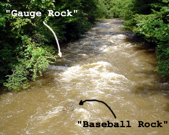
Most paddlers in the area use these 2 rocks as a visual water gauge. This is what you will see when standing on the takeout bridge looking up river. Gauge reference: Minimum = water flowing over some of "gauge rock" (very scrapy),, Low = water flowing over most/all of "gauge rock",, Medium to High = when the water level is getting near the top of "baseball rock" (starts getting pushy),, High = when baseball rock is covered or there is no sign of it,,,, hold on for a rip roaring flush.
Jeff Macklin
gauge rock & baseball rock
n/a