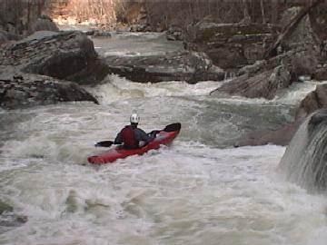
Bee Creek
Taft Center or County Bridge at Glade Creek to Caney Fork
December 31, 2014
| Reporter | Clay Wright |
Bee is a big step up in creekiness from Caney Fork but can be run just as often. Watch out for sieves as there are some BIG ones!
Kirk Eddleman showed me a cool trick that makes Bee much more accessible.
For a 90 min walk from the confluence you can run all the rapids with no shuttle!
Paddle the flat water across Caney Fork and up Bee from confluence to the rapids, paddle / hike upstream on river left and look for orange tape marking a trail up onto a higher berm - follow trail along river upstream and over a taller bench then down to a big pool. Paddle that pool upstream to the end and you will see an old road on river left. Set watch.. plan to hike about an hour. Follow that old road to Rose Cave access and past it - upstream and slightly up hills for about 1 mile before it peaks out high above the gorge, then it's another mile flat then downhill to a creek crossing or two - Look for flagging tape and old cans, 2 white boundary signs, that sound of rapids will have been drawing you in at this point. Follow yellow blazes to river access. If you look upstream and see rapids.. you didn't go far enough. The top 3 rapids are back to back so make sure you put in with flat water above. This is the very top of the best gradient! Follow Pink Tape to scramble down to the river and SCOUT this first series of drops as well as several downstream. Like Richland, this is not an eddy-hop / boat-scouting run until you know it well - you will be scouting a lot! This run has some big boots and slots and a lot of bang for the buck as most of the gradient of Caney Fork is condensed into this short stretch. Enjoy!