Little
4. Townsend to Dam at Melrose
July 17, 2016
| Reporter | Forrest Easterly |
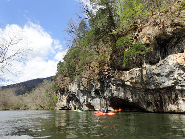
The Little River below Townsend and upstream of the mill dam at Melrose (along hwy 321 below Walland) is a great class I-II section of river within close driving distance to Knoxville/Maryville/Oak Ridge/Sevierville. From the launch site in Townsend, downstream to the mill dam (do NOT paddle near/over the dam), there are short, class II rapids/shoals separated by long, quiet pools of gently flowing water. A few rapids could be considered class II+ at levels above 2,000 cfs. This section runs best in the Spring and Winter, with Summer and Fall runs possible with ample rain in the Great Smoky Mountains. Minimum recommended flow is 500 cfs on the Maryville gauge. Boaters may opt for 'extreme low flow' levels of down to 250 cfs, but expect to put your river reading skills to the test to find the deeper channels. This reach of the Little River is paralleled by the scenic road 'Old Walland Highway' therefore access in case of emergency is possible. Please respect the rights of the property owners. From Townsend, past Camp Wesley Woods, and down to the Foothills Parkway bridge, there are several easy class II rapids and shoals, the largest being just below Kinzel Springs. Here the river widens and is covered with rocks and boulders and is rather shallow and requires somewhat complex maneuvering at lower levels to navigate successfully. Below the shoals, there are a few smaller 'rock garden' rapids with boulders located mid-river requiring basic skills to navigate safely. One of the major dangers on this stretch are 'strainers', which are trees that have fallen into the river. Stay AWAY from them, they are very dangerous. As far as islands on this section, the best rule of thumb (for this section) is to stay in the middle or where most of the water is going. Just pay attention for strainers or logjams as this section can get huge from torrential rains in the Great Smoky Mountains. Just past the Foothills Parkway bridge, another rock garden rapid entices the novice to maneuver around and practice eddy catching or ferries in good moving current. Approaching Walland, you will notice the large, scenic bluffs located on river right at an L-shaped bend in the river. Right as you paddle by Walland, you will pass under two bridges back-to-back, one being permanently closed to vehicle traffic. On river left there is a store/gas station with snacks, drinks, and picnic tables if you need to eat or stretch. Below Walland, you will navigate through some class II shoals with some maneuvering required at lower water levels to find the chutes of deeper water. A pool of water with small gravel bars is next for about 100 yards until you reach the partially demolished dam below Walland. This is not the dam where the takeout is, but is located at the start to fast water leading into a rapid called 'The Rapid.' The last rapid or shoal of any fame on this section is called 'The Rapid' and it is located downstream of Walland and just upstream of the small lake created by the mill dam at the takeout. At levels above 2,000 cfs, this rapid moves from a class II to a II+ but is still pretty straightforward. Swimmers take note to always keep your feet up if you swim during this rapid as there are large boulders underwater just below this one. The lake created by Peery's mill dam at the takeout is roughly 7/10 of a mile long. Stay left after the bridge at Melrose, as stated, there is a sign warning about the dam, so pay attention. Takeout on river left.