Obey, E. Fork
1. Cliff Springs to TN 85 Bridge
April 7, 2002
| Reporter | William W. Thornton |
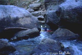
Very nice ,strange run.we arrived late in the afternoon and put-in about half way down the run by hiking into the canyon just below the Indian Creek confluence on the west side of the canyon. There was a moderate amount of water at our put-in, est.200 cfs which held to below the first short boulder clogged gorge.below this gorge water fell out of creek bed into underground caverns by pouring down several siphons.This reduced flow to about 40 cfs. after a spell of wheelchairing, and boat dragging, water came back into the creek though several cliff bases bumping it up to a higher level than before maybe 350-400 cfs. pretty good class 3 section for a couple of miles with one section of good fluffy low angle play holes this ends up at river wide 5 to 6 ft. ledge into a big pool,water goes under ground again at this pool leaving steam very low again. there is another extremely boulder clogged section below this that was very cool with mulitiple low volume slots mazing through gaint boulders.we scaped on down to the 85 bridge .Big Laurel Creek comes in on the left just above the bridge depositing massive amouts of orange gunk in this pristine steam complely killing all moss and life in the Obey and staining all the rocks a rusty orange.Very nice area and intersting runs can't wait to go back and run the whole thing at a good water level.
WATER LEVELS
we ran it at 560 on the Jamestown Gauge this is too low, this gauge is several big tribs downstream and is likely twice to three times the water that is in this upper section.I am guessing that 800 to 1500 would be a good medium level. any more input on levels would good.