Gooney Run
Boyds Mill (Intersection of VA 622 & VA 649 [Browntown Rd.]) to Karo Landing (Route 340)
January 1, 1900
| Reporter | Mark and Clare Anderson |
This is First Falls at low water. The slab rock in the middle of the picture is undercut. So is the rock in the bottom right. The left line is very narrow and possibly blocked by the tree midway at this level.
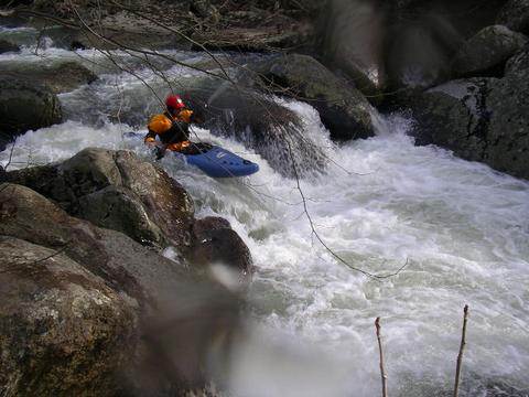
Ian is spot-on for the low water left line on Second Falls.
Good thing he got a good boof, cause he's offline.
At low water making your way down this left line on the bottom half of No Place To Swim helps you avoid embarrassing pins.