Chehalis
1 - West Fork to Pe Ell
March 21, 2026
| Reporter | Thomas O'Keefe |
| Gauge Reading | 1020 cfs at CHEHALIS RIVER NEAR DOTY, WA |
| Flow | Medium Runnable |
Normally the gate to the Chehalis River watershed is closed, but on this day we were on an escorted tour to learn about the proposed Chehalis River dam, and the flows happened to be ideal for boating. Why not get dropped off and take the opportunity to tour the proposed dam and reservoir site by packraft? Our tour guides obliged, and we had a wonderful trip.
After a stop at the dam site and a discussion of the project with colleagues from the Chehalis River Alliance, we were on the water at approximately 2:30 in the afternoon on a beautiful sunny day with optimal flows—a rarity on the Chehalis.
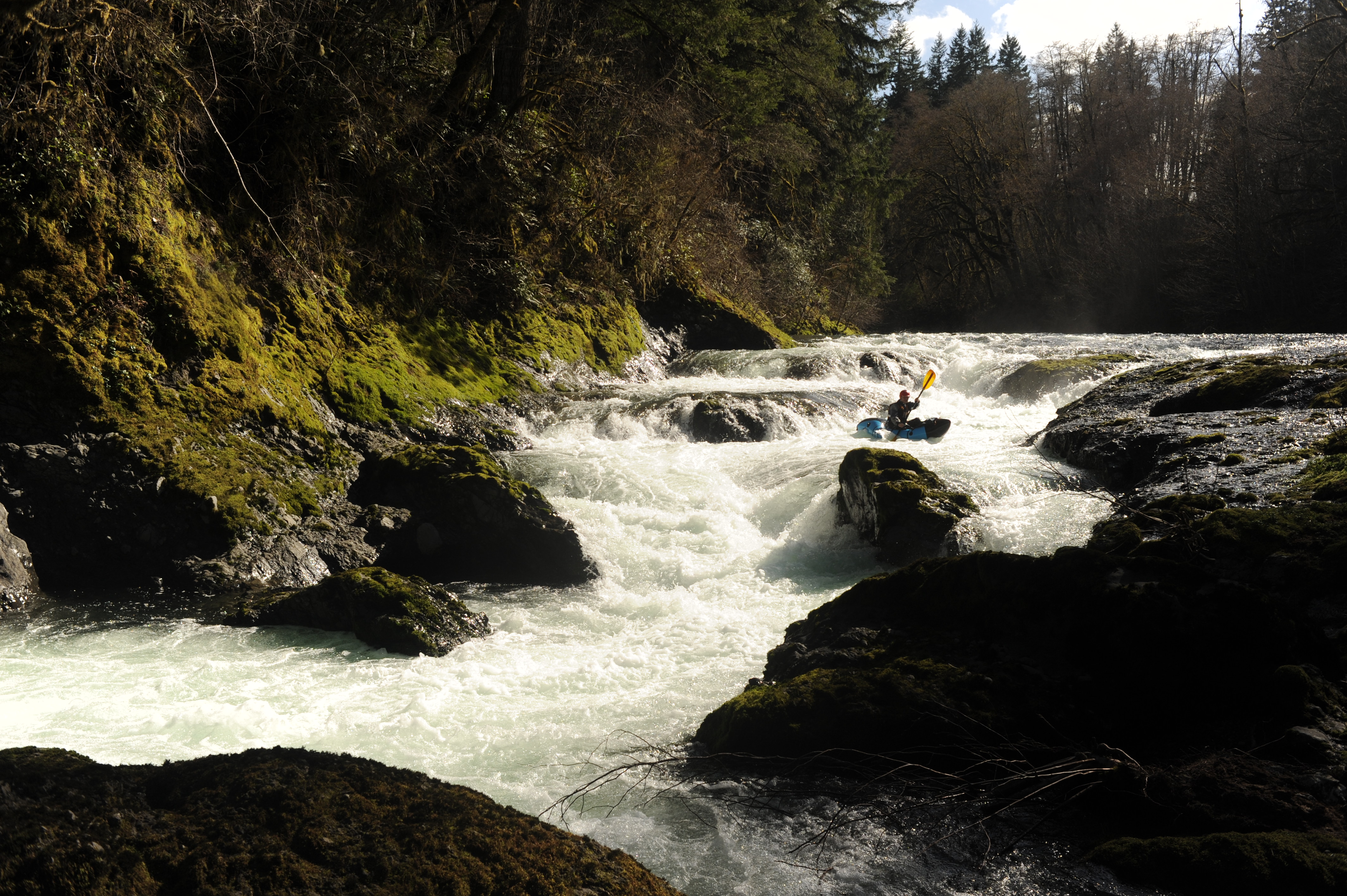
We followed the mainline to a point a couple miles upstream of Fisk Falls and enjoyed several fun Class II+ rapids over approximately 40 minutes of paddling down to Fisk Falls. We took out above the falls and scouted from the bedrock shelf on river left. After a thorough scout, Nick and I decided to give it a go. The opening sequence went smoothly, starting far right and then moving across the center to finish far left—a line that avoided the biggest hydraulics. Following this opening drop, the river narrows into a slot against the bedrock wall on river right. I encountered a deceptively sticky hydraulic in this section but managed to work my way out after about four attempts. Had I flipped, I don't think it would have been possible to get out without assistance from a rope. We enjoyed one final pitch before reaching the calm water below and passing under the bridge.
It was a lovely float from Fisk Falls down to the confluence of Crim Creek, which enters on river left near the area of the proposed dam site on the Panesko Tree Farm, located within surrounding Weyerhaeuser forest lands. This section has several Class II rapids and some surf waves. While the riparian buffer seems a little narrow in spots, the river corridor is lovely and offers a view quite different from that experienced on a driving tour of the watershed. A mix of conifers and deciduous trees lines the shoreline, the water was exceptionally clear, and ideal spawning gravel was dispersed across the riverbed. Having spent time along many sections of the Chehalis River, this upper reach clearly has some of the highest-quality habitat. The dam, even if the reservoir is allowed to drain as is currently proposed, would have a devastating impact on the landscape.
Continuing past Crim Creek, the gradient picks up, with an obvious horizon line marking one of the bigger drops on the run, located near the proposed dam construction site. Nick fired it up with a clean line down the right side of the main river left channel. Below here, the river enters a beautiful gorge with some great Class IV whitewater. We passed under the new bridge (which replaced the covered bridge washed away in the 2007 floods) and enjoyed several great rapids over the next quarter mile or so. While a couple had slightly intimidating horizon lines, we were able to find the lines by boat scouting. When the gradient finally tapered off, we passed through the tranquil waters of another beautiful gorge.
We reached our take-out at the Highway 6 bridge on river left in Pe Ell at approximately 6:00 p.m. It was a bit of a muddy scramble up the bank. We then walked back to our cars, which were parked at the Pe Ell trailhead where we had met earlier in the afternoon. It was a great trip, and I hope more people get the chance to experience this river.