Chehalis
1 - West Fork to Pe Ell
March 31, 2024
| Reporter | Brad Houser |
| Gauge Reading | 1000 cfs at CHEHALIS RIVER NEAR DOTY, WA |
| Flow | Low Runnable |
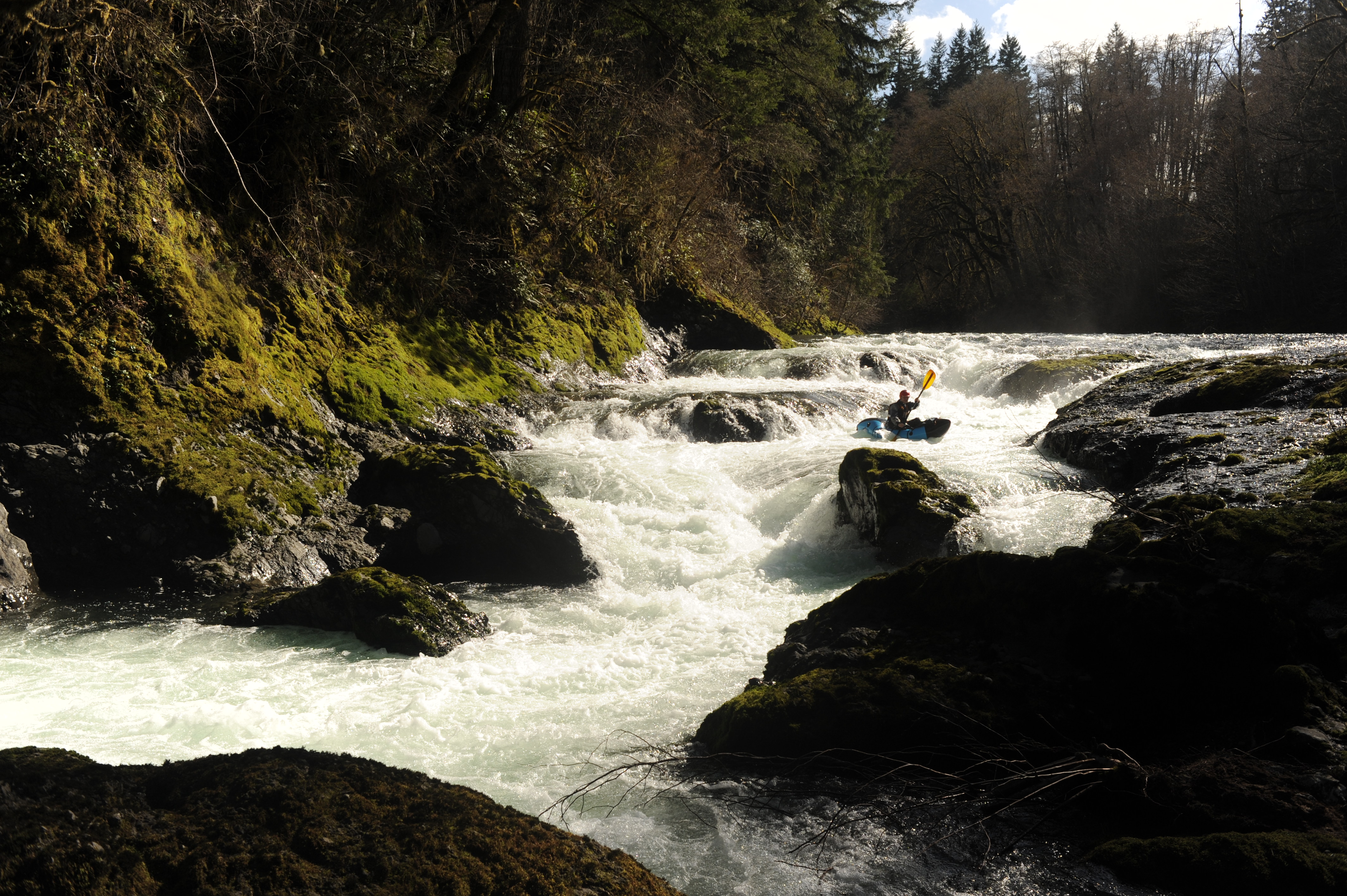
Myself and a friend drove to the 'put in' to find the gate closed to the Mcdonald tree farm as of 3/30/24. We knew this was a risk, so we put our packrafts into our backpacks and started walking. We walked around 11 miles and ended up putting in at the confluence of the east and west fork. If a car could get through the gate, it could get to the confluence. We did see other a few other cars driving behind the gate, so keys / access certainly exists, not sure how one can go about getting one as a private individual (if it is possible at all) through Weyerhauser. As you walk (or drive) you can see the majority of the run through the trips as you drive near the river for a lot of the run. The flow was on the low side but definitely floatable. The majority of the run is class II (or II+) except for two notable rapids which were in the IV range. The first is fisk falls, around halfway through the run and is marked on american whitewater at the correct location. Scout left, portage left if you desire. The second is just before the locked gate around 'charlie's hump'. Scout right, portage right if you desire. This rapid continues downstream, but we had a nasty flip on 'charlie's hump' and did not want to walk any further, so we took out at the last bridge just before the locked gate. There was no wood on the entire run. There was a good amount of metal on the side of the river to watch out for, hard to say how much might be underneath the surface.