Chehalis
1 - West Fork to Pe Ell
March 21, 2026
| Reporter | Nick Boguslaw |
| Gauge Reading | 1000 cfs at CHEHALIS RIVER NEAR DOTY, WA |
| Flow | Medium Runnable |
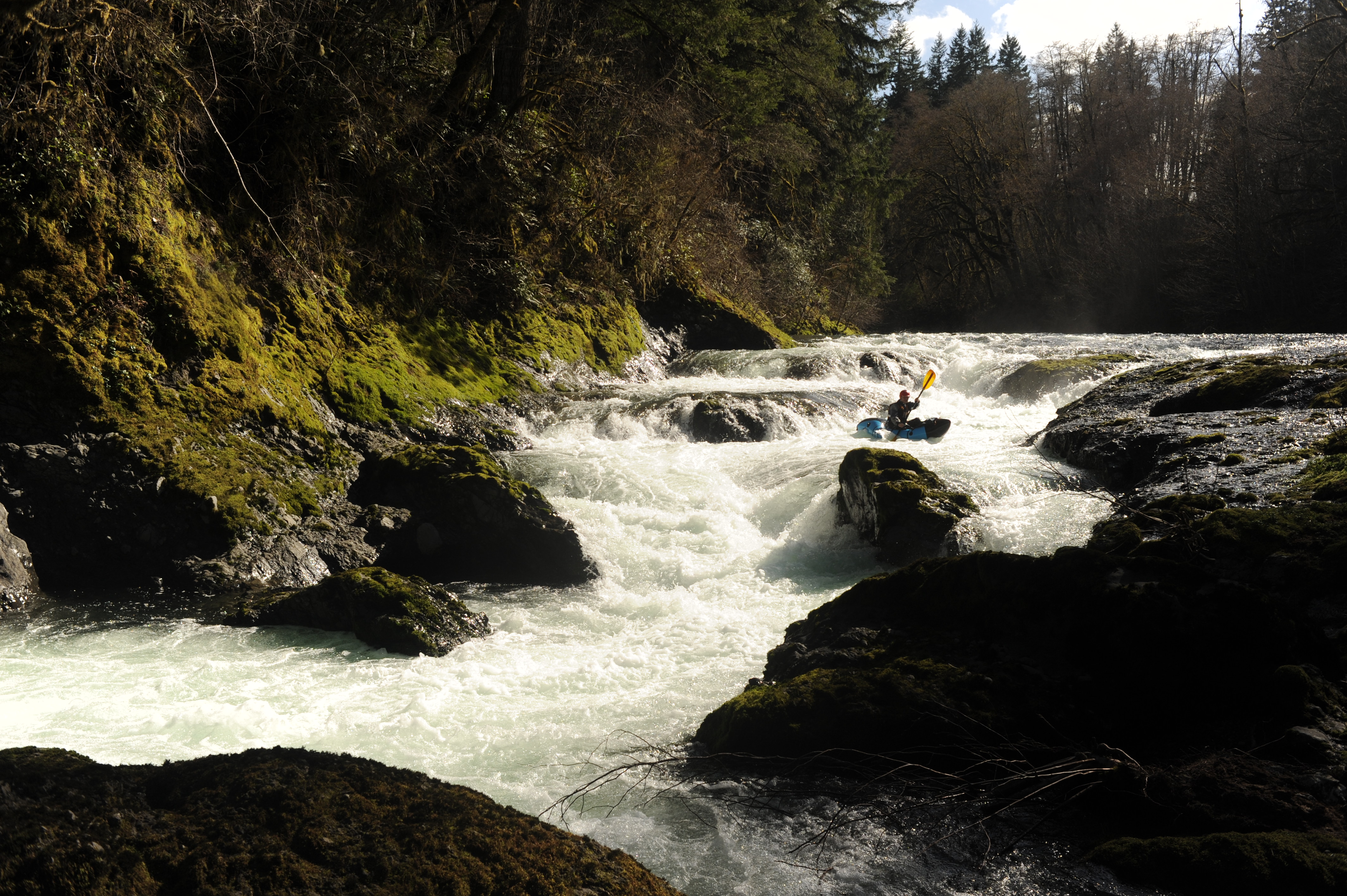
Wow. I feel so fortunate to have finally got the opportunity to paddle the Upper Chehalis. Locked away behind Weyerhauser gates, this run is difficult to gain access to. If you get the opportunity to explore it, take it. This river and its geology feels unique amongst Washington runs. While generally not gorged in, bedrock is nearly always within sight. This makes for lots of fun little ledge waves prime for surfing. The run has a mix of meandering class II-III, a couple impressive class IV+ sequences, and a few exciting class IV- drops. A stunning mossy gorge at the end completes the experience. This run leaves me wanting to explore more of the upper reaches of the Chehalis and other Willapa Hills runs.
Tom, Ariel, and I hit the river in the afternoon after attending a tour of the proposed dam site that would destroy this run. Thanks to all that organized and attended the tour! Weather was cool & sunny, flows were a medium low 1000cfs on the Chehalis @ Doty gauge. We put in a bit below mile 6.9 bridge where the road was closed.
Put in: 46.47932, -123.29548
The next couple miles were pretty floating with a dozen or so fun little class II-III rapids with some chill surf waves. As we approached fisk falls, we floated river left over a long bedrock shelf submerged under 8 inches of water. We hopped out of our boats and walked onto the bank to scout / portage. Tom and I walked back upstream to run the first portion of the falls and then eddied out to regroup. Tom sent the last drop and immediately got sucked back into the recirc. He had to fight hard to break free. Knowing what I know now about how sticky that last drop is, I don't think I would run the falls. If anyone was, I'd definitely set safety above and below that final drop.
Fisk Falls: 46.50227, -123.29008
After another few miles of scenic floating and some fun little whitewater, we approached the next big drop above the old covered bridge that was washed away in 2007. We parked our boats on river right and worked our way down the bank to scout. This drop may have changed a bit since the AW description was written. It had a nasty pocket hole extending from the left bank wall that you would want to avoid at all cost. I would recommend a scout.
Covered bridge rapid: 46.54412, -123.29727
After covered bridge rapid, we passed through a pretty little gorge. Not much later were a few really fun class IV drops, the last of which tripped me up and sent me for a quick refreshing dunk. Around this time, the canyon walls started to close in to form a proper bedrock gorge covered in moss. Absolutely stunning.
As the canyon walls opened up again, we came upon highway 6 and took out on river left under the bridge. A short walk through town and we were back to our cars at the Willapa Hills Trailhead.
Trailhead parking: 46.56943, -123.29686