Presque Isle
D) 'Bottom Presque': South Boundary Rd to Lake Superior (1.1 miles)
November 1, 2013
| Reporter | Jonathan Sisley |
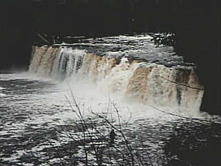
Ran the Lower Presque Isle October 27th, 2013 at 6.1 on the South Boundary Rd. bridge gauge. Earlier this year there was a massive log jam river left against the middle bridge pillar and the shore which blocked a lot of the flow from running against the gauge. The park has cut out the jam, so the bridge reading is accurate as of 10/27/13. The only issue is new wood along the run below the bridge. The wood on the right side boof of Nawadaha Falls is still there, but looks cleaner than last year. We were able to run everything fine, with only Manido Falls presenting an issue running river left, as a small diameter log is laying ~8' off the left bank pointed downstream. We skirted the log on the right, still pretty close to 'main line' on the left side. Center right on Manabezho Falls has a pretty massive log laying up against the falls, which was there earlier this year. A small tree is still dangling over the left line in Zoom Flume. Where the river splits (left is Zoom Flume and right channel only runs with a lot of water), right channel had a huge log teetering over the edge (which we pushed in earlier this year) has floated away. This means the Presque must have had a big water event this past summer!