Menomonee
A) *2026.04.15 WOOD UPDATE* MenFalls: Main Street to Arthur Ave (0.4 mile)
| Difficulty | II-III |
| Length | 0.41 mi |
| Avg Gradient | 60 fpm |
| Gauge | Menomonee River at Menomonee Falls, Wi |
| Flow Rate as of 40 minutes | 2 cfsbelow recommended |
| Reach Info Last Updated | April 16, 2026 |
Quick Facts:
The name 'Menomonee' means 'swift water' in the Menominee language. Please note that this is the Menomonee River, not to be confused with the Menominee River. Both have three listed sections of whitewater. The Menomonee River is in S.E.Wisconsin, while the Menominee River is on the northern border, between Wisconsin and Michigan.
Since the name is pronounced almost the same (whether with the 'i' or with the 'o'), we distinguish the runs here by abbreviating the section names. This run on the Menomonee River in Menomonee Falls becomes 'MenFalls'. (In similar fashion, other two runs on this river are 'MenWesTosa' and 'MenTosa'.)
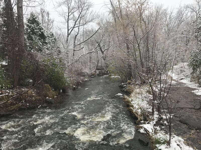
For more than three years (spring 2022 through August 2025), this run was essentially closed due to more than 20 trees down across the river! Epic rains hit the area in August of 2025 and flushed much of the wood out. Unfortunately, winter 2025-2026 has added more deadfall.
ALWAYS WALK THE FULL RUN BEFORE PUTTING ON ... GET EYES ON EVERY INCH OF THE RUN TO BE CERTAIN OF ACTUAL CONDITIONS THE DAY YOU ARE THERE ... JUST ONE FALLEN TREE, BRANCH, OR OVERHANGING SHRUB IN THE WRONG PLACE CAN TURN THIS FUN RUN INTO A DISASTER! If you aren't willing to do that, PLEASE skip this run and go elsewhere!
Location: Downtown Menomonee Falls
Put-in: Mill Street Parking Lot, Menomonee Falls, WI
Take-out: 43.1751, -88.1118 (public parking lot off of Arthur Ave., behind a Dairy Queen)
Shuttle Length:
Free municipal parking is available adjacent to the river.
This can be a fairly busy location, so if you need to change into or out of boating gear, please be discreet, or consider using the take-out parking area instead (since it is at least slightly less conspicuous).
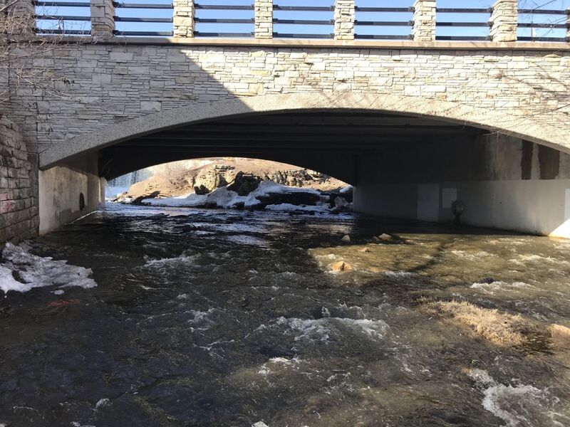
From the parking lot, carry north on the path and upstream until under the main street bridge. A cement 'sidewalk' (submerged at runnable flows) runs along the river-right wall of the bridge. High flows in 2025 have created a rubble shoals just off that cement path. At most flows, you'll be able to 'beach' your boat on the shoals to mount up.
Paddle upstream under the bridge to play a wave which forms as the flow (coming over the dam upstream) caroms off the upstream face of the bridge and hits the slower water in the pool under the bridge. Currents can be tricky, so you need quick recovery strokes (bracing strokes) to play the wave. If you flip or are out of your boat, it is shallow, and you (and your gear) will be flushed quickly into the opening drop sequence.
In recent years, this wave has been less well formed, so boaters may opt to put in from shore just downstream of the bridge (though at high flows, there won't be much dry shore).
Coming out from under the Main Street bridge, the run starts right off accelerating down a nice pitch, swinging left just a bit, then tighter to the right around a bend, dropping into a fine little dells.
At the base of the First Pitch, water hits a brief flowing pool. Experienced, aggressive paddlers may break out of the flow, catch the river-right eddy, and go for surfs in the wave/hole which forms here.
On surfer's-left (river-right), there is a diagonal wrapping wave/hole, while the center-to-left can form a pretty decent wave. There will be a narrow eddy tight to the river-left vertical wall of rock. You will need to be aggressive and in control to avoid being flushed downstream if you try for repeat play here.
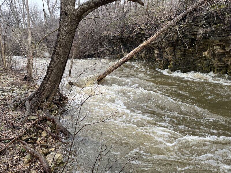
The current from the first pitch flows swiftly through a short pool, tripping across shallow rocky debris, then drops into the Heart of the Dells. The river twists sharply left, the right wall is slightly undercut/overhanging, and the currents flow hard and fast into it.
HINT: If you have your bow pointed downstream, aligned with the current, you will almost certain be pushed into the wall! Instead, point your bow toward the left shore (even a bit upstream!) and paddle aggressively out of the strongest current, so as to not get shoved up against the undercut right wall. (You want to end up along the left wall immediately below the bend!)
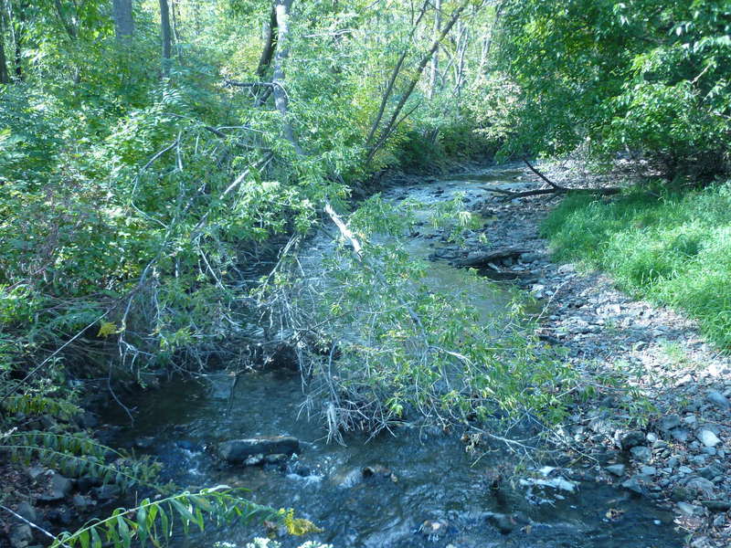
NOTE: The tree in the photo had blocked the dells for years. It has been cut and should flush downstream the next time the river rises to runnble flows.
SCOUT THIS LOCATION TO KNOW IT IS CLEAR, AND TO ENVISION THE MOVES YOU NEED TO MAKE!
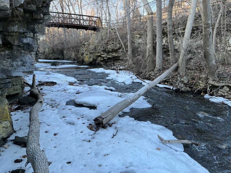
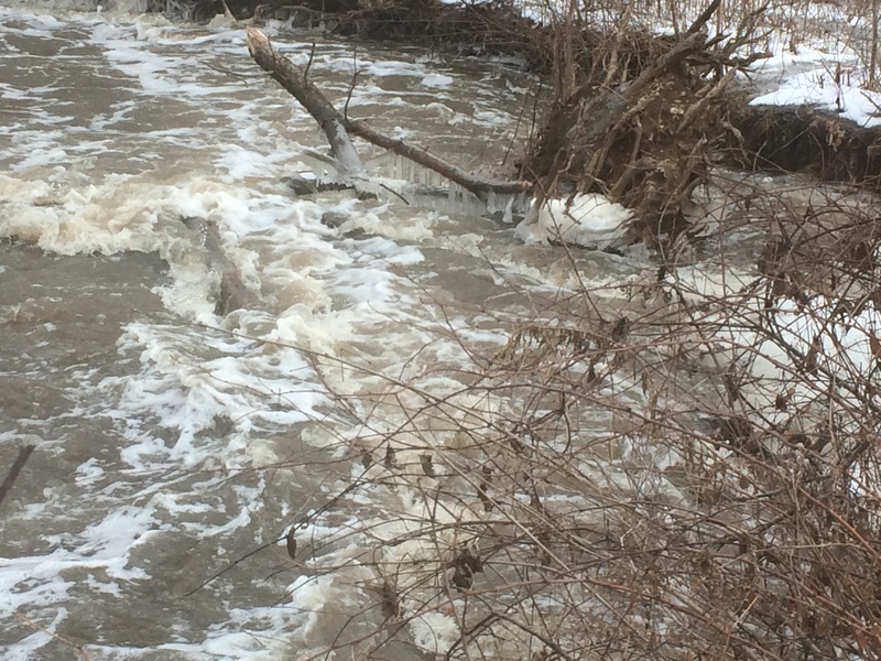
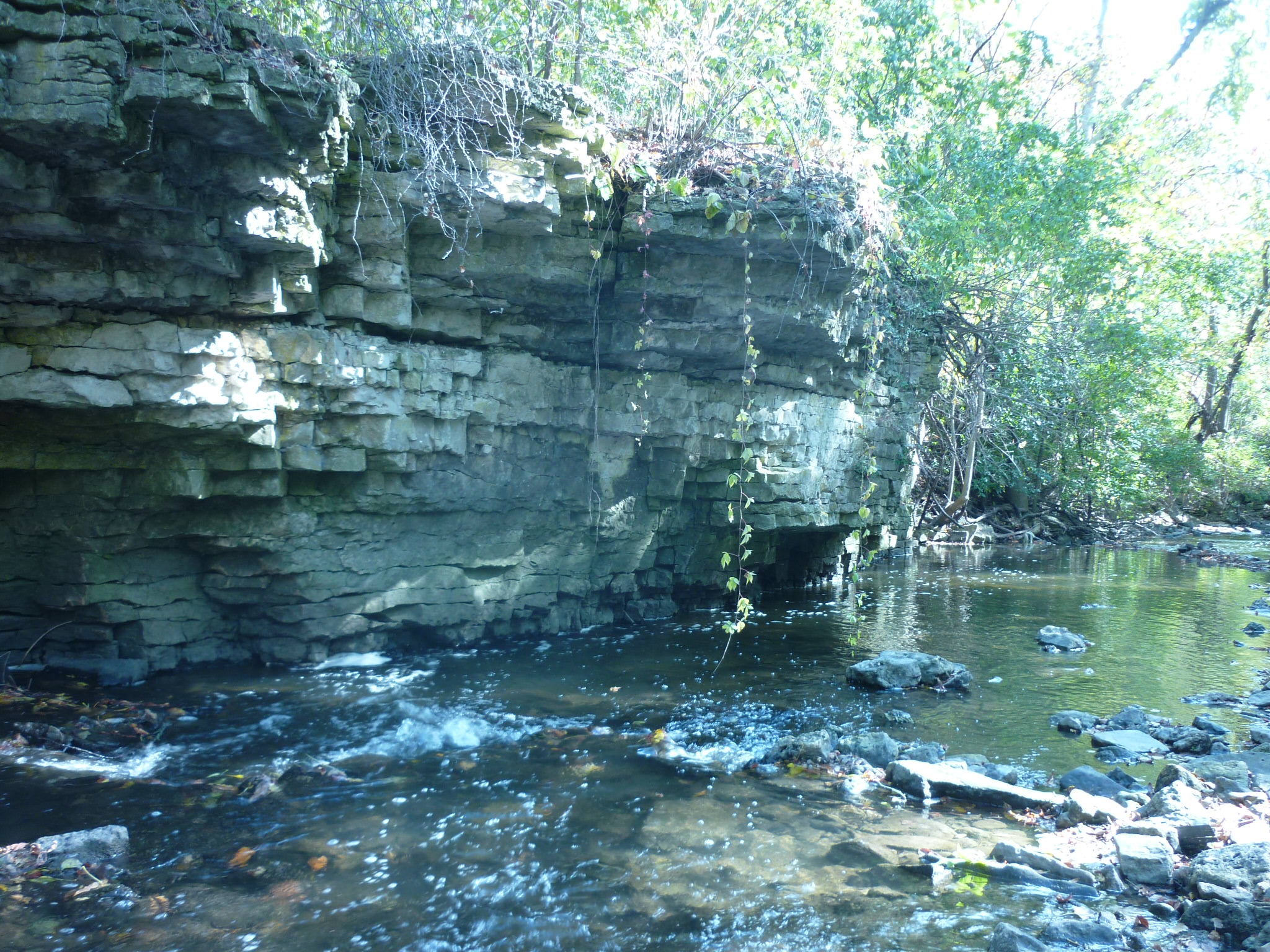
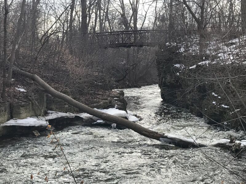
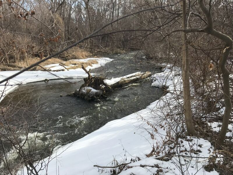
After passing under a footbridge, you enter the lower dells. The footbridge (rebuilt in 2025) provides a convenient way to look upstream and downstream to scout the dells.
NOTE: The trees which had been in the river here (as shown in the photo) have apparently flushed out during a high-water event. It would be a good idea to have a look here (before putting on) to know that there is still clear passage.
Not far downstream, an eddy against the river-left vertical wall (which normally allows 'staging' to try for a few small catch-on-the-fly, one-and-done waves which form at higher levels) has an accumulation of wood (as of Sept.2025). The main channel is clear/passable (again, as of Sept.2025).

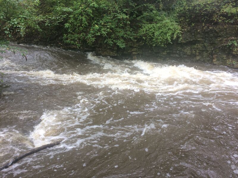
The river veers left and trips down a short (~3') ledge. At low-to-moderate flows, this riverwide feature offers surfs and spins. The pool is shallow, so no elevated or aerial moves at any but highest flows. Above 300-400 cfs this gets sticky and can stop boaters who don't hit the right spot or have momentum and good technique. (Aim for a river-left seam. It may look like the gnarliest backwash, but current pushes through the pile!)
Some people assert this falls gave the village its name. Historically, quarrying changed much of the area where the park is now. It is unlikely that this is a natural ledge/falls, but was a result of quarrying. The dam just upstream of our put-in appears to sit upon quite an outcropping of rock. It is far more likely it was constructed upon what may have been a more natural falls giving the village its name when this area was settled.
Just downstream, a large tree arches to lay in the water. Narrow passage exists river-left, but you need to look at this before putting on to assure no new wood has blocked things up, to assess the situation for yourself, and know what you need to do here. (This makes good reason for novice paddlers to run far left, to be lined up for the river-left passage, reducing the danger of being swept into the tree.)

Coming out of the pool below the Falls, the flow spills down brief rubble-filled gradient then heads toward a rock wall on river-left.
Large tree trunks have blocked this area for years! Scout this area before putting on to be sure there is no impassable wood in this stretch.
To avoid being stuffed into the undercut/overhanging wall, point bow to the right or even angled upstream and paddle to stay center-river!
There is nothing but swift moving water from the undercut wall and the sharp left bend downstream.
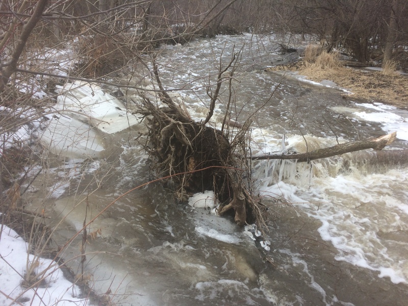
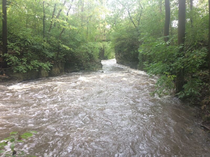
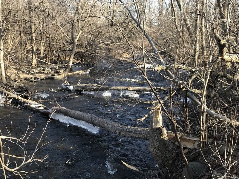
This stretch of river is subject to deadfall which can span the river, blocking passage (as shown in the photo). It is also subject to significant overhanging shrubbery.
BE SURE TO SCOUT THIS AREA AS THOROUGHLY AS POSSIBLE BEFORE PUTTING ON to assure you can get through!
The photo was from between 2023 and 2025, when this stretch was totally IMPASSABLE! High water has removed most of what is shown in the photo, but new deadfall blocks shore-to-shore as of March 2026! Always scout this stretch before putting on, because any downed wood can totally block passage, and finding an eddy and getting out of the river will be difficult through here.
The stream takes a rather significant left-hand bend. The right bank is seriously eroded, undercutting the bank. Years back, a very large tree into the river. That has been cut, and the root-ball end of that trunk is now mostly out of the way of things, but more smaller trees now lay into the flow from the right bank. YOU NEED TO SCOUT THIS LOCATION BEFORE PUTTING ON, to know if it is passable, and what moves you will need to make.
Downstream, a couple more zig-zags and more trees along shore may complicate passage. Skillful paddlers should be able to avoid being tangled in the tree roots and shrubbery protruding from the shores, while novices and less aggressive paddlers will likely end up pushed into them.
Situations through here can change randomly every year, so make sure to check this area carefully before putting on.
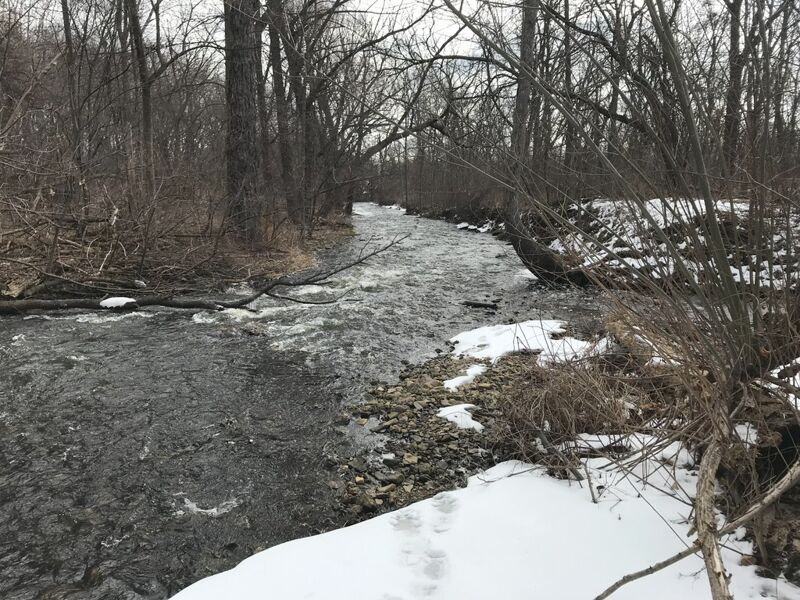
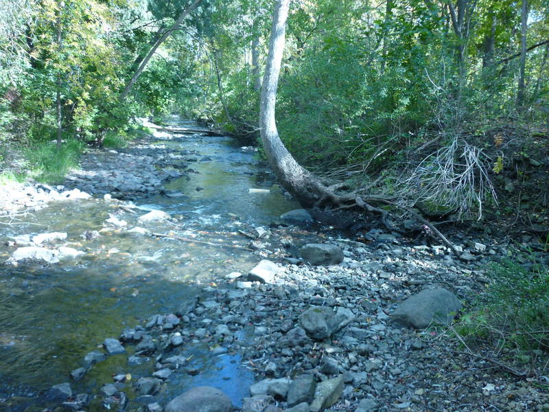
A small side stream flows in from the right. Gradient on the run has significantly diminished by this point. The water no longer has the force to carry as much rocky debris, so a rocky shoals has built up just before this confluence.
Boaters may opt to shorten the run (and the carry) by taking out upstream of this creek, walking out on a dirt/mud path (parallel to the side-stream, not the river), then up the paved path to the put-in/parking area. Otherwise, swiftwater continues downstream to Arthur Avenue (the listed bridge take-out). This allows you to skip the muddy path, having all paved path to carry back to the put-in/parking area.
While doing your pre-run scouting, when you get down to this confluence, you should be able to see most of the way down the final stretch. The banks are a little lower, and the gradient is less, so if it all looks clear, you can probably get to the take-out (or be able to get out if something blocks passage before the take-out).
As of March, 2026, there is quite an accumulation of wood here, complicating passage.
Egress is possible either river-left before the bridge, or (if you miss that) on river-right just past the bridge. Carry up a paved path through the park to your car, or to put in and run it again!
A small parking lot for the city park is tucked behind a Dairy Queen (and other businesses).
Since this is such a short run, it is generally done by carrying up (rather than bothering with a vehicle shuttle). Thus, you can decide if you want to start up top or down here. (Parking 'up top', you start with a short carry and finish with a long carry. Parking down here, you long-carry first and finish with a short carry.)
In either case, we suggest you walk the whole reach before putting on, to know whether it is passable!
HINT: I don't recommend parking here, carrying your boat upstream, and scouting the river as you go, since it is often impassable, meaning you'd end up carrying your boat back down to your vehicle!
Folks might wonder, 'Why not keep going?' 'What's downriver?' It is possible to double the length of the run by continuing to Pilgrim road, to take out at river-left where there's parking for a ball field.
The additional 0.4 mile is a continuation and gradual diminishing of the type of gradient (swiftwater, riffles and shoals) as from the tributary/confluence to the listed take-out. As a result, most whitewater paddlers will use the listed take-out, getting the best action, and having the shortest walk as their shuttle. (Continuing down to here is likely only if you set a vehicle shuttle, or need to chase errant gear if someone has an out-of-boat experience.)
After Pilgrim Road, the river is flat and flowing, with little-to-no natural rapids until the next listed section (MenWesTosa).
Apr 10, 2025
This run has been essentially closed due to wood for a handful of years. At one time, I counted at least 21 individual trees (6'-12'+ diameter) blocking the stream. In one spot, a group of at least 3-4 trees with enough branches and other woody accumulation as to dam the flow, backwatering a bit, and 'waterfalling' on the downstream side'
Sep 25, 2018
A large tree spans the river. At high flows, water is over the trunk, but ... it is seriously dangerous. Check additional photo for the view from downstream!
Sep 25, 2018
This shows (at least a little bit) how dangerous a tree in the water can be, as it accumulates other woody debris! The (initial, biggest) first problem is the LARGE tree which fell across the river due to the soil having been eroded out from under it. (The 'root ball' is center-frame, the main trunk almost entirely submerged to the right of it.) You can see it has snagged a large branch (mostly above water above the main trunk). Less obvious is another log/tree-trunk in the water upstream, submerged against the middle of the main trunk (causing a hump in the water/flow), and angling diagonally up to river-right (photo-left) shore.