Tyler Forks
B) Gehrman Creek (Hwy.169) to Brownstone Falls (1.8 miles)
| Difficulty | II-IV |
| Length | 1.9 mi |
| Avg Gradient | 37 fpm |
| Gauge | Tyler Forks River at Stricker Road Near Mellen, Wi |
| Flow Rate as of 1 hour | 5 cfsbelow recommended |
| Reach Info Last Updated | September 7, 2020 |
The first three quarters of a mile of this reach are flat, followed by some drops which may be run with caution. Take-out before the footbridge on a trail in Copper Falls State Park. Scout this location well while setting shuttle (before putting on). The ledge drops by the bridge (the 'Tyler Fork Cascades') lead swiftly into Brownstone Falls (29').
May 2, 2002: One of the area's best paddlers was severely injured in a run attempt of Brownstone Falls. This drop has a steep, complicated entry in which the paddler lost momentum, resulting in a vertical descent of the falls. At the base of the drop, bedrock extends into the curtain. The paddler struck this rock with sufficient force to cause compound fracture of both ankles. Extrication/evacuation from the gorge was a many hours long ordeal. Even with a good launch here, the pool at the base is not particularly deep and would require a highly controlled angle of entry to avoid injury.
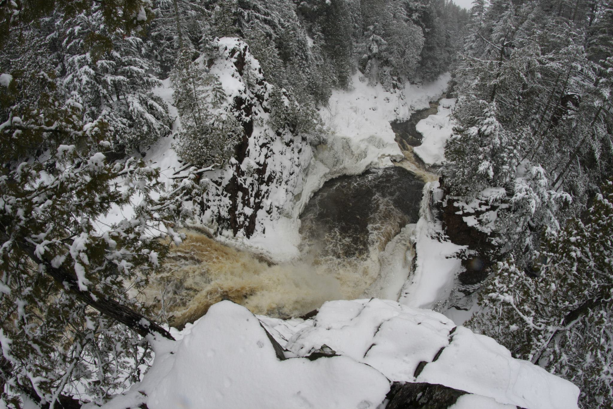
Note: the 'featured photo' at the top of the page is an 'overhead' view down Brownstone Falls. As mentioned in the main write-up, while the plunge pool looks large, there is rock at the base of the falls, making running this falls (intentionally or not) a very risky, dangerous proposition. Also visible in the picture, the water you see coming from top-left of photo is the Bad River downstream of Copper Falls. As it meets outflow from the pool below Brownstone Falls, it veers to the left (rightside of the photo) heading to Devil's Gate.
No trip reports yet.