Salmon, North Fork
Gallia Mine River Access to Forks of Salmon(NF Canyon Run)
| Difficulty | III-V |
| Length | 11 mi |
| Avg Gradient | 85 fpm |
| Gauge | Salmon R a Somes Bar Ca |
| Flow Rate as of 22 minutes | 277 cfsbelow recommended |
| Reach Info Last Updated | May 15, 2025 |
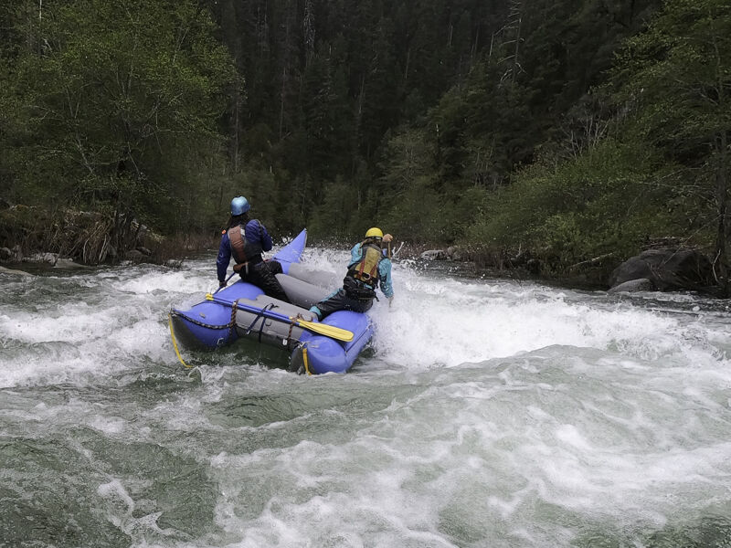
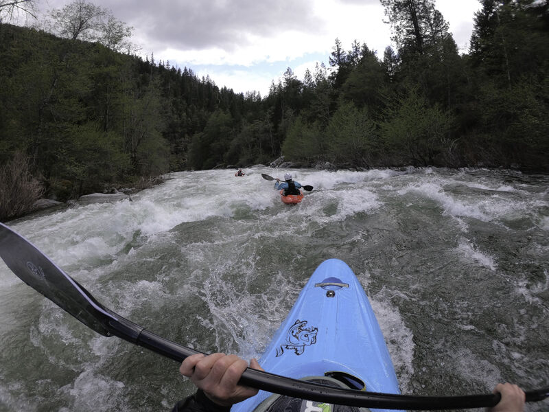
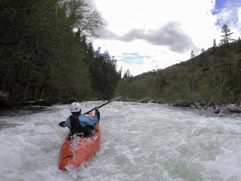
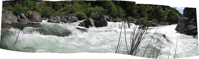
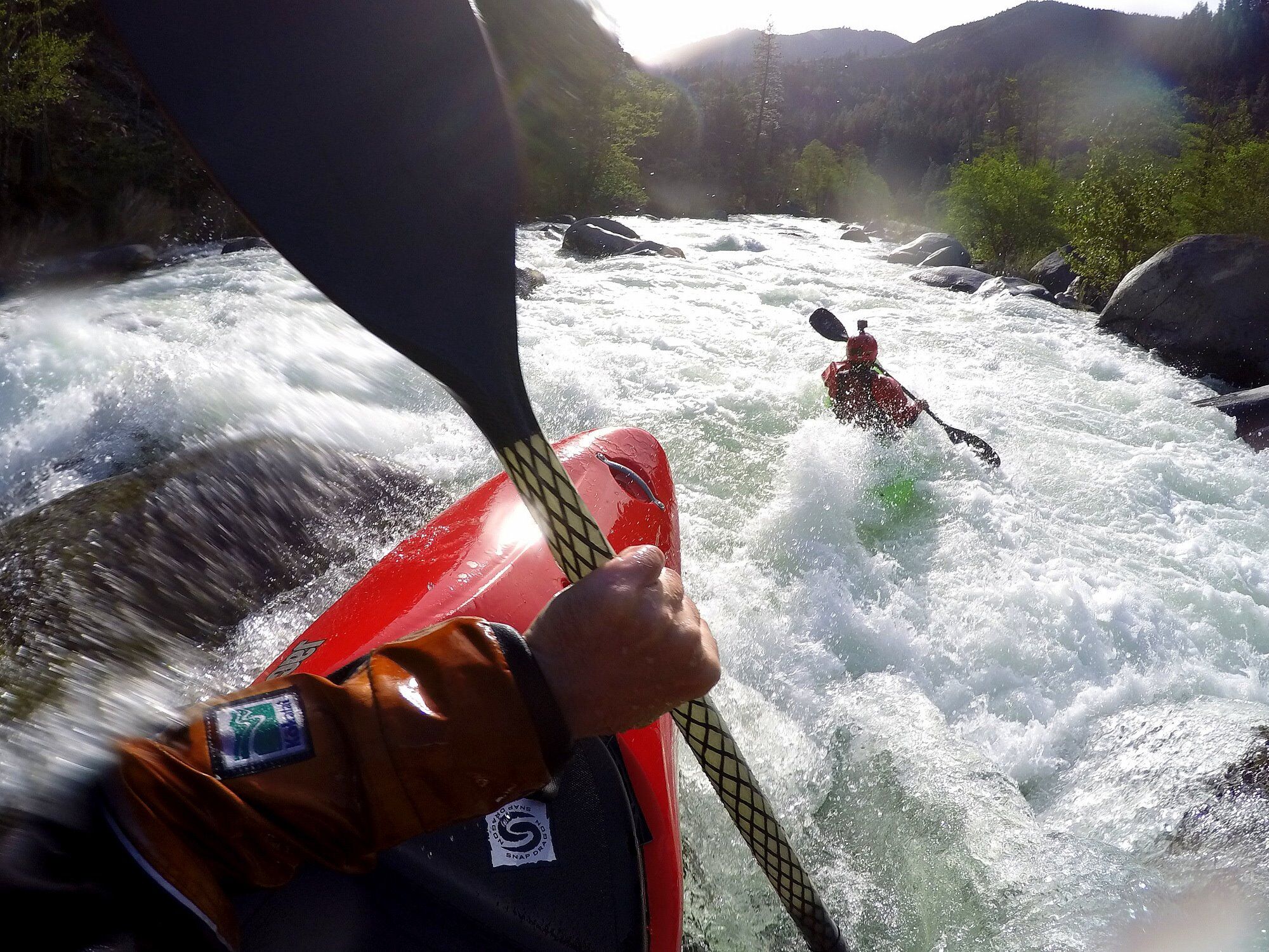
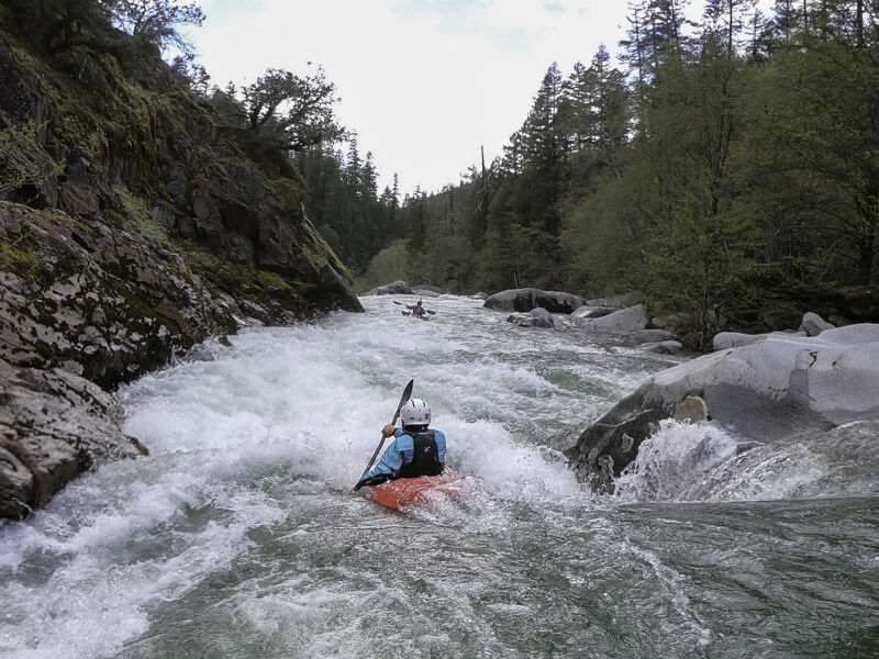
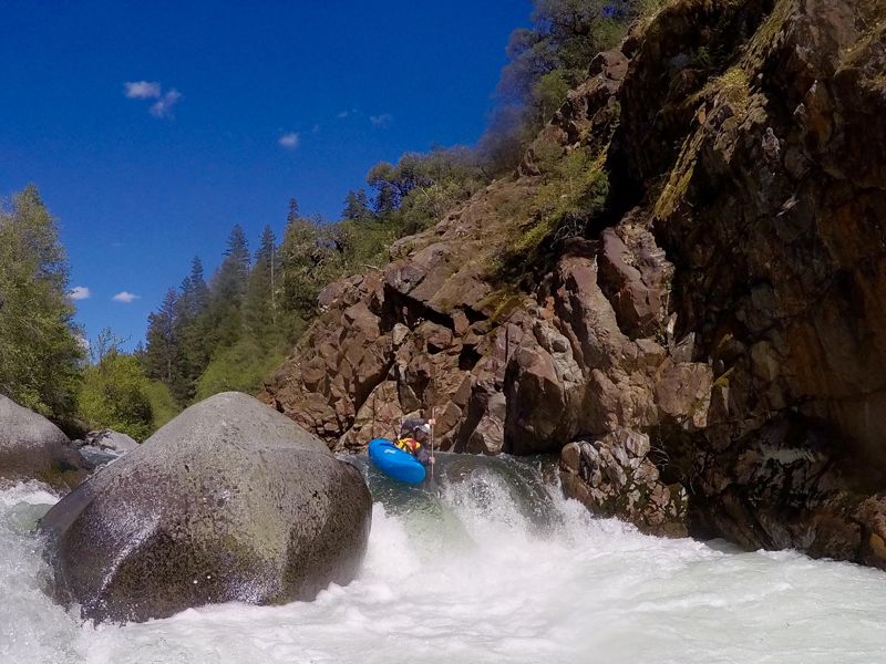
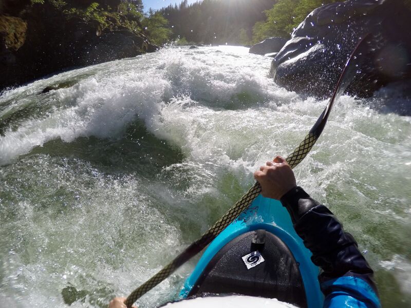
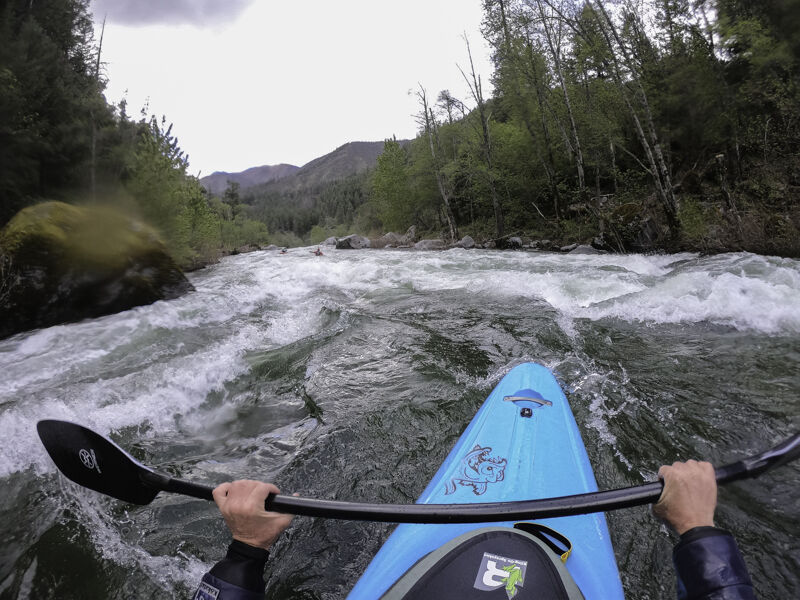
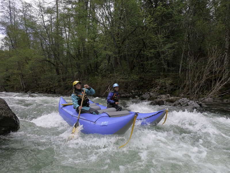
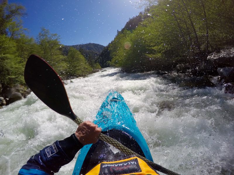
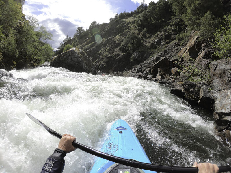
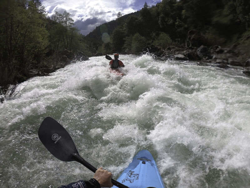
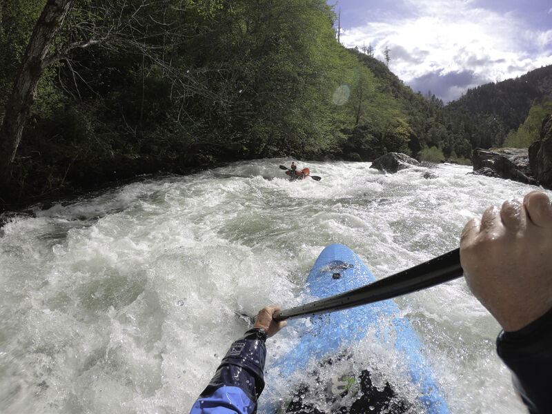
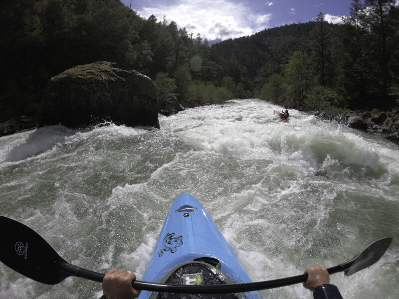
Advanced paddlers looking for a high-quality, under-the-radar Class IV(V) adventure will appreciate the 11-mile Canyon Run on the North Fork Salmon River (Karuk: Masúhsav), from the Gallia Mine access to Forks of Salmon. Though it sees less traffic than other runs in the watershed, it really shines when flows range from 4,500 to 7,000 cfs at the USGS Somes Bar gage. Comparable in difficulty to the more popular South Fork Gorge Run, this stretch is steeper, more continuous, and has a grweater diversity in its style of drops. Overall, it is defined by its silver granite boulder gardens and ledge drops. Most boaters take-out after 6.5 miles at Saw Pit Flat to avoid the Class V Indian Point Gorge downstream and keep the overall run difficulty in the Class IV range.
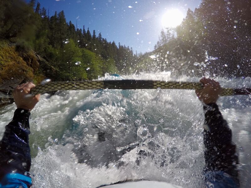
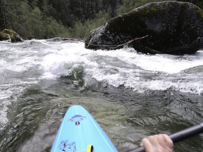
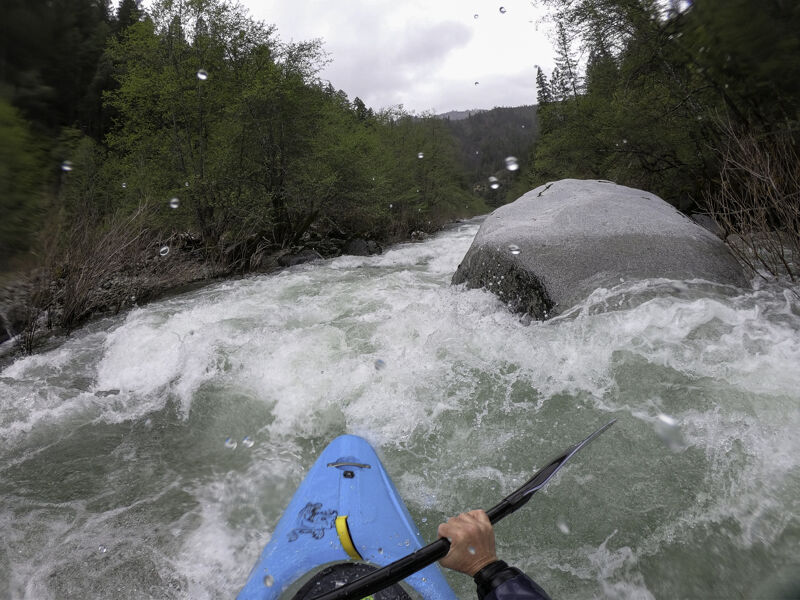
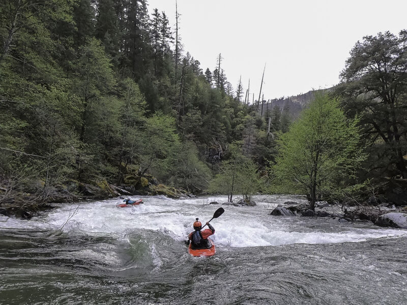
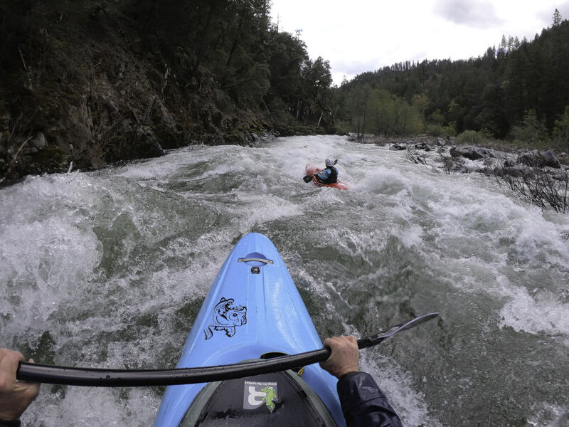
After a 3/4-mile-long warm-up below the Gallia Mine put-in, the river begins to drop and its pace is steady as the it flows through numerous granite boulder gardens and ledge drops for the next five miles. The abundance, diversity, and quality of the rapids in this reach is outstanding and although it is pool-drop, the main rapids keep coming without long sections of doldrums. At higher flows, the river really rallies along. Much of this reach can be boat-scouted by experienced paddlers, but if you don't know the run or if there have been recent high flows, be sure to scout Boulder Gulch and some of the other larger drops with blind horizon lines. Recent wildfires have resulted in an increase in wood moving down the North Fork Salmon and the river is small enough to catch and hold wood in places. Read the feature descriptions below and fully avoid the river left side channel below Kanaka Falls at Red Bank: it is full of strainers.
To get a good taste of this run without some of the larger rapids, put in at the Red Bank River Access using the short spur road just upstream of the campground (near road milemark 7.5). There ares still some great
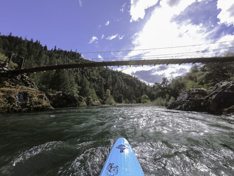
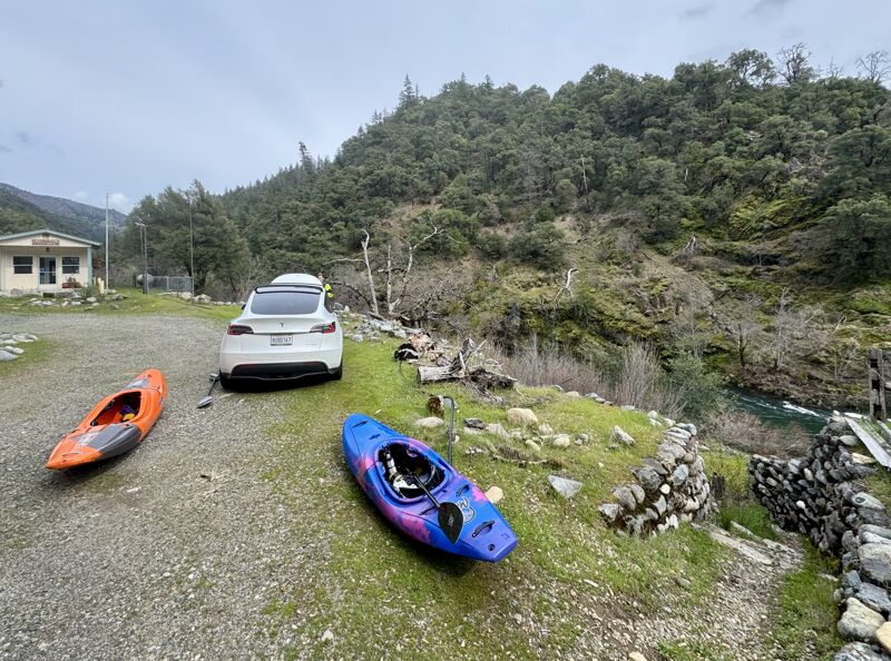
...The Gallia Mine River Access is located just upriver from the 10-mile marker on Sawyers Bar Road. Take the dirt road toward the river that is marked with a River Access / Engine Fill sign. The sign is difficult to see if you're driving upriver due to a tree blocking its view, so be sure to pay attention to the road milemarkers.
This rock garden drop signals the start of the larger rapids on this run.
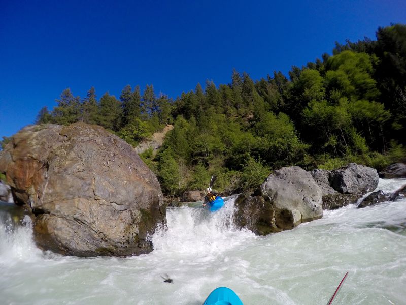
The river rounds a right hand bend and gets pinched between a large boulder on the right and the left wall. Skip over the breaking wave/hole and eddy out quickly on the right before entering Boulder Gulch rapid.
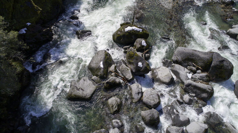
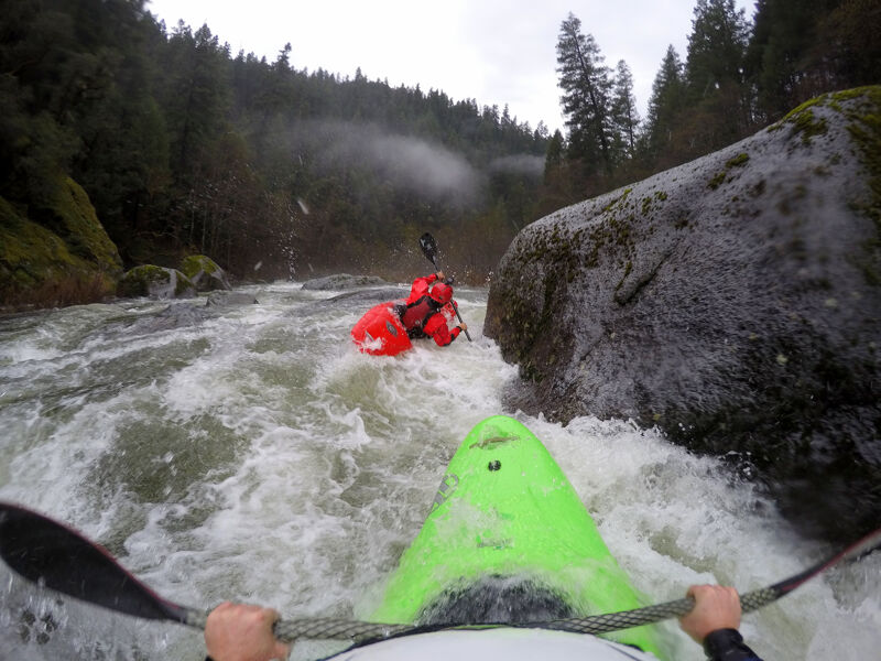
This long rapid includes three distinct drops plus plenty of boulder garden action packed together in continuous flow. It is full of sieves and undercut boulders.
Run the full length of the rapid on the river left side of the channel, and don't be tempted by potential sneak routes on the right or middle: they get congested and sieve out. Scouting the full length of the rapid is a challenge but can be done on river right. It's never a bad idea to check the first ledge for wood before paddling into the drop. Much of the North Fork watershed has burned in recent years and there is an increased amount of wood moving now. The scouting eddy is on river right following The Pinch and just above the first ledge in Boulder Gulch. The other two distinct drops in the rapid can be boat-scouted to a modest degree but still have blind horizons. Drone scouting is useful here and can be done from the road during shuttle.
The first ledge has a sticky hole at medium and high flows (named Mary's Hole for Mary DeRiemer's epic sidesurf in the 90s). Point straight ahead or slightly right as you vigorously launch the lip: do not point left toward the rock wall.
The second distinct drop is a double-drop with current pushing to the right. Quickly move left upon landing to avoid undercut boulders on the right. There is a large eddy on the left that's great for re-grouping and admiring the bouldery scenery.
The third distinct drop is usually launched off the middle or just right of middle.
The action continues for a good distance before the rapid finally ends in a long pool.
Boulder Gulch Rapid is also known as Nine Mile Rapid (Otter Bar Lodge Kayak School staff's preferred name) or, far less commonly as Devious (the name Lars Holbek gave the already-named drop the one time he paddled it).
If needed, there is an overgrown double track trail on river right that connects to Sawyers Bar Road just upstream of the 9-mile marker. The trail is hard to find at river level but is marked with a brown numbered sign up on the road. To portage the rapid, do so entirely on the river right shore and expect it to take some time.
Route your way through or around a couple punchy holes on the entry and line up to go either right or left of the tall boulder that splits flow. If you choose the left side, be sure move back toward center after passing the boulder; the far river left side turns into a sieve. No matter which side of the boulder you took, line up to shoot the center of the slot between the large granite boulders at the bottom. There's a big curler here at certain flows. This beautiful rapid can be blinding on sunny winter afternoons.
This is a prelude to Kanaka Falls which is just below.

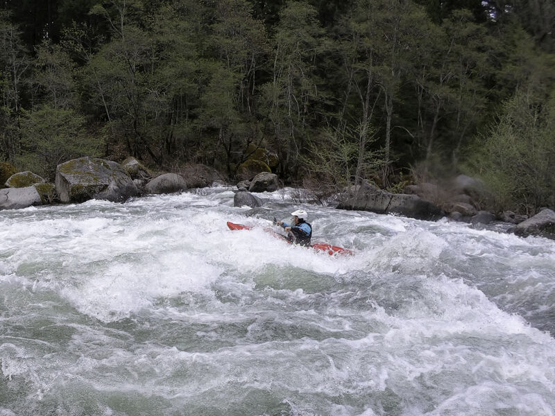
This is a long and fun granite boulder garden with an abundance of possible lines. It is visible from Sawyers Bar Road just upstream from the Red Bank Campground.
Be sure to hit the four-foot boof in the middle of this rapid; stern-first landings are the norm. The bottom third of the drop can be a bit chunky at medium and low flows, and the cleanest route is often found by staying on the left side of the channel (which may not seem intuitive).
There is a river access on the right at the bottom of the drop but boaters almost never use it because it only serves to cut the good whitewater short.
DO NOT ENTER THE RIVER LEFT SIDE CHANNEL BELOW KANAKA FALLS! There are numerous strainers blocking this smaller channel, most of which cannot be seen from the entry to the channel. Stick the the larger, obvious main channel on river right and boat past Red Bank Campground.
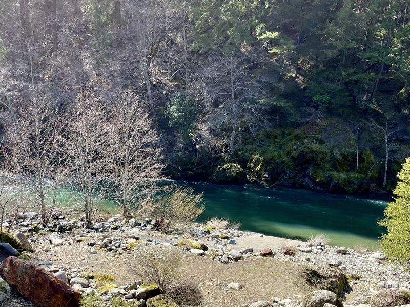
Red Bank Campground is about a half-mile below the drop on river right and is a fine place to camp for free (it has pit toilet and tables but no water or trash cans).
Red Bank River Access is marked as an Engine Fill Site and spur road 54D007 off of Sawyers Bar Road near milemark 7.5, just upstream of the Red Bank Campground. It is an informal access point with no amenities. The access is on river right.
The river flattens out briefly just after Kanaka Falls and there's a huge bar on river left. At higher flows, a side channel opens up on the top river left side of the bar, but there are numerous large logjams in the side channel that cannot be run or easily portaged. Do not enter!
DO NOT ENTER THE RIVER LEFT SIDE CHANNEL BELOW KANAKA FALLS! There are numerous strainers blocking this smaller channel, most of which cannot be seen from the entry to the channel. Stick the the larger, obvious main channel on river right and boat past Red Bank Campground. There are warning signs along the river here.
This rapid is easily identified by the house-size boulder in the middle of the river at the very top. The front of this rock is undercut and sometimes holds wood, but it is easily avoided. After passing the giant boulder, the rapid consists of a boulder garden that is usually run from left to center to right at the bottom. It is named for the family that homesteaded this site and lived on a mining claim here; the house foundation and orchard still exist along the unsigned river access road here. Also called Big Rock.
This is a long rapid with a fun little boof in the center left near the bottom.
Long rapid that ends at the old Dell Brown homesite (river right).
As the name implies, there are three holes in this rapid. The first two can be avoided or punched but the third hole, which is near the bottom of the drop, is sticky at low and medium flows and should be avoided. Stay far right to miss the third hole; the challenge is that the river is pushing you left and the bend in the river may distract you from seeing the hole in time.
Big, fun waves along the river left with eddy access surfing possible at medium flows. This rapid is plainly visible from Sawyers Bar Road near the 5.5 milemark.
This chunky drop is on the right side of an island (which you may not even notice) and is easy to spot from Sawyers Bar Road just upriver of the 5-mile marker—especially when driving upstream. Run far right (far left also goes at medium to high flows), but avoid the middle, which remains chunked out even at higher flows. In winter, afternoon sun aligns directly with the river here, making it nearly impossible to see through the glare—hang on and have faith.
Long rapid with technical maneuvering and one or two snaggletooth rocks to miss, depending on flow. The first is right of center at flows under 5,000 cfs at Somes Bar and the second is a bit left of the middle near the bottom. Both can be hit or missed, your choice.
Enter middle, move left, and follow the current banking off the river left rock toward the center as the rapid drops into a sometimes sticky, but generally friendly, hole. There's also a line down the middle.
There's a great upriver view from the river left eddy at the bottom. Rapids continue, but the river eases its gradient and pace below this drop for the next three miles until the entrance to Indian Point Gorge (V).
One of many class III rapids on this run, this one has a couple fun big waves.
Long rapid that passes by the last operating commercial gold mine on the river. Although the mine was likely only an investment scam in its final iteration, it operated into the 1990s.
The Saw Pit Flat River Access is commonly used as an take-out to shorten the run and avoid its most difficult section, the Indian Point Gorge which is about two miles downstream. The river access is at milemark 3.8 on Sawyers Bar Road. Someone stole its river access sign along Sawyers Bar Road in 2024, but the dirt road leading the river is pretty easy to find.
This is the last drive-up river access upstream of Indian Point Gorge (Class V). The river is primarily Class II between Saw Pit Flat and the Indian Point Gorge (two miles downstream), but the short length of this easier reach and the lack of a developed take-out before the gorge means that boaters typically do not use Saw Pit Flat as a put-in to run this short Class II reach.
Just below the beach at Saw Pit Flat, the river splits around an island. The left side is more commonly paddled because most of the water goes there and the right often collects wood.
This is the absolute last take-out before the river enters the vertical-walled Class V Indian Point Gorge (it is also the put-in for the gorge for those few paddlers who choose to run the gorge as a stand-alone section).
This is not a developed access and, by appearances, it is on someone's private property containing a yellow house on river left, a swinging bridge over the river, and a stone garage on river right. However, all of this is located on public national forest land and the property is unoccupied. It is a former mining claim known as Schwartz's (or Domino Mine), and the unique construction and infrastructure of the home is an excellent example of post-Depression era mining residences on the river and is under consideration for addition to the National Historic Register. You may legally access the river here; please don't disturb the historic structures or artifacts laying around.
If you're using this take-out, don't miss it. It is possible to take out right at the swinging bridge over the river just upstream but it is a steep, rocky climb up to the road. It is easier to continue past the swinging bridge and around the sharp bend in the river immediately below. Eddy out on river right just after this bend and take out. Walk toward the old stone garage and you'll find the path up to Sawyers Bar Road. There is no good parking here so you'll need to park vehicles a short distance up the road toward the swinging bridge. Most boaters that don't want to run the Indian Point Gorge take out upriver at Saw Pit Flat (road mile mark 3.8) due to easier access but the river is pretty and has some small rapids between Saw Pit and Schwartz's.
This straightforward class III rapid marks the entrance to the Indian Point Gorge. Murderer's Gulch comes in on river right at the bottom of the rapid. If you have doubts, this is the last place to exit the river, although you will have to bushwhack up the gulch through poison oak to get to the road or, perhaps more simply, walk back upstream the access by the Schwartz's rock garage. The next 1/2 mile is the steepest section of the North Fork and has a series of large rapids, including the largest, most congested rapid in the watershed.
Named by Lars Holbek, the river splits into a right hand line and left hand line coming out of the pool at the top. Both are runnable and both have their challenges and hazards.
River right is a technical line around the right side of a large boulder. The hazard is that the side of the boulder is undercut and you want to be sure not to drop sideways onto this side of the rock as you paddle past it. Also, watch for wood in this narrow channel.
River left is something of an off-axis double drop with a sticky hole at the bottom. You wouldn't be the first to take a beating here and swim out while your buddies scramble to catch your boat before it washes into the large rapids immediately downstream. A few boats have poorly suffered this fate.
On a bad day, particularly at higher flows, a swim at Foreboding could continue into Indian Point Falls. Best not to swim but, should you, swim vigorously for shore here and don't swim after your gear.
Also known as the the Landslide Rapid, Two-Mile, The Portage, and P-Word, this large drop is boulder-choked and steep. Lars Holbek's guidebook says it has a 'villainous appearance.' It is formed by large landslide debris that has rained down into the river from the road cut high up on river right and a natural landslide on river left.
The rapid can be scouted easiest on river right by walking downstream from the small pool separating it from Foreboding, the rapid above. But you won't be able to easily see into the crux section of the rapid because the boulders are large enough to block the view. Keep walking downstream and scramble out on the rocks to get a better look. For a full view, scout river left and take a long walk through the brush all the way to the bottom to see the whole thing. You also don't get a very good view from Sawyers Bar Road, even though you can see some of the drop from the pullout high above (mile mark 2).
Most paddlers portage this rapid (river left only), but there is a managable though tight line through it at all but very low flows. Those who run it usually begin from the river right eddy above the rapid, paddle out toward the middle and eddy out behind the first giant boulder that's above the steeper part of the rapid below. From here, move river left and bounce down the left slot into the faster current, adjust boat angle and very quickly get lined up for the slot in the middle. Missing this line can mean washing into the boulder sieve on the left (really not good). The slot is tight at low-medium levels and juicy at high-medium levels, so watch for the backender. Land the move, head far right, and follow the rocky line along the right bank to the bottom. The view back up from the bottom is impressive. Don't underestimate this drop. Some boaters will wheelchair down the far, far right from the top when flows allow for this (scout this sneak too!).
Lars Holbek's account is that whatever it was his group was concerned about in this drop 'looked hard to avoid' during their run in the 80s or 90s. It's a straight down-the-middle affair, really, but has a hard hit with a breaking wave/hole at most flows. Just take the hit, it's hard to avoid.
Giant boulders split the river to right and left channels. Although the right one looks more interesting, it drops you into the side edge of an undercut rock that is unpleasant at the least. Avoid this by taking the less exciting left channel and be sure to look back up at the right channel from the bottom to appreciate your choice.
The final drop in the Indian Point Gorge series and the last of the larger rapids on the North Fork Salmon. After paddling the others in Indian Point Gorge, this one won't seem like much, but it's a decent-sized and straightforward drop. The run continues to Forks of Salmon but eases to class II below here.
The lowermost mile and a quarter of the North Fork Salmon is great for intermediate boaters and has a nice series of eight class II+/III- rapids before reaching the confluence with the South Fork. To run this section, put in about 1/4 mile upstream of the one-mile marker on Sawyers Bar Road where a short dirt road (54D009) departs from the pavement at an upriver angle. Walk from the small parking/camping area to the river on a user trail that turns into a steeper route over bedrock. This is a great upriver extension of the Forks Run that ends at Nordheimer Campground.
Although it is possible to take out here from the NF Canyon Run, nearly all boaters choose to continue to the Forks Community Park River Access about one mile downriver for ease of access and to enjoy another mile of gorgeous river with rapids that will feel cruisy compared to those upstream.
Take out on river right immediately upstream of the Cecilville Road bridge. There is a path from the river up to the Forks of Salmon Community Park near the USFS restroom and US Post Office. There is a parking area and a public phone here too plus a large North Fork Salmon River sign along the road to make it even more obvious.
Paddlers may also continue downstream to the mainstream Salmon River and go another 1/2 mile to take out at the sandy beach on river right below the Forks of Salmon Elementary School. This is accessed by the unsigned gravel road off Salmon River Road that is directly across from the white Community Club building at the 17-mile marker.
Mar 29, 2025
Early spring day on the North Fork from Gallia all the way in to Forks of Salmon. I'd call this the lower half of a medium flow: plently of water to make the full run enjoyable but not fluffy, and not too much flow for the Indian Point Gorge to be unreasonable.
May 17, 2023
The entire staff of American Whitewater had an opportunity to get out on the Salmon River in the early evening as part of our staff retreat at Otter Bar. The run began on the Wild Mile section of the North Fork and continued on down the mainstem on the Forks Run to the Nordeimer Campground access. The run took us approximately 90 minutes with a short surf session at Otter Bar Waves. It only took us about 10 minutes to run this Wild Mile section of the North Fork. Additional photos can be found on a trip report associcated with the Forks run.