Piru Creek
4) Lake Piru to Santa Clara River(Lower Piru)
August 22, 2009
| Reporter | Paul Martzen |
Rick Norman reports:
IMHO: kayaks and ww short canoes are best suited. Hotshot IK's may have a blast. Small rafts will have an arduous day, and large rafts will have a long picnic followed by a 'lotta 'spainin' to do'' as you portage over the private property dude ranch, seeking the road home.
Lower Piru Creek: SF Dam spillway/power plant to 1st Bridge:
Special Shuttle access to the River Gauge located 300 yards below the SF Dam is provided by arrangement of UW as FERC re-licensing mitigations. Private boater vehicles do not have access over the local private properties, nor over the SF Dam facilities. The initial special shuttle details have yet to be fully determined and published. Such initial shuttle availability may also reflect boater turnout: hopefully we show the same intense interest displayed by our enthusiastic participation in the whitewater feasibility studies in 2005, 2006 and 2007.
One option is that the shuttle will load boats and boaters at a turnout on the upper road leading to Piru Lake Rec. Area, very near to the actual Dam's Upper Facility entrance. This route takes an adventurous road across the spillway, switch-backs down the Dam abutments, and finally ends at the River Gauge area, approximately. 300 yards below the base of the Dam powerhouse.
The second shuttle option passes thru a different locked gate, using a UW easement over the private ranch property, arriving at the same aforementioned River Gauge put-in site.
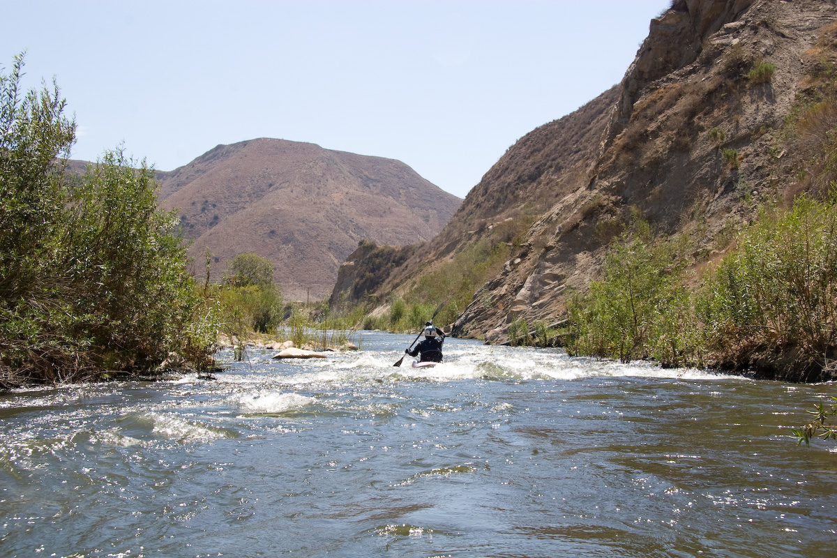
This upper put-in to the Lower Piru Creek, below Lake Piru, offers an additional 1.7 miles to the run, an additional rapid, beautiful riverine float scenery, and a low- weir formed play-wave for show-time and warm-up located just above the put-in.
Peeling out of the play-wave and heading due south a short distance, the boater plunges into the overhanging trees. A sharp right bend in the river points the unwary boater to travel west into a swamp like bottom land that peters out towards a now little-used river channel below the westerly Dam spillway. A dead-end for Deadheads.
Back upriver, just a few yards AFTER that first sharp westerly right bend, care should be taken to float ' leftwards through the willow/shoals' in a southerly direction. Hopefully there may be some enterprising kayakers willing to take a scythe and machete; creating a path though the willows in the early days of the boating season; maybe the best way to establish the most viable route leading to the next worthy feature, described below.
As the boater continues south and emerges from the willow/shoal jungle, the river again consolidates the many braids into fewer channels. The boater may see the main river channel disappear into a stand of eucalyptus and cottonwoods. There is a good landing at river right just before the trees gobble up the river in a swift current rush. A scout trail, that may be shared with the occasional cattle and attending bull, leads a 100 yards to view a sharp dog-leg right-left turn and then a beaver dam-like ledge drop, located at the exit from the dark and gloomy tree- tunnel section.
This tight turn and ledge feature, and the narrow raging channel upstream, have the most potential for low hanging branches, fallen branches, and log-jams. It may be a good idea to scout the whole section before committing to the entrance. Very few, fast , and brushy eddies are available in this wild-thrill: It's a Piru E-ticket ride.
Below the Dog-Leg-Ledge drop, the river calms considerably for its preamble across the flood-plain of ancient, pre-dam deposits of rich soil from the high country surrounding Mt Pinos and Los Padres National forest.
Occasional Ranch Temascal water pump facilities of the so-called real world float by, as the boater enjoys the riverside reeds, the flora/fauna, and the cool stream. A good place for dreamers.
My foggy memory provides no further detail, as soon the boater approaches the 1st Bridge (as counted, starting from the dam spillway).
A fine addition to our rare inventory of Southern California boating opportunities.
Rick Norman
Aug. 22,2009