Conasauga
Hickory Creek Trailhead to East Cowpen Road(Upper Upper Conasauga)
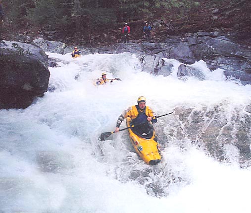
December 14, 2004
| Reporter | Robert Maxwell |
The paddler's gage for this run is on the East Cowpen Road bridge. Its on the downstream river left bridge support. The bridge is 2 miles downstream of the take-out. 6' is probably minimum. My guess is that 1 foot is medium and 1'6' is probably high. I've heard of a group running it as low as 3', but that would be an ELF run (Extrememly Low Flow)
A good way to gage if the Conasauga is running is to check 02385800 HOLLY CREEK NEAR CHATSWORTH, GA. If it is over 450 cfs the upper upper is probably running.
P.S: the old Elbow Tree has finally rotted and fallen into the river. Its now useless as a gage for the river.