Conasauga
Hickory Creek Trailhead to East Cowpen Road(Upper Upper Conasauga)
April 28, 2010
| Reporter | Alex Zendel |
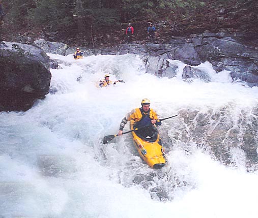
We paddled the upper upper (uu) into the upper on 4/25/2010. This was a first for everyone in the group and I thought it was one of the best class III-IV(V-)wilderness runs in the SE. The uu felt a lot like paddling in the Smokies - smooth rounded bolders and crystal clear water. It also felt like plateau because the low angle slides kept coming and coming. Very fun run.
Here are some gauge readings that correlate to our run. It had been a pretty decent spring in the Southeast, but a little on the dry side. I had heard that Chattanooga was 5' behind in rain. We weren't aware of the gauge of river left at the take out when we set shuttle. It was at 2 feet when we took off (this is NOT the gauge at East Cowpen Rd - it's at the take-out at the confluence of a side creek and the Conasauge. This felt like a medium low level in the uu and a solid, somewhat juicy medium level in the upper. The COHUTTA #1 RAWS NEAR CISCO rain gauge had shown that 3' of rain had fallen and in the 24 hour period ending at 4AM. We put on the uu11 hours later at 3PM. This gauge can be found here: http://bit.ly/a8Z9bO. A map of all NOAA rain gauges in GA can be found here: http://amazon.nws.noaa.gov/hads/gmap/GA\_gmap.html. The USGS Holly Creek stream gauge was peaking at 1300 cfs when we put on. This gauge can be found here: http://waterdata.usgs.gov/usa/nwis/uv?02385800. Cheers, Alex Z