Conasauga
Hickory Creek Trailhead to East Cowpen Road(Upper Upper Conasauga)
January 1, 1900
| Reporter | Robert Maxwell |
After lugging your boat 1.5 miles down the Hickory Creek trail to the put-in, you have about 50 yards before you have to run the longest and one of the most challenging rapids on the run. A great way to start the day!
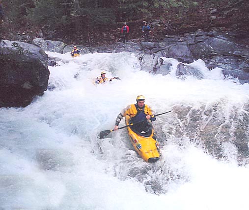
Jim Kelley running the middle of Cherynoble; the longest and one of the most challenging rapids on the Conasauga River.
Todd Lasher running the middle of Cherynoble; the longest and one of the most challenging rapids on the Conasauga River.
The East Cowpen Road Bridge Gage is 2 miles downstream of the take-out. Located on the upstream river left side of the bridge. 6' is probably minimum. At 9' it was getting low.
For years, or should I say decades, the 'Elbow Tree' has been the way to gage if the Conasauga is running. Well, it died, rotted and fell into the river. This is whats left. Now the official gage is the East Cowpen Road Bridge gage. Located 2 miles downstream. 6' is probably minimum for this section of the Conasauga.
Jim Kelley running double drop.
There's plenty of parking at the Hickory Creek Trailhead.
The Hickory Creek trailhead is well signed and easy to find. The actual put-in is 1.5 miles down the Hickory Creek trail to the confluence of Rough Creek and the Conasauga River.
Marshall Fox zig-zagging through one of the many rapids on Upper Upper Conasauga.
Jim Kelley at the top of a very long multiple slide rapid.
Jim Kelley dropping into a sticky little slot hole.