Buffalo
3) Ponca to Kyles (10.6 miles)
June 28, 2025
| Reporter | Dewey Fuller |
| Flow | Low Runnable |
Ponca Gauge: 130 cfs when we put in on the 13th, low flow
Pruitt Gauge: about 500 cfs on the 15th, medium flow
St. Joe Gauge: about 2000 cfs on the 16th, medium flow
Harriet Gauge: about 3000 cfs on the 16th, medium flow
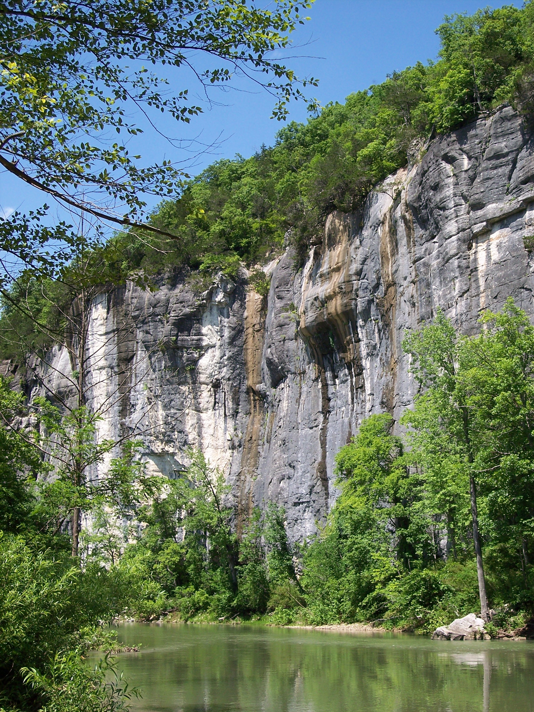
We got lucky on this one. The Buffalo is normally not running in mid-June but heavy rains earlier in the month left us with a narrow window to do a multiday day self-support run that included the stunning high bluffs of the upper section – Ponca to Kyle’s Landing. The short timeline left little opportunity for proper planning. Thanks to extremely good luck and the advice of local outfitters we were able to pull off a successful run. When we put in at Ponca the level was close to the minimum needed for a loaded tandem canoe. With 130 cfs on the Ponca gauge it was NOT scrappy for the most part. Only one shoal required getting out of the boat for a short drag. After the first few miles we had plenty of water. The water was clear for the first 50 miles even after some heavy rains the second night. The current moves along with few calm spots. Easy class II rapids are frequent, keeping it interesting. With stunning scenery, clean clear water and wilderness setting, it’s easy to see why the Buffalo was our country’s first National River.
Some notes on logistics:
Shuttle can be arranged by local outfitters. We used Buffalo Outdoor Center (BOC) since they are in Ponca where we put in. If you do a lower section another outfitter might work better for shuttle. We had our own boat and equipment. Outfitters may be able to provide boats.
Water is available at parks and campgrounds along the river. BOC provided us with a free map indicating where tap water is available. Other services are also marked.
No permits or fees are required to run the river.
There is no cell service on the upper river but some campgrounds have free landline phones. The people at BOC marked phone access points on our map. The lower river has limited cell service.
National Geographic Trails Illustrated Maps 232 and 233 are excellent topographic guides to the whole 135-mile National River corridor and its surrounding area. 232 is the river west, 233 is the river east. These maps give information on river access points, campgrounds, parking, trails, etc.
Camping is allowed on the beaches and rock/sand bars. We found spots to camp more plentiful on the upper river. There are also public campgrounds.
Things close early in the Ponca area. BOC closes at 6pm as do the few other businesses. If you are arriving late, make sure you have a place to camp lined up for the night. Steel Creek Campground is a few miles from Ponca but they may be full; some sites can be reserved. Also, BOC has cabins. If you arrive late and need to make a call, BOC’s WiFi can be accessed if you stand close to their main entrance. There is no cell service.