Fishkill Creek
Beacon
| Difficulty | II-IV |
| Length | 0.4 mi |
| Avg Gradient | n/a |
| Gauge | Wappinger Creek Near Wappingers Falls Ny |
| Flow Rate as of 1 hour | 27 cfsbelow recommended |
| Reach Info Last Updated | April 26, 2016 |
Info from New York Exposed: The Whitewater State, Vol. 2.
Local paddler Ken Bolton shared, in 2009:
New York Exposed calls this Fish Kill, but that's slightly erroneous and confusing. NY State DEP calls this Fishkill Creek.
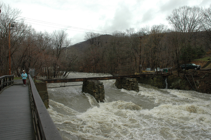
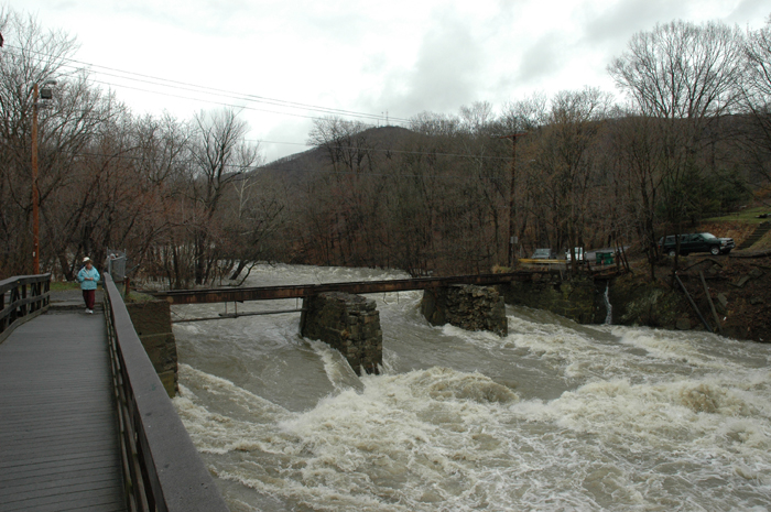
Further, while I haven't run the lower section down by Madame Brett Park, there is a great 0.5 mile run further upstream when the water is between 2 and 5.5 feet. Put-in is at Bridge St., off of Liberty. Cross the wooden bridge by foot and scramble down to the water. (The landowner and I are discussing access to the creek from the near-side.) Paddle upstream ~20 yards to a fun little hole on the left. The gauge is under the bridge on the left. A nice creek-wide standing wave is just below the bridge and makes a great play spot. Things flatten out until a hearty class III just before the take-out at the Central Hudson power station. A ten-minute walk up Liberty brings you back to the put-in. This creek is polluted: local kids, nearby auto dealerships, and the Walmart and Home Depot parking lots upstream contribute to a local history of toxic dumping. Shale creek-bottom, corroding rebar, and natural strainers abound.
Downstate New York Area Reaches
Beer Kill Beer Kill, W. Branch
...
See the main page. This is the putin for a half-mile section which has a play wave and a III rapid.
Ken Bolton shared:
'There is a spot locals call 'Red Rocks' about a quarter mile from the standing wave under Bridge Street. It's probably a class II+, and should be scouted for debris before it is run.'
Lat/longitude coords are a wild approximation, from online maps.
Dec 2, 2013
Ran the segment above Madame Brett Park when visiting parents for thanksgiving, missed the water from the rain by a day or two.
Put in below rapids after the dam, using a set of stairs from the trail down to the creek. Level was very low and the creek was rocky. I was able to surf a small consistent wave towards river left below the rapids after the dam. Very short, rocky run that was not very eventful, other than getting stuck on the rocks a couple times. Takes maybe 5 minutes to get through it. Ended at bridge in front of park parking lot. The creek is divided into three segments by the bridge supports. River right segment was a little too low and my paddling buddy got stuck on the rocks. Center section had enough water to run without issue. Took out river right at a small beach after the abandoned hat factory that had a path up to the main trail.
Will be exploring this again when I'm in the area if the level is a little higher. Also want to try to run the rapids above the dam at the park. Need to first investigate to see if there is a better way to get access to it other than paddling upstream.
Apr 17, 2007
Captured at high flood stage. Bronx river pkwy was under 10ft of water that day.