Clear Fork
3. Burnt Mill Bridge to Confluence with New River
April 5, 2015
| Reporter | Watts Hudgens |
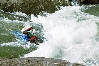
Thursday we had a mixed group, from Canada eh?, that did Clear Fork to the Confluence while a smaller group went all the way down to Leatherwood Ford on the BSF proper. Clear Fork was approx 570cfs. Six BlackFly canoes and one kayak (me). Plenty of water to avoid a scraping, shallow day on this section. Once you turn off of Highway US27 the posted directions for this section work fine, but there are also supplemental Brown Natl Park Service signs and other signage to get you to Burnt Mill Bridge without issue. Pit Toilets at BMB now. Our group all scouted Funnel/Flume Rapid from river left and setup rope on river left. Speaking of which, about the time you'd be thinking that 'Flume should be showing up soon' Clear Fork starts to narrow down and you get into your first more-interesting rapid after a long-ish flatter stretch. Even from low-down, close to the water in my kayak, you definitely get the sense that something more substantial is approaching and I could see strong indications that the river was going to get very narrow between some large sets of boulders even though I could not see the Flume-Hole itself until we got out and scouted.