Elkhorn Creek
Forks of Elkhorn, Church lot below US460 Bridge to Knight's Bridge on KY1900 (6 miles)(Elkhorn Gorge)
| Difficulty | II(III) |
| Length | 7.6 mi |
| Avg Gradient | 10 fpm |
| Gauge | Elkhorn Creek Near Frankfort, Ky |
| Flow Rate as of 1 hour | 948 cfsmedium runnable |
| Reach Info Last Updated | November 14, 2024 |
The 'Elkhorn Gorge' begins at the confluence of the north and south tributaries at the Forks of the Elkhorn bridge on US 460 just east of Frankfort (about a 45 minute drive from Lexington).
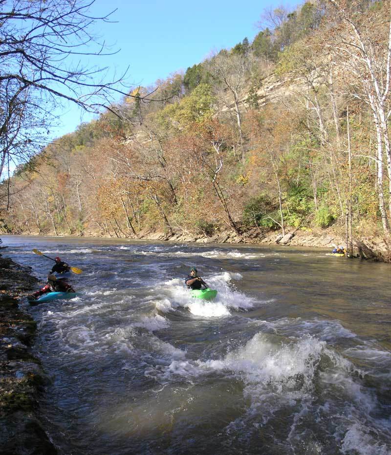
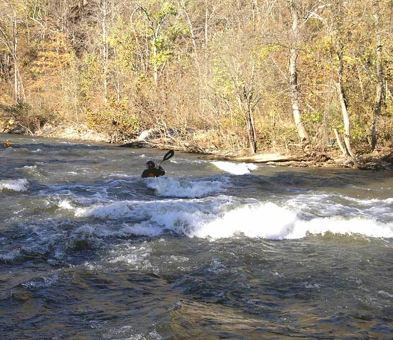
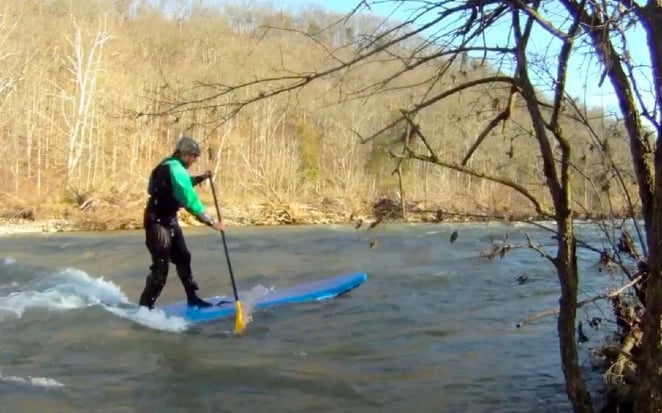
Filled with class II (and occasional class III) rapids, the Elkhorn has plenty to satisfy the novice or experienced whitewater paddler, making it an excellent ww classroom and play run for paddlers from Kentucky, Indiana, and Ohio.
Wide enough to generally stay free of strainers, the Elkhorn has a large watershed, allowing it to keep its flow longer after a rain when others in Central Kentucky have dropped too low.
The Jim Beam Distillery dam was removed in the summer of 2021, so paddlers no longer have portage around a deadly low-head dam.
To read more about the creek (and how the takeout land was obtained, and history of the paddler/land-owner interactions), click this link for the online American Whitewater Journal article that appeared in the March/April 2000 issue: >>> 'AW Acres: The Elkhorn Saga' <<<.
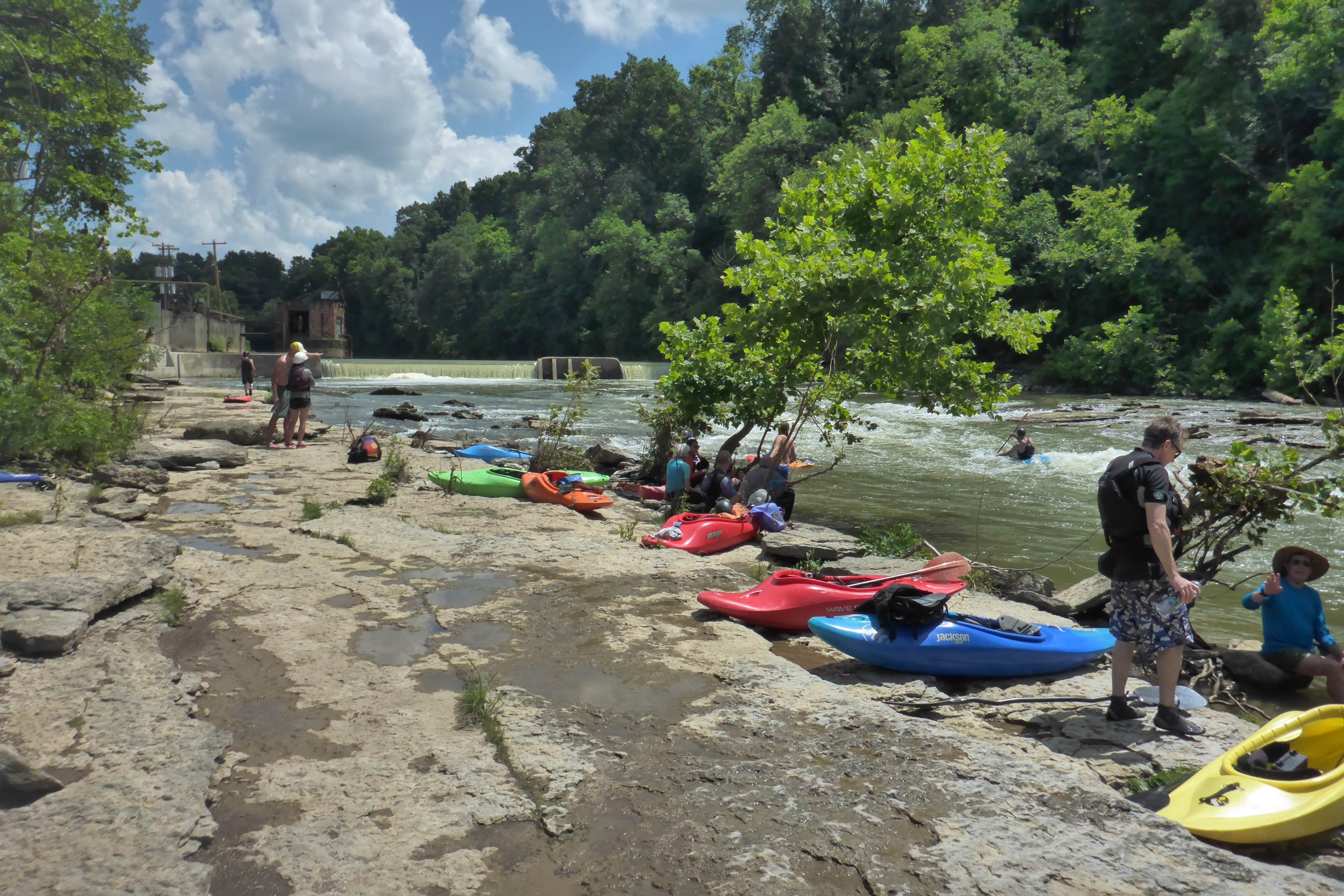
Putin: Forks of the Elkhorn Bridge on US 460 about 3 miles east of Frankfort,KY. As announced on the BWA website in October, 2021, parking and put-in at the church is now officially legal! Pay your parking fee at the honor box: $5 for BWA members, $6 for non-members.
Shuttle: From the put-in, take US 460 west 1.1 miles towards Frankfort. At the stoplight, turn right, onto KY2822/Steadmantown Lane. Go about 1.2 miles to a stop sign. Go right to continue on KY2822/Steadmantown Lane for about 1.9 miles to a stop sign at Peaks Mill Rd (KY1900N). Turn right and go 2.3 miles. Look for AW Acres takeout, on the left, just before Knight's Bridge over the Elkhorn.
Other Information Sources (click links!):
...
As of October, 2021, negotiation has been successful to allow parking and put-in at the church (north/downstream of the highway bridge).
Pay at the honor box! (DON'T CHEAT ON THIS AND BLOW IT FOR ALL BOATERS!)
Within sight of the put in are several small rapids. The middle one has the remains of a low dam arching across the river. With good flow, this low structure forms Church Wave, a fine beginner's play spot.

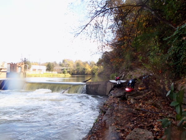
The river curves gradually right around the Jim Beam Distillery. These bridges used to serve as signal to move river-left to portage a low head dam.
REJOICE! That is no longer necessary.
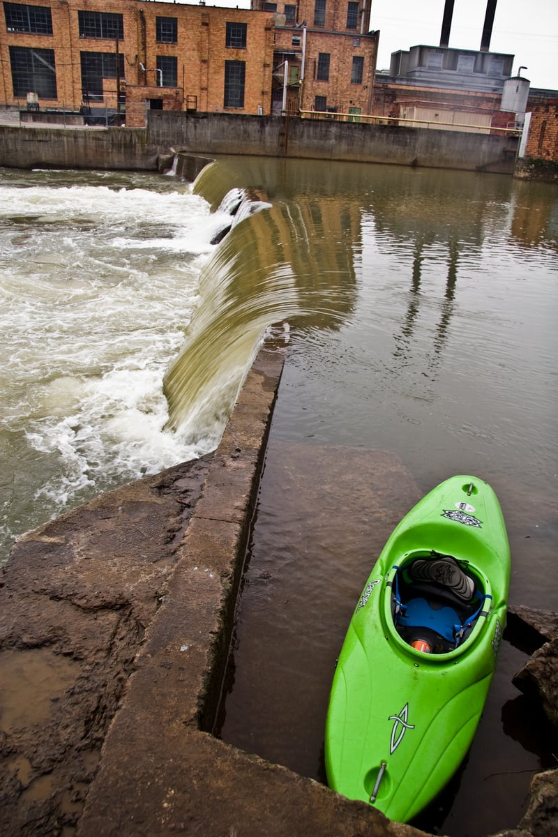
In summer of 2021 this dam was finally removed. We leave the photo to remind folks of the many years of portaging, and the unfortunate deaths which had occurred here and elsewhere at similar low-head dams.
Just byond the location of the former dam, a significant rapid can be run down the middle.
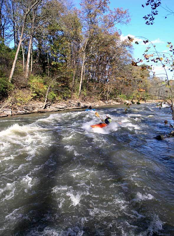
S-Turn Rapid contains a diagonal wave which may reach maximum height in the 1500-2000 cfs range.
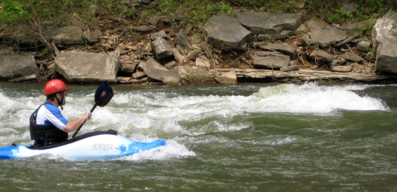
This hole can pack a punch. Possibly class 3 at higher flows.
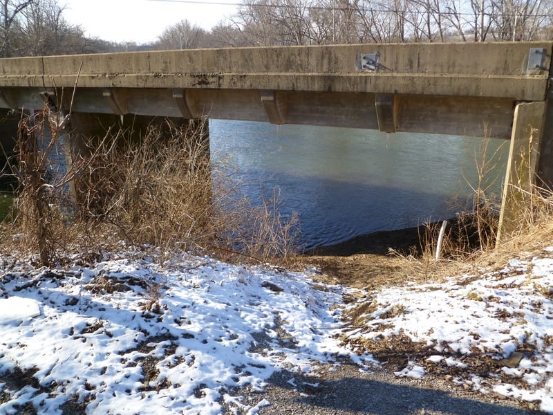
Pass under the Peaks Mill Road bridge (KY 1900), then take out on river left.
The first take out (very close to the bridge) is for Canoe Kentucky customers.
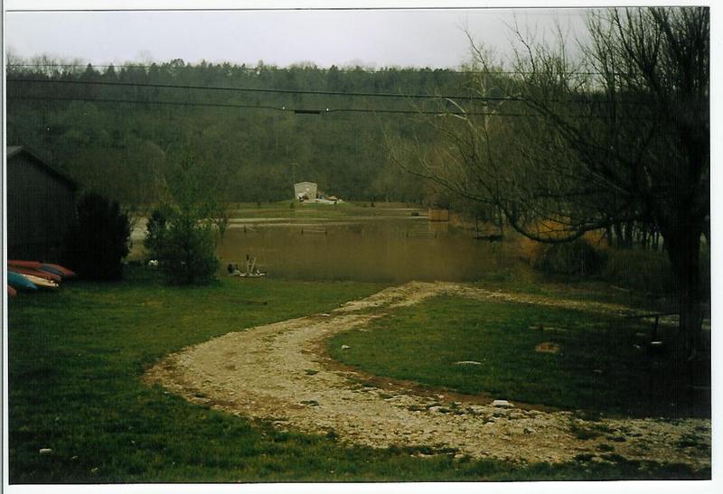
The public take out is about 100 yards below the bridge. The take out is owned by American Whitewater and managed by local boating clubs: Bluegrass Wildwater Association, Vikings Canoe Club, and the Elkhorn Paddlers. There is a sign with a Venmo QR code on it where you can donate money to American Whitewater to help maintain this take out for the whole community.
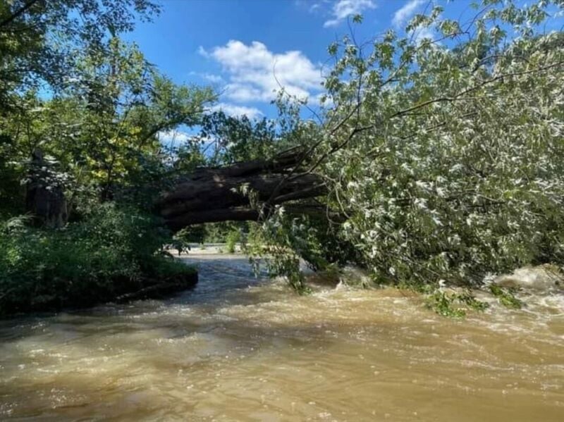
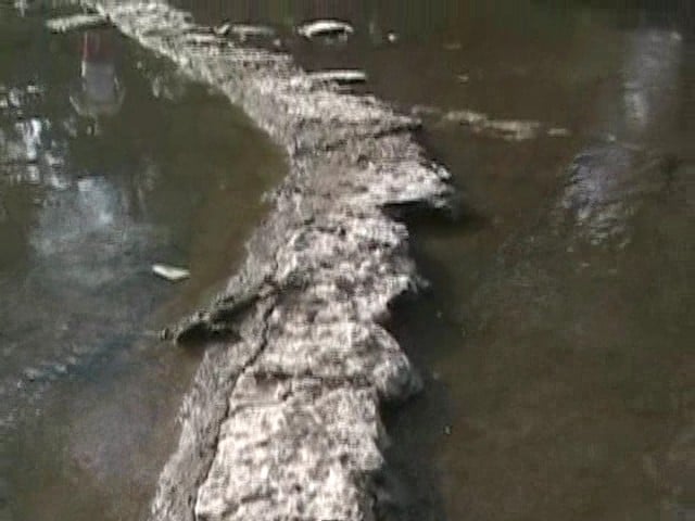
The photo shows the field flooded during very high water.
(Subsequent improvements have been made here.)
May 31, 2019
Dilution was the solution and so the water in the Elkhorn should be fine.
Jul 26, 2011
7/25/11 600 CFS Trip Report.
The night before Elkhorn was running at 1000 CFS and so my brother and I made plans to run Elkhorn the next day. We thought the level would be around 700 CFS by the time we put in. I have run it at 700 CFS and Surf City was pretty good at that level. We ran it a few days later at 800 CFS and Surf City was great at that level. I once ran Elkhorn at 500 CFS in a Coleman raft and swore I would never run it at that level again. Much later I ran it at 350 CFS and had a blast, which made me think 500 CFS might be a good level as long as you're in a kayak.
We decided to use Canoe Kentucky for a shuttle. They charged us $25 for two kayaks and at 1p.m. they have you follow them to the AW takeout and then haul you and your stuff to the put-in. We figured the campground charges $4 for parking, and so subtract that from the $25 and you are left with $21, which is about what we would have spent on gas bringing another vehicle anyhow(it's 100 miles of driving including the shuttle).
Church Wave was a total bust, but we found a couple rope swings before the dam and had a good time with that. It had rained earlier and I said I bet Elkhorn will be at 1000 CFS tomorrow, and it turned out I was right. Before the dam there is a cool cascade on river left and we decided to hike up it. The cold water on our feet felt great and eventually we got to a spring. I washed my face in the water and it smelled like gasoline, my brother thought so also.
The surf wave on river right after the dam was at it's prime in a way. It gets bigger at higher levels, but at 600 CFS, not only was it big, but it also had eddy service. It required a very strong brace to keep you from turning and flushing out of it.
There was a cool waterfall that was about 10 feet wide and 30 feet tall. It only took us 30 seconds to hike up the hill to check it out, and it was so cold that I'm sure it's spring fed.
S-turn was pretty weak, but at least the lateral wave was in, which I surfed all along as it flushed me out.
Lunch Stop was also a bust, and so was Surf City. We hung out at Surf City anyhow just to lay in the creek and cool off. There was a tiny surf wave on river right, but it wasn't much at all. The Angioplasty side had more water, but Angioplasty was not in at all.
The wave directly after the large boulder on river right(this rapid needs a name and it needs to be added to AW) was in. The level was low enough that I could finally see what causes this wave; a large drop forces a ton of flow directly at a V shaped 2 foot ledge. This wave gets huge at higher levels, but at 600 CFS it was almost more of a hole than a wave. I tried surfing the wave and water from both sides of the V filled me up and it took a lot of effort just to get out of it.
The 2 mile section through the woods moved along great for the first half, but the second half is so slow. As slow as it was, we were still able to just lay around in our boats and let the current do all the work. By the end of the trip we were pretty exhausted due to a climbing and caving trip we did the day before.
All in all it was a great trip, escaping the summer heat, and at least we got to surf it up at the Dam Rapid. During the flat water stretches we took lots of swims and we would float down the creek letting our PFDs do all the work while we put our feet on top of our boats, our bodies in a hammock like position.