Antietam Creek
3) MD 34 to Potomac River(Lower Antietam/Burnside Bridge Section)
| Difficulty | I-II |
| Length | 5.8 mi |
| Avg Gradient | 7 fpm |
| Gauge | Antietam Creek Near Sharpsburg, Md |
| Flow Rate as of 19 minutes | 2.32 ftbelow recommended |
| Reach Info Last Updated | May 8, 2026 |
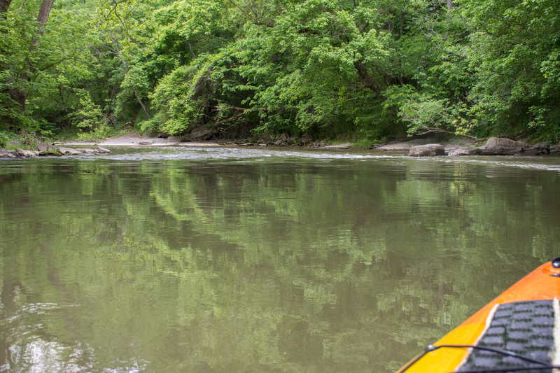
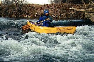
Antietam Creek is a great Class I-II run through beautiful natural scenery and the historic Antietam civil war battlefield park.
located southeast of Hagerstown, MD.
Putin at the Rt. 34 bridge (downstream side; river left) between Keedysville and Sharpsburg.
Takeout on the Potomac River at the C&O Canal camprgound located just upstream of the creek's confluence with the river.
An excellent website for the creek is maintained by Antietam Creek Canoe Co..
Description:
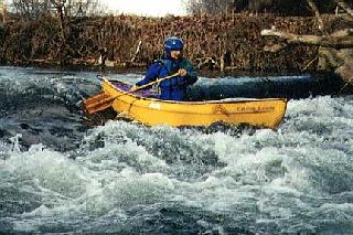
This section is primarily characterized by Class I-II water with rapids created by dam ruins and sharp, tight turns on this narrow creek. Spring-fed, it holds water longer than other small streams in the area and is the last to freeze and first to thaw. Practiced novice boaters should be able to handle the rapids but watch out for downed trees, which can pose serious hazards on this tree-lined run.
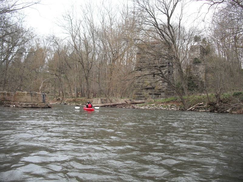
Landing at the historic Burnside Bridge at the Antietam battlefield is prohibited by the National Park Service. Below the bridge is an intact dam/weir that provides a two foot drop and bump. It is best run a little left of center. About 50 yards below the dam there is a landing on river left if you'd like to visit the battlefield site. The long middle part of the run consists of Class I moving water: shoals, eddys, small chutes and occasional strainers. Near the end of the run the gradient picks up as you approach the Potomac River.
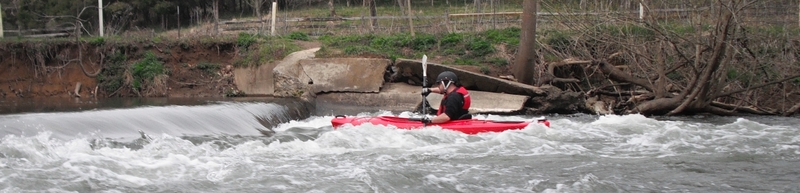
The last rapid - Furnace Rapids - is a long Class II that can be scouted on the left. Immediately below is a bridge where an old but now closed takeout point was located. Continue down the Potomac River and paddle upstream to the takeout.
Shorter or longer trips can be made on this creek, but some of the bridge crossings other than at Rt 34 and at the C&O Canal park have historic preservation and/or landowner access issues.
MD Rt 34 River left side immediately below the road bridge.
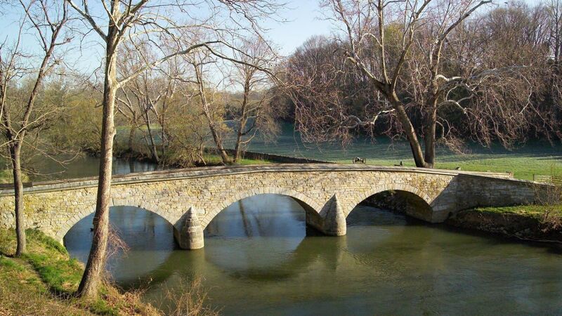
Landing at the historic Burnside Bridge at the Antietam battlefield is prohibited by the National Park Service. But you can paddle under it and admire it from the water. About 400 yards below the bridge there is a landing on river left at 'Molly's Hole' if you'd like to walk upstream to visit the Burnside Bridge battlefield site.
Below Burnside Bridge is an intact dam/weir that provides a two foot drop and bump. It is best run a little left of center.
Molly's Hole refers to a deep spot in the creek that has been used as a swimming hole for locals. The New Burnside Bridge Rd. parallel's the creek at this point which provides access and some parking.
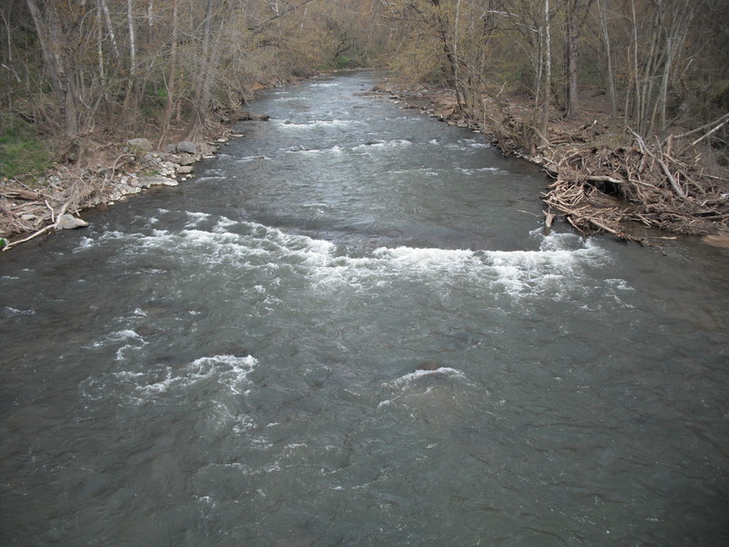
Furnace Rapids - (AKA 'Ironworks Rapid') is a long Class II that can be scouted on the left. Immediately below is a bridge where an old but now closed takeout point was located.
Continue down the Potomac River and paddle upstream to the takeout.
Oct 9, 2021
We ran this at a gauge height of 2.8' today, 09 Oct 2021, in packrafts, entirely smooth trip. Very pleasant paddle throughout, no strainers present and no portages required. Biked back up to the put-in at the bridge on MD-34, with a few hills but easy ride. (Note that Sherrick Farm Trail from Burnside Bridge Rd to MD-34, which some apps give as the fastest route by bike, is not actually open to bikes; go into Sharpsburg then out 34 instead.)
Dec 6, 2020
Have recently run this section at 2.3 ft in October 2020 (lots of dragging, but possible) and 2.65 ft in December 2020 (much better). No strainers on bridges. Pretty easy. The higher water level obviously made the dam smoother. There's just one spot to play around/surf/learn. December trip was showing 15 mph winds, but with the exception of about 2 minutes of the trip down, there was no wind, likely from bank/tree protection. This made a huge difference for a 45 degree day.
Jul 12, 2018
Went down this section on June 16th, 2018. Noticed that a large metal canoe had sunk and wrapped
around a rock about a mile and a half before the takeout, creating a new rapid, now dubbed 'Manard
Falls'.