Emile Creek
End of "BLM 2 2 Rd" to Little River
| Difficulty | IV+ |
| Length | 1.5 mi |
| Avg Gradient | 210 fpm |
| Gauge | Little River at Peel, or |
| Reach Info Last Updated | June 4, 2019 |
Stream: A short, but neat run with an easy shuttle and good bedrock rapids.
There is wood present, so only boaters comfortable with dealing with that obstacle should attempt the run. 1 wood portage in 2017.
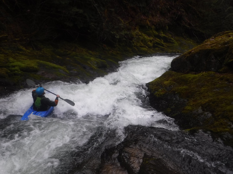
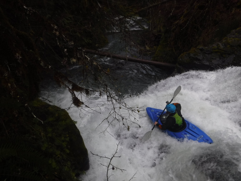
The creek starts out bouldery before reaching a IV+ gorge to kick off the good whitewater. At the end of this short gorge section is a 3 foot ledge with a log on the left that looks like it will be there forever. This ledge can be boofed to the right, but keep paddling as that lands you in an eddy circling back into the ledge.
Just downstream the creek gets gravelly for a moment and this is where the one portage is, a quick one over a small log jam. Just downstream is the largest horizon line at 'Self Satisfaction', a two part drop that can be scouted on the left (portaging the bottom portion would be difficult).
Downstream the creek is class IV and portage free (in 2017) all the way to the confluence with the Little River. About halfway down this class IV section the creek passes under a bridge. Immediately after landing in the Little River paddle to the right bank and take the short trail up to the parking area.
It is convenient to combine this creek with other runs in the area.
Flows: The Little River provides a decent estimate on what flows you will find in Emile Creek, however visual inspection is necessary and personal judgement of flows required. There is a boulder just upstream of the bridge n
...Feb 15, 2017
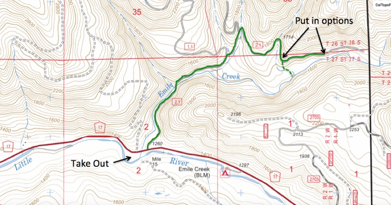
The Shuttle for Emile Creek (shuttle road is indicated with the green line). Either walk down the nose of line indicated by the dashed line, or continue up the road a short distance to where the road gets nearer to the creek. What is in that upper 1/4 mile upstream of the nose of land is unknown as of 2017.
Feb 15, 2017
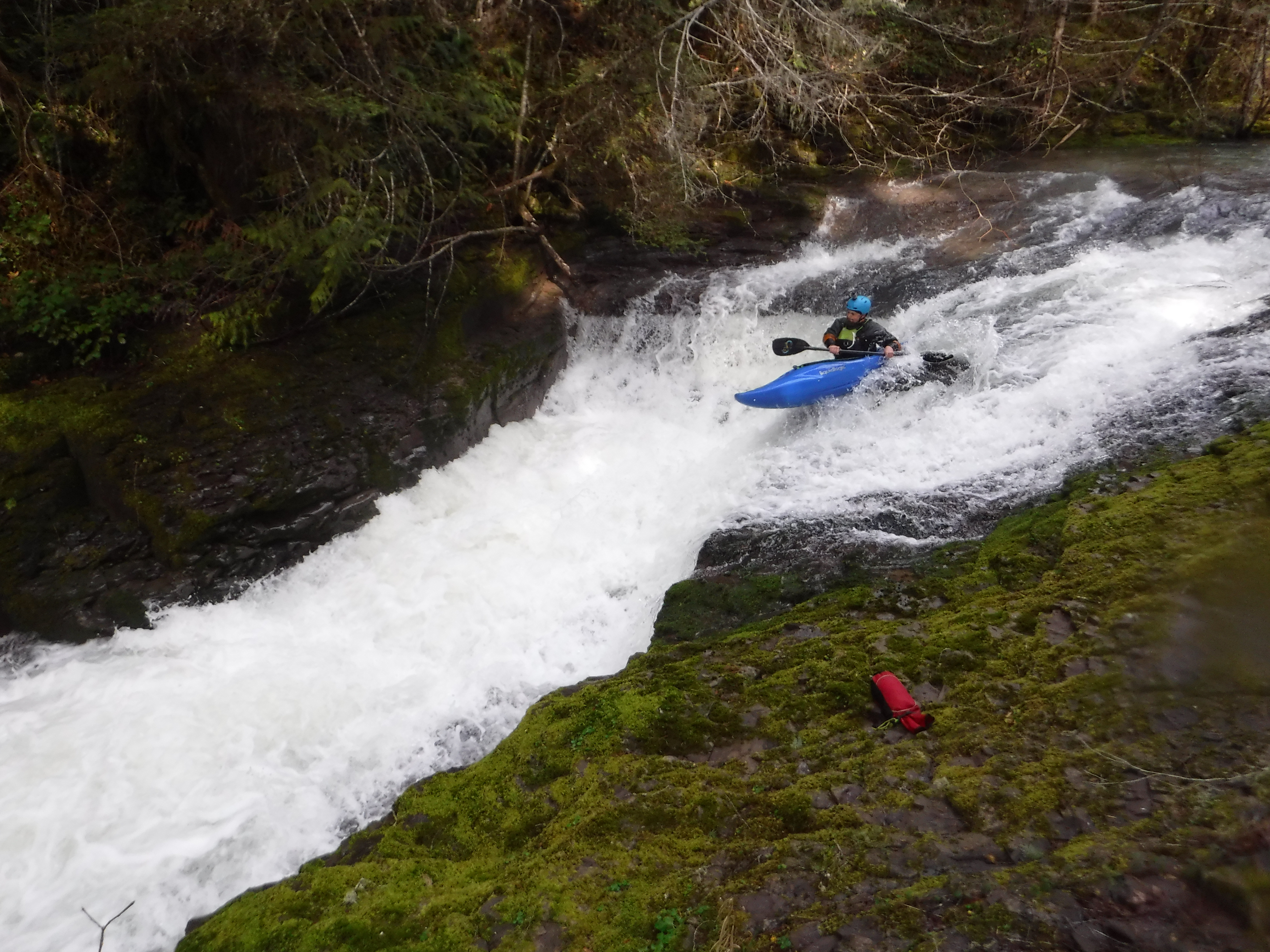
In the first bedrock section of Emile Creek.
Feb 15, 2017
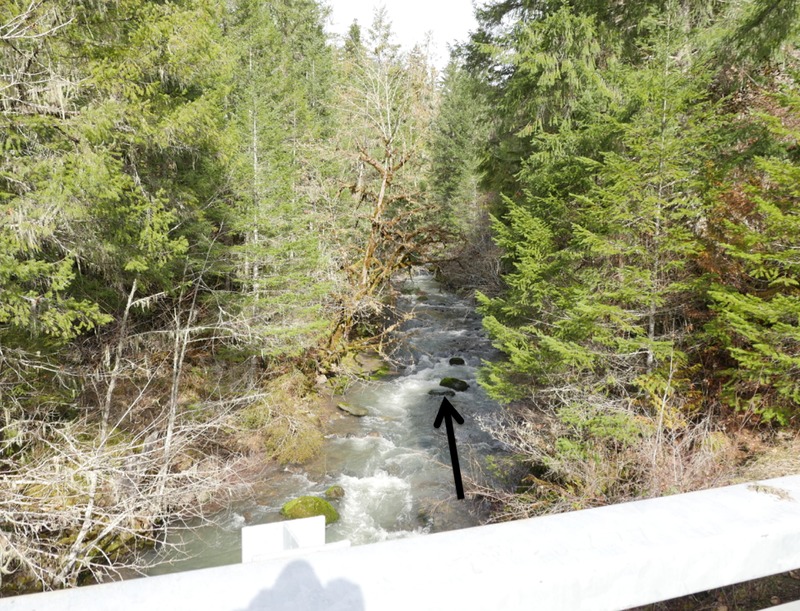
Looking upstream from the lowest bridge over Emile Creek (Little River Rd Bridge) Feb 12, 2017 with 1,200 cfs on the Little River gauge. This was a low, but acceptable level for figuring out the run.
If there is any water what-so-ever going over the rock with the arrow pointing to it, there is enough water in Emile Creek. If there is no water going over it at all, it is too low. The upper limit is unknown.