Klamath
07. K’účasčas / Fall Creek Access to Iron Gate(Iron Gate Run)
| Difficulty | II+ |
| Length | 6.3 mi |
| Avg Gradient | n/a |
| Gauge | Klamath R Bl Iron Gate Dam Ca |
| Flow Rate as of 47 minutes | 885 cfslow runnable |
| Reach Info Last Updated | August 25, 2025 |
Restoring the Klamath River: A Historic River Reborn The Klamath River now flows freely for the first time in more than a century. The removal of the four lower Klamath dams—J.C. Boyle, Copco 1, Copco 2, and Iron Gate—marks the most ambitious river restoration effort in U.S. history. For [...]Read More
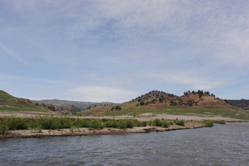
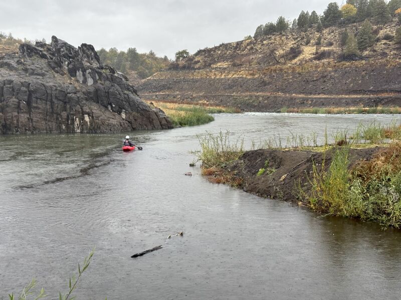
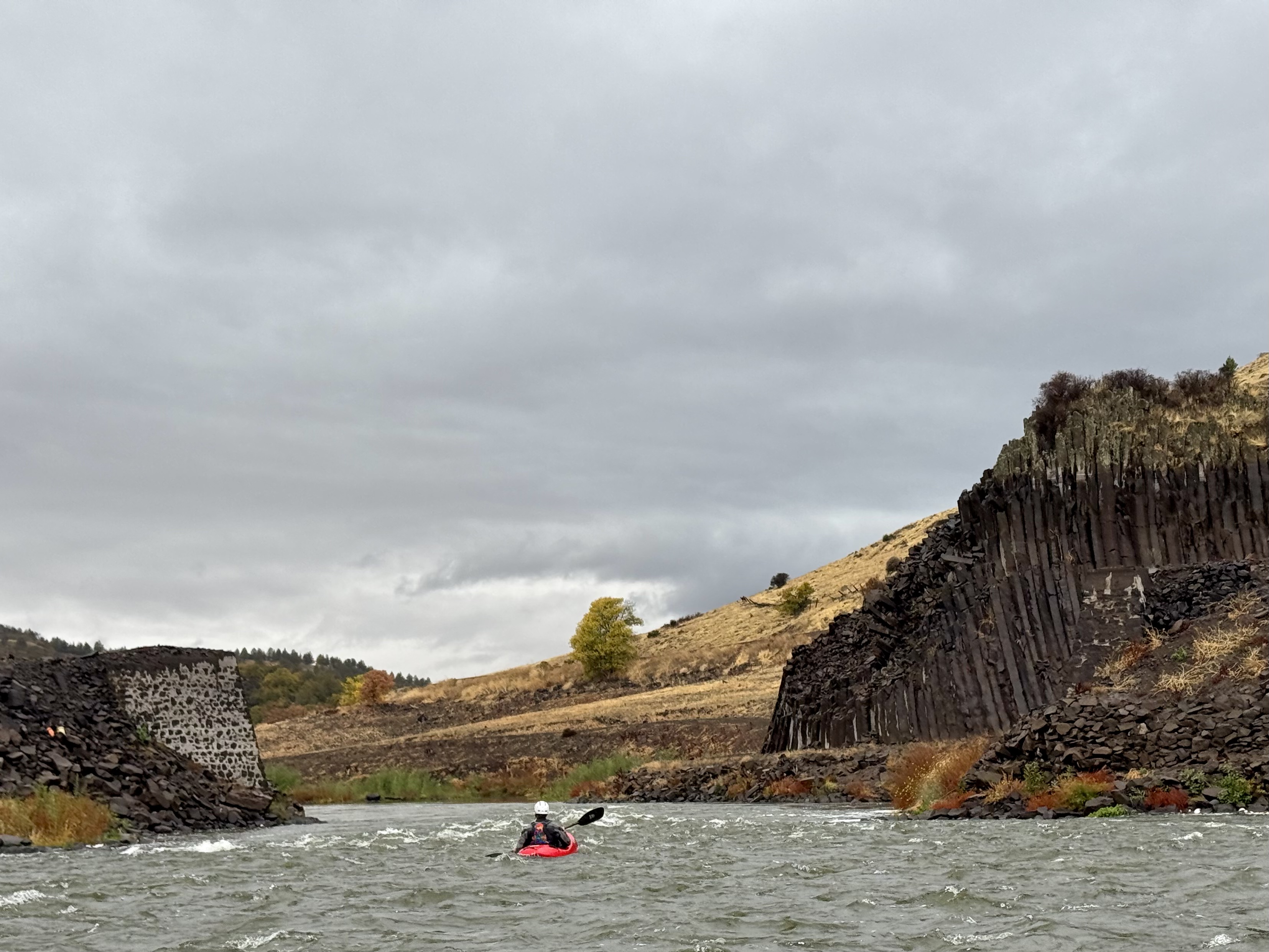
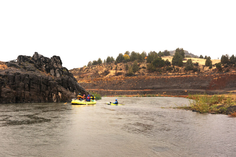
In the Iron Gate Run, the river finds a happy medium between the mellow meanderings of K’íka·c’é·ki Valley and the steeper sprints of Big Bend and K’íka·c’é·ki Canyon upstream. In this final stretch of the formerly dammed reaches of the Klamath, the river flows through a semi-arid canyon dotted with oak, juniper, and pine above the former reservoir footprint. The run ends below Iron Gate, the scenic red-rock narrows for which the dam that once stood here was named.
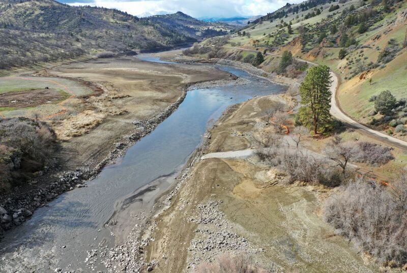
From 1962 to early 2024 this reach was flooded by the 173-foot-high Iron Gate Dam. The dam's low level outlet was opened on January 11, 2024 and the draining of Iron Gate Reservoir began. The dam was fully removed by late September 2024.
This reach combines good summer flows with enough gradient for year-round intermediate whitewater. It is long enough for a day trip or can be combined with adjacent sections for longer runs. The first four miles descend at a brisk 30 feet per mile as the river courses through a narrower canyon. Three miles above Iron Gate the canyon broadens and the gradient eases to 16 feet per mile, with good current but milder rapids in the final stretch.
The run’s proximity to I-5 makes it a great option to see and experience a restored segment of the Klamath River just eight miles off the interstate. making it the most accessible intermediate whitewater on the entire Klamath and much of it is away from roads. As with Copco Reservoir, draining Iron Gate Reservoir has exposed 1,000 acres of previously flooded land, but unlike Copco there are no homes along the shore. With proper stewardship, Iron Gate could will continue to offer excellent scenery and seclusion.
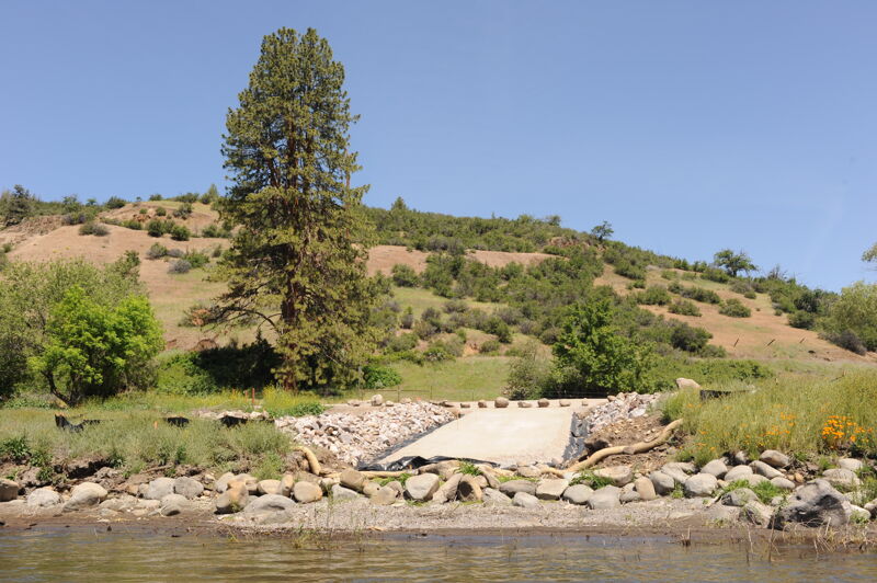
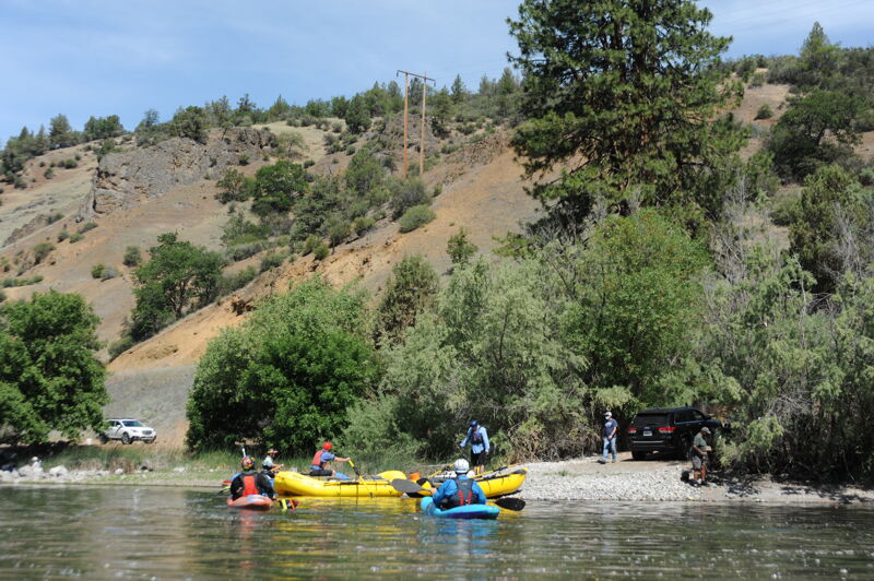
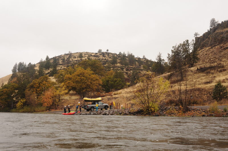
The river access site at K’účasčas (pronounced K’OO-chahs-chahs), just downstream of Fall Creek on river right, is managed by California Department of Fish and Wildlife on land set to be transferred to Shasta Indian Nation. Located at the end of K’íka·c’é·ki Canyon, this site was once the start of Iron Gate Reservoir. K’účasčas was a Shasta Indian village and remains sacred. Please stay on developed areas and show respect. American Whitewater secured $3.5 million from California to build this site and two others, also used for boater access and fire management. The site is available for day use from dawn to dusk. Amenities include access road, boat launch, turnaround, staging area, parking, bike rack, accessible toilet, trash, picnic table, fire pit, and a multilingual kiosk.

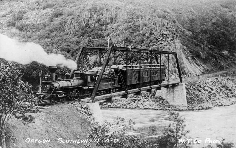
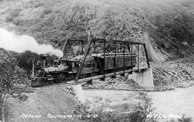
About one mile below the K’účasčas, the Klamath is pinched between narrow columnar basalt walls. This narrow spot made it an ideal location for the the old railroad bridge, the abutments from which can still be seen. Built primarily to haul lumber, the rail line was completed in 1903, repurposed in 1911 to haul materials for the construction of Copco Dam, and abandoned in the 1940s.
Jenny Creek, a major tributary flowing south out of the Cascade-Siskiyou National Monument in Oregon, enters on the right. The Oregon portion of the creek is a federally designated Wild and Scenic River. The gradient increases for the next mile and the river passes through a series of fun rapids.
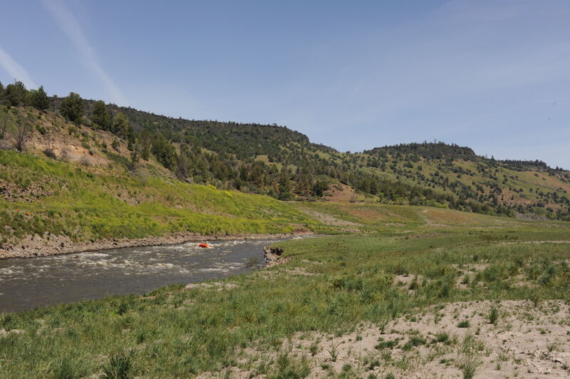
Just after passing the confluence with Jenny Creek, and after floating through the rapid below the confluence, the river enters a short segment of public land administered by Bureau of Land Management. This parcel includes land on both river left and river right that is separated from the highway and suitable for a lunch stop or a river camp. This is the only public land in the reservoir footprint.
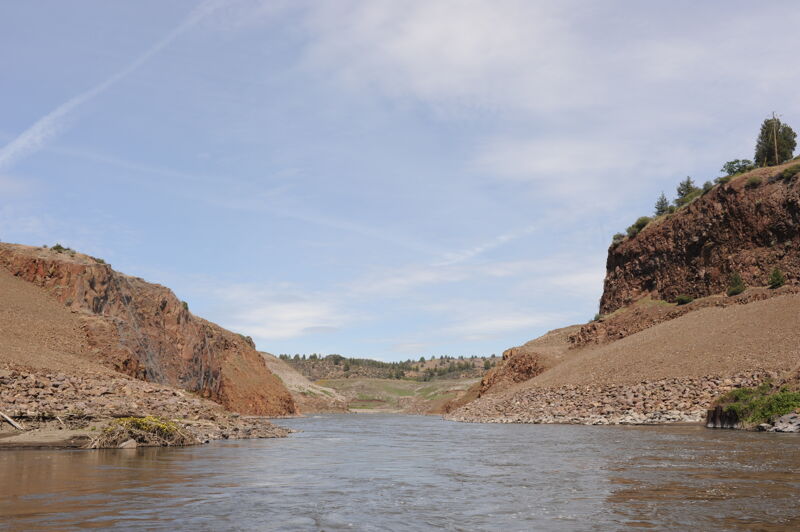
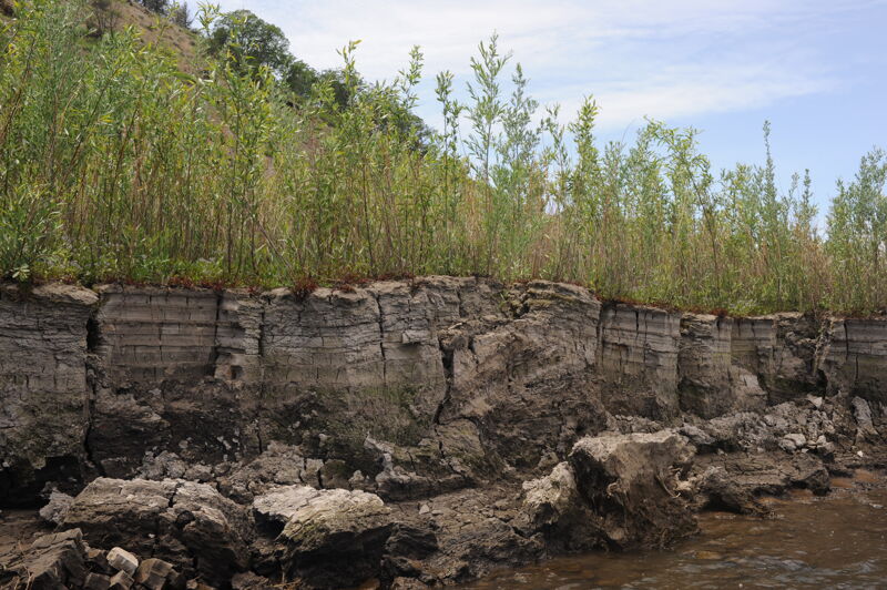
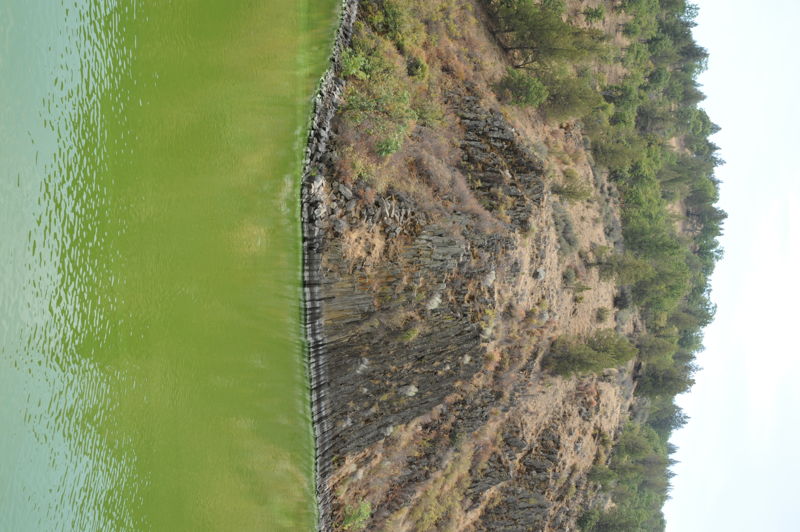
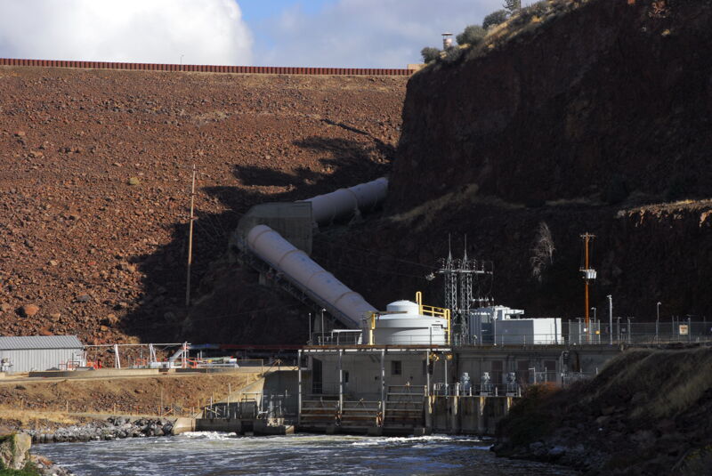
The river cuts a short, narrow canyon through red-colored Western Cascade lava flows of Tetiary age. These rocks are much older than those upstream in K’íka·c’é·ki Canyon. PacifiCorp built its 173-feet tall and 740-feet wide earthern Iron Gate Dam in this canyon. It was completed in 1964 and removed in 2024, its materials being placed back within the nearby quarries from which they came. The dam was built to regulate and smooth out the wild flow fluctuations caused by its upriver hydropower operations and provide a steady outflow so the river downstream didn't rise and fall with the power generation schedule, as it had since 1918 when Copco 1 Dam came online. The steady flow out of Iron Gate matched the flow of the river coming into the hydropower project (plus accretion from tributaries). The dam did not store a large volume of water.
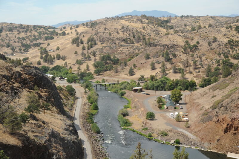
Iron Gate Dam was located immediately upstream of this access point that is on the downstream river right side of the Lakeview Road Bridge. American Whitewater worked to formalize this site as an access point for recreational river runners and fishermen as a condition of the surrender order for the hydrolectric project. The access point that serves river runners also serves as an access point for water trucks engaged in firefighting. The site has a concrete boat ramp, river access spur road, picnic table, toilet, and parking area including space for trailers. The Lakeview Road bridge over the Klamath will remain for the time being but is closed to traffic and has been replaced with the truss bridge just upriver.
May 25, 2026
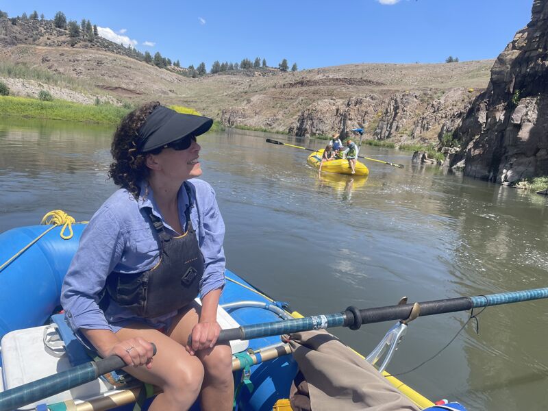
I ran this section soon after dam removal and hadn't returned for around 18 months. The first trip was barren and exposed but today I was blown away by how much life has returned. Flowers, plants, fish, it’s all thriving and beautiful. I had not previously appreciated how great of a run this really is. I’m gonna go ahead and claim that this could be the best class II run in the area now. The current is almost completely continuous for 6 miles at 1400 with very few pools at all. Enough spash to keep the kids laughing, the adults on their toes but not to difficult for novice boatmen . Awesome family rafting.
Jun 6, 2025
History fans may be interested to know a bit more about the old railroad that used to run along this stretch. In addition to the bridge foundations now exposed at this point, you can now see the old railroad cuts in the basalt cliffs along the south side of the river for at least a couple of miles downstream.
The Klamath Lake Railroad was initially built between 1901 and 1903 by the Pokegama Sugar Pine Lumber Company to ship logs out of timberlands a few miles north of the Klamath River in Oregon. It descended a series of switchbacks along Fall Creek to the Klamath River just downstream of Copco Reservoir. It then generally followed the river downstream to meet the main Southern Pacific Railroad about 4 miles southeast of Hornbrook (specifically, the historic terminus of Thrall, 41.88964, -122.48285). From there, the train rain to the former sawmill at Klamathon (near the present Hornbrook-Ager Road bridge over the Klamath River).
Unfortunately, the mill burned down, so the train was never actually used to ship logs. However, the railroad company set up a stage from its upper terminus (New Pokegama) 30 miles to Klamath Falls and ran freight and passenger services along the route. Weyerhaeuser bought the tracks in 1905, change the name to the Oregon Southern Railroad in 1907. By 1911, Weyerhaeuser abandoned the easternmost part of the tracks, and leased the western section to the Siskiyou Light and Power Company in 1912 for construction of Copco Dam. The successor California Oregon Power Company (COPCO) bought the railroad in 1921, but the tracks were little used after 1925. The U.S. Army bought up and removed the rails in 1942.
See http://www.trainweb.org/highdesertrails/kblrr/pokegama.html for more info.