Klamath
07. K’účasčas / Fall Creek Access to Iron Gate(Iron Gate Run)
May 25, 2026
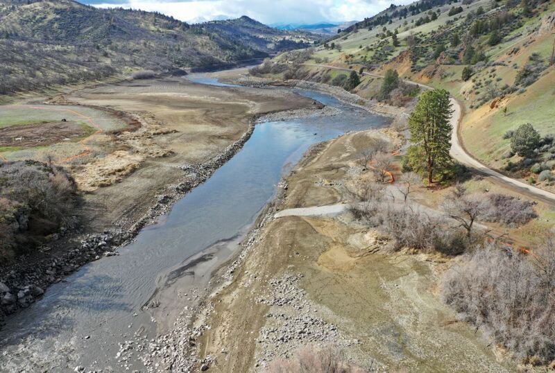
I ran this section soon after dam removal and hadn't returned for around 18 months. The first trip was barren and exposed but today I was blown away by how much life has returned. Flowers, plants, fish, it’s all thriving and beautiful. I had not previously appreciated how great of a run this really is. I’m gonna go ahead and claim that this could be the best class II run in the area now. The current is almost completely continuous for 6 miles at 1400 with very few pools at all. Enough spash to keep the kids laughing, the adults on their toes but not to difficult for novice boatmen . Awesome family rafting.
Jun 6, 2025
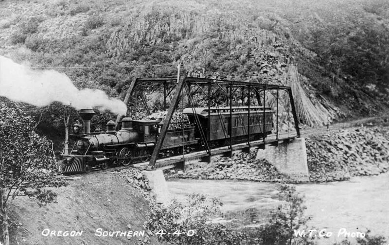
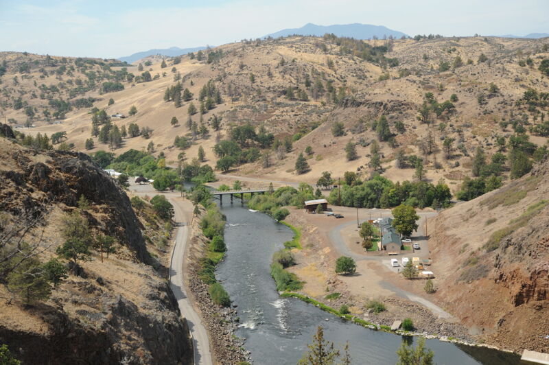
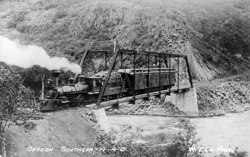
History fans may be interested to know a bit more about the old railroad that used to run along this stretch. In addition to the bridge foundations now exposed at this point, you can now see the old railroad cuts in the basalt cliffs along the south side of the river for at least a couple of miles downstream.
The Klamath Lake Railroad was initially built between 1901 and 1903 by the Pokegama Sugar Pine Lumber Company to ship logs out of timberlands a few miles north of the Klamath River in Oregon. It descended a series of switchbacks along Fall Creek to the Klamath River just downstream of Copco Reservoir. It then generally followed the river downstream to meet the main Southern Pacific Railroad about 4 miles southeast of Hornbrook (specifically, the historic terminus of Thrall, 41.88964, -122.48285). From there, the train rain to the former sawmill at Klamathon (near the present Hornbrook-Ager Road bridge over the Klamath River).
Unfortunately, the mill burned down, so the train was never actually used to ship logs. However, the railroad company set up a stage from its upper terminus (New Pokegama) 30 miles to Klamath Falls and ran freight and passenger services along the route. Weyerhaeuser bought the tracks in 1905, change the name to the Oregon Southern Railroad in 1907. By 1911, Weyerhaeuser abandoned the easternmost part of the tracks, and leased the western section to the Siskiyou Light and Power Company in 1912 for construction of Copco Dam. The successor California Oregon Power Company (COPCO) bought the railroad in 1921, but the tracks were little used after 1925. The U.S. Army bought up and removed the rails in 1942.
See http://www.trainweb.org/highdesertrails/kblrr/pokegama.html for more info.
May 15, 2025
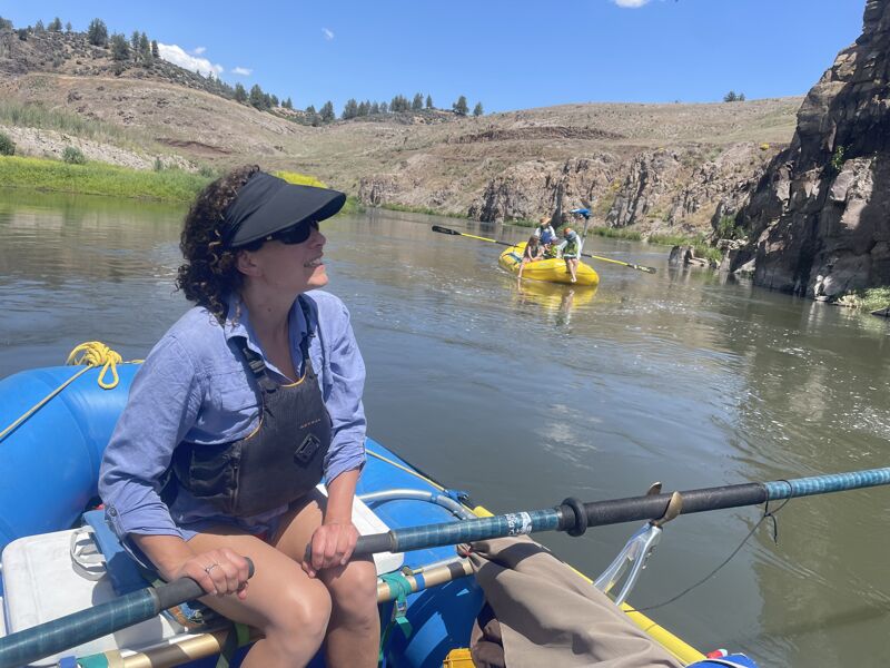
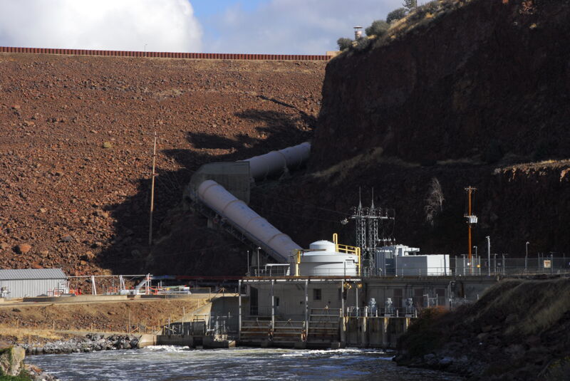
Following the removal of the Klamath River hydropower dams, work began on recreational infrastructure to support the ability of the public to experience the restored river corridor from Keno to Iron Gate. As part of this effort American Whitewater worked to secure resources to design and implement river access faciltiies and on May 15th more opportunities for river runners became avaialble including the ability to put in at Fall Creek at the exit of K’íka·c’é·ki Canyon offering a 6 mile class II+ run through the former Iron Gate Reservoir footprint. While the new K’účasčas Access at the confluence of Fall Creek on river right is not yet open (but is expected to open in August), Klamath River Renewal Corporation has provided a temporary access on river left across the Daggett Bridge. This access was opened on May 15th and we took the opportunity to enjoy this beautiful stretch of river down to Iron Gate. The run had fun splashy class II+ rapids, a front row seat to the restoration efforts underway and colorful fields of California poppies, and ended with an awe inspiring float through the Iron Gate where a massive dam once stood.
Nov 1, 2024
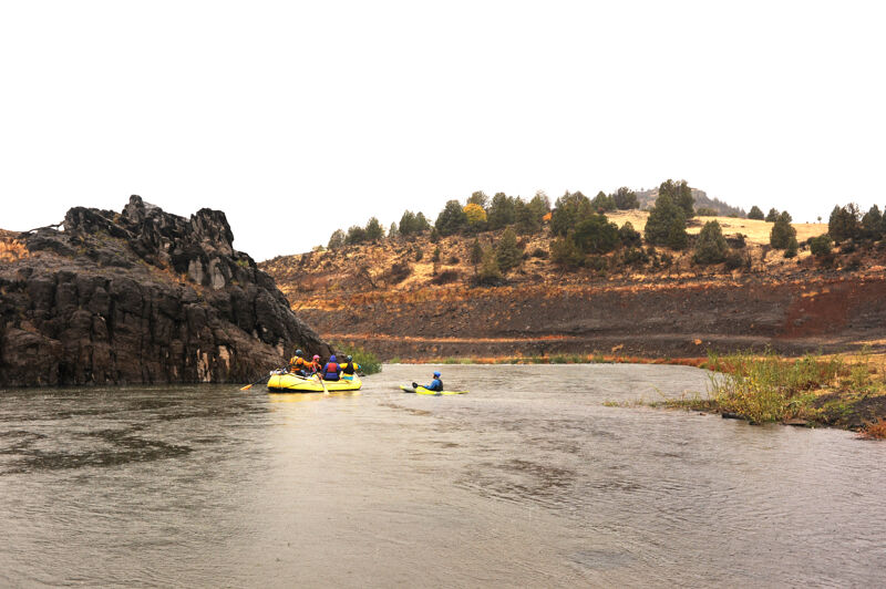
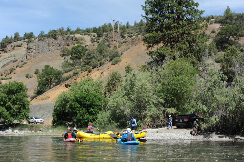
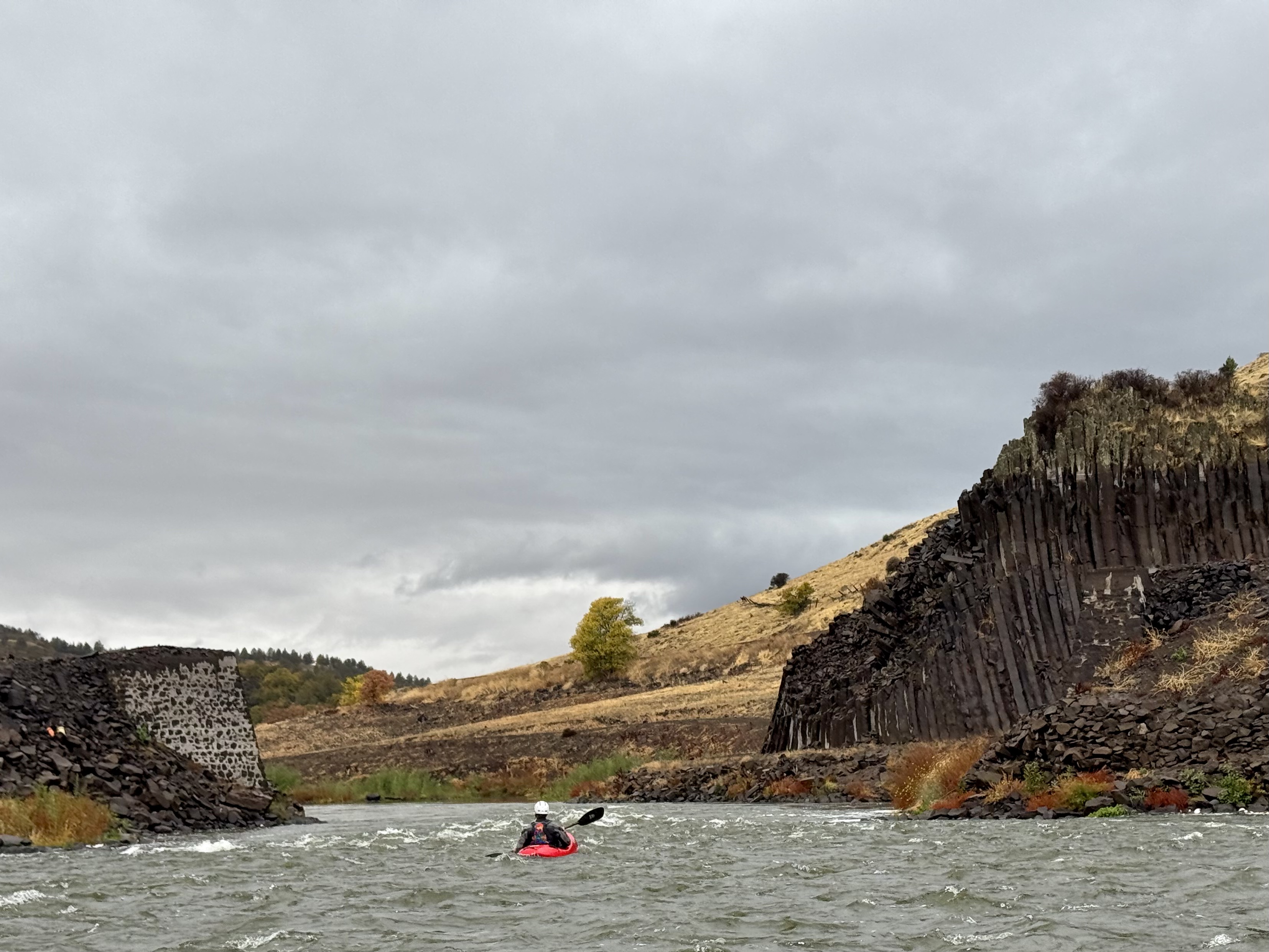
We paddled the 16 miles from Access 1 to Iron Gate, a trip that took 4 hours and 15 minutes. The float from Kucascas, the exit from the Canyon approximately 6 miles above Iron Gate, to Iron Gate was approximately 2 hours. We experienced swift current through the reach with a few class II rapids and no major hazards.
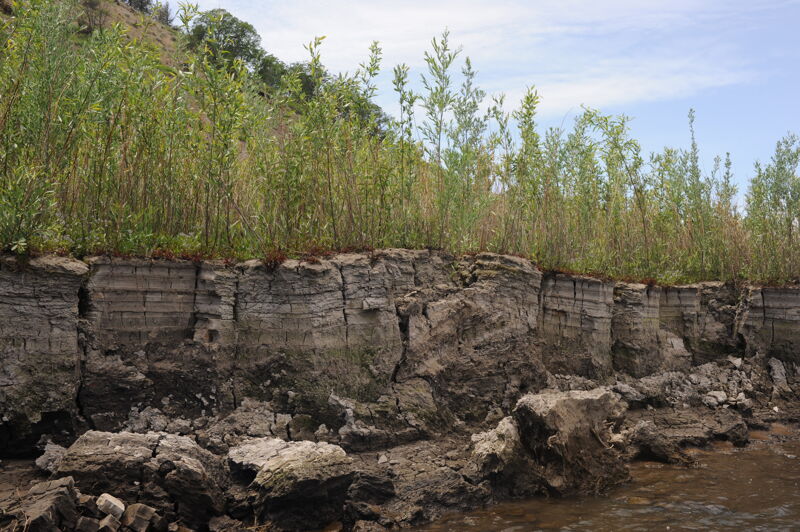
The float was a fascinating experience through a landscape that was buried under a reservoir. Vegetation has started to grow in the old reservoir sediments with willow thickets becoming established along the banks. We also saw ideal spawning gravel that salmon were taking advantage of particulalry at Jenny Creek.
Feb 8, 2024
Selected accesses and points of interest following the gradual drawdown of Iron Gate Reservoir, which began on 1-11-24.
Aug 18, 2020
Aug 18, 2020
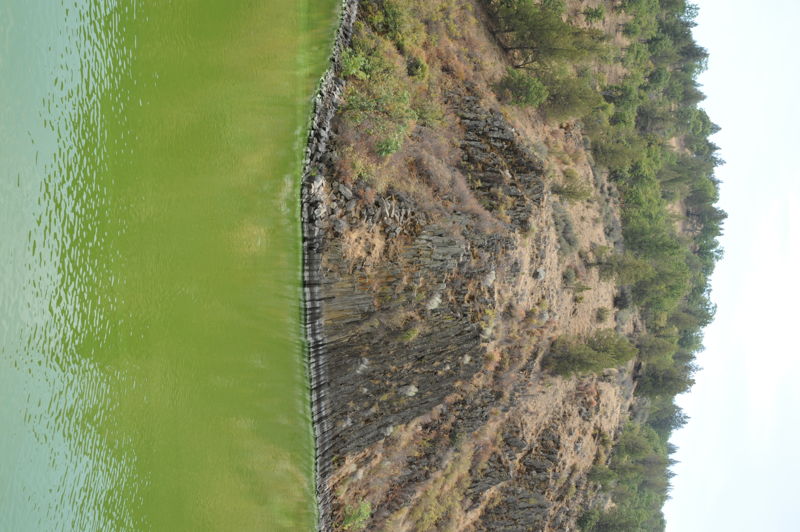
Water quality is so bad in the reservoirs that it is a threat to human health.
Jun 10, 2020
Photos from Irong Gate Reservoir taken during the flow study weekend of Wards Canyon.
Nov 6, 2017
Jan 1, 1900
Historic photos of the Iron Gate run of the Upper Klamath.