Rio Grande
07. Quartzite River Access to County Line River Access(Pilar or Racecourse)
| Difficulty | III |
| Length | 4.4 mi |
| Avg Gradient | 12 fpm |
| Gauge | Rio Grande Blw Taos Junction Bridge Near Taos, Nm |
| Flow Rate as of 53 minutes | 174 cfsbelow recommended |
| Reach Info Last Updated | August 20, 2024 |
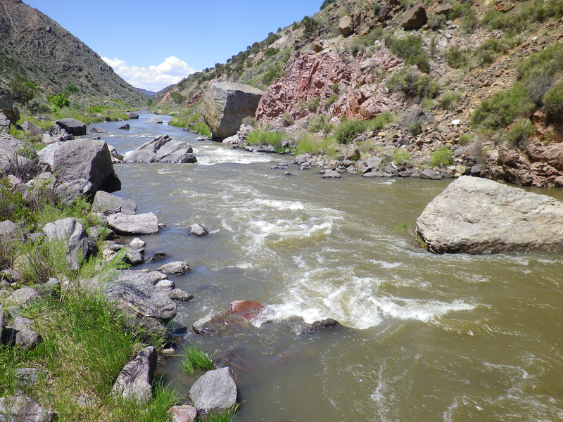
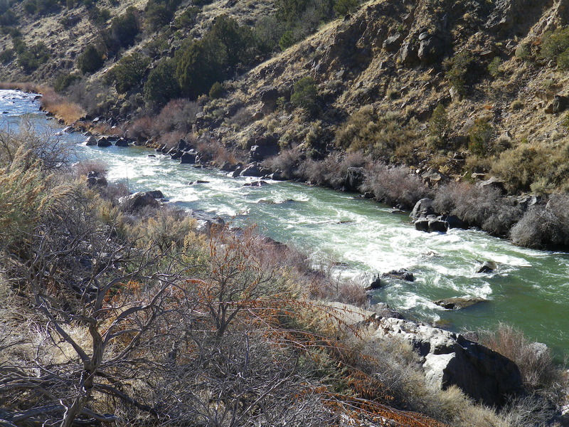
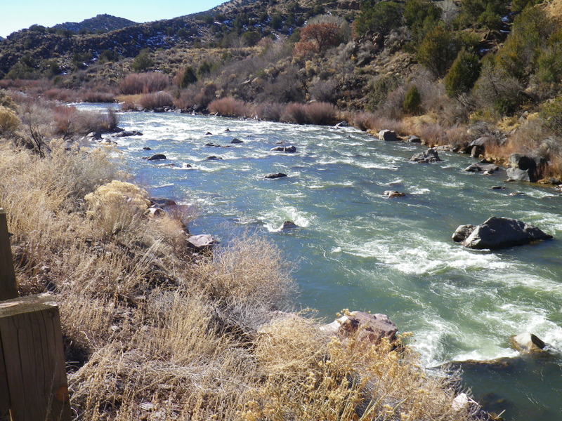
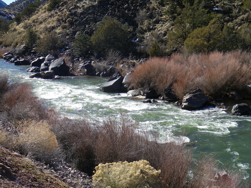
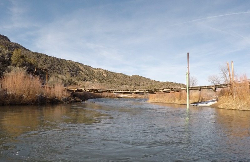
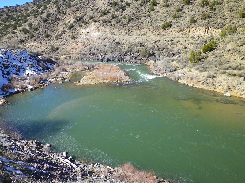
The Racecourse is far and away New Mexico's most popular whitewater run. Just downstream from the tiny artists village of Pilar the Rio Grande flows more westward after colliding with the Pilar Cliffs on river left. The Cliffs are made of resilient quartzite-schists: ancient stone that in places is 1.7 billion years old, predating the origins of life on Earth. In contrast, on river right, are the relatively more recent basalt lava flows found in the upstream canyons. Just upstream from the Quartzite put-in is the Rio Grande Gorge Visitor's Center providing bathrooms, water, and a giftshop including many books on geology, plants, animals, and folklore. Quartzite River Access provides porta potties and a changing area, roughly marked spaces for parking, and a picnic table. Boaters launch from one of two rocky beaches. County Line River Access has BLM maintained bathrooms, two paved boat ramps, and picnic tables. Permits are not required to boat on the Racecourse.
This section of the Rio Grande is not as isolated as the Lower Taos Box or the Orilla Verde since State Road 68 follows the river closely for the entire run; but the highway runs high-up on the banks in most places, and a boater tends not to notice it while shooting rapids or recovering below them. The road provides opportunities to scout nearly all the rapids on the run. Take care pulling over and getting out of your vehicle because many drivers speed down the highway in this canyon and accidents are unfortunately not that uncommon. In several places trails run steeply down the left bank from highway pullouts to the river, notably at After Five, Sleeping Beauty, and Souse Hole. Sleeping Beauty has an excellent surf wave easily reached by parking in the highway pullout alongside the road just beside the rapid. Kayakers are often seen hauling gear up and down the trail to login surf time in the large curler in the main drop of the rapid. The land along the Racecourse is a mixture of public and private
...Excepting some busy summer days, two large beaches usually allow for ample room to launch. A moderately sized parking lot is available, as well as pit toilets, a picnic table, and two changing areas. Quartzite is not far from the Rio Grande Gorge Visitors Center just up the road towards Taos. At extremely low flows, the bottom ramp can be difficult to launch large rafts from as the dropping water exposes the shallow beach.
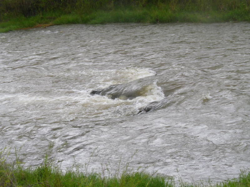
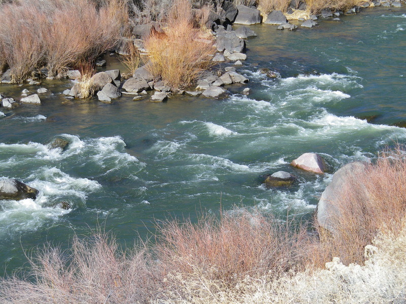
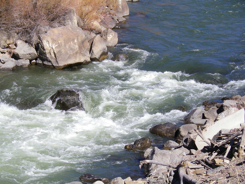
Rocks appearing in the middle of a riffle just downstream of Quartzite River Access. Easily missed on the right. At high enough water the rocks form a nice to hole to get an good initiation splash before continuing downstream.
Named for the large saddle-shaped rock at the bottom of the rapid. The popular line at the top of Saddle Rock is down the channel on river left, where boaters usually work their way to river right very close to shore, then weave their boats through rocks at the bottom. There is another favorite line not far from the left shore, available when water levels permit. At low flows the entrance on the left can be pushy and the river tends to push boaters into the left shore or one of the center rocks where a high side may be necessary. At high flows this marks the beginning of Mile Long Rapid, a class IV rapids that includes, into a continuous stretch of whitewater, the rapids of Saddle Rock, Albert Falls, Herringbone, Eye of the Needle, Narrows, Boulder Field, Dead Foot Falls, and Final Drop. Saddle Rock is easily scouted from the road on river left.
Purportedly named for Albert Einstein in the 1950s by kayakers who worked at the Los Alamos National Laboratory. At moderate flows the rapid is entered left of center, just left of a large pour over. The curling wave at the bottom of the first drop is a lateral wave, and boaters usually square up to the wave by pointing the front of their boat slightly towards the left shore. Boat Eater hole is located right of center and can give an unwary craft a wild ride for a good while. At higher flows (around 2500 cfs) Albert Falls is considered class IV and the lateral below the first drop becomes massive; at this level Albert's is a mandatory scout. There is a tricky sneak run along the right shore (and to the right of Boat Eater). At low water (below 300 cfs) the middle run is usually not an option, and boaters typically work along the right shore then over a drop that takes them across the river toward the left shore. From there boaters usually remain mostly left of center over the smaller drops; after the last of these pull boaters usually hard to the right of center to miss the midstream boulders. At extremely low flows the top of the right side of the rapid is blocked partially by shallow rocks; at these levels boaters often enter the rapid on river left just downstream of these rocks, cutting across currents and eddies (between these upstream rocks and the downstream impassable upper falls) to get to the main entrance near the right shore. The rapid is easily scouted from a turnout on the road on river left.
Shallow boulders guard the entrance to Herringbone. After weaving among the shallow rocks boaters usually enter the rapid near the shore and into a chute. Be alert for a boulder/pour over near the bottom of this chute; boaters usually pass to the right of the boulder/pour over, though many elect to run the narrower and more turbulent channel between the boulder and the left shore. At low water, below the boulder/pour over, navigate more towards the center of the river to avoid the shallow rocks. At all water levels miss the large Whale Rock at the bottom of the rapid; boaters usually pass the Whale Rock on the left.
The tricky part of this rapid is usually at the bottom. At moderate to high flows boaters usually run the rapid down the middle and veer left near the left shore to exit. At low flows the left channel exit is too shallow and boaters usually thread their way through the Eye of the Needle: three large spaced-apart boulders. Beware the 'Birth Canal', the middle slot in this rapid at intermediate flows; advanced kayakers can run it but it's one of the worst raft pin spots on the river - tends to dissappear below 300 cfs. Boaters usually opt to cross the river from left to right to pass between the first two boulders located in the center of the river, then turn abruptly downstream to pass between the most downstream of these first two boulders and a third along the right shore. Across from the Eye of the Needle boulders, along the left shore, there is an eddy that provides a great opportunity to setup for the move. At extremely low flows (< 240 cfs), a large boulder appears in the middle of the Eye. Kayakers should be able to navigate to the downstream side of it, but rafters may have to play around with their weight in order to get over. At this flow, this rapid is pretty difficult, but the slow, shallow water makes it rather inconsequential.
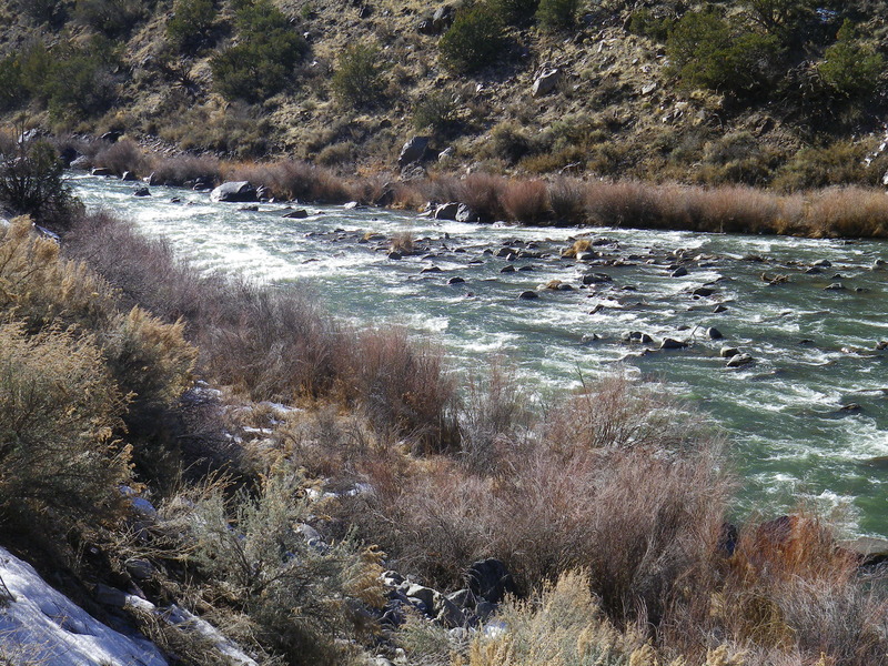
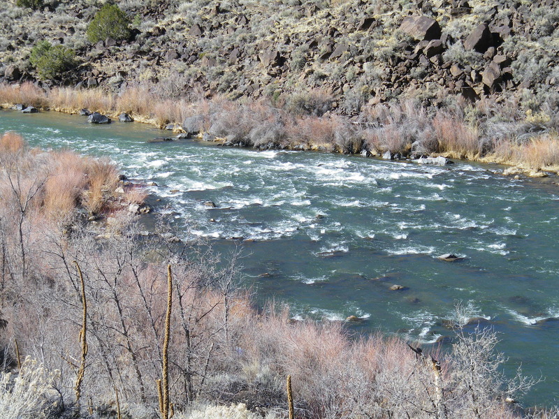
Sometimes “Narrows” is used to refer to the next four class III rapids; here the Narrows refers to the first rapids of this sequence. At moderate to high flows the Narrows provide some of the best standing waves on the run. At these levels the run is pretty much down the middle. Watch out for Glory Hole on the left at the bottom of these rapids and Mother Rock (at high water Mother Hole) just right of center at the entrance to the Boulder Field (see below). At low water the Narrows are a formidable challenge. Boaters usually squeeze between a large boulder near the right shore and some smaller rocks further off shore, then swing around and dash for a channel near the left shore, then recenter the boat to miss some shallow rocks, then miss the rock outcroppings in the middle of the river by passing on their left, then miss the boulders immediately downstream by pulling to the right. The Narrows can be scouted from the road.
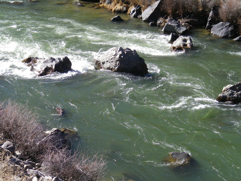
A wide section of river where a fence-like jumble of rocks cuts across the river. The entrance to the Boulder Field begins with Mother Rock, the largest boulder in the rapid and it's usually passed on the left. Higher flows turn Mother Rock into Mother Hole.
At moderate to high flows boaters usually run left of center over the waves while dodging pour overs.
At low flows boaters typically navigate down to the fence-like rock jumble ('The Bermuda Triangle') then move to the center of the river to pass through two large guard rocks called the Horns (or the Fangs). There are two commonly used channels to get to the fence-like rock jumble: weaving through the boulders following a line just left of center, or in very low water conditions along the left shore. At the jumble boaters paddle across the river just upstream of the jumble and slip through the Horns/Fangs with a turn to the left. Beware of Hemorrhoid rock below the Horns/Fangs – it splits the channel below Horns/Fangs in two, the left channel being the rockier of the two. At low-moderate flows, there is a large safety eddy below Hemmorrhoid on river left. At extreme low flows a small partially submerged rock appears just above the Horns/Fangs: rafters have to pick-up enough momentum to slide up and over the rock and into the Horns/Fangs. Boulder Field can be scouted from the road.
The rapid is usually entered center or just right of center and the current takes boaters directly into the Fang/Nemesis Rock. The easier channel is on the left of the rock. Below Fang/Nemesis the river drops over the remains of an old diversion dam providing great standing waves below. The passage on the left of Fang/Nemesis leads to a wide channel passing over the rocks of the dam, but the channel to the right leads to a pool above the rock piles of the dam and usually a narrower channel then must be taken over the remains of the rock pile. Near the end of the wave train below the dam is Dead Foot, a large boulder on river left. At high flows Dead Foot forms an impressive hole. The top of Dead Foot Falls is easily scouted from the road, but portions of the remainder of the rapids can be obscured by brush.
The last rapid in the sequence of class III rapids sometimes collectively called the Narrows. At high water (above 2500 cfs) this is the bottom of Mile Long Rapid, the stretch of continuous class IV whitewater starting at Saddle Rock rapids. Final Drop is usually ran down the middle at all flows, with a slight right of center exit at low water. At the bottom of the run out be alert for the huge boulder jutting out from the right shore into the center of the river. Final drop is easily scouted from the road.
Named for the rocky shallows that make-up this rapid, and the potential swim that almost certainly is less like slipping down a water slide and more akin to sliding down a cheese grater. The rapid is usually ran down the middle. At low flows, about halfway down the rapid some weaving to the right and then back to the center, is usually needed. As with any rapid, in Cheese Grater take precautions to avoid foot entrapment if you find yourself swimming. Cheese Grater is easily scouted from a pullout along the road.
Old, dilapidated bridge purportedly build by a commune that lived at the site of the Glen Woody mine town on river right. Beware of possible fishing lines with hooks still attached that might have been accidentally snagged and dangling from the bridge. At high water the river rises very close to the bottom of the bridge and the bridge must be portaged on the left bank.
Commerical trips often regroup in the large pools and eddies just below the bridge to prepare for Big Rocks.
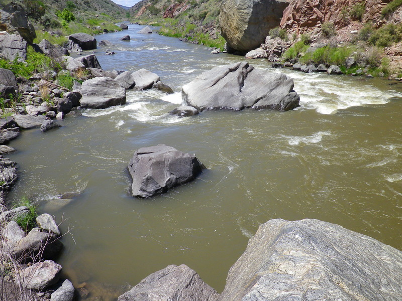
A long rapid that starts below the pool at Glen Woody Bridge. The river makes three turns before flowing into a jumble of truck-sized boulders. Upstream of the jumble the rapid is usually ran up the middle, and at low water, between the second and third turns, just right of center.
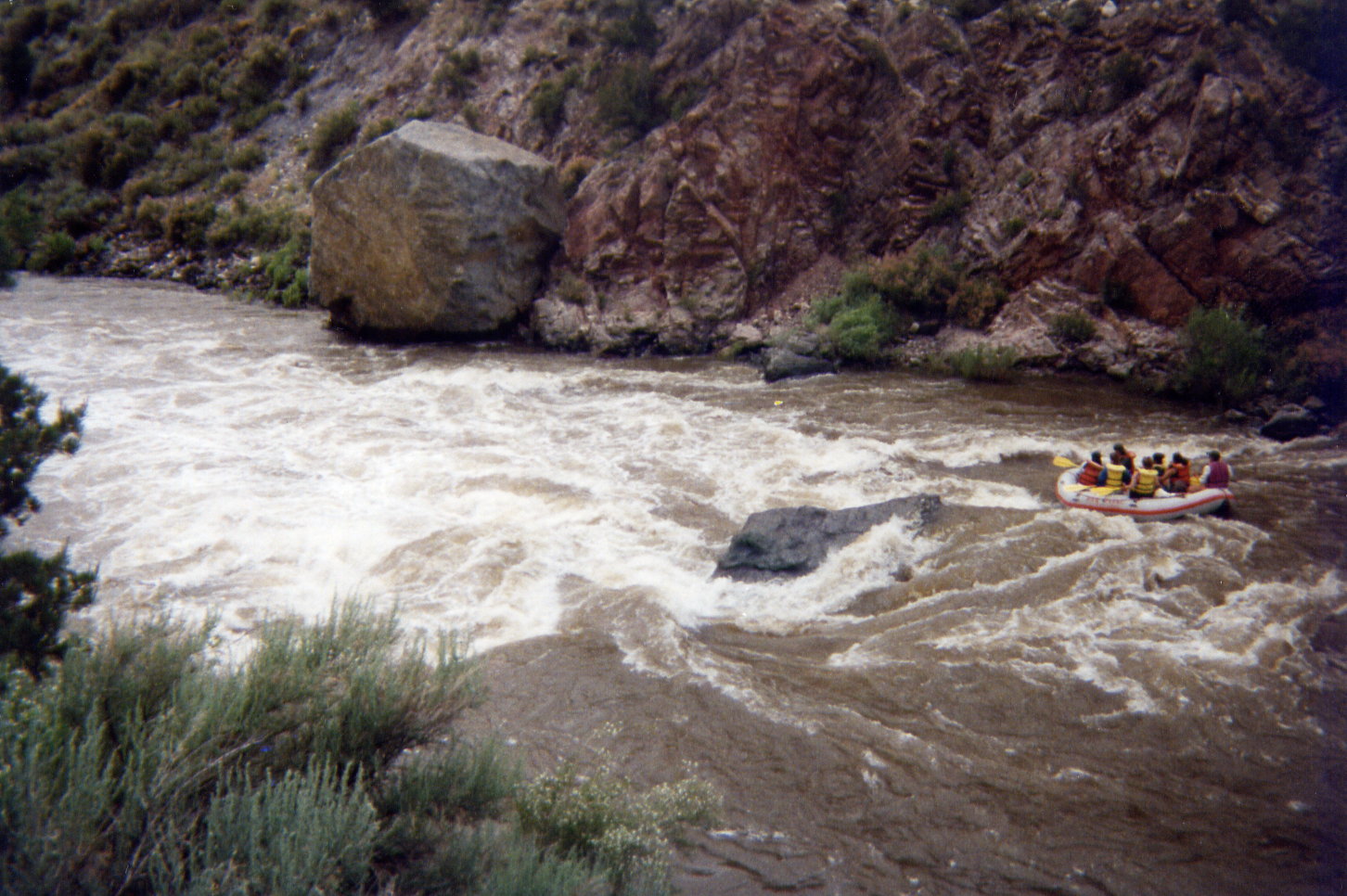
The line boaters take through the jumble at Big Rocks is inordinately flow dependent. The major landmark for determining a line is Pilot Rock, the first large center boulder the river passes in the jumble. At high flows boaters can pass just left of Pilot then pull to the right to miss the second large center boulder (Thunderdome or Pyramid), passing between Thunderdome and the right shore (a channel called the Ledge). Beware of the 'Room of Doom' in between Pilot and its twin just to the right (Co-Pilot). As long as these rocks are visible, there is a sieve in between these rocks large enough for a person to flush through but too small for the vast majority of boats.
An alternative high water line starts between the second and third river turns above the jumble, where boaters move along the right shore (specifically between Co-Pilot and the right shore) then pass over the Ledge. This line is an easy sneak as long as the Ledge is runnable and becomes the preferred line when the water is high.
At moderate flows the route along the right shore might be too shallow or constricted and the channel left of Pilot is the best option. Again, pass on the left of Pilot then pull right to pass between Thunderdome and the right shore and over the Ledge.
The Toilet Bowl – a very push class IV channel on the left side of Thunderdome – is a major concern. A wave train in the channel on the left side of Pilot can push boaters towards the left side of Thunderdome and into the Toilet Bowl Drop. In the left channel, striking and bouncing off Pilot with a boat often bounces boaters into that same predicament. The Toilet Bowl is a recirculating hydraulic sandwiched between two rocks that are rumored to be undercut. It's the biggest hazard on the Racecourse at most flows and should not be run except by the most experienced boaters.
At low water (< 480) the Ledge becomes impassable but another channel is exposed between Thunderdome and the Ledge: this low water channel is called the Slot. The Slot starts at Thunderdome and cuts across the river on the downstream side of the Ledge, then a hard left turn (AFTER a rock called Gumball just downstream of the slot entrance) takes boaters downstream and out of the rapid. Because boaters are cutting across the current in front of Thunderdome, the river often pushes boats against Thunderdome causing them to flip on the rock; a preventative downstream lowside usually keeps boats right-side-up entering the Slot. This is also useful for getting rafts over the 'chair' rock on the right side of the slot. At flows below 250, the shelf on the downstream of this rock starts to come out and can hold a raft in place.
Running the Slot usually takes some setup. At moderate to high flows being too far left while passing Pilot is a sure recipe for going into the Toilet Bowl. But at low flows, when the Slot is exposed, a large eddy appears along the left shore immediately downstream of Pilot, and catching this low water eddy prevents boaters from going into the Toilet Bowl; it also gives them a great place to setup for the Slot. But low water exposes a new obstacle in the left channel: Velcro Rock, just upstream from the low water eddy. At low water boats that strike Pilot often get pushed up onto this slightly submerge boulder where dislodging a raft takes some tugging.
The boulder jumble at Big Rocks is easily scouted from the road.
This rapid is highly channelized and unique because many of the rocks that give this rapid its name have been added by rockfalls in the past few decades.
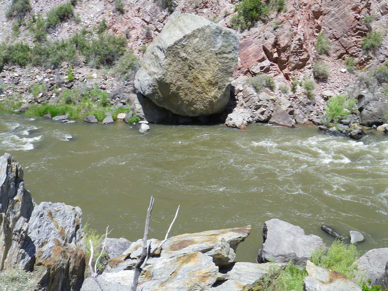
Massive boulder that fell from the canyon rim in 1991, punched a large hole in the highway, shattered a riverside boulder making Baby Huey bounce and land on the otherside of the river.

A great playspot for kayakers with a nice pool at the bottom. A steep, sagebrush-packed trail winds from the road down to the pool.
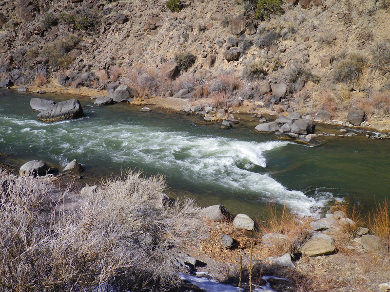
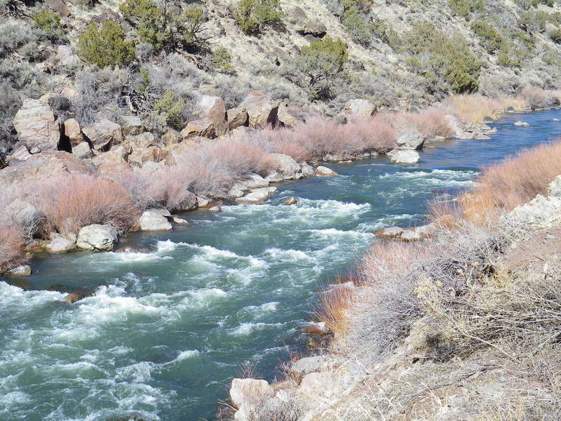
A drop into a big reversal wave. At low water the drop is usually ran down the channel along the right shore; at moderate to high flows preference for how much splash a boater wants determines how the drop is ran; boats without sufficient momentum to punch through the reversal might be in for a surf and a flip! Be mindful of the large boulders at the bottom of the rapid coming off the right shore. This is a favorite surf playspot for kayakers. A trail runs from a pullout alongside the road down the river bank to the rapid. At lower levels Sleeping Beauty becomes a fun surf for rafts. The rapid is easily scouted from the road.
One of the more famous rapids on the run, as it offers a solid splash at even the lowest river levels. At low to moderate flows Souse is ran usually down the left channel. Rafts can surf the hole at the bottom of the last drop at low flows. At high flows the rapid creates a near river-wide massive hole renowned for flipping boats. Boaters looking to avoid the huge wave can sneak the rapid along the left shore. At all flows be mindful of currents coming off the left shore that may push your boat too far into the center of the river into a large rock or hole, depending on flow. A trail comes down from the road to the pool at the bottom of Souse. The rapid is easily scouted from the road.
This is the photo rapid for the Racecourse's commerical rafting trip due to its omnipresent top hole and easy road access. Be aware of commercial rafts spreading out in the long area of slackwater before this rapid.
This rapid is created by the island in the middle of the river just downstream from the pool below Souse Hole. At moderate to low levels the right channel is usually the only channel deep enough to navigate. Near the bottom of the island the river swings left; stay alert for 'Charmin' rock near the right shore at the bottom of the run out.
Savvy boaters will take out on river left just after this rapid and hike their boat up to the Sousehole parking lot. This avoids the dreaded 'mellow mile' in between Last Chance and County Line. There is no boat ramp here and the stairs out are steep, but it may be easier than navigating around the commercial raft swimmers on busy July days.
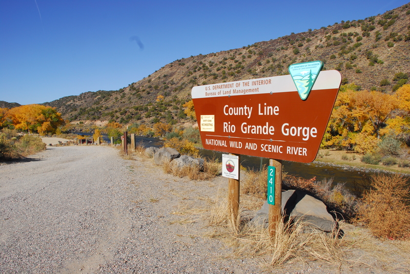
One smaller and another larger boat ramp are available, along with picnic tables, and BLM-maintained outhouses providing ample space for changing. The first ramp is intended to be the takeout for private boaters, while the second is intended for commercial rafts. A shallow riffle (usually ran along the left shore) indicates the river's approach to County Line; a second riffle begins just above the second boat ramp.
Also the put in for the scenic, class II- Bosque run.
May 3, 2026
Although flows across New Mexico were low in May, we decided to run the Race Course section of the Rio Grande. We connected with several guides from Far Flung Adventures and launched from their private access in Pilar, just upstream of the Quartzite put-in. Our group included a mix of hard-shell kayaks, packrafts, and inflatable kayaks.
The river was flowing at 217 cfs, definitely near the lower end of the runnable range. The channel was technical at this level, requiring careful boat maneuvering, but it remained fully navigable and provided an enjoyable run. Despite the low water, there were plenty of local paddlers on the river, along with a couple of rafts.
We launched at approximately 10:30 a.m., passed the Quartzite put-in around 11:00 a.m., and reached the take-out shortly before 1:00 p.m.
It was a beautiful day on the water and a great opportunity to paddle with the local boating community. While everyone agreed that runs upstream like the Taos Box would have been too low to run at these flows, the Race Course still offered an enjoyable and worthwhile outing, even near the bottom of its navigable range.
Sep 10, 2021