Antelope Creek
Hogsback Road to Cone Grove Road
| Difficulty | III-IV |
| Length | 22 mi |
| Avg Gradient | 46 fpm |
| Gauge | Antelope Creek Near Red Bluff |
| Flow Rate as of 22 days | 358.35 ftstale data |
| Reach Info Last Updated | February 27, 2024 |
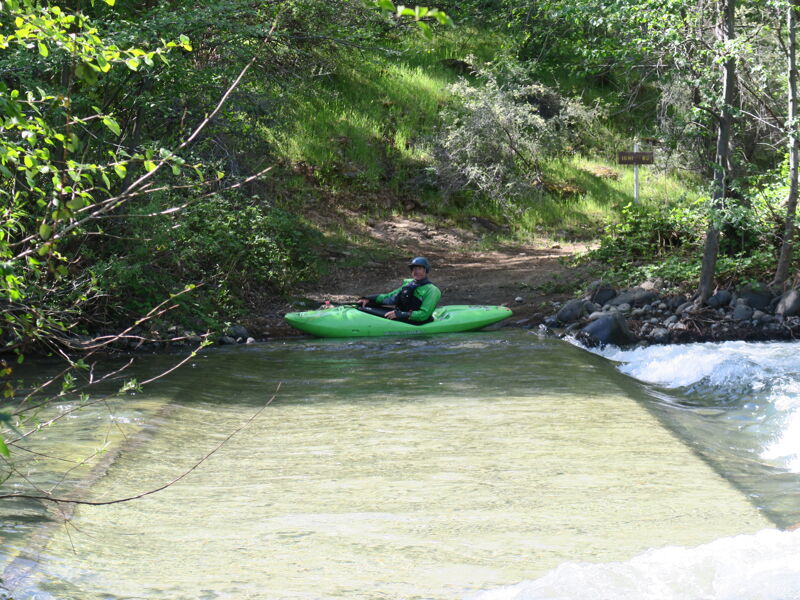
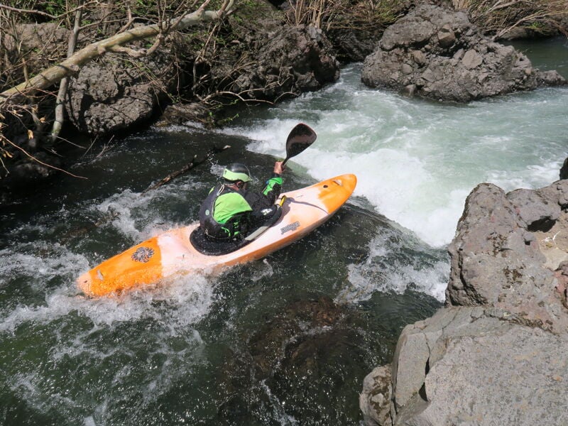
Antelope Creek is like a mini Deer Creek (a stout wilderness classic just south) with shorter distance, easier rapids, but similar land of the dinosaurs feel. It's just a really unique and beautiful part of the state with basalt bluffs lining the run the first 18 miles. The run is mostly Class II-III with about four Class IV rapids, a couple of which involve a challenging portage.
This run, at lower flows, is a perfect trip for those wanting to do their first self-support class IV overnight. It can also be done as a long day trip.
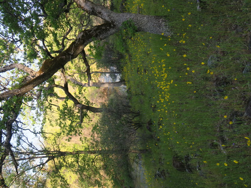
As with all creek runs, don't run anything that you can't see and be prepared for river-wide strainers. The best camping on the run is between Cameron Creek, Mile 4.2 and Facht Place at Mile 6.2. In this section the canyon widens and there are big flat benches above the river with afternoon sun and more expansive views. There are plenty of campsites all along the route though. Be prepared for some bush-whacking at the end of the run when you get out of the canyon and into the valley.
Read through the river features below rapid and hazard data.
Shuttle
The shuttle takes an hour if you follow these instructions, but a lot more if you don't. Don't rely on Google Maps for the shuttle.
From Cone Grove Park, get onto 36 East and turn off at Paynes Creek. From there take Plum Creek Road until the intersection of Hogsback Road at Plum Bottom Ranch. [Do not take the earlier right turn that is a cutoff 'shortcut' to Hogsback]. Once on Hogsback, continue past a lake until you go over a cattle guard, and turn left onto Ishi Road which will get you down to the put-in [do not follow Google and take the first left that looks like a shortcut, you will encounter high clearance only until you hit a locked gate]
This route will work in a lower clearance vehicle.
Other Information
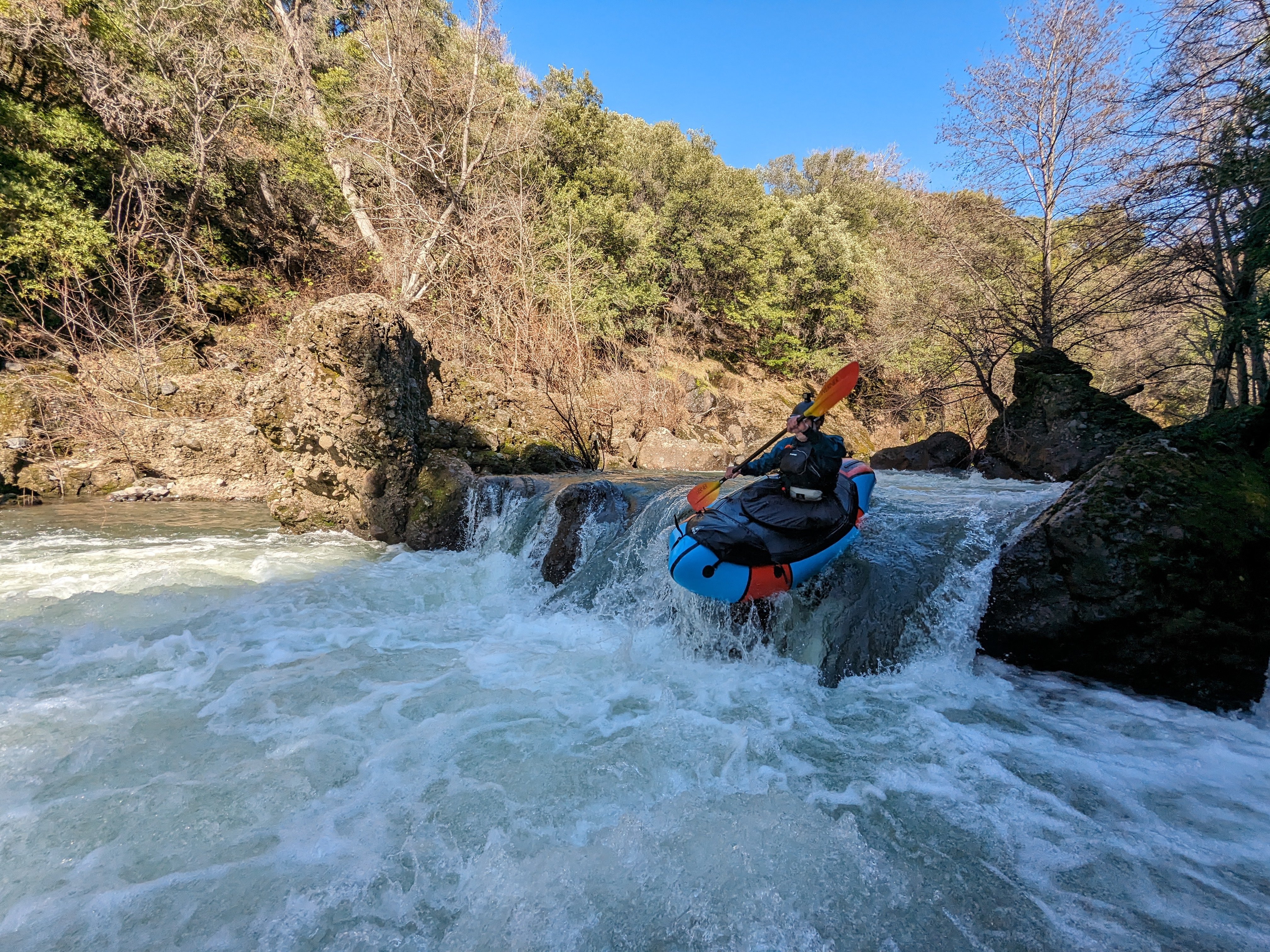
Blind class III drop, ending at a large mid stream boulder and a heavily undercut right bank. Stay left of the boulder, if you get pushed against the right wall at the bottom, it's heavily undercut and there is a log wedged into the undercut [Feb 2024]. Drowning risk.

This is a two part rapid just down stream of the powerlines. The scout pool is directly under the powerlines. It's a 2 part rapid and the 5' ledge is a lot of work to scout, as it's the second part of the rapid around a blind turn, with one small eddy river left before the ledge. The eft and center pourovers both went fine at 300 cfs.
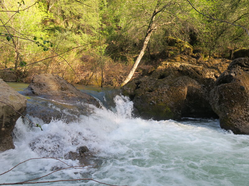
This rapid has a nasty undercut on river left and most of the water feeds into it. Best portaged on the right.
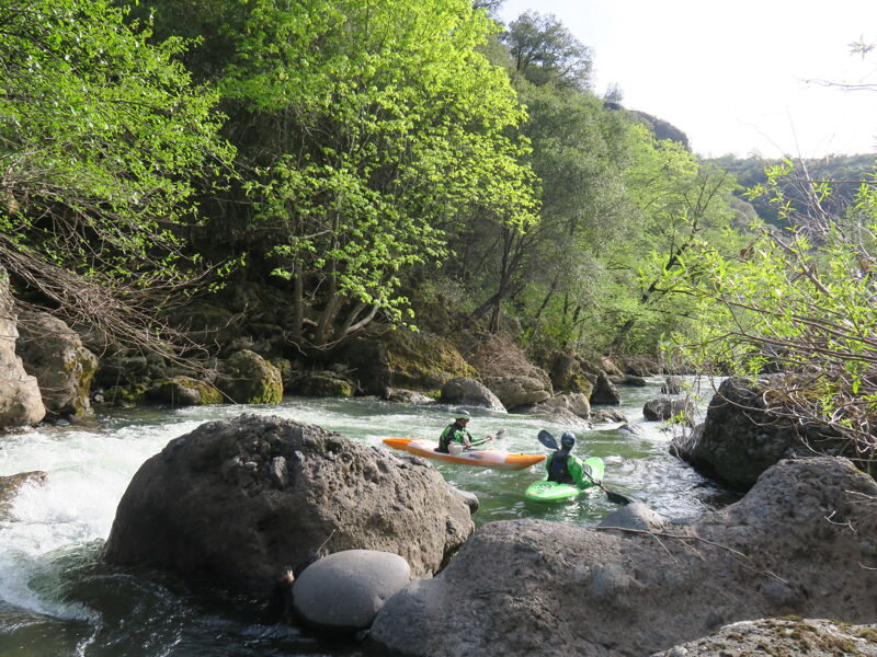
There are nice camps above and below Cameron Creek a tributary that comes in from the right.
River goes into 2 channels just after the cement low water crossing. The left size ends in a choked out willow section that involved a tricky move at low water. The right side looks like it would be pretty fun with more water, but wasn't an option at 300cfs.
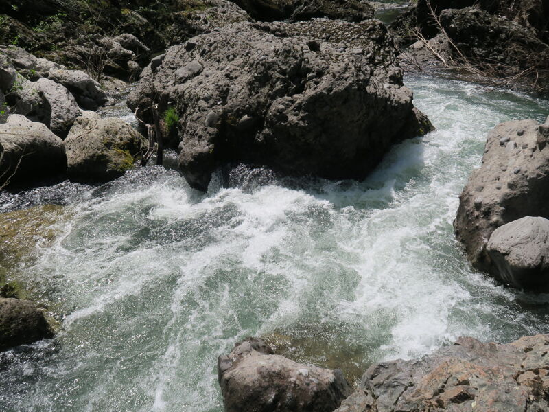
This rapid at low water has a nasty seive and undercut rock with a narrow entrance that feeds you into both. Might clean up at higher water.
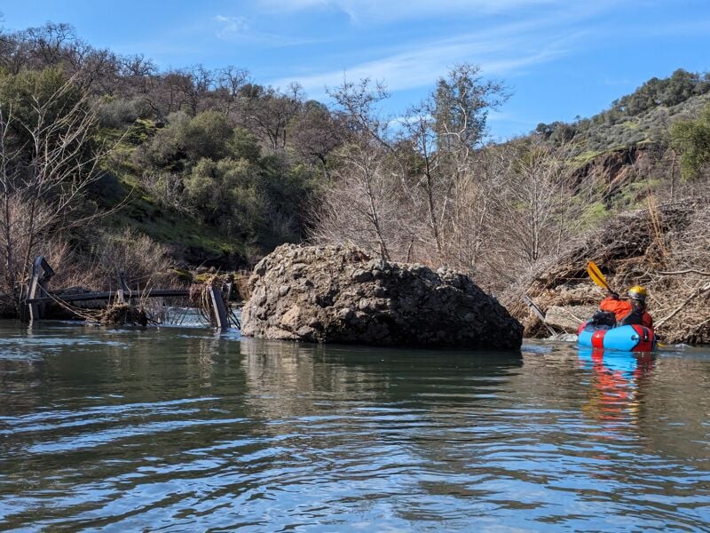
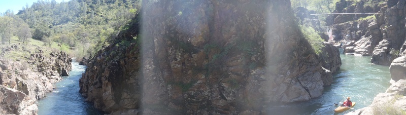
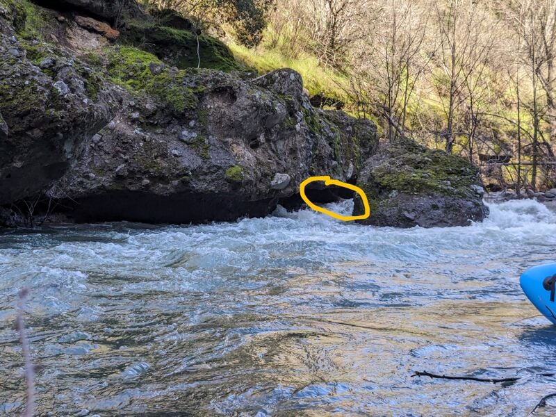
Destroyed bridge/dam here has metal in the water. In this pic, you can see that at high water, the metal strainer left of the boulder would be harder to see. Stay right.
Feb 24, 2024
Wonderful weekend with 70 degree high in Feb. Otter deer, and bald eagle sightings. I love this section of river and the geology in this part of the state. We put on with 315cfs and came off with 220. I did this last year at 220 holding from snowmelt later in the year. I think it would be really fun at 400/9'. Don't get confused by the linked gauge on Dreamflows or Cacreeks, this is the new gauge that isn't an estimate from Deer Creek.
Apr 24, 2023
Antelope Creek is a great run and a perfect trip for those wanting to do their first self support overnight. Our flow was very much on the low side of runnable. That said, this is a very beautiful run that is worth doing as a long one day or an overnight. There are a hand full of class IV rapids, some may get easier with more water. We had two rapids and a log that we portaged. The rapids could be run but were very scetchy. As with all creek runs, don't run anything that you can't see. The best camping on the run is between Cameron Creek, Mile 4.2 and Facht Place at Mile 6.2. Be prepared for some bush whacking at the end of the run when you get out of the canyon and into the valley.
People have been using the Deer Creek guage as an estimate for this run. I can say for our run, that estimated flow was not accurate. Probably off buy at least 50%. Also, there is a gauge for Antelope Creek, so there is no need to use the Deer Creek guage. The guage only gives you stage height so paddlers will need to calibrate to that number. Our flow of 8.5 was definitely the bottom end for hardshell kayaks and maybe for inflatables. I havtotal row 24664
e seen pictures of other trips that were at a flow of 10-11 feet and that flow looked pretty ideal. I don't really know where the upper end is but guess thing would get pretty exciting at flows above 14'.