Antelope Creek
Hogsback Road to Cone Grove Road
Feb 24, 2024
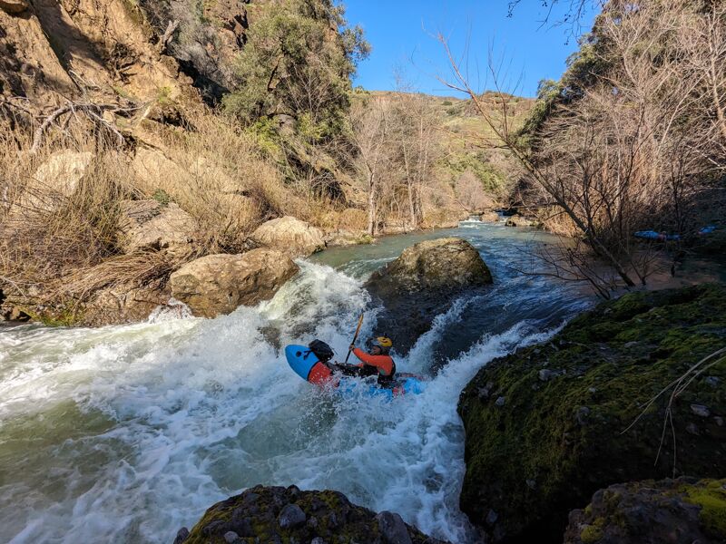
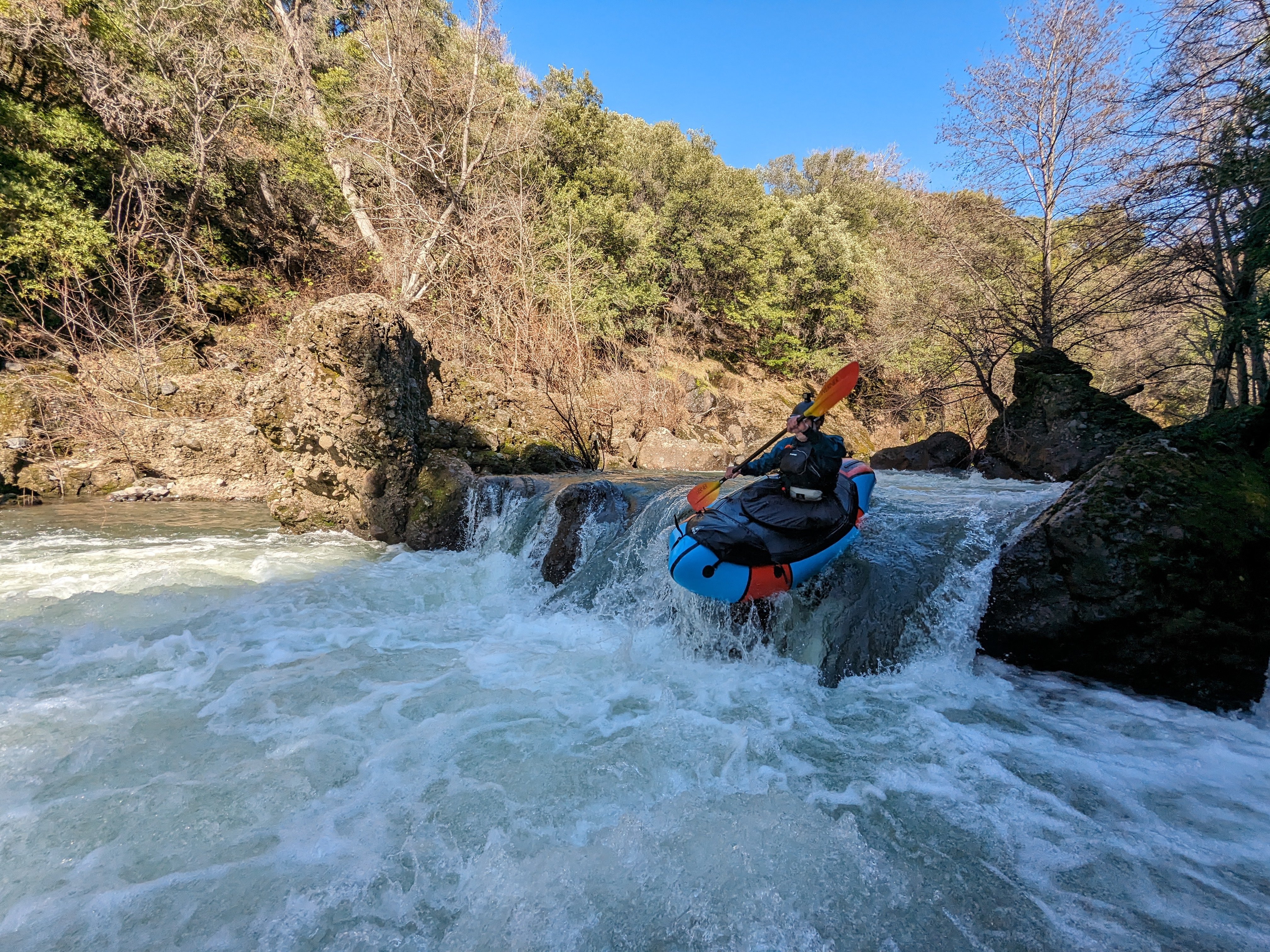
Wonderful weekend with 70 degree high in Feb. Otter deer, and bald eagle sightings. I love this section of river and the geology in this part of the state. We put on with 315cfs and came off with 220. I did this last year at 220 holding from snowmelt later in the year. I think it would be really fun at 400/9'. Don't get confused by the linked gauge on Dreamflows or Cacreeks, this is the new gauge that isn't an estimate from Deer Creek.
Apr 24, 2023
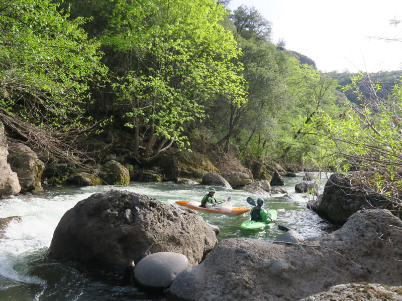
Antelope Creek is a great run and a perfect trip for those wanting to do their first self support overnight. Our flow was very much on the low side of runnable. That said, this is a very beautiful run that is worth doing as a long one day or an overnight. There are a hand full of class IV rapids, some may get easier with more water. We had two rapids and a log that we portaged. The rapids could be run but were very scetchy. As with all creek runs, don't run anything that you can't see. The best camping on the run is between Cameron Creek, Mile 4.2 and Facht Place at Mile 6.2. Be prepared for some bush whacking at the end of the run when you get out of the canyon and into the valley.
People have been using the Deer Creek guage as an estimate for this run. I can say for our run, that estimated flow was not accurate. Probably off buy at least 50%. Also, there is a gauge for Antelope Creek, so there is no need to use the Deer Creek guage. The guage only gives you stage height so paddlers will need to calibrate to that number. Our flow of 8.5 was definitely the bottom end for hardshell kayaks and maybe for inflatables. I havtotal row 24664
e seen pictures of other trips that were at a flow of 10-11 feet and that flow looked pretty ideal. I don't really know where the upper end is but guess thing would get pretty exciting at flows above 14'.
Mar 21, 2016
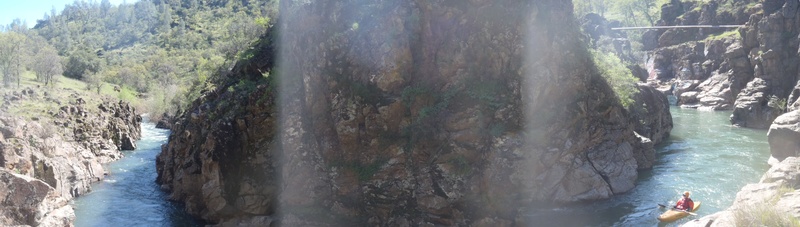
As of Mar 2016: Great run! Had about 430 on gauge, which was mellow but slightly boney in places. All read and run boat scouting except one blind boof. No portages for wood and no dangerous looking wood in rapids. My first time down but it only took just over 5 hours (solo) with minimal drifting and still time to get out and poke around . High water could be dicey because some of the rapids are very tight and blind. 2 very fun blind maze rapids in that lower gorge, which is where the best scenery is. Ran into 2 wardens at top and bottom. The one at the top was going to keep me from doing the run 'because it's closed'. If you run into this same issue you might remind him that the actual closure is everything south of the creek and the 'freedom of navigation' laws (or whatever its called.) We had a friendly chat and he let me go. I found a sign at the closed gate at the bridge which spells out the closure. The shuttle only takes an hour. If you have a very low clearance car I would take the next right about 2-3 mi. past the road which CaCreeks calls 'Oak Creek Rd' and the 2 roads meet back up in about 5 mi or so. I think this is the shortcut to avoid which Lisa mentioned. (a little confusing b/c both write-ups mention roads not to take)
Apr 13, 2011
Trip Report From Lisa Williams April, 2011
We ran Antelope Creek near Red Bluff as a 2-day run. This was my first time running it and it was really my first run of the season and in a brand-new boat. So, I was a little nervous. I would call Antelope Creek a Class II-III with about 4 Class IVs. A couple of the class IVs are pain-in-the-behind portages. There are 2 mandatory portages around trees anyway - one of which is a river-wide strainer at the bottom of the Powerline Rapid. At my best I would call myself a competent Class IV boater and these Class IVs were definitely manageable. We had about 500cfs on both days. Antelope is small and creeky, so the few named rapids would be akin to a small NF American Chamberlain Falls run or the lower McCloud overnight run. But, the rapids are smaller, shorter, and less cfs. We also portaged the last dam - lots of rocks at the bottom to catch and hold you in the backwash to the dam. Easy portage on the left.
We put on the river at 2pm on the first day and found 2 good camps right after Powerline Rapid. Camp Here!! There are no good camps for miles afterwards! We put on the river at 12 noon the next day and were at the take out by 4:30pm. The shuttle from the take-out to the put-in is 4 hours! So be sure and grab some great Mexican Food next to the fairgrounds before you go...I think it is Don Fernandos on the right side of the road as you do into Red Bluff.
The roads are good enough although slower going in a low-clearance vehicle (Toyota Tercel). Use Hogsback road on the way to the put-in instead of taking the shortcut that is steeper, and rockier. The difference is only 2 miles and about 5 minutes, but Hogsback is much less wear and tear on your car.
You can put in at the Thorton Lee Fischer Campground. We put in 1/2 mile downstream where Ishi Rd crosses the creek and has great access and you miss one Class IV caused by a landslide.