Kalama
3. Lower Kalama Falls to Red Barn or Modrow Road(Red Barn Run)
| Difficulty | III-IV |
| Length | 7.5 mi |
| Avg Gradient | n/a |
| Reach Info Last Updated | February 8, 2026 |
Washington’s legendary volcanoes – Mount Rainier, Mount St. Helens, and Mount Adams – are the source of wild, free-flowing rivers and streams that cascade over big drops and through deep basalt canyons on their way to the Columbia River. Rivers like the Clear Fork of the Cowlitz, Cispus, Green, [...]Read More
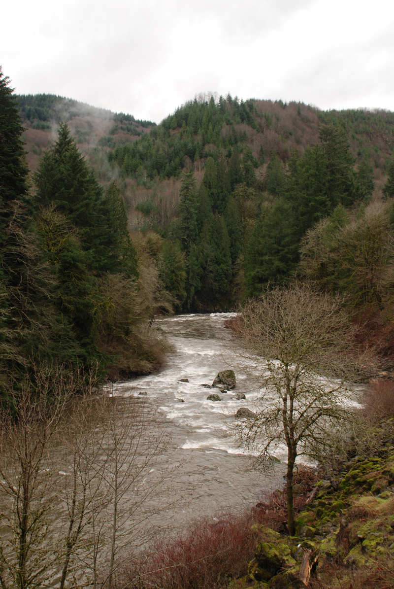
The Kalama is a great whitewater run that comes to life with the fall rains and holds its water better than many nearby rivers, making it a reliable option through the winter and into spring. The Kalama is a rain-dominated basin below the snowline, with a noteworthy amount of groundwater input relative to other area watersheds. This helps sustain flows even when rainfall is limited, resulting in less dramatic seasonal swings than many nearby runs. Combined with easy logistics, it’s a solid choice for a half-day trip.
The standard run begins at the fisherman’s trail that descends to the river below Lower Kalama Falls. Expect a 5–10 minute walk down to the water, where a gravel bar—exposed at moderate flows—provides a good staging area to get organized before launching.
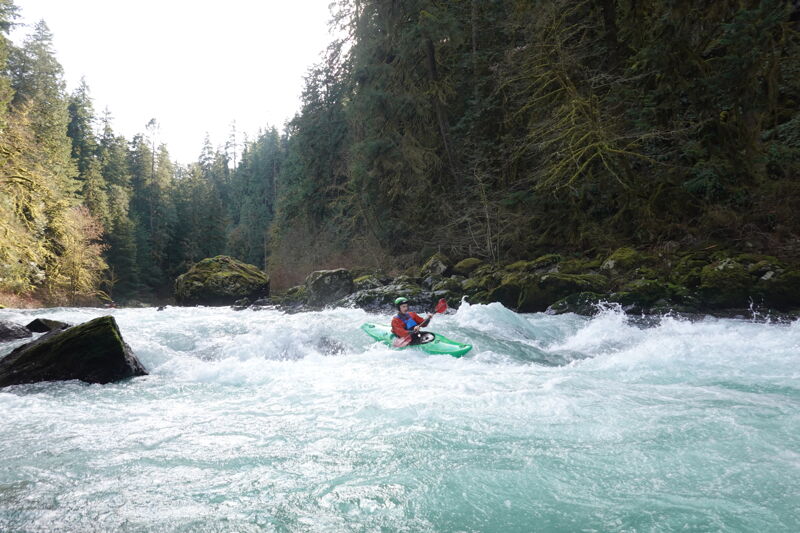
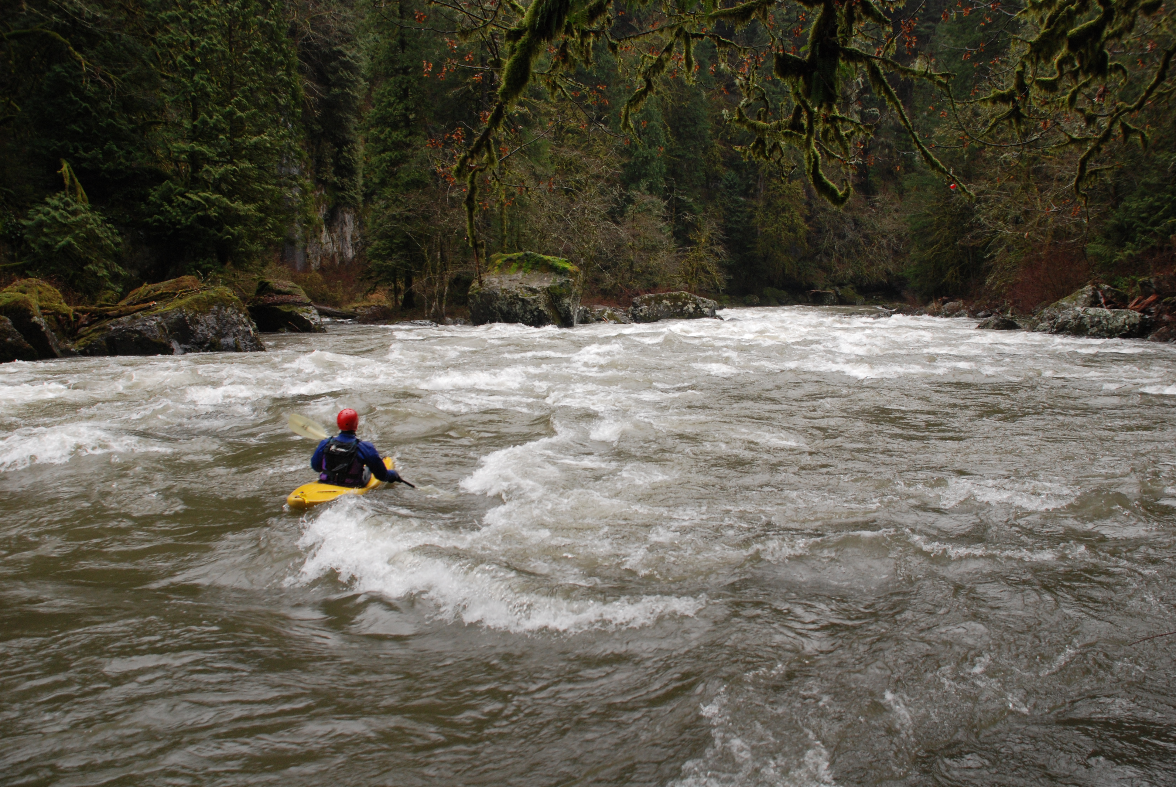
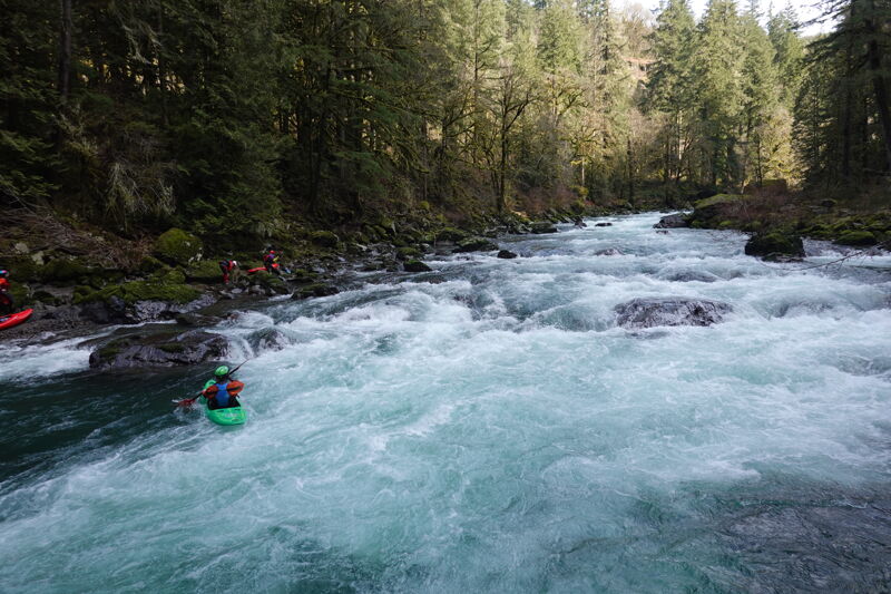
The first couple of rapids are III but can push to class IV at higher flows. After a short warmup stretch, the river bends left about a quarter mile from the put-in and drops into the first and largest rapid on the run, Barnyard. This long, steep boulder garden can be scouted from the fisherman’s trail on river right, and a good recovery pool waits at the bottom.
About another quarter mile downstream is the second major rapid, Haystack. It is similarly steep but shorter, comes up quickly, and is scoutable from river left.
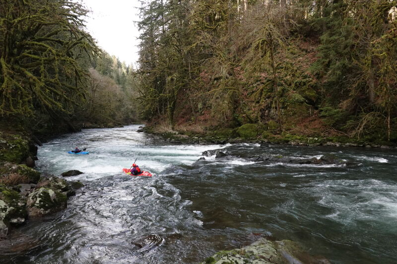
After these two rapids the intensity begins to taper, but stay alert for Piggly Wiggly less than a mile downstream. Here, a sequence of two ledges forms a fun rapid with boof opportunities. It can be scouted from the left, and the top ledge is easy to lap for practice.
Once the road comes into view on river right, you are nearing the first—and most common—take-out at Red Barn, marked by a large red barn visible from the river at the confluence with Indian Creek. The short run to this point (about 3 miles) is commonly called the Red Barn section, though drift boaters sometimes use the name for the stretch that begins here and continues downstream to Mod
...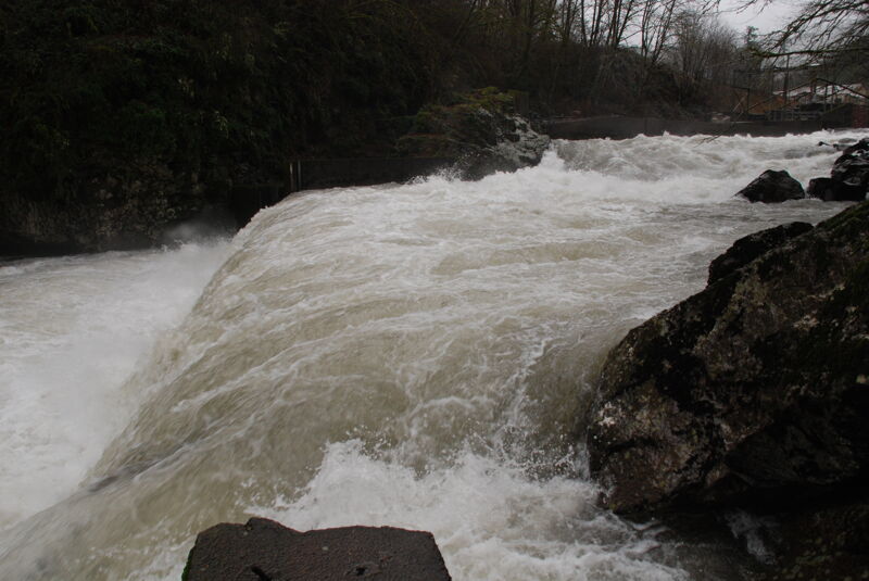
Lower Kalama Falls is located immediately downstream of the fish hatchery. The standard put-in is downstream of this falls. The falls itself is a severe hazard due to the riverwide dam at the end of the falls that forms a deadly hydraulic. If you are on a longer trip beginning upstream a portage on the left side of the falls is available but be sure to get out at the first eddy above the start of the falls.
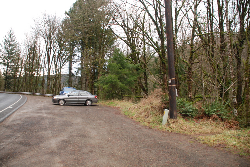
This access trail is the standard put-in for this run. It can be found next to the utility pole at the pull-out 8.2 miles from I-5 before you reach the turn to the fish hatchery. Located at USGS river mile 10.6.
Lines vary depending on flows and your preferences but starting center left and working towards center is a good option. A right line is also available.
A sequence of two ledge drops with a couple different lines depending on flows and your preferences.
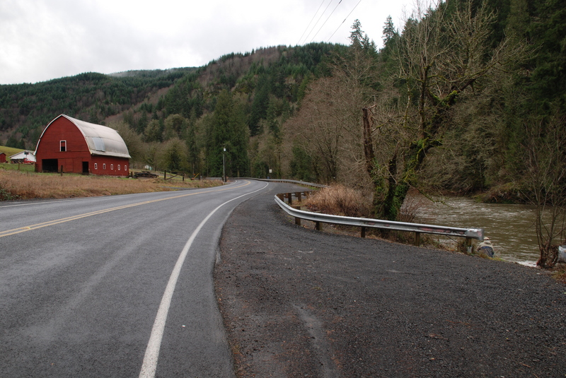
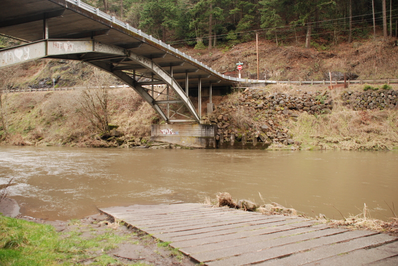
This access is located 5.5 miles east of I-5 and is recognized by the big red barn along the road. This access is often used as a take-out for those doing the short run from Lower Kalama Falls down through the canyon. It can also be used as a put-in for those wanting to enjoy the class I/II float downstream. During fishing seasons this is a popular launch point for fishermen and the limited parking can fill up. During fishing season it best to consolidate vehicles and just leave a single shuttle car here. Located at USGS river mile 7.7.
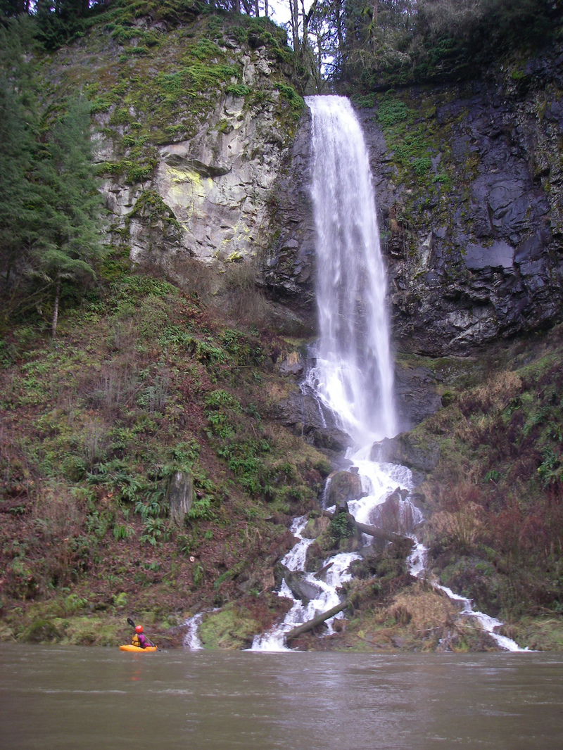
An impressive waterfall cascades in from river left. USGS river mile 6.1.
A WDFW Access (requires a parking pass) on river right with a good ramp located 3.4 miles from I-5 and just upstream of the Lower Kalama Hatchery. USGS river mile 5.2.
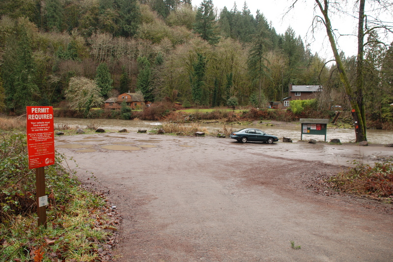
A WDFW Access (requires a parking pass) on river right located 2.9 miles from I-5 and just dowstream of the Lower Kalama Hatchery. Located at USGS river mile 4.7.
A WDFW Access (requires a parking pass) on river left with a good ramp located 1.2 miles from I-5 and across the Modrow Road bridge. Located at USGS river mile 2.9.
Feb 6, 2026
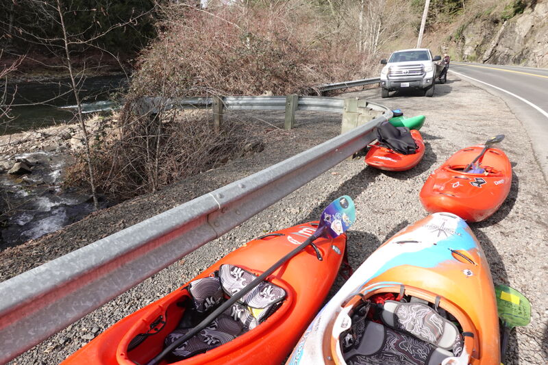
We had a great trip on the Kalama with Jim, Tom, Bryan, Dawn, Annastasia, Matt, Terry, and Rachel. We met up at Haydu Park and consolidated into two vehicles for the put-in, with one vehicle set as the shuttle at Red Barn. Most of the group paddled hardshell kayaks, with Terry bringing his inflatable kayak. The flow was around 420 cfs for a noon launch. It was a good flow with well-formed rapids and fun features to enjoy.
The sun was out, making for an enjoyable day on the water. We had a couple of swims—one at Barnyard and another at Piggly Wiggly—but we gathered up all the pieces and everyone made it safely to the take-out.
Fishermen were out searching for winter steelhead, and we encountered several anglers along the banks. Jim showed me a great way to build goodwill between kayakers and anglers: collecting stray bobbers stuck in places that are hard for fishermen to reach but easy for kayakers to grab, then gifting them back along the way.
The Red Barn Access was busy with fishermen launching rafts and drift boats, but we were still able to find space.
Total float time was about 90 minutes for the 3-mile run.
Jan 5, 2008
A long day on the Kalama paddling from the Upper, portaging Kalama Falls, and continuing on downstream through the Red Barn run. Flows were moderately high.