Matheny Creek
North Fork to FR 21 Bridge (Upper & Middle)
| Difficulty | IV+ |
| Length | 9.2 mi |
| Avg Gradient | n/a |
| Gauge | Queets River Near Clearwater, Wa |
| Flow Rate as of 1 hour | 527 cfsbelow recommended |
| Reach Info Last Updated | November 29, 2021 |
American Whitewater is proud to be a leading partner in the Wild Olympics Campaign, a collaborative effort to protect the wild rivers, ancient forests, and salmon habitat of Washington’s Olympic Peninsula. Working alongside conservation and recreation organizations, American Whitewater helped launch this campaign with the leadership of our local [...]Read More
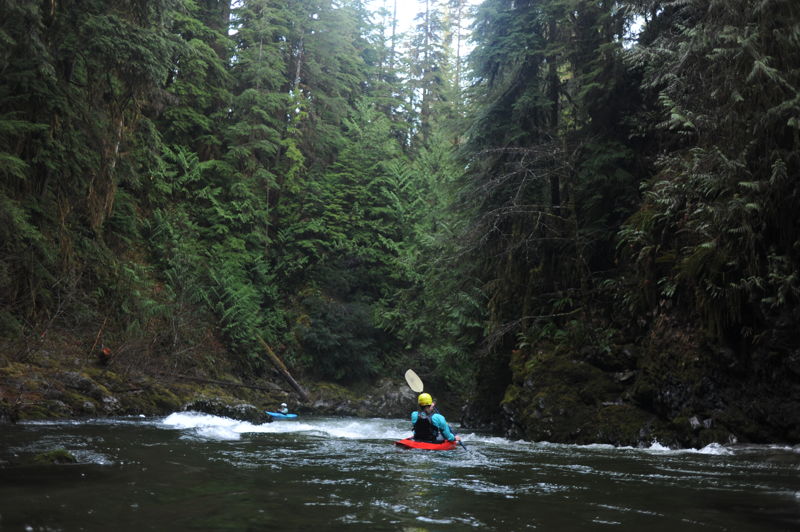
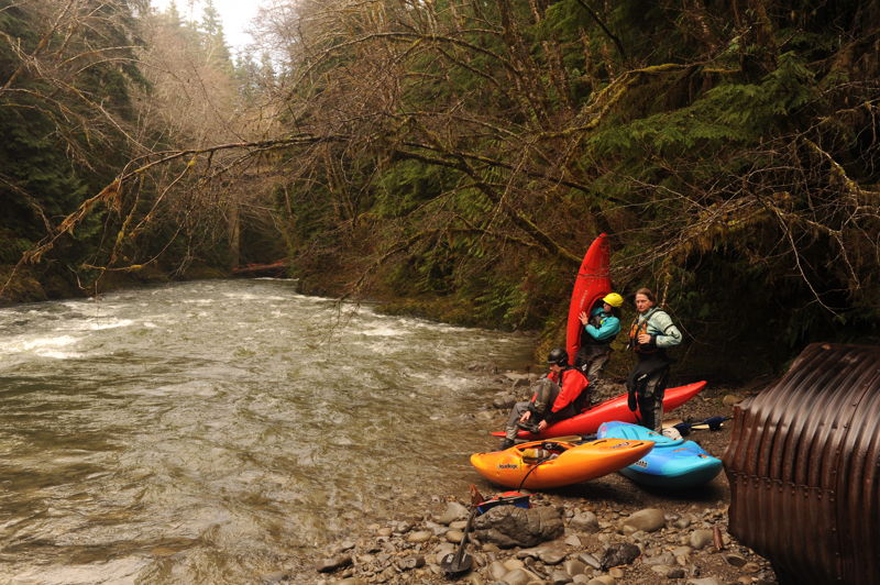
In his book, a Paddler's Guide to the Olympic Peninsula, Gary Korb describes Upper Matheny as containing 'some of the best and most scenic whitewater in Washington,' It truly is an Olympic Peninsula classic and one of the region's best creek runs for experienced class IV paddlers in an incredibly beautiful canyon. It has good access, great scenery, and plenty of fun pool-drop class IV rapids with unique and distinct characteristics. This run includes the class IV upper section and the class III middle section. The run is typically in during winter rain events but it can spike up or drop out quickly.
Upper Matheny, class IV+, 2.5 miles
You will likely start your run down the North Fork, a tight little tributary that will have you bouncing off lots of rocks. Stay well spaced and soon you'll be at the confluence with the South Fork and a fun rapid that starts things out with a big flush through a narrow constriction in the bedrock. Although not easily visible from the top of the rapid, there is a good recovery pool at the bottom.
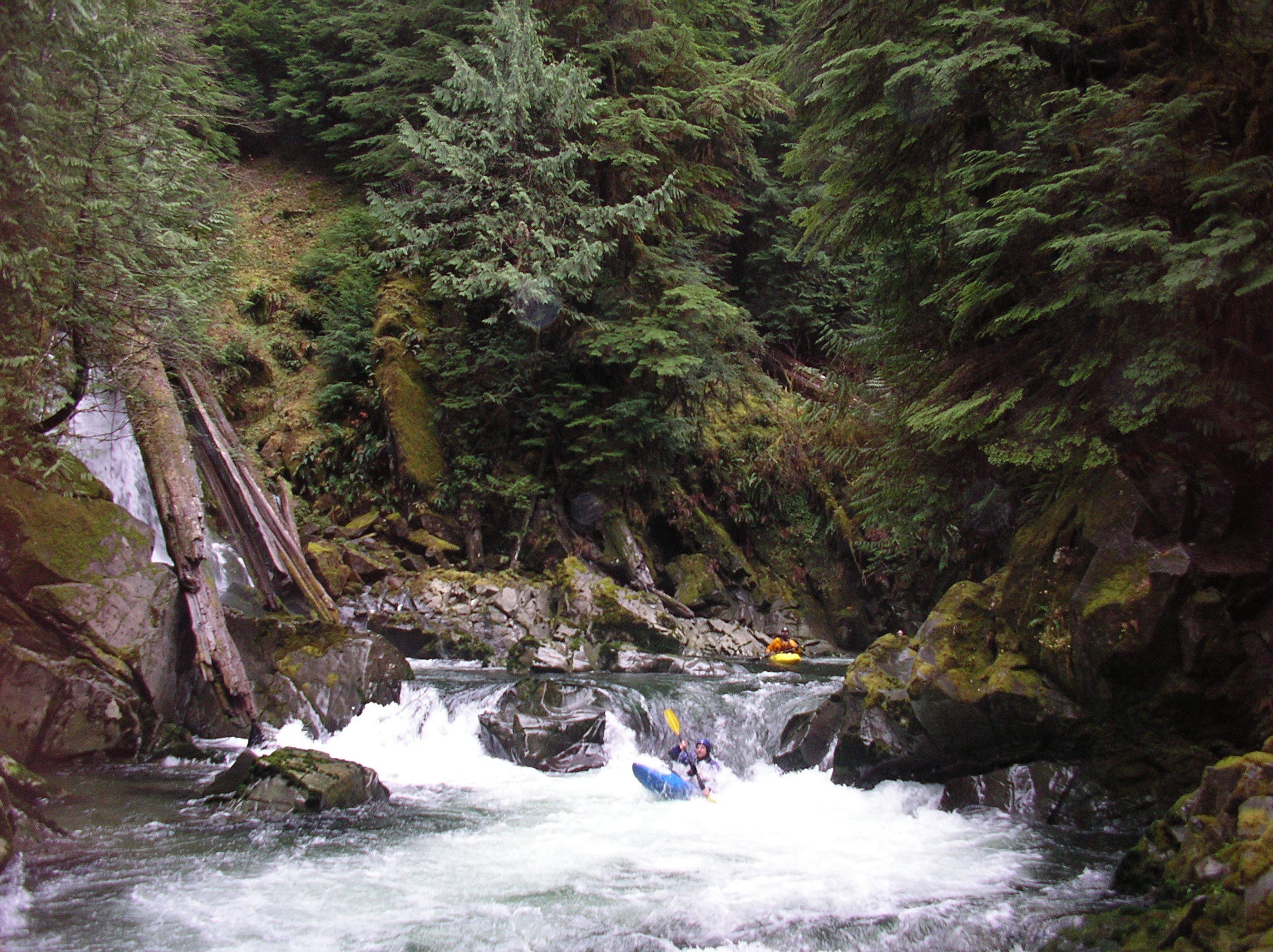
Within a short distance the river plunges over the first of several great 6' ledge drops at the Tongue of Pleasure. The river calms down a bit while still providing constant action with some fun class III drops through the scenic bedrock canyon. The pace picks up again in a tight section with a number of ledges packed close to together, and the first of these is Shark Fin Falls which is the biggest ledge drop on the run. You can recognize it by the major tributary that comes in from the left just below it. What follows downstream of Shark Fin Falls is a fun class IV sequence of ledges that you will most likely be able to boat scout. This section is the highlight of the run and finishes off with a beautiful drop where a waterfall comes in from the right.
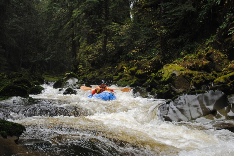
Middle Matheny, class III, 6.2 miles
Soon you will come to the 2160-080 bridge which crosses the river high above. This is the traditional div
...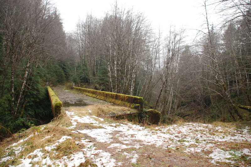
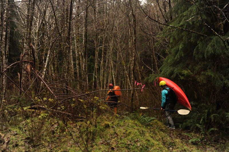
Access the river at this bridge across a major tributary of Matheny Creek and bump your way down to the confluence. Some just hike through the woods.
This bridge is the traditional dividing point between the Upper and Middle run with class IV rapids upstream of the bridge and class III downstream of the bridge. It would be a tough place to take-out so most continue on downstream and run at least a few miles on the middle section. Those looking for a class III run can put in here but you will likely need to use your rope to lower boats down. There is a decent spot a couple hundred yards downstream of the bridge on river right.
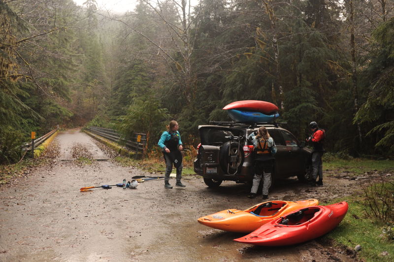
This is a good take-out option for those running the upper particularly if you have gotten a later start and also a put-in for those running the lower. At mile 3.0 on Forest Road 2160, after crossing the Hook Branch which is a major tributary, you will find a pullout on the right located directly across from the 2160-060 spur which heads up the hill to the left. It's about a 10 minute scramble down the bank to Matheny Creek and you can likely find a kayaker trail which is sometimes flagged. If using this as a take-out, note there are few distinguishing features visible from the river so it's a good idea to hike down and mark it.
The take-out is on river right. The best access is about 100 yards upstream of the bridge where you can climb up the bank and then access a short social trail that heads up to the parking area on the upstream river right side of the bridge. If you can't find this trail you can also scramble up under the river right side of the bridge.
Nov 27, 2021
Just one photo from the Middle for a trip that continued on down the Lower. See the rest of the photos and full trip report on that river page.
Nov 26, 2021
With water washing over the big gage rock and knowledge that the last section of road accessing the Upper was washed out, we decided a run on Middle Matheny was the prudent choice for our Friday after Thanksgiving #OptOutside adventure. Flows were 20,000 cfs on the Queets at 10am and 18,000 cfs at 2pm. We put in a couple hundred yards downstream of the 2160-80 bridge on river right and used ropes to lower boats. The whitewater was fun and consistent class III with lots of good moves and the beautiful Matheny Creek scenery and clear water; a few spectacular Douglas fir trees still line the banks. We took out just upstream of the 2160 bridge on river right where a rough trail accesses the river. Flows dropped over the course of our run with levels at a near optimal level for the lower (a few inches of the big gage rock showing) and we briefly considered continuing downstream. Ultimately we decided to save it for the next day. Boaters on the trip included Tom O'Keefe, Cyn Taylor, James Girton, and Leanna Girton.
Nov 23, 2020
As of 11/22/2020, the road is indeed still...washed out. I don't think it will be repaired this decade. That said, we hiked along the road and put in on the NF Matheny creek, which we would describe as 'New England Low' when the correlation gage for the main run was reading about 8k. On the NF, there were a few portages..most minor, one major. It's up to you if this is a preferable strategy than more hiking with your boat to the main putin, which runs about 2.8 miles from the road wash out. The rest of the upper and middle sections were good to go. A couple tight spots with wood where the conservative boater may portage, but there was a good line. 8k on the upper felt solid medium, though it felt a bit low on the middle section. In all, a long, rewarding day in the OP sunshine.
Dec 13, 2018
Put on the Middle section as the Queets gage was peaking at 35,000. It was solid class IV big-water. There is one large log-jam about 2-3 miles into the middle section. There is a decent portage trail on river right. At the flows we had, there was extremely limited eddy access for the portage, so be careful. Regarding the Upper, a local told us that the road was washed out and you couldn't reach the put-in. We did not confirm this.
Oct 26, 2015
An isolated rain storm was just enough to bring Matheny, the forks of the Humptulips, and the Hoh in for some packrafting. The little entry creek into Matheny was very skinny, but once in the main creek there was enough water for fun lines through the rapids. Matheny, like pretty much everything on the Peninsula, is extremely scenic. Classy run for packrafting - we loved it!
Nov 26, 2011
During Thanksgiving 2011 we found ideal flows on Matheny Creek with the Queets gauge at 7200 cfs. The road to the put-in was open and in good shape. We had an efficient trip down the upper and paddled halfway down the middle to the intermediate access point.
Nov 16, 2010
I just got off the phone with the Ranger district and the bridge has been repaired. They confirmed access to the bridge over the Matheny, the middle put-in. There is a washout on the way up to the upper...I would check with them before you go but it appears the Middle is open for business.