Matheny Creek
North Fork to FR 21 Bridge (Upper & Middle)
Nov 27, 2021
Just one photo from the Middle for a trip that continued on down the Lower. See the rest of the photos and full trip report on that river page.
Nov 26, 2021
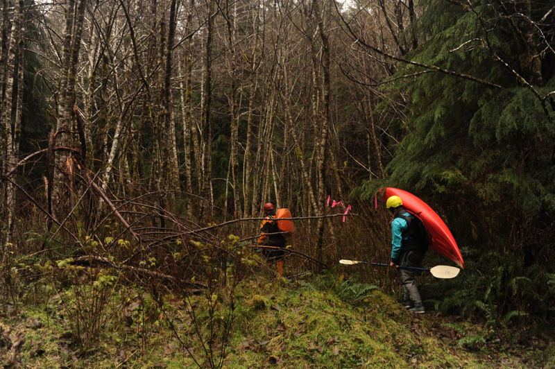
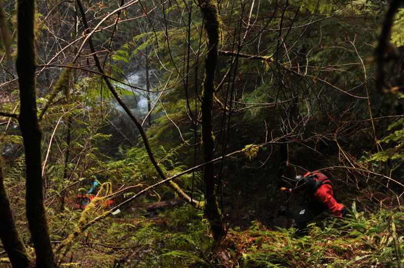
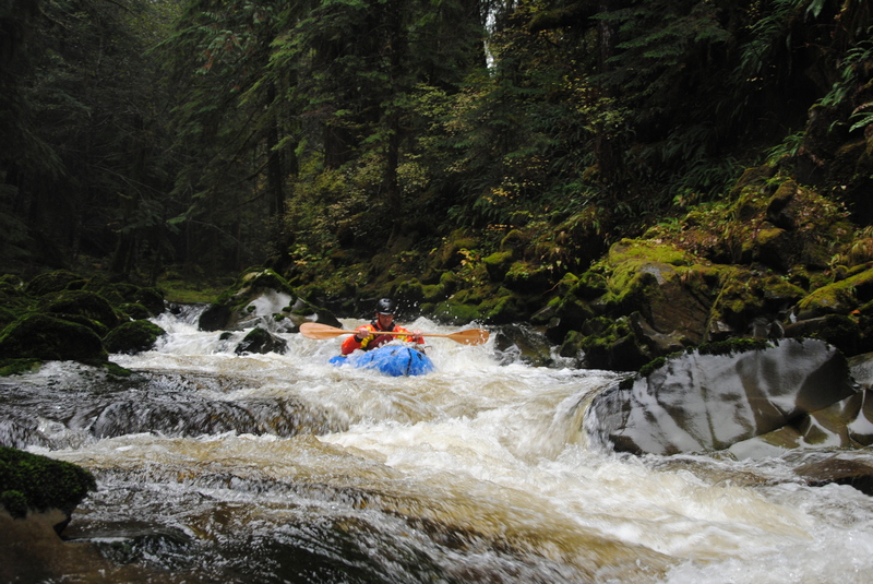
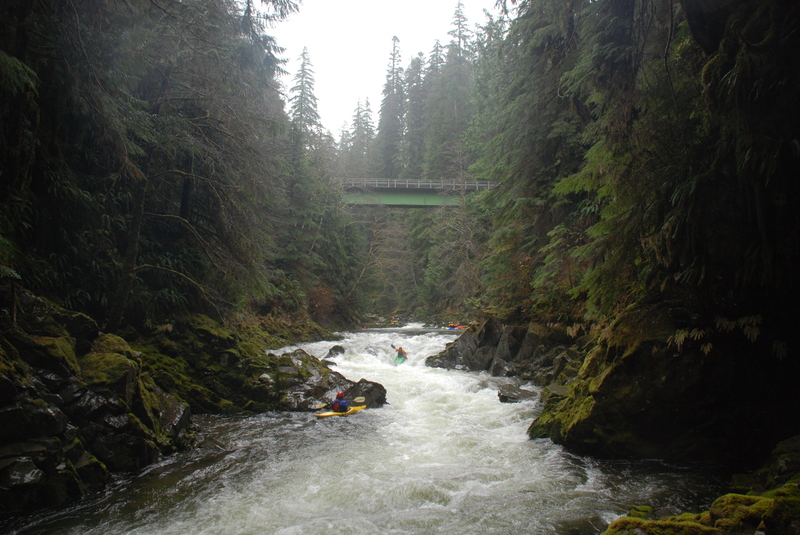
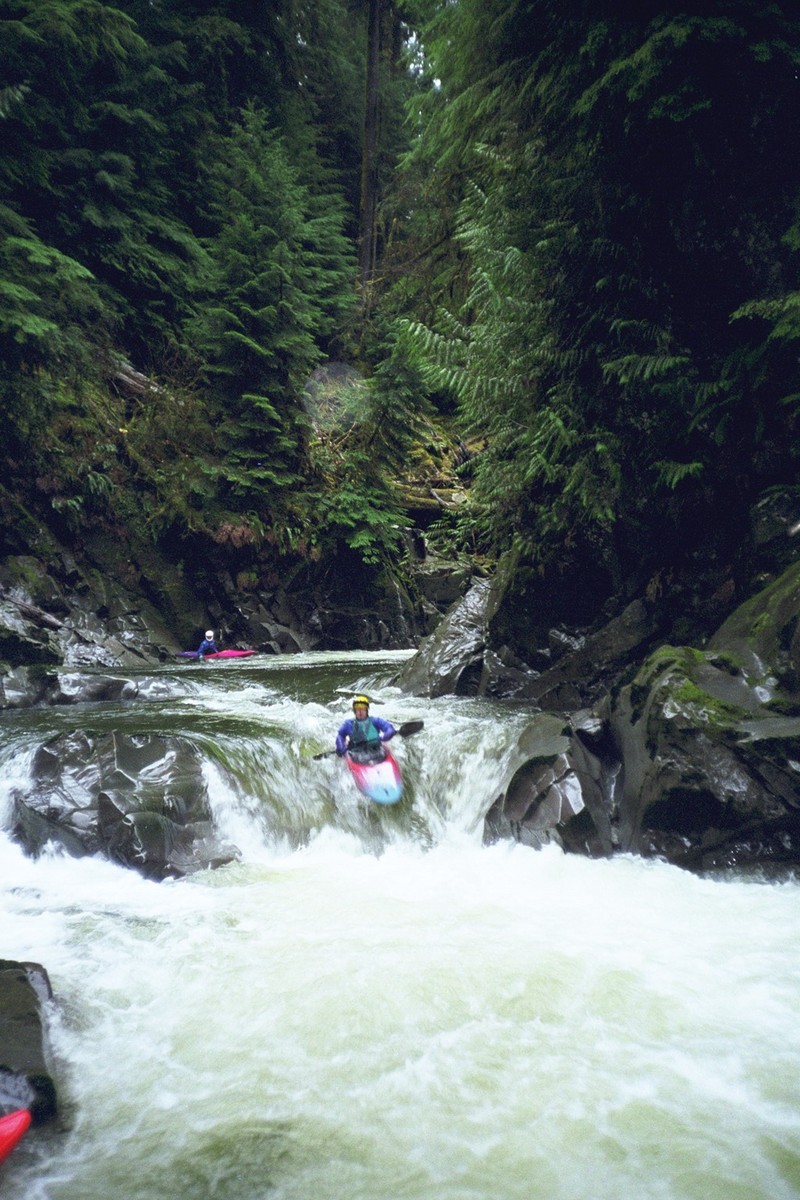
With water washing over the big gage rock and knowledge that the last section of road accessing the Upper was washed out, we decided a run on Middle Matheny was the prudent choice for our Friday after Thanksgiving #OptOutside adventure. Flows were 20,000 cfs on the Queets at 10am and 18,000 cfs at 2pm. We put in a couple hundred yards downstream of the 2160-80 bridge on river right and used ropes to lower boats. The whitewater was fun and consistent class III with lots of good moves and the beautiful Matheny Creek scenery and clear water; a few spectacular Douglas fir trees still line the banks. We took out just upstream of the 2160 bridge on river right where a rough trail accesses the river. Flows dropped over the course of our run with levels at a near optimal level for the lower (a few inches of the big gage rock showing) and we briefly considered continuing downstream. Ultimately we decided to save it for the next day. Boaters on the trip included Tom O'Keefe, Cyn Taylor, James Girton, and Leanna Girton.
Nov 23, 2020
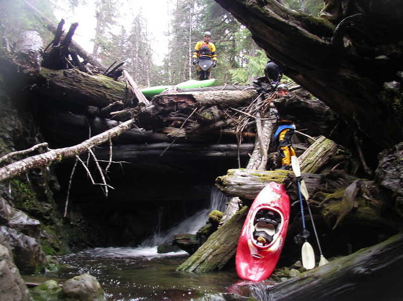
As of 11/22/2020, the road is indeed still...washed out. I don't think it will be repaired this decade. That said, we hiked along the road and put in on the NF Matheny creek, which we would describe as 'New England Low' when the correlation gage for the main run was reading about 8k. On the NF, there were a few portages..most minor, one major. It's up to you if this is a preferable strategy than more hiking with your boat to the main putin, which runs about 2.8 miles from the road wash out. The rest of the upper and middle sections were good to go. A couple tight spots with wood where the conservative boater may portage, but there was a good line. 8k on the upper felt solid medium, though it felt a bit low on the middle section. In all, a long, rewarding day in the OP sunshine.
Dec 13, 2018
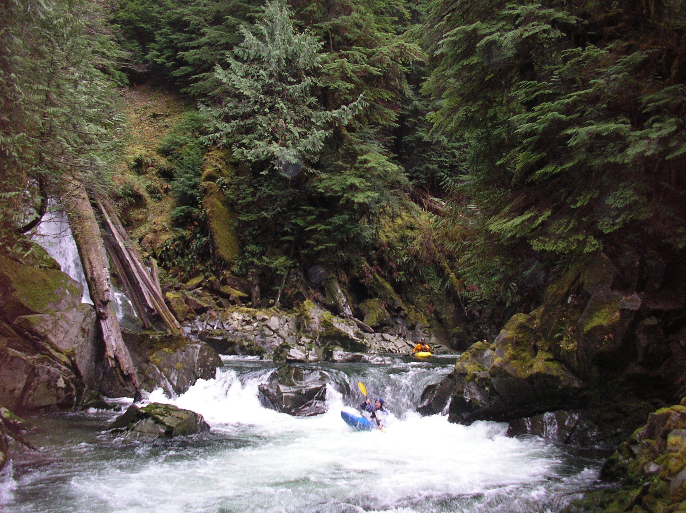
Put on the Middle section as the Queets gage was peaking at 35,000. It was solid class IV big-water. There is one large log-jam about 2-3 miles into the middle section. There is a decent portage trail on river right. At the flows we had, there was extremely limited eddy access for the portage, so be careful. Regarding the Upper, a local told us that the road was washed out and you couldn't reach the put-in. We did not confirm this.
Oct 26, 2015
An isolated rain storm was just enough to bring Matheny, the forks of the Humptulips, and the Hoh in for some packrafting. The little entry creek into Matheny was very skinny, but once in the main creek there was enough water for fun lines through the rapids. Matheny, like pretty much everything on the Peninsula, is extremely scenic. Classy run for packrafting - we loved it!
Nov 26, 2011
During Thanksgiving 2011 we found ideal flows on Matheny Creek with the Queets gauge at 7200 cfs. The road to the put-in was open and in good shape. We had an efficient trip down the upper and paddled halfway down the middle to the intermediate access point.
Nov 22, 2010
Ran Upper, Middle & Lower on 11/20-21. Beware of some wood in the lower...easy to spot and portage on either bank.
Nov 16, 2010
I just got off the phone with the Ranger district and the bridge has been repaired. They confirmed access to the bridge over the Matheny, the middle put-in. There is a washout on the way up to the upper...I would check with them before you go but it appears the Middle is open for business.
Jan 11, 2009
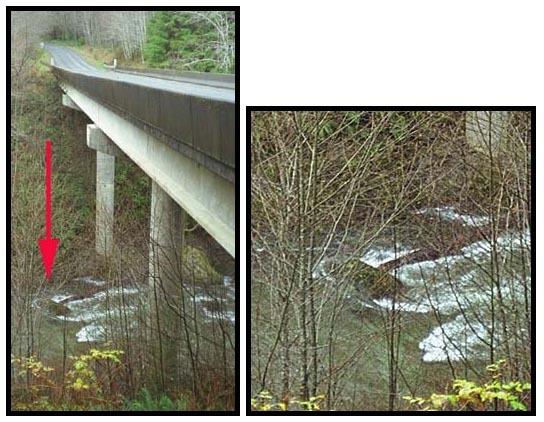
The Forest Service reports that the bridge across the tributary at mile 1.9 on the 2160 road has washed out meaning you can no longer drive to the put-in.
Nov 27, 2006
We tried to run Upper Matheny on 11-24-2006. There is a 2' diameter log across the road, a mile or two above the takeout.
Nov 26, 2004
The Friday after Thanksgiving in 2004 we found good flows (low side of medium) and had a great time on Upper Matheny. As of this date the road has been repaired and is open to mile 5.9. There is a washout at that point requiring you to hike for about an hour to reach the put-in to the upper, but it's an easy walk on the road bed. We ran down through the first half of middle Matheny and took out at the intermediate access point. The flow was at 9000 cfs on the Queets gage at 11am and dropping fast with cold weather. It was a fun level but the river could have used a bit more water. All the drops were great but a few of the sections in between were a little boney. All the drops were clean except for one massive log jam on the North Fork that we had to portage. Paddlers on the trip included Mike Rausch, Pete Mattson, Thomas O'Keefe, Bryan Cunitz, Jan Tackett, Ryan Hagg, Eric Bessette.
Nov 27, 1999
We had a good trip on Matheny Creek but had a big group and got a late start. The upper run was in great shape and we took time to scout drops and shoot photos. By the time we reached the middle section the light was starting to fade and we found ourselves completing the run in the dark. Disoriented at the take-out we did not realize we had made it to the bridge and ended up hauling boats up with ropes never realizing there was a trail we could have used with much less effort.