Raging

Preston to Fall City

Reach banner
DifficultyIII+
Length4.8 mi
Avg Gradient71 fpm
GaugeRaging River Near Fall City, Wa
Flow Rate as of 11 minutes
36 cfsbelow recommended
Reach Info Last UpdatedMay 23, 2025

Projects

Stewardship in the Mountains to Sound Greenway (WA)

The Mountains to Sound Greenway stretches more than 100 miles along Interstate 90 from the shores of Puget Sound in Seattle, across Snoqualmie Pass, and into Central Washington. Encompassing over 700,000 acres of public land managed by local, state, and federal agencies, the Greenway protects an extraordinary landscape that [...]Read More


River Description

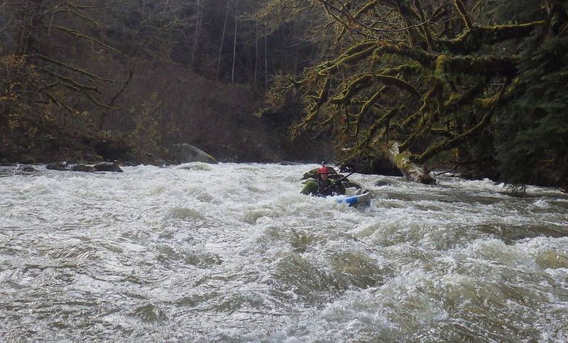
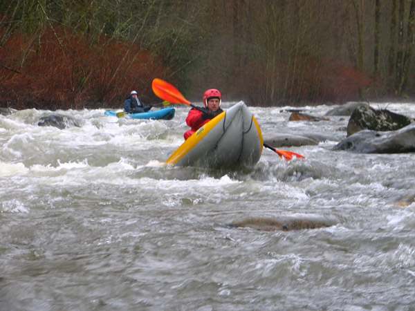
This is a rainy season run that typically requires a few days of solid rainfall to reach runnable flows. The river begins as a class II section as it meanders through the small town of Preston. The Raging is prone to wood accumulation, and while most hazards can be seen and avoided, paddlers should expect to get out and portage in places. About halfway through the run, the river swings close to the road and drops into the class III+ 'Cheesegrater,' a boulder-strewn rapid with powerful holes. It then passes under the Preston–Fall City Road and enters a dark-walled canyon, where another class III rapid turns sharply away from the road. From there, the river gradually eases before reaching its confluence with the Snoqualmie at Fall City. Due to frequent wood hazards, scouting is strongly recommended before running.

Additional Information: A Guide to Whitewater Rivers of WA, J. Bennett (1990)


River Features

Preston Put-In

Distance: 0.03 mi
Preston Put-In

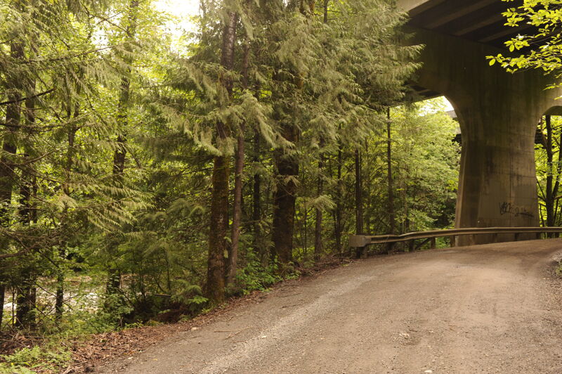
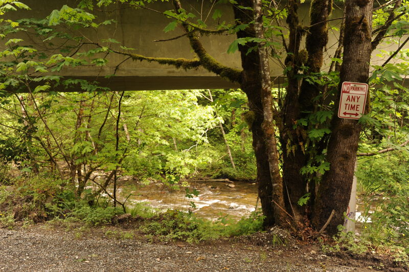
A good access is available just upstream of Preston along 312th Ave SE underneath the westbound lanes of I-90 that cross high overhead.

Fall City Park Take-Out

Distance: 4.77 mi
Take Out
Fall City Park Take-Out

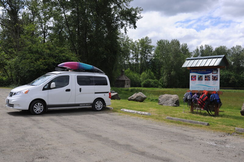
The run finishes off with a short paddle on the Snoqualmie River where you pass under the bridge in Fall City and take out on river right at the Fall City Park.


Nick Borelli
Nick Borelli

Nov 16, 2015


Nick Borelli enjoying 1050 cfs

JA
Jon Almquist

Mar 17, 2014


A few logs span the river just upsteam of the 86th St. bridge in Preston. You can easily scout this from the bridge during shuttle, and decide if you want to put in here or upstream at the usual 'under I-90' put-in. Below here there was one large log limbo move in the braided section just above Icy Creek. At higher levels this limbo might not go, but portaging looked to be straight forward. There was a channel-wide log right at the confluence of Icy Creek that could be paddled over or carried. With more water you might not even notice this log... Everything below here was fairly clean. Sure, there's some wood, but everything was easily avoidable.

BV
Brian Vogt

Nov 8, 2006


Ran the Raging again, first november after work run ever. This was our first post-flood run.

There is new wood in the section below Preston but above Cheesegrater. Visible from the road is a major tree spanning the entire river bed with few easy portage options. Portaging is possible, but will be a slog through the underbrush and hard on gear. Cheesegrater looked clean, but we launched downstream at the gauging station and ran into Fall City.

There are many changes in the river bed. Most significant is the rapid in the canyon. The rocks on the left have washed several yards downstream, opening up a high water slot on the left. There is less constriction here and not as much push into the undercut on the right. I'd say it's a little more open in the main line.

The island above the canyon goes in either channel, but the left channel could be blocked by a short log, so leave your options open here.

The gauge read 400 but felt more like 600-800 of the past. Probably the guage needs recalibration.

Jeffrey Holden
Jeffrey Holden

Apr 17, 2006


April 16, 2006 Flow: 334

After doing the section above we proceeded under the I90 bridge. There is a put in just above.

Logs

We got out an looked frequenly because of blocked channels and logs across the river. The worst spots and places we portaged are where the river branches into a number of channels especially 3 or more. These occur in the wide gravel flats not in the rocky straight sections.

Cheese Grater

We thought we saw Cheese Grater from the road but did not remember it on the river. In retrospect it was a section we scouted a long time. The log in the video shown in the middle of the river was gone replaced by a single log where the paddlers went under the log. In that spot there is a new and lower log. We went left where the log in the video blocks. It is now clear. This was the most exciting, but not the most dangerous part of the river.

Log Jam

A few bends later the river turns left at a high gravel bank. Powerlines cross the river just before. A log comes from the right side followed by another parrallel to the river, and with that having the left channel blocked. It could be very dangerous without a scout. We walked on the left side, then put in above the parrallel log and went right. If look more first, it could be run. Soon after there is another three channel island. The right channel is blocked by a log. The very left channel was clear but check it out first. We landed on the island first.

A few turns later an even worst jam appeared. I pulled in just before commitment point. It looks like you can duck the first log, but beware the second log you cannot duck.

The canyon came next. I walked down along the left. We ran it against the right wall. The sticks we saw at the end of the canyon were easily bypassed on the left. After that it gradually calmed down.

Note that the order may not quite be correct.

Nick Borelli
Nick Borelli

Mar 30, 2005


Update from 3/27: The run is clean from I-90 thorugh Cheesegrater. About .5 mile below Cheesegrater the river comes close to the road, then makes a hard left turn. Right around this blind corner is a dangerous root ball and log. There is a thin line starting river left then hard right behind the root ball (and in front of the log), but this is a hard Class III+ move at 600 cfs. At higher flows this will become more dangerous...take out of the left bank gravel bar before you go around the corner and make the easy portage to avoid trouble. Below this, I'm happy to report clean conditions all the way down.

BV
Brian Vogt

Dec 14, 2004


Ran the Raging 12.12.2004 on a flow of 500 and dropping from 1900-odd. No noticable new wood. The section two corners below Cheesegrater, where the channel is a very narrow slot on river left, with 90% of the river blocked by wood is a bit worse now. Looks like the high water has reshaped the stream bed. It is much more shallow over on the left now. We've never had trouble getting through there even at 300 cfs; at 500 this time, it was much more boney. Approach with caution at lower flows.

BV
Brian Vogt

Aug 25, 2004


Ran the Raging 1/31/2004 at ~450 cfs. The run was very clean; no portages. You'll see the tree in Cheesegrater, which recommends a right side run over the main drop. The only other wood is a spot above the canyon where there is nearly river-wide wood with only a small channel on river left. There's room, but be on your toes. Not a place to swim.

BV
Brian Vogt

Aug 25, 2004


Ran the Raging 8/24/2004 after work. In August ... unheard of. We had ~400 cfs and dropping. Plenty of wood in the run, but no portages. The log in Cheesegrater is still there, so run right. The logjam creating the narrow slot on the left above the canyon is still there as well. The canyon was clean of wood.

DB
Daniel Bough

Jan 27, 2003


Updated info as of Sunday, February 26th, 2003.

We did the Raging at about 900-1000 cfs. It was a big flush, so wood was a concern. We scouted it thoroughly before hand, making sure to visibly clear the canyon. There was only one portage; a river-wide log that could come up on you quick. For the most part, though, as long as you keep your eyes downstream everything can be seen and avoided. We did have to limbo under a few trees. The run was great fun, though!