Amity Creek
Skyline Pkwy to Lester River (2.4 miles)
| Difficulty | IV-V |
| Length | 2.2 mi |
| Avg Gradient | 130 fpm |
| Reach Info Last Updated | May 9, 2023 |
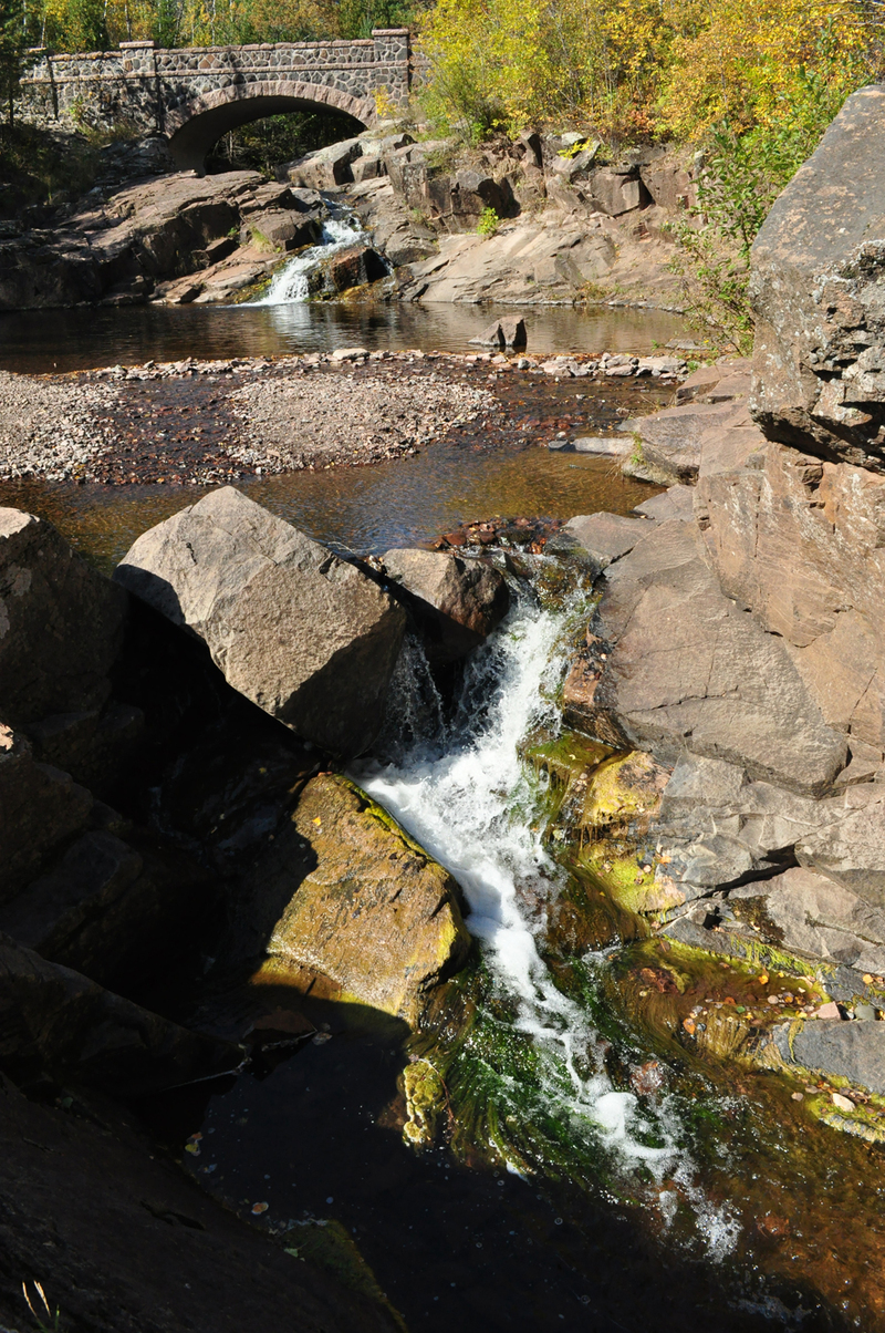
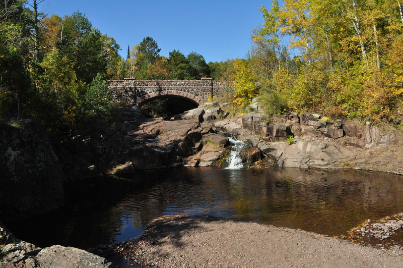
Access for this reach is by driving up 'Seven Bridges Road,' the beginning of the 'Skyline Parkway.' (This scenic drive around the hills overlooking Duluth, MN is highly recommended for boaters and non-boaters alike.) Put-in is above seventh bridge (actually, there is an eighth bridge one might use as put-in).
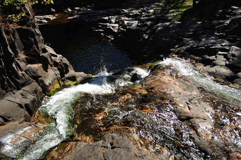
The first drop is a long, convoluted flume with great scenic rock outcroppings. Click this link for a YouTube Video of early action
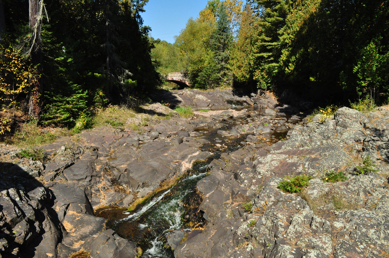
Action greatly subsides for a ways below this. Numerous smaller ledges and drops ensue. A few will merit scouting, if nothing else than to reassure where you want to hit a boof or punch a hole.
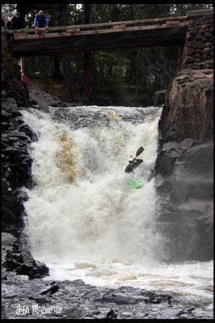
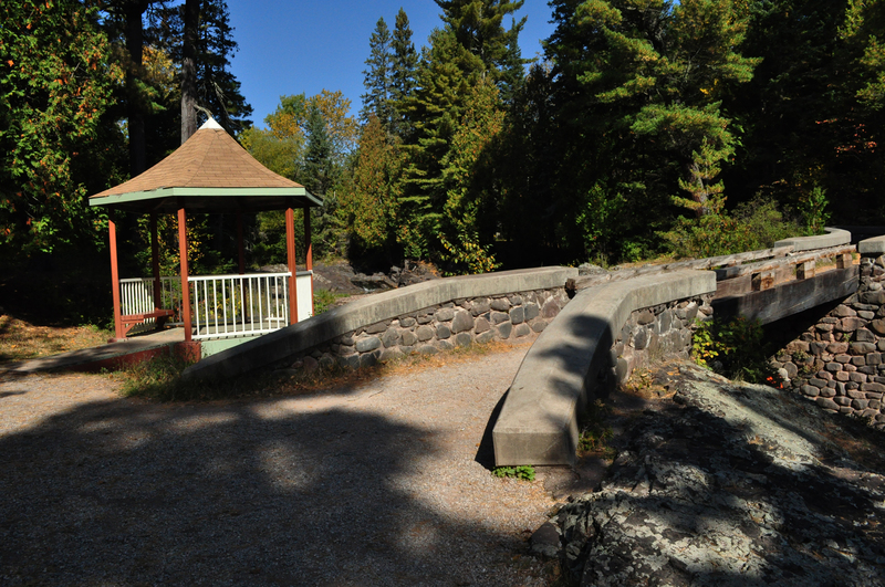
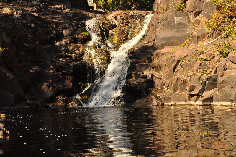
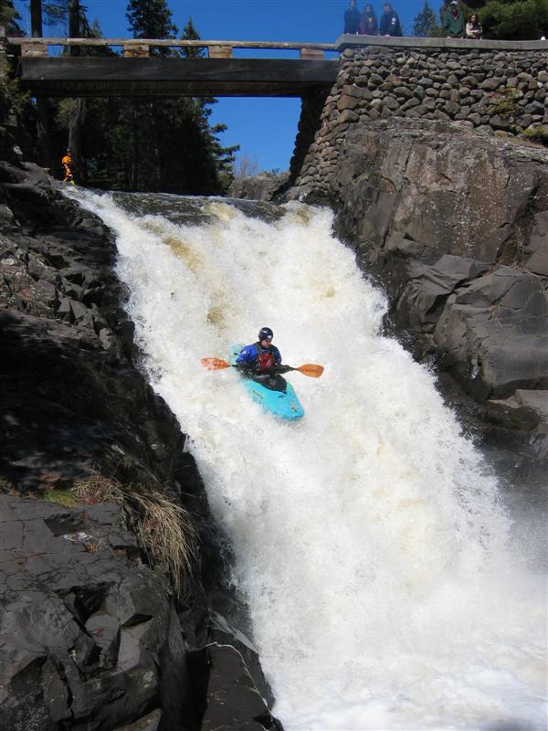
The other large drop comes as you reach the upper limits of Lester Park. When you see a gazebo on the right and a footbridge spanning the river, get out to scout. The river narrows and twists approaching the bridge, then jumps down a steep slide into a deep pool. Click this link for a YouTube video run of Gazebo Falls
Some lesser rapids follow. Take out before the confluence with the Lester River, and carry across the park to the parking area. Downstream of the confluence, the combined flow drops into some gnarly holes, twists and falls over a ledge, then flows (almost guaranteed past numerous people fishing, anytime the river is likely to be run) to meet Lake Superior.

This is not on Seven Bridges Road (so doesn't really run counter to that name) but on East Skyline Parkway.
A USGS sampling site at this location lists drainage area of 16 square miles.
The Lester has 53 square miles at its sampling site downstream of the confluence with Amity, which makes it roughly 37 sq.mi. upstream of that confluence, or about 2.3 times as large a drainage as Amity.
You will spot a gazebo on the river-right shore and a pedestrian bridge over the creek which allows viewing of Gazebo Falls. While this is regularly and easily run, you should certainly have a look at it, either scouting on your shuttle up or getting out before running on your way down. (Hey, you'll want photos and/or video anyway!)
Apr 14, 2013
Historic flooding has changed the nature of streams in Duluth to Silver Cliff. Old lines and splish-splash water shouldn't be taken for granted your first time down since the flood.