Winnipesaukee
2. Cross Mill bridge road to Franklin (Lower Winni)
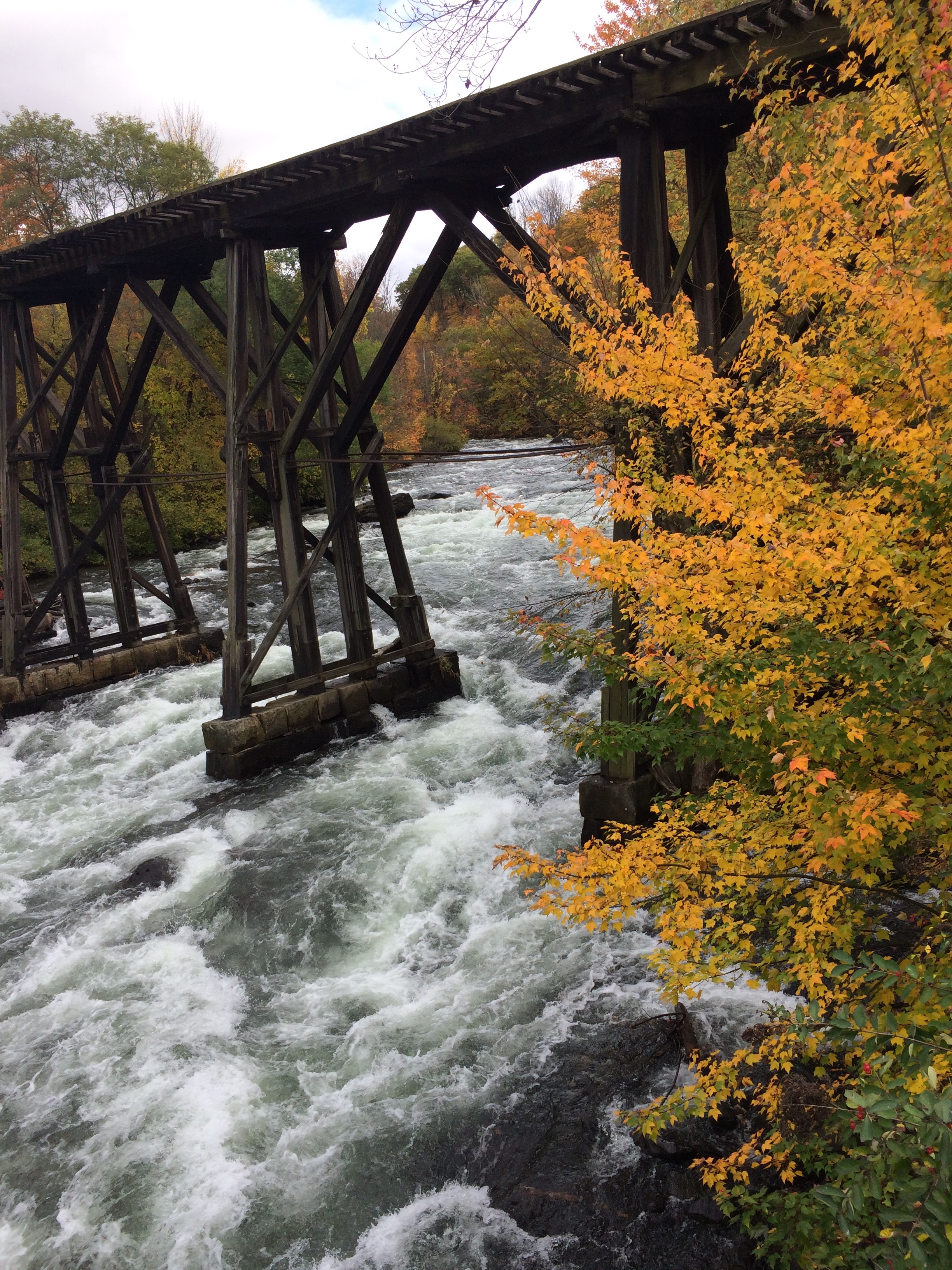
| Difficulty | III+ |
| Length | 1.2 mi |
| Avg Gradient | 80 fpm |
| Permit | |
| Gauge | Winnipesaukee River at Tilton, Nh |
| Flow Rate as of 1 hour | 374 cfsbelow recommended |
| Reach Info Last Updated | April 29, 2023 |
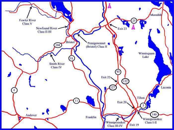
The lower Winnipesaukee (The 'Winni') is a popular run in southern New Hampshire, just 90 minutes from Boston and offers excellent paddling at nearly all flows throughout the year. Clear water, quality rapids, and an easy shuttle provide for plentiful laps that are appropriate for intermediate and advanced boaters alike.
As of late 2017, there is a new parking area available at the putin on Cross Mill Road, made by the generous support and activity of American Whitewater.
Winnipesaukee River Days is an annual whitewater festival in downtown Franklin typically held in mid to late June. The festival will coincide with a recreational release on both sections of the Winni. Come and support the town and paddling community. More information on events can be found at the Winni RiverDays website.
Winnipesaukee Recreational Plan: Info at: Winni Proposal We need backing on this from the paddling community. We are looking for summertime releases on this river and this event will help publicize our request.
The Winnipesaukee river was a heavily used industrial river in the early 20th century. The upper Merrimack Valley was considered the bread basket of New Hampshire about a century ago. Wheat and other grains grown in the Franklin region was transported to several grist mills that were built on the banks of the Winnipesaukee river. Dams were built to harness the mechanical power for turning grinding wheels that turned the grain into flour. There are still several grinding stones that can be seen along the river bank. They are about 4 feet in diameter with a hole in the middle and what looks like spokes ground in the granite stone. Those mills are now mostly gone with trees replacing the scenery. The dams were eventually knocked out one by one by the force of great floods. There are at least 7 dam sites along this short stretch of river. In the earl
...American Whitewater secured a donation of the land for this put in and built a parking area for river users.

Similar layout to first dam but better surfing. Eddy left above the drop and catch the two nice waves on the way down. The tailrace has other surfing possibilities along with a good squirt line. Watch out for left over rebar on river right at low water.
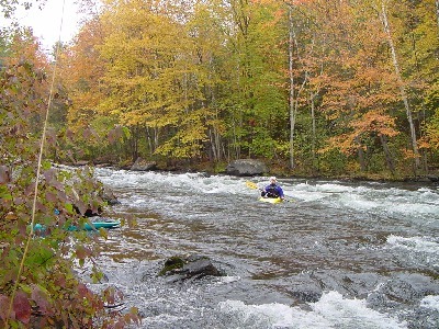
Named after (guess what?) that was in the middle of the rapid for several years. No particular hazards here just lots of waves and holes to catch on the fly.
Easy rapids ending at a large pyramid shaped rock with an iron ring at the top. When you view this rock take out downstream on river left to scout Colloseum.
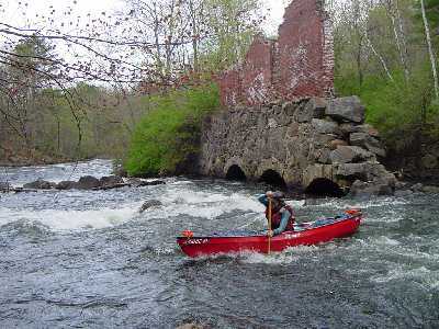
The most technical rapid on the river with two choices as described below. The whole run is very short but tricky and should be land-scouted on river left by first-timers from the easy to catch large eddy before the entrance to the rapid. About a third of the river volume channels to river right into the basment of a delapataded mill building (The Room of Doom) it then passes through the old discharge arches that are usually clogged with debris such as trees. 'The Room of Doom' is full of rebar and log cribbing, it also contains 4 vertical penstocks 5' in diameter one of which still sucks water through creating a visible wirlpool at low water levels. The discharge for the tube is probably under the rock pile in the middle of the river. Any paddler who enters river center will end up in a dangerous boulder sieve. In short, you must go right or left. There is an small eddy on river right that can be useful to get a better eye on things from your boat before entering the rapid.
(1) Class III common route: enter the rapid river center and take a sharp 90-degree left. Maneuver over a boulder strewn drop, where the river heads directly into a stone wall, and take a hard 90-degree right. There is also an eddy river left just before the stone wall (some rebar here at low water).
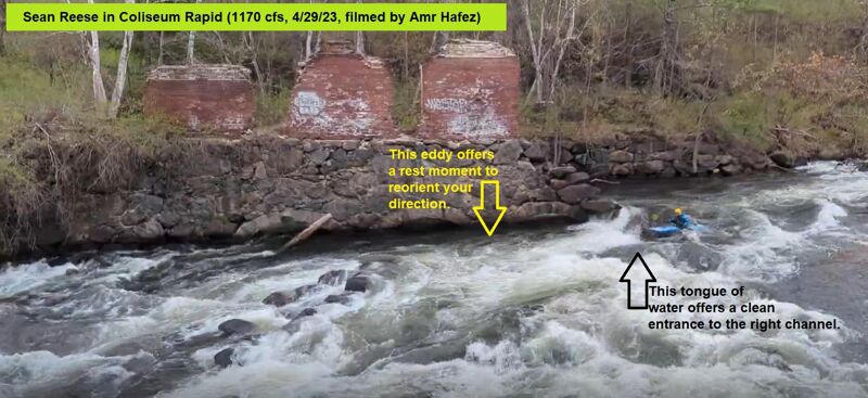
(2) Class III+ maneuver for the adventurous: start at river center and stay right-center to push through a high-penalty surf wave (easier on its left end) and catch the eddy swirling immediately under the brick arches. Adjust your orientation and then proceed down a boulder-strewn drop staying river right while avoiding a piton rock and the rock sieve in river center.
See this YouTube video of 4 paddlers passing through Coliseum Rapid at 1170 cfs.
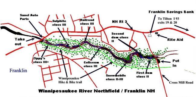
See the Coliseum Rapid Map
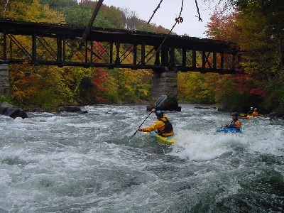
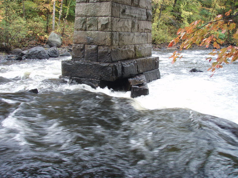
At high water (>1500 cfs) Coliseum and Railroad Rapids merge into one rapid and should be considered class IV. Just upstream from the railroad bridge there are several large holes to punch or manuever around. There are two common routes to avoid the large bridge abutment. Unfortunately, there is not an easy eddy to pull out and scout this rapid and it comes up very quickly after Coliseum Rapid.
(1) Start high on river left and diagonally cross the river (maneuvering around large holes) then move into a small eddy just above the railroad bridge on river right. If you run this route you are commited to running the far right channel to the right of the abutment. There is a 3' vertical drop into a non-sticky hole directly under the bridge. Some paddlers start on river right (there is a eddy, but hard to catch) and then work there way down to the right channel.
(2) There is a very fluid run that stays to the left of the bridge abutment. Start high on river left and stay aggressively center-left to push through the middle channel under the bridge through a dynamic wave train. This route can be difficult to maintain because the current will push boats to the right. If you find yourself heading towards the abutment, then continue to move to the right and plunge over the drop.
There is a fairly large pool at the bottom with a large eddy on river left useful to catch your breath or catch a swimmer. :)
Immediately below the Sulphite railroad bridge the river cuts through a break in another old dam, this time on the right. At higher water (>900 cfs)there is an interesting chute with a flat rock ski jump on the left of what remains of this old log crib dam, but be careful since debris often lodges in this narrow passage. On river right just below the break in the dam there is a nice eddy on river right with a good surf wave at higher water levels. Below this eddy Sulphite rapid starts. River left is generally shallow and impassable at medium to low water. A hole at the top of the drop can be skirted to the left. The current then forces paddlers to river right through heavy turbulance, small holes and overhanging tree branches (watch your paddle). There are a couple micro eddies on the right that allow access to some nice surfing waves within the wavetrain. The rapid then opens up to a wide section of river that has only a couple large holes to avoid just right of river center. Sulphite ends at an eddy on river left just below a almost river wide hole that offers some rough play. At high water there may not be any noticable break between Sulphite and Zippy's.
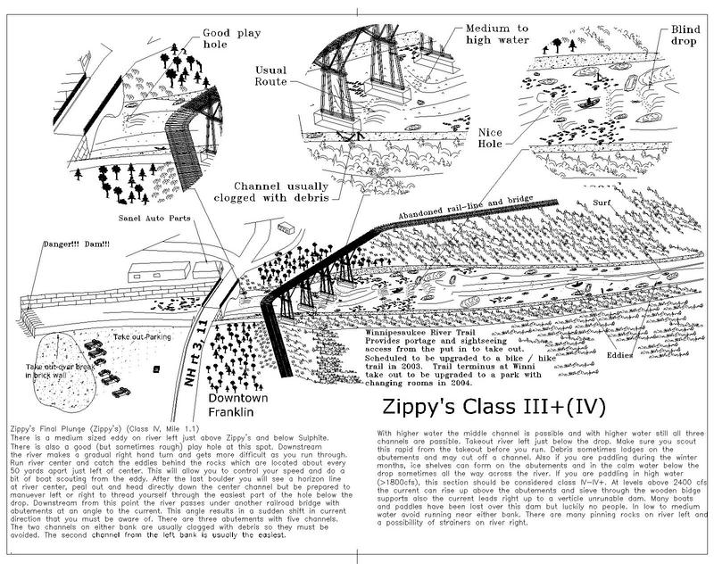
Best choice is to scout this rapid from the take out parking area before you run the river. Debris sometimes lodges on the abutments and may cut off a channel. Also if you are paddling during the winter months, ice shelves can form on the abutments and in the calm water below the drop sometimes all the way across the river. If you are paddling in high water (>1800 cfs), this section should be considered class IV. At levels above 2400 cfs the current can rise up above the abutments and sieve through the wooden bridge supports.
There is an important medium sized eddy to catch on river left just above Zippy's that can hold about 6-8 boats to prepare for the final rapid. There is also a large hole at this spot that offers rough play. Downstream the river gets more turbulent as you run. Stay in river center-left and catch the eddies behind the rocks which are located about every 50 yards apart just left of center. This will allow you to control your speed and do a bit of boat scouting from each eddy. After the last boulder you will see a horizon line at river center and the bridge will appear. Head directly down the center-left main current, but be prepared to maneuver through a turbulent drop before the bridge.
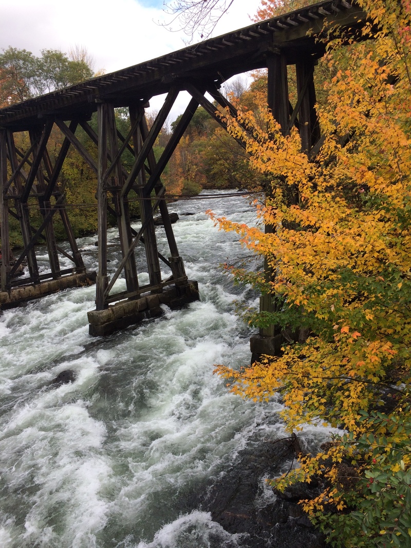
Immediately downstream from this drop the river passes under another railroad bridge with abutments at an angle to the current. This results in a sudden shift in current direction that requires caution. There are three abutments with five channels. The two channels on either bank are usually clogged with debris so they must be avoided. The second channel from the left bank is usually the easiest and the current from river center-left general flows this way and carries your boat with it without trouble. The turbulence from the water after the drop helps slow down your boat to manage the shift in direction. With higher water the middle channel is passable and with higher water still all three channels are passable.
In 2020, the new whitewater park (see Mill City Park) was built up and the end of Zippy's was transformed into a permanent playwave. This reduced the intensity of the original wave train under the bridge, which would plunge most kayak boaters' heads under water! Stop and play or push through the wave and take out on river left just below the amphitheater.
Shortly after the take out, the river leads right up to a high vertical drop unrunable dam. Many boats and paddles have been lost over this dam.
Also see the Zippy's map
Apr 27, 2017
Late spring, after work runs on the Winni
Sep 16, 2011
ran the Winnie twice the day after the comment about the railroad rapid wood was posted. Level was similar, 1600 or so. Some of the tree that was sticking out to the left of the pylon seems to have broken-- the far right channel is still obstructed, but getting past it on the left is pretty easy. I didn't try sneaking on the right but it looks like that would be much harder then the left line now
Dec 27, 2005
I encourage everyone to contribute a brick to the new Trestle View Park project at the end of the run -- which is now almost entirely complete! The park was built/designed largely to accomodate whitewater boaters, and the town has done a very nice job of creating a very welcoming spot for us.
Jun 5, 2005
This is the drop under the right side of the bridge at Railroad.
Bill is heading for the center span of the Railroad bridge.
This is the play wave with a large service eddy below Sulfite and before Zippy's.
This shows the top half of Zippy's Final Plunge, just before reaching the railroad bridge. The photo was taken from the top of the railroad bridge.
This service-road/bike-path runs along river left for the entire 1.25 mile run. It allows non-paddlers to come along, but the road is 100 feet up a steep hill side from the river and as you can see, the trees make it hard to see the river in many places. It provides a good escape route if you need to abort your run, or a good way to make a two-foot shuttle.
This shows the view of Railroad Rapid from the railroad bridge. The most common line is down river right, then moving toward river center at the very bottom left corner of the photo, then passing under the center span of the bridge.
This route opens up at higher water levels. Watch out for the boulder sieve, it's a good place to break a paddle.
The easiest route at Coliseum is to make a very sharp turn and head for the river left eddy in the middle of the rapid. You can't start too close to the left shore as there are some shallow rocks. Paddle hard left as the currnet tries to sweep you down into the wall.
I've seen people take the above three routes in Coliseum. The center and alpine routes are not available at lower water levels.