Tuolumne
4. Lumsden Campground (Merals Pool) to Wards Ferry Bridge(Main Tuolumne)
| Difficulty | IV |
| Length | 18.1 mi |
| Avg Gradient | 40 fpm |
| Permit | Permits become available the last Sunday in February of each year for trips from May 1 through October 15. While permits for day trips or weekday overnight trips are generally available on short notice, advance reservation for weekend overnight trips is recommended. |
| Gauge | Tuolumne River at Merals Pool |
| Flow Rate as of 22 days | 258 cfsstale data |
| Reach Info Last Updated | January 16, 2026 |
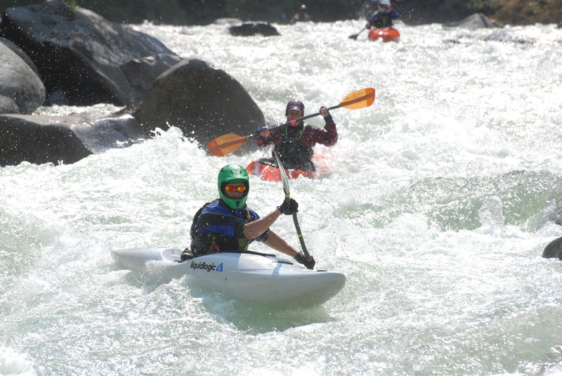
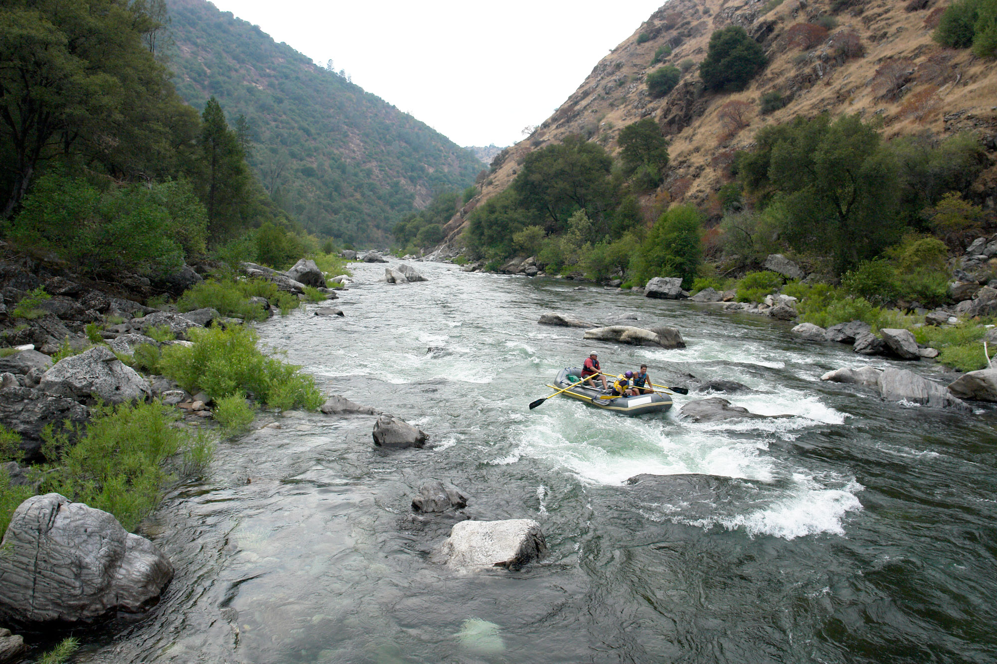
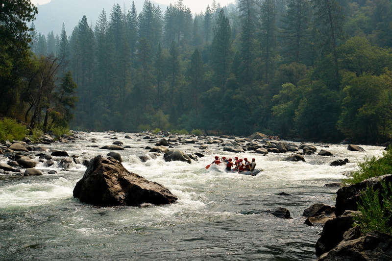
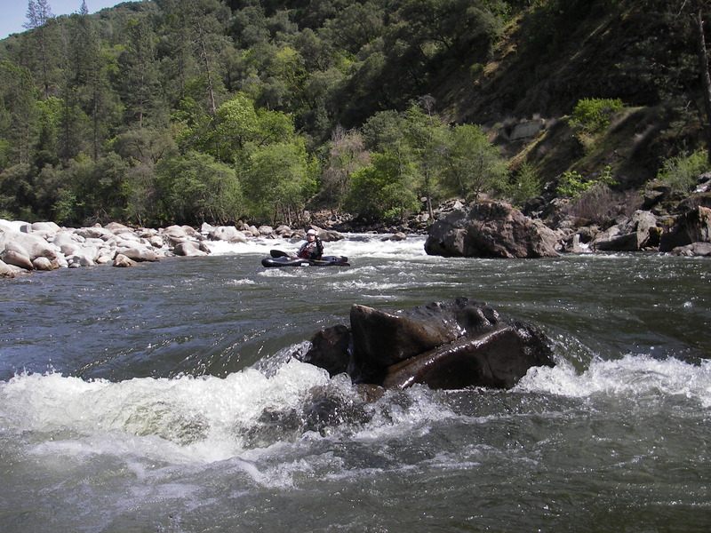
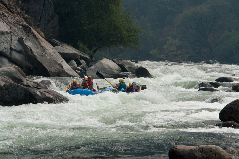
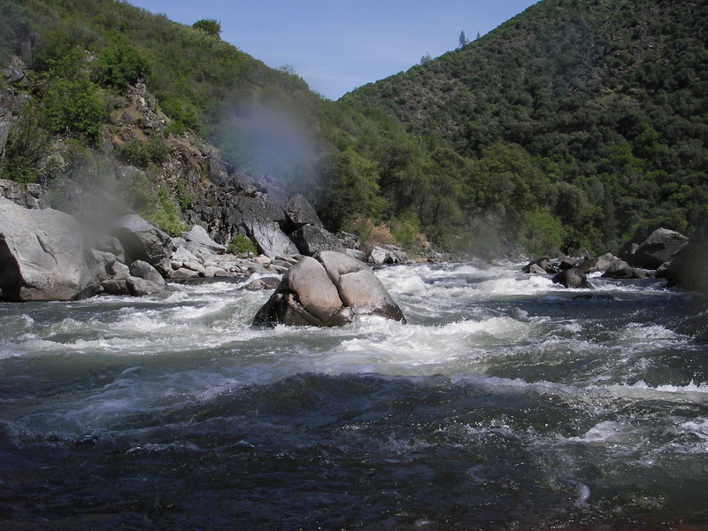
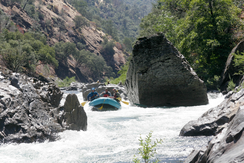
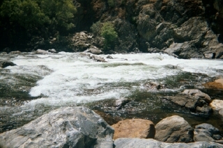
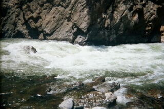
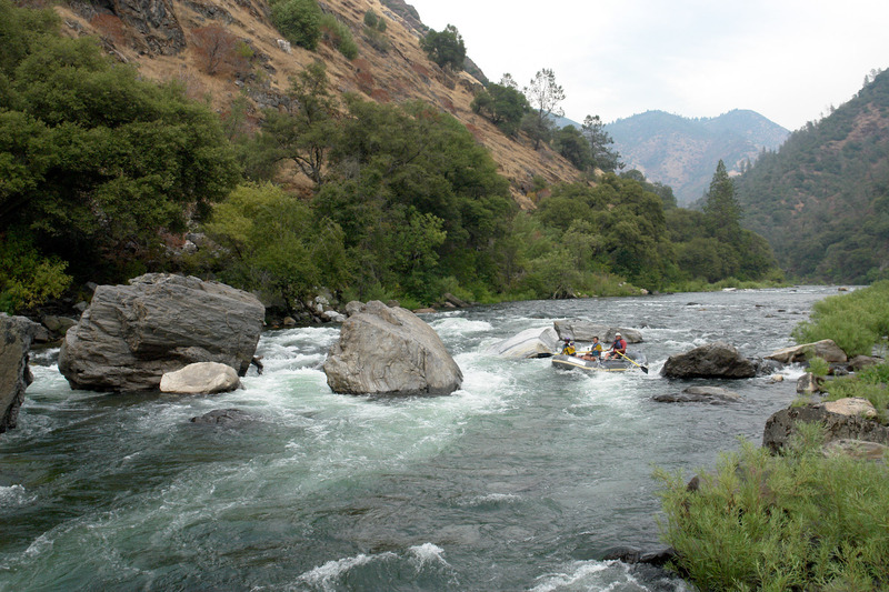
The Tuolumne River is one of California’s premier overnight whitewater runs, combining sustained Class IV boating with granite canyon scenery, clear water, and a strong sense of remoteness despite its proximity to Yosemite National Park. The classic reach from Meral’s Pool to Wards Ferry Bridge offers 18 miles of continuous action, with long technical boulder gardens, powerful mid-stream hydraulics at higher flows, and only short stretches of recovery water between major rapids. While many boaters complete the run as a long day trip, most choose to spread it over two or even three days to enjoy the camps, side hikes, swimming holes, and historic sites scattered along the corridor.
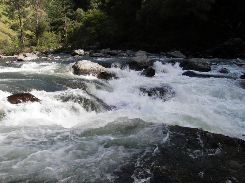
The river flows through a steep, glaciated Sierra Nevada canyon dominated by polished granite walls, pine forest, and open bedrock slabs. In spring, snowmelt brings cold, fast water and pushy hydraulics; in summer, controlled releases provide dependable boating flows with clear lines, exposed boulders, and technical maneuvering. At all flows the Tuolumne rewards precise boat handling, good scouting habits, and solid Class IV skills, with a few Class V hazards that demand respect.
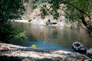
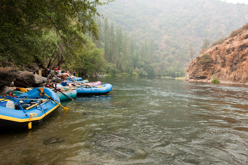
Campsites are frequent and well spaced, many on bedrock benches or forested terraces just above the river. Side streams such as the North Fork Tuolumne offer inviting exploration, and the corridor contains remnants of early mining and settlement history, adding to the sense of traveling through a living landscape rather than simply running a sequence of rapids.
Flows are supplemented by releases from the Holm Powerhouse on Cherry Creek, and long-standing coordination between water managers and the boating community has helped maintain reliable summer boating opportunities. The result is a river that feels wild and committing on the water, yet predictable enough to support everything from commercial rafting to self-supported kayak and raft expeditions.
Overall, the Tuolumne is best descri
...
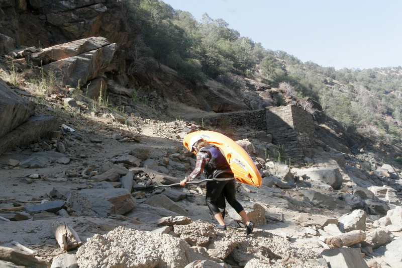
For kayakers, hiking boats down South Fork Road (FS Rd 1S01) often provides the best put-in option. The hike covers about 3 miles and usually takes no more than an hour and a half, often taking little more time than driving Lumsden Road while avoiding the need to drive that road twice at the end of the day. When Lumsden Road is closed, South Fork Road may be the only access. Forest Service Road 1S01 begins 11 miles east of Groveland on Highway 120. Turn left at the second entrance to Yosemite Westgate Lodge and the Lucky Buck Cafe. Follow the road east, staying to the right, to a gate with nearby parking. The road descends through a side drainage and emerges onto an east-facing ridge above the South Fork Tuolumne, with full morning sun, little shade, and views of the river cascading through a dramatic canyon. At the bottom, South Fork Road meets Lumsden Road at the South Fork Bridge; if flows allow, boaters can launch here and paddle a short distance to the main Tuolumne, otherwise turn left and continue a few hundred yards to Lumsden Campground and Meral’s Pool.
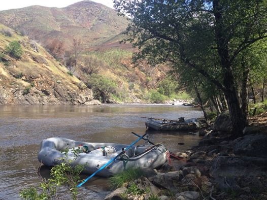
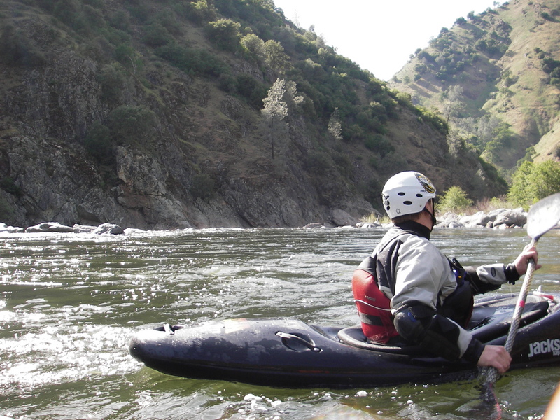
Merals Pool is the primary put‑in for the Main Tuolumne, named for Jerry Meral, an early paddler who helped popularize this section of the river. The pool opens onto a calm, wide stretch of water framed by granite and forest, giving paddlers a clear view of the canyon and boulder-strewn river that lies ahead. Parking sits on a small riverside area with room for cars and trailers, and vault toilets and picnic tables are available at nearby Lumsden Campground and other Forest Service sites along Lumsden Road. When roads close in winter or spring, paddlers can hike in via South Fork Road to reach the put-in.
At low summer flows around 1300 cfs, many raft guides consider this the hardest rapid on the river because the river is wide and there are rocks everywhere. Typically rafts enter on river right, then about the middle of the rapid work their way through boulders to the river left side. Lots of rafts hang up in the middle of this rapid and all the other rafts at the top have to wait till the stuck raft gets clear. Kayakers can work their way down through any part of the rapid without a lot of difficulty. Just eddy hop and pick your way.
This is a very long complicated rapid with a number of distinct levels. At low flows both rafts and kayaks have to maneuver their way past numerous rocks and drop offs. It is a really tricky rapid that tends to wrap rafts or at least get them very stuck. It is characterized by a long, easy entrance and current that drives into some rocks called 'the Jacks.' At low water, the classic run is down the right side and then entereing a tricky chute down the middle. Most wraps occur when rafts eddy out on the right just above the tricky chute; the eddy is very tough to exit and they end up wrapped above the chute. At higher water (about 3,000 cfs and above), the middle becomes much more exciting with holes and big waves. At these flows, a nice cheat line opens up on the far right. The kayaking lines are pretty much the same with half a dozen lines for competent, adventurous kayakers.
The river makes a sharp turn to the right, then picks up speed as it flows in a fairly straight line against the right side wall. The top half of the rapid is fairly open with numerous rocks forming eddies. At low summer flows, boaters can eddy hop down a ways until the river drops down a steep narrow chute. Several big holes wait at the bottom of the chute, occupying the center and right. The typical route is to start down the center of the chute then power left before the bottom. This rapid is named for Dick Sunderland, an early California river-running pioneer.
A busy rapid with a large rock in the center of the river near the bottom that creates a large hole at high flows. This rapid is named for Bob Hackamack, a strong advocate for protecting the wild and scenic Tuolumne river.
Another very long rapid that narrows as it goes. A big rock occupies the center waves near the bottom of the rapid. At high flows this rock forms a big hole which requires a lot of work to avoid.
Large boulders block much of the river, especially at low flows. Scout from river left. A narrow channel remains between the left cliff wall and a very large boulder. It is a cliff-formed hallway. Kayakers have to stay straight, but it is really tight for rafts. Oarboats have to make sure their oars do not hang up on the walls. A center route is good at higher flows, but is shallow and tricky at low summer flows.
The first of two drops in this staircase rapid are the biggest. An 8-foot sem-verticalp drop on the right, called 'The Falls' takes boats into a foaming current that pushes them toward the left wall. The second drop is guarded by a boat-crunching hole across the left half of the river. A left-side run avoids the Falls but also leads to the big hole. A portage on the right is available. The most dangerous part of this rapid is 'Dinosaur Rock' at the bottom of the rapid. Few people rarely walk down to scout it and many boats hit it. It is fairly easy to wrap or flip on this rock at flows above 2,000 cfs. Even if you miss the rock to the left, a steep eddy line will flip a raft or throw a few paddlers out. Kayakers that float over this line may end up in a tricky eddy behind the rock. There have been two deaths on this rapid, both above 8,000 cfs and both kayakers. Kayaks that paddle over the top of Dinosaur end up getting caught in a part of the rock that split off on the back side. This would be horrible place to swim, but it's worse in a kayak, because a kayak can easily pin here.
The hole is just downstream of Clavey Falls and virtually unavoidable—a boat-cruncher. After the high water year of 2005, some rocks shifted below the hole, which changed it's character. At low water, this used to be a steep 2-3 foot drop into a sticky hole. Now, that feature is pretty much gone and instead it's a tricky manuever between boulders and the potential to wrap a boat has increased. The hole is most fierce at higher flows when it's steep and surges unpredictably. It's possible to avoid the hole completely, but then you're set up to run right into Dinosaur Rock, so most people hit the edge of the hole. At high water, Clavey Hole is still as fierce as ever.
This rapid is probably the most fun on the Tuolumne. It's about half a mile long and full of rocks, holes, and waves. At lower water (below 1500 cfs), it's a zigzag between rocks and over drops. At about 2500 cfs, a big hole appears at the entrance on the right. You can skirt this hole by running a technical left route. At flows above 4000 cfs, this hole can easily flip rafts which would lead to a long swim.
An easy route is available on river left at all flows. A more exciting center route goes between the two huge boulders, but is not recommended; the center boulder appears to be undercut and the current pushes directly into it.
A large boulder bar/field on the left pushes the channel over against the right wall. The river has cut two channels across the top of the boulder field, but the main channel is the furthest right. The rapid drops steeply to the right, then curves steadily back to the left.
Big Creek is visible directly ahead on river left. Then the river bends sharply to the right and enters Hells Kitchen rapid. This is a long, steep and busy rapid. At normal flows, it's a technical line through huge boulders right down the middle. At the higher flows (above 5,000 cfs) you'll want to start looking for lines down the left side to avoid the huge powerful waves in the center.
Campsites are located on both the upstream and downstream sides of this creek. It is a very pretty area to explore
This short but tricky rapid appears only at very low reservoir elevations. A line of large boulders blocks the river with a number of openings, but each is semi-blocked by smaller boulders. Kayaks should have no problems, but rafts can get hung up.
This bridge was constructed in 1971 to keep the road above the high water mark of New Don Pedro reservoir. The stone abutments of the old road remain just upstream on each side of the river. A steep trail on river left is suitable for individual hikers and kayakers, but rafters will use the slightly wider trail on river right. It is an awkward, slippery, difficult carry, so be careful. Raft companies use a winch to lift their boats straight from the water to the bridge deck. American Whitewater is working with users of this site to design, fund, and construct a better take out.
The river will continue past the Wards Ferry Bridge to Deer Creek when the reservoir elevation is 750 feet.
The river will continue to this point when the reservoir is at 700 feet elevation.
The river will continue to this point when the lake is at 650 foot elevation.
Pick up point for those arranging a tow out.
Jul 2, 2026
Lumsden Road is now reopen to the public as of 5/19/26. Lumsden campground is also open.
Ward's Ferry road remains closed and the tow out to Moccasin Marina is the only take out option.
Anthony is a local that provides tow out services and shuttle services. Contact here to schedule: (209) 338 7434
Apr 30, 2014
Tuolumne River is open and runnable. No restrictions are posted on Lumsden Road. Burned areas from the Rim Fire are noticeable and significant but most of the vegetation at river level has survived, and the popular camp sites along the river are in good shape.
Apr 30, 2014
View from Lower Tuolumne put-in, looking upstream. Hillside burned in 2013 Rim Fire