Rogue, North Fork
4. Mill Creek Falls to Lost Creek Reservoir(Mill Creek Run)
| Difficulty | IV |
| Length | 3.3 mi |
| Avg Gradient | 109 fpm |
| Gauge | Rogue River Below Prospect, or |
| Flow Rate as of 16 minutes | 647 cfsmedium runnable |
| Reach Info Last Updated | January 11, 2023 |
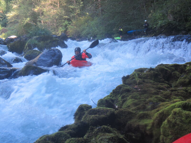
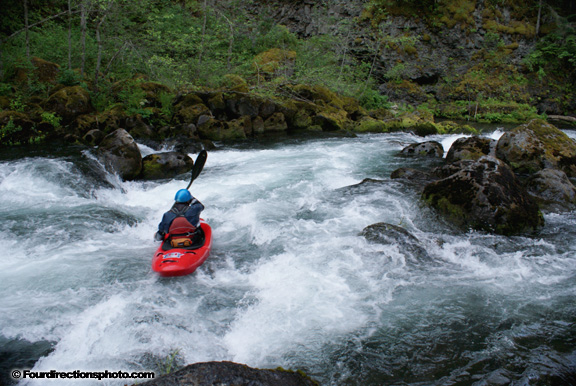
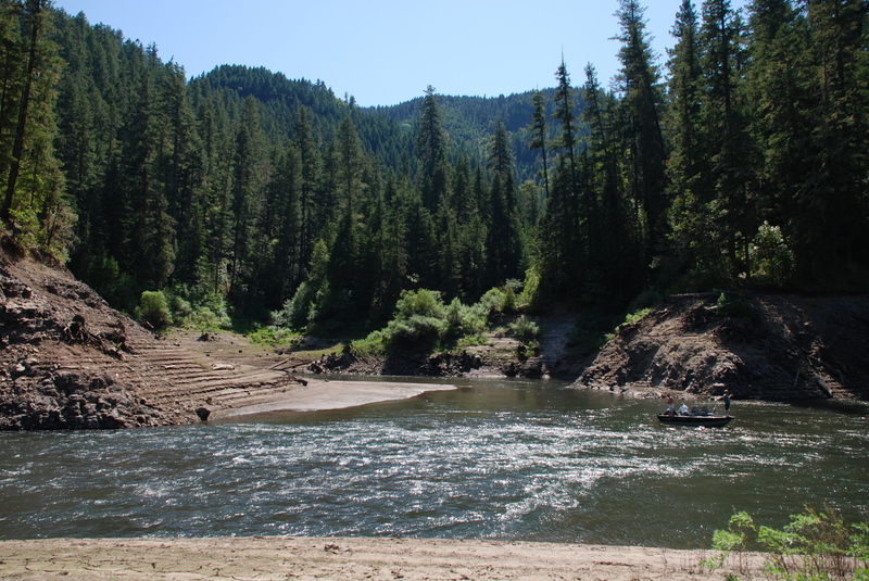
This is a short but great continuous class IV creek-ish run on the upper Rogue River. The first 1.3 miles from Mill Creek Falls to North Fork/Prospect powerhouse is nearly continuous whitewater with many class IV drops connected by class II and III whitewater. Below the powerhouse, the river eases off to class III but the powerhouse adds up to an additional 1,000 cfs. Most paddlers take out at the powerhouse to take advantage of the free shuttle on scheduled release weekends. Continuing downstream to Lost Creek Reservoir increases the total run length to approximately two miles and adds several class III rapids but requires a hike out at the end once you reach the reservoir.
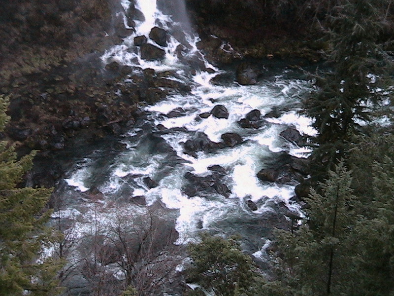
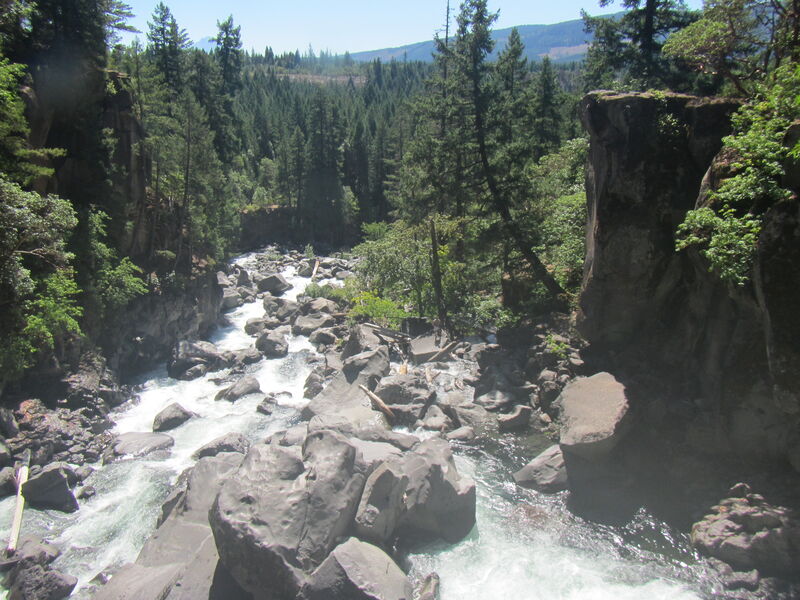
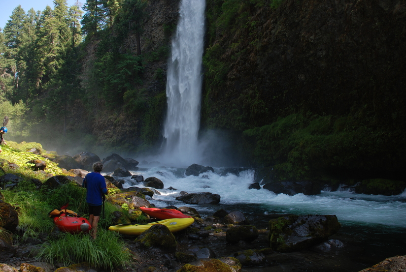
Before embarking on the Mill Creek run, curious paddlers may want to take a look at the stout Avenue of the Boulders section upstream. The best view is from the bridge over the Rogue on Mill Creek Drive. This class V-VI section has been run in parts but is more scenic than paddling material for most. Upstream from the bridge is the class V+ Prospect Falls that was featured in a now-vintage Ashland Mine Productions film. From this scenic view spot it's 0.4 miles down the road to the Mill Creek and Barr Creek Falls trailhead parking area, from which you hike your boat to the water.
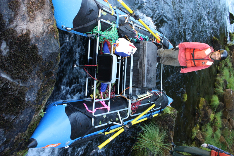
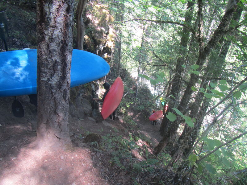
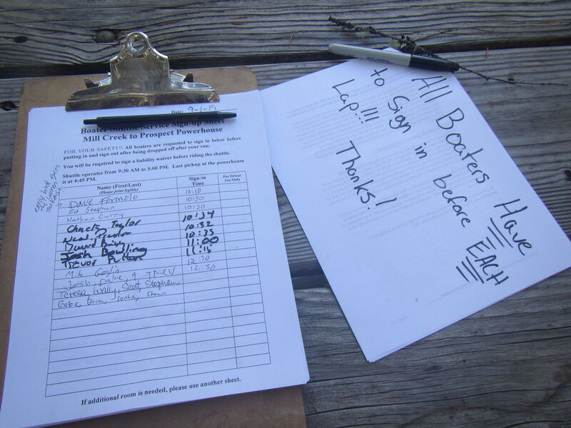
Getting to the put-in is more frightening and strenuous than the river for the experienced creek boater. During PacifiCorp's scheduled recreational flow releases there is a free van shuttle from the powerhouse take-out back to the put-in. Be sure to sign up for the shuttle at the put-in using the the clipboard that's on the picnic table at the southeast corner of the of the parking area. From this spot the hike is all downhill, gentle at first and then ridiculously steep. Take the most direct downhill trail at each intersection. The hike is gentle until the trail drops into the basalt gorge, where you shoulder your boat on the right and down climb a steep trail using handholds on the cliff to your lef
...
A steep trail enters the gorge across from Mill Creek Falls.
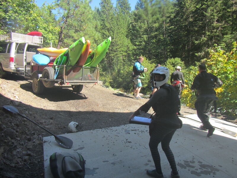
PacifiCorp provides a shuttle to this access points on release weekends.
A trail up from the reservoir crosses private property requiring permission from the landowner.
Sep 12, 2019
The Pacificorp Prospect Whitewater Page link is out of commission and has been since at least Labor Day weekend this year when I first attempted to access flow information. I am removing all but one references to the link from the description text. Was maintaining this page part of the agreement with AW? Here is the link for future reference.
https://www.pacificorp.com/es/hydro/hl/wr/rr/bf.html
Aug 20, 2011
A run from Mill Creek Falls down to the reservoir with Thomas O'Keefe, Omar Jepperson, Jennie Goldberg, and Pat Welch.
Mar 30, 2011
I managed to get on this run a no. of times last summer during the schedule release. The three times I did, the stick gauge at the put in read between 2.1 and 2.8 a low to medium flow. Perfect for the class 4 boater such as my self. With-in these flow parameters there were lots of eddys and the water did not have much push giving you plenty of time to make the technical moves necessary for this run. I hear as the flow goes up so does the rating, and I can see that. The class 4 section starting below Mill Creek falls to the Powerhouse is essentially a 1.3 mile long class 3 to 4 rapid and tons of fun, all set in a spectacular gorge with 2, 170' tall waterfalls, tall canyon walls and fantastic water color and quality. Even though I live less than an hour from the put-in, I like to camp up above Prospect on the release weekends, That way you maximize your boating time and can get the whole NF Rogue boating experience by adding runs down the Natural Bridge, Takilma Gorge and River Bridge sections as well as a couple of laps down the Mill Creek section. That all adds up to a great summer weekend of boating! Below the powerhouse is a good section of class 3 that reminded me of the upper McCloud...continuous, fairly shallow rocky rapids with good gradient (50fpm) and a couple of nice surf waves on the day I paddled it..The class 3 section goes 24/7/365 but has access problems both at the put-in and the take-out...too bad because I bet it would be fun in the playboat.