McKenzie
2. Carmen Reservoir to Trail Bridge Reservoir

| Difficulty | III-IV |
| Length | 5.5 mi |
| Avg Gradient | n/a |
| Reach Info Last Updated | July 4, 2021 |
Upper Carmen Bypass Reach
The Whitewater Boating Feasibility Report found that the 2.5-mile Upper Carmen Bypass Reach, with a gradient of 50' per mile, could provide Class II–III boating opportunities with adequate flow, but such flows are unlikely to attract whitewater boaters. While the segment travels through a scenic forested environment, it lacks interesting channel features and whitewater rapids. The reach has extremely porous volcanic terrain and complex hydrology.
Lower Carmen Bypass Reach
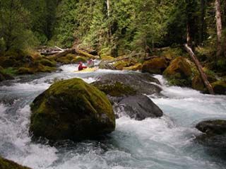
The lower Carmen Bypass Reach is about 2.4 miles long. The gradient in the first mile of the reach exceeds 200 ft/mile; below the gorge, the gradient decreases to approximately 60 ft/mile. Below 45-foot Tamolitch Falls, Blue Pool collects aquifer discharge near the base of the falls and other nearby springs. This produces base flows from 140 to 160 cfs in the gorge (with slightly higher flows downstream of Kink Creek). Spills over the Carmen Diversion Dam and basin inputs during rain or snowmelt events increase these flows—sometimes by several hundred cfs—although several factors related to the porous aquifer complicate the timing and amount of flows. Blue Pool is the put-in for the lower Carmen Bypass Reach boating run, and is accessible by hiking at least 2 miles on the McKenzie River Trail. An alternative is to hike to Blue Pool down a steep informal trail from an old road spur off Highway 126.
Documented use of this river segment dates back to at least 1996 when the reach provides kayaking opportunities during occasional higher flows. A narrow channel and multiple logs and log jams probably preclude rafting use. The reach is generally class IV with technical rapids requiring scouting and portaging.
Boaters who participated in the Whitewater Boating Feasibility rated hypothetical flows for boating to be between 100 and 2,000 cfs; flows below about 300 cfs are predicted to be unboatable, but from 300 to 500 cfs, small flow increases are p
...Tamolitch Falls empties into the Blue Pool and marks the dividing point between the upper and lower sections.
Oct 2, 2006
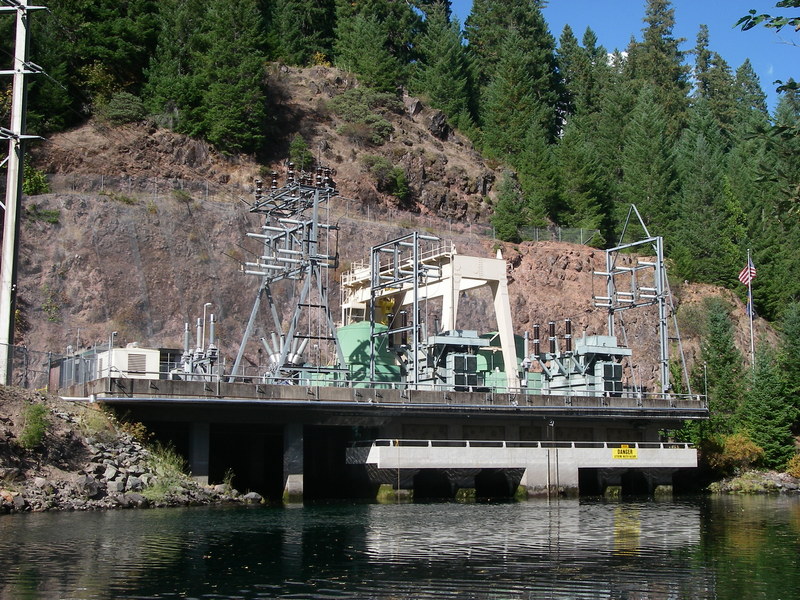
Carmen-Smith Powerhouse is one of two powerhouses on EWEB's Carmen-Smith Hydropower Project (FERC P-2242) which includes three dams, and two powerhouses. The rated capacity of the total project is 124.5 MW.
Trail Bridge Dam and Powerhouse is one the dams on EWEB's Carmen-Smith Hydropower Project (FERC P-2242) which includes three dams, and two powerhouses. The rated capacity of the total project is 124.5 MW.