Payette, S. Fork
1 - Grandjean to Deadwood(Grandjean)
| Difficulty | II-III+ |
| Length | 35.6 mi |
| Avg Gradient | 40 fpm |
| Gauge | South Fork Payette River at Lowman, Id |
| Flow Rate as of 1 hour | 697 cfslow runnable |
| Reach Info Last Updated | June 17, 2026 |
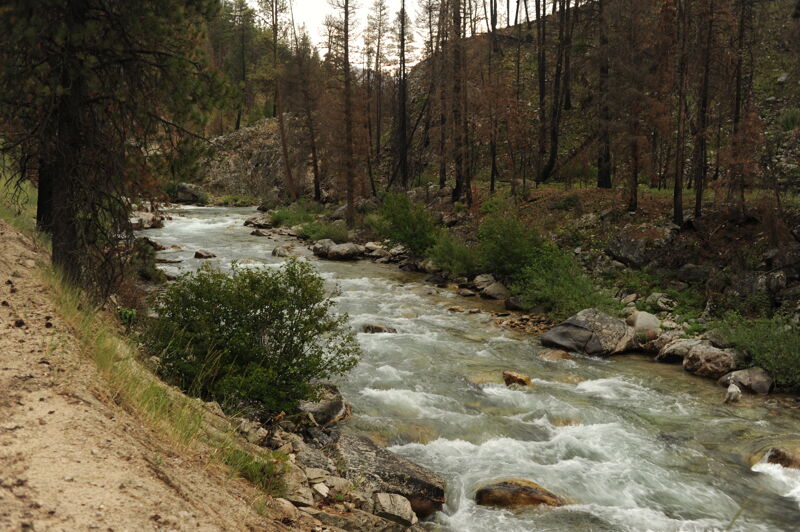
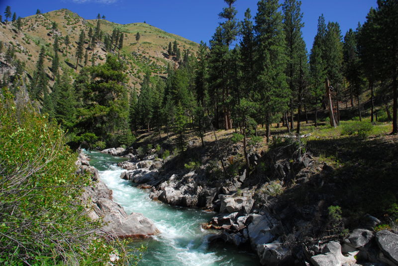
The run from Grandjean to Deadwood is 35 miles and is typically divided into segments based on flow, skill level of the group, and the wood situation. The run can be divided in different ways with groups doing longer or shorter segment but the descriptions below provide common ways this segment is subdivided.
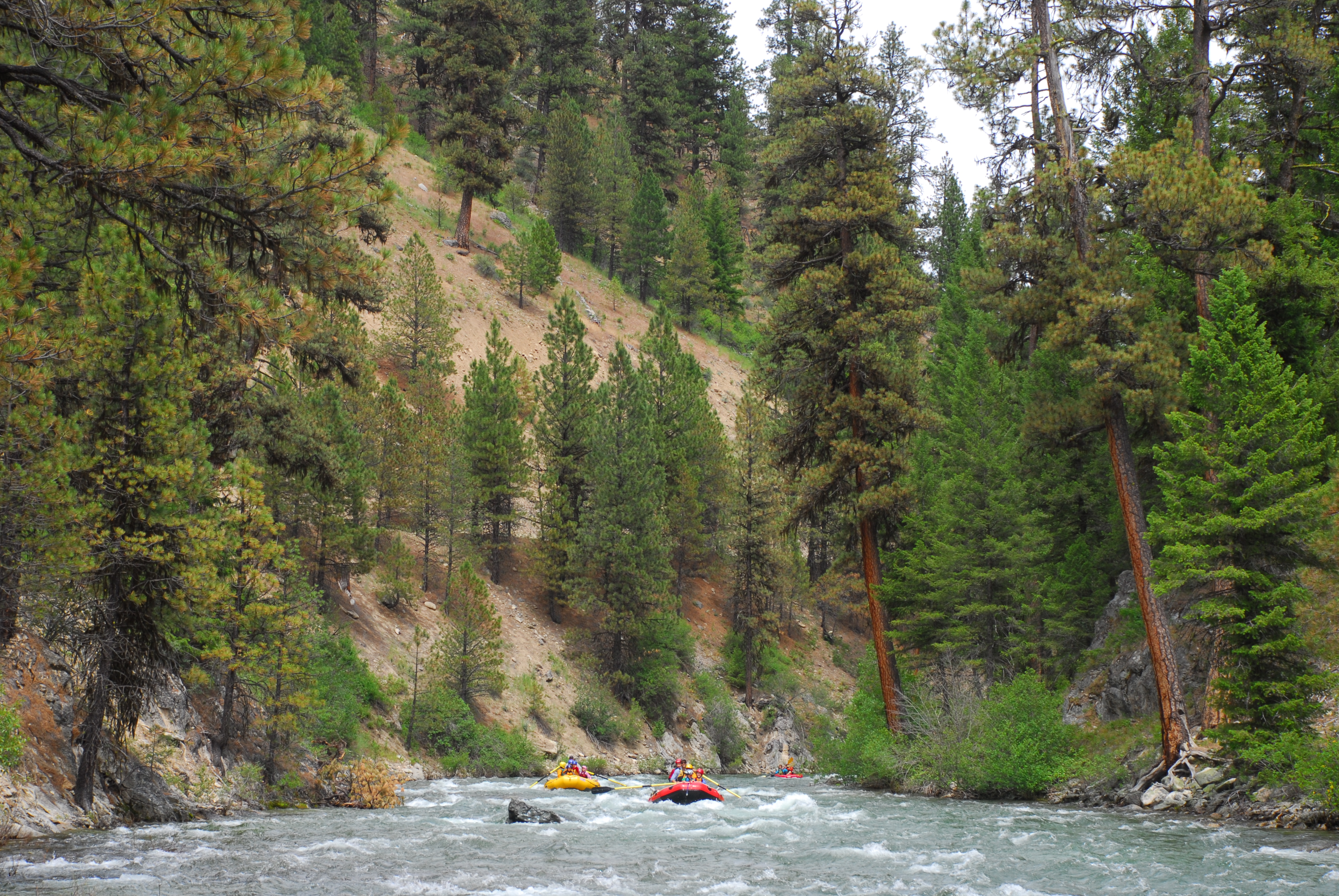
Grandjean (rm 140.6) to Bonneville (rm 131.7); class II(IV); 8.9 miles
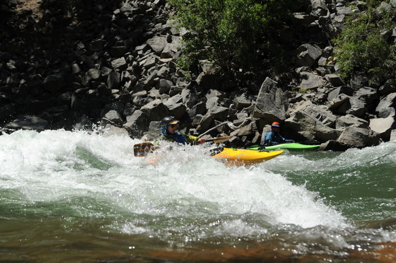
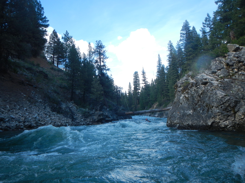
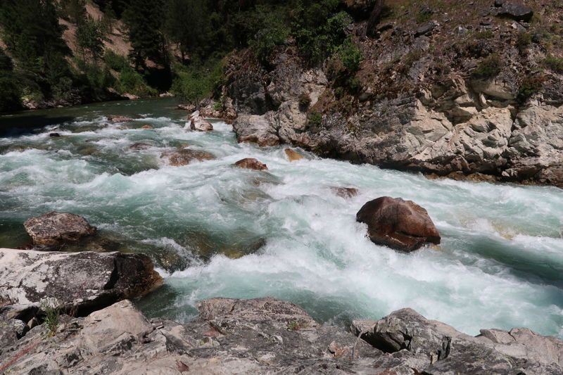
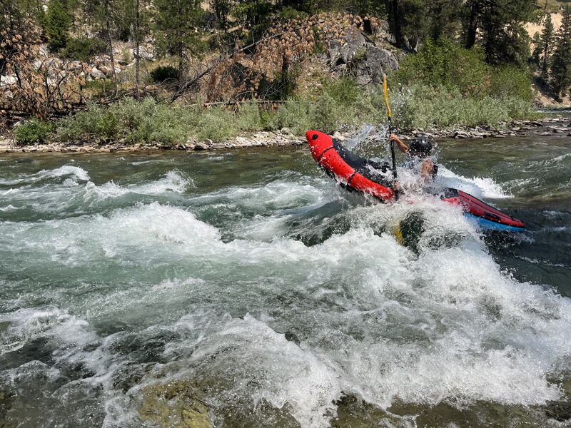
The section from Grandjean to Bonneville is mostly class II with the notable exception of Canyon Creek Rapid which is class III+ (IV above 2000cfs) and the short gorge just upstream of Bonneville which is class III+. Wood can be an issue in this upper segment of the run and higher flows greatly increase the risk and difficulty. Use caution in this remote stretch. Canyon Creek (III+/IV) is a read-and-run with a couple of the biggest hits on this section. Follow the big tongues and crash the holes for a thrilling start to your run. Scout from the bridge at the Canyon Creek confluence with the South Fork if desired and make use of the forgiving eddies as needed. The gorge before Bonneville hosts two significant rapids. First up is Emesis (III), which can be road scouted on the drive up. Enter river left and ride the rowdy wave train. Next is Kicks John's Ass (III), which is a stronger and slightly longer version of Emesis (plus a few powerful laterals to test your combat roll). This can also be road scouted.
Bonneville (rm 131.7) to Helende (rm 119.0); class II-III+; 12.7 miles
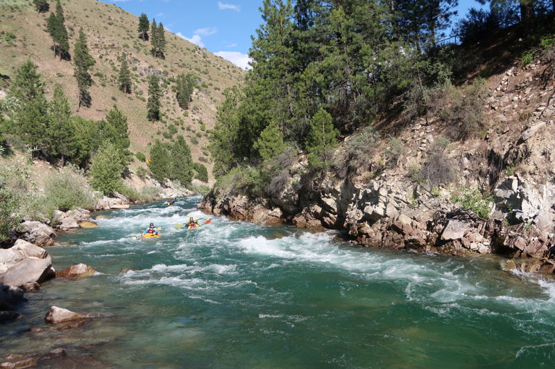
A popular run begins at Bonneville (III). If you begin about a mile and half upstream of the campground you can start out with the fun class III rapids in the short gorge (described in segment above) that finishes off as you pass under the ID-21 bridge. Swing left around the riverbend and stair-step down three small drops. As the river widens and accelerates, a fun wave train finishes the rapid as Warm Springs joins with the South Fork. Blue Jay (II) is just before the bridge.
...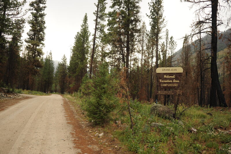
The Grandjean Campground is reached from Highway 21 mile 93.8. Follow Forest Service Road 524 to its end at mile 7.0. There is no dedicated day-use river access site but campsites 7 through 12 are along the river and there is a separate parking area for hikers.
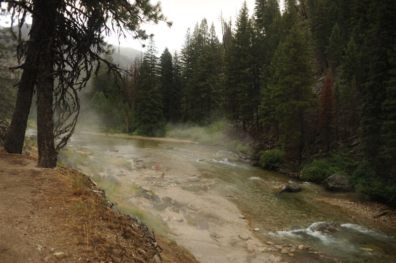
As flows drop, a nice riverside hot spring emerges along the river bank.
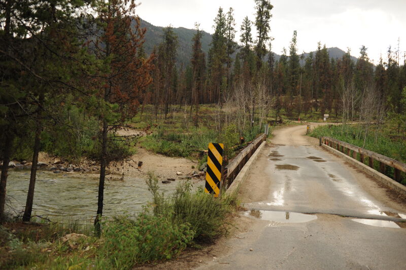
This access is reached from Highway 21 mile 93.8 where you turn onto Forest Road 524. Follow this road 4.5 miles to the Wapiti Creek Bridge that crosses the South Fork Payette. Good low bank access is available on the upstream river left side of the bridge suitable for hand-carry craft.
Most significant drop in this section. USGS River Mile 134.3.
Access is just upstream of Bonneville at a dispersed campsite located at ID-21 mile 93.0 that is a functional access for kayaks and smaller hand carry craft. Bonneville Campground at ID-21 mile 91.5 is also listed as an access in some guides but this puts you in downstream of some good class III/IV. USGS River Mile 131.7.
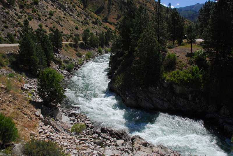
A great class III+ read-and-run down the middle. Logs occasionally get stuck about 80% of the way through the rapid. USGS River Mile 129.1.
Access at a dispersed campsite across from Warm Springs Guard Station that is an easy raft launch. To reach it turn onto 025-RB at ID-21 mile 91.3. Follow this road 0.9 miles downstream and turn left into the dispersed campsite just before you reach the guard station. This access puts you in just downstream of Chapman Creek but just above Alcatraz. USGS River Mile 128.6.
For those who want to avoid Alcatraz, the class III+ immediately downstream of this access point, a couple more roadside pullouts and dispersed campsites provide access as you continue downstream.
At a distinct horizon line the river cascades through a big Just past the Warm Springs Guard Station this class III+ drop awaits. It is recognized by a midstream boulder that is to be avoided. A good line is down the left side and finishing off towards the center but watch the smaller holes at the top that can quickly send you off your line. USGS River Mile 128.4.
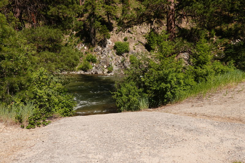
Tenmile Creek Road Bridge is at ID-21 mile 85.5 and is sometimes used an access that comes at the end of some class II/III and the start of a short class II reach. The best access is on the downstream river right side of the bridge where a short fisherman's trail leads down to the river. It is suitable for hand-carry craft and is feasible for rafts with some effort.
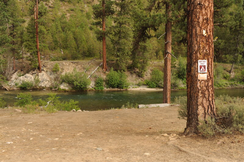
Helende Campround at ID-21 mile 81.5 is a good river access that serves as a take-out or put-in. It is a good access point for rafts and a great campground to stage adventures in the South Fork Payette drainage. The access point is adjacent to but separate from the campground. To reach the river access, enter the campground but instead of following the loop around the sites, head straight on the dirt road towards the river. Rafts can easily use this access. USGS River Mile 119.0.
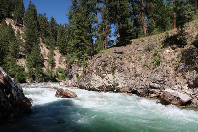
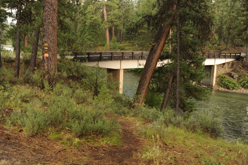
A short bedrock gorge with a horizon line at the start. This is just below the Forest Road 542 bridge (which can be used as a take-out if you don't want to run this rapid or the Kirkham Gorge). You can road scout the gorge from mile 78.2 on Highway 21. USGS River Mile 114.9.
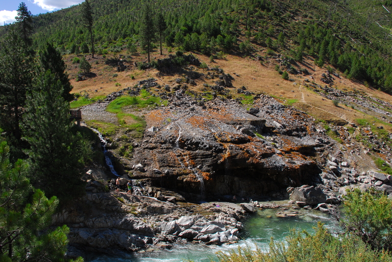
This recreation site is sometimes used as a take-out by kayakers (hauling rafts out would not be practical here but you can still stop). It is located at ID-21 mile 76.9. The hot spring is just below Kirkham Rapid on river left. Enjoy a nice soak and take out here or continue on your way. USGS River Mile 113.3.
Easy to road scout at the Hot Spring. The meat of the rapid is just below the bridge used to access the hot spring. USGS River Mile 113.4.
Mountainview Campground is at ID-21 mile 73.3 and serves as a take-out or put-in. Parking is limited but there is an area to unload boats, including rafts, and easily access the river. USGS River Mile 109.5.
This access point also serves as the put-in for The Canyon run. It is a formal river access site and day-use area adminstered by the Forest Service with a fee. The site is located at mile 29.9 on the Banks-Lowman Road at USGS River Mile 105.1. The access is suitable for rafts.
Aug 4, 2022
An idealic late summer run that was so much fun that we did two days in a row. At these flows the run is a great novice run, or perhaps even beginner run. Water temps were warm enough to paddle in shorts and a t-shirt. There was a fun wave relatively close to the end that we sessioned with surfs and rocket moves. The first half of this section is more open and flows through back yards, but then it transitions to a nice little canyon section.
Jun 29, 2022
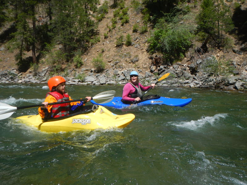
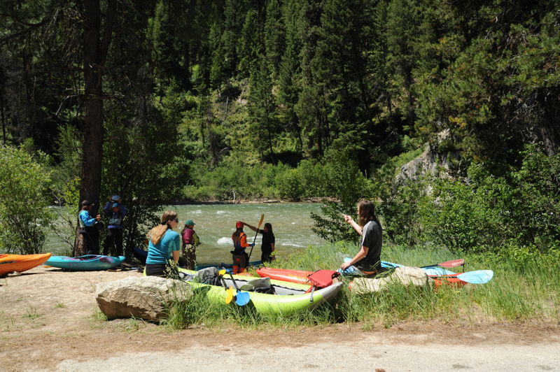
We did the run from Mountain View down to Pine Flats with a big group of about 30 people including hardshell kayaks and inflatable kayaks. Although we found plenty of room to unload and stage at Mountain View Campground, which has easy river access, parking was limited to only a couple of cars. At this flow the river was fairly continuous and the current was swift with several fun class II rapids. We found one really great play wave downstream of Lowman. A few paddlers took out at the Deadwood Access while others continued downstream to Pine Flats where we were camped. This adds a couple class III rapids to the run. The access at Pine Flats is a steep climb up the bank but the trail is short and you can directly access campsites 5, 6, and 7. The kids were able to carry their boats up.
Jun 11, 2018
We ran from Warm Springs Guard Station to Mountain View Campground in a 14 foot oar rigged raft. Flows were around 2,250 @Lowman. The run took around 3.5 hours. Plenty of water at this flow, but Little Surprise and Kirkham Gorge and are a tight fit in an oar boat. Make sure you are able to put your boat exactly where you want it before attempting to row this run. I would recommend 4WD for the Warm Springs launch site with a boat trailer, as it is a little steep getting out. I would also recommend that large groups not try to take out at Mountain View, as there isn't much space there. Its fine for a boat or too, but might get a little hectic with several boats and vehicles, especially with trailers. Continue a couple of miles more down to Deadwood.
May 4, 2017
1660 at the Lowman gauge. We put in just above Canyon creek and almost immediately ran into two mandatory portages (riverwide trees) with a third possible portage that we squeaked over. After that it was a fun and sporty section with Little Surprise being the last rapid we ran.