Flathead, Middle Fork
1. Schafer Meadows to Bear Creek (Upper Middle Fork of the Flathead)
| Difficulty | III-IV |
| Length | 27.5 mi |
| Avg Gradient | 35 fpm |
| Gauge | M F Flathead River Near West Glacier Mt |
| Flow Rate as of 38 minutes | 3120 cfsmedium runnable |
| Reach Info Last Updated | August 23, 2025 |
This is the multi-day Wilderness run of the Flathead River National Wild and Scenic River. It begins in the Bob Marshall Wilderness, traverses the Great Bear Wilderness, and the take-out is on the southern border of Glacier National Park. The whole concept of the Wild and Scenic Rivers system has its roots in the Flathead River system. Frank and John Craighead, two wildlife biologists from Montana, found themselves fighting the proposed Spruce Park Dam on the Middle Fork Flathead that would have inundated bear habitat along the river. Through articles in Naturalist in 1955 and Montana Wildlife in 1957, the brothers developed a concept for a system and classification for free-flowing rivers that became the basis for the Wild and Scenic Rivers Act in 1968. The Middle Fork Flathead was designated from its headwaters to the confluence with the North Fork in 1976. Quite the pedigree - and it is more than deserving.
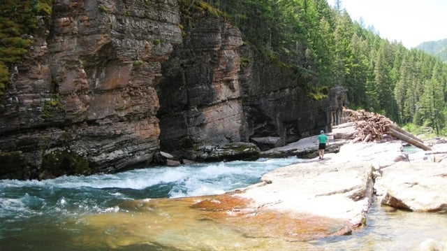
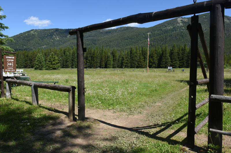
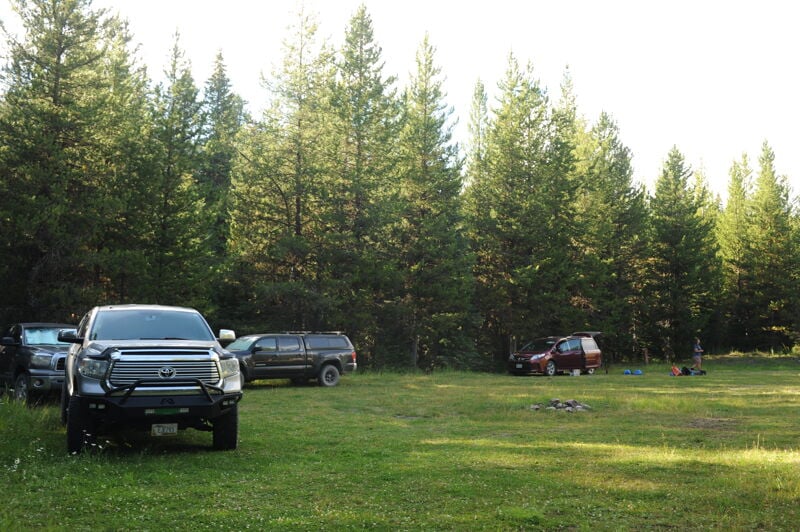
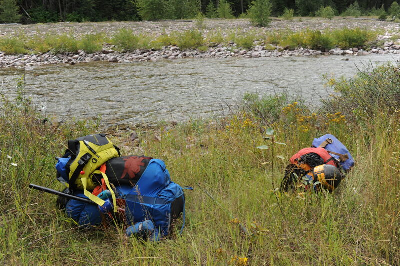
While most visitors choose to fly into Schafer Meadows, kayakers and packrafters can hike or paddle down Granite Creek 6 miles to enjoy the final 18 miles or so of the Middle Fork. Packrafters can also hike in to do the full run by hiking in approximately 14 miles on the Morrison Creek Trail. Another option for a fun day trip is to hike approximately 5 miles up from Bear Creek to run the Spurce Park Series as a day trip. For those flying to the top, flights out of Kalispell, Montana take about 20 minutes to reach Schafer Meadows. Bush planes have gear weight and size limits, so call ahead for reservations and details so you can plan accordingly (you can typically get kayaks under 9' in a Cessna 206). The river is about a 1/4 mile muddy hike from the airstrip. Granite Creek, about 11 miles downstream from Schafer Meadows, is a significant tributary, and flows increase after it joins the main stem near the Granite Cabin making this an option when flows are lower
...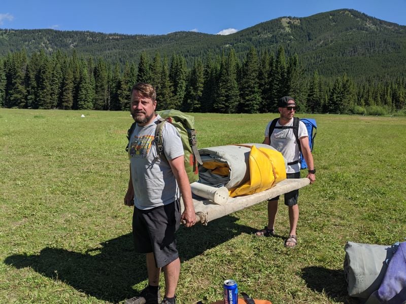
Obviously, you can't drive here. You have to hire a small plane to fly you in, or hike!
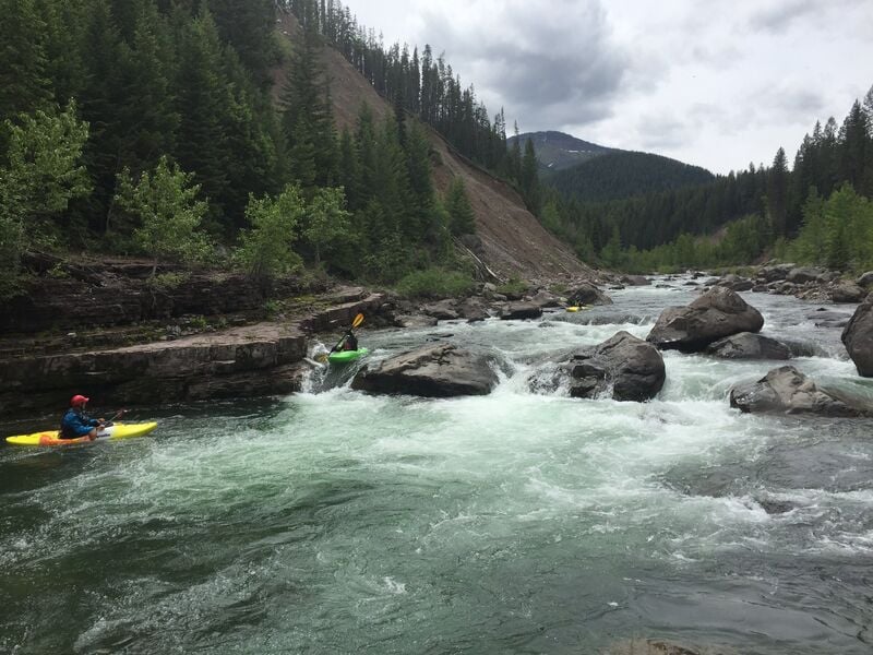
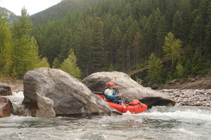
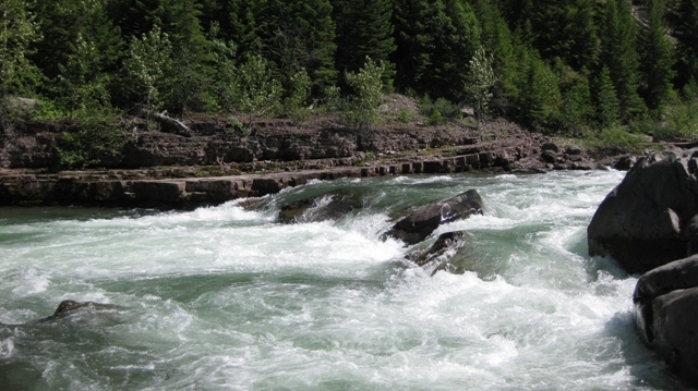
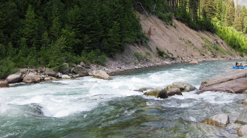
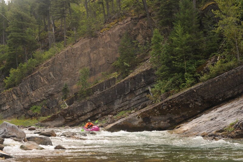
About three miles downstream from Schafer Meadows putin, the Three Forks Rapid series begins. This two-mile section of intermittent rocky rapids requires some maneuvering, but most are read-and-run. Around 3.6 ft, rafting becomes more challenging due to the number of exposed rocks and scouting may be advisable. Kayaks can easily navigate these rapids at a variety of flows. The last rapid in the series is the largest and is marked by a drop with several narrow channels. Different lines may open up at different flows, but at 3.6 ft take the far right channel to drop into the large pool below.
The Morrison Creek Trail provides an option for a hike in with packrafts without chartering a plane to fly in. The trail descends gently along Morrison Creek, offering a scenic journey through dense forests and alongside the creek itself. It is predominantly downhill, with a descent of about 1,400 feet. You should be prepared for multiple creek crossings that may present challenges during periods of high water. To reach the trailhead take Highway 2 and just west of Marias Pass turn south onto Skyland Road (Forest Road 569) and follow it approximately 9 miles to the Morrison Creek Trailhead. From here it is an approximately 10 mile hike down the Morrison Creek Trail (trail #154) to the Big River Trail (trail #155) that parallels the Middle Fork Flathead and allows you to continue another 4 miles upstream to Schafer Meadows.
From Highway 2, just west of Marias Pass turn south onto Forest Road 569 and follow it approximately 8 miles to the Granite Creek Trailhead. From here it is 6 mile hike down the Granite Creek Trail (trail #156) to the Big River Trail (trail #155) that parallels the Middle Fork Flathead. This trail provide an option for an overnight packraft trip through the Spruce Park Gorge during lower summer flows. While formal camping is not available at this site, you can bivouac in the grassy parking area if you arrive late and want to start your hike in the next morning.
An alternate start point for a trip on the Middle Fork by coming in on the Granite Creek Trail #156.
Busy at the top but very scout-able with a center to right-of-center line most of the time. A pyramid rock at the bottom that could do some damage; go either side.
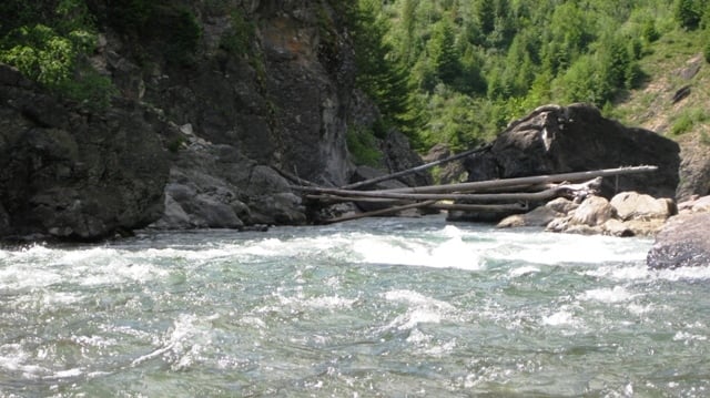
A large midstream boulder just upstream of the Cye Creek confluence. Scout for wood.
The Lunch Creek series of rapids begins just downstream of Lunch Creek and continues through several fun read and run rapids.
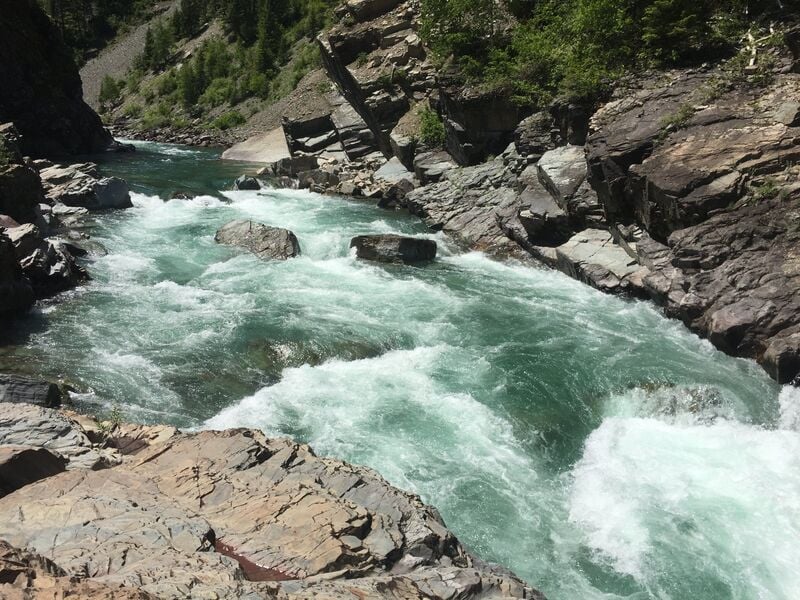
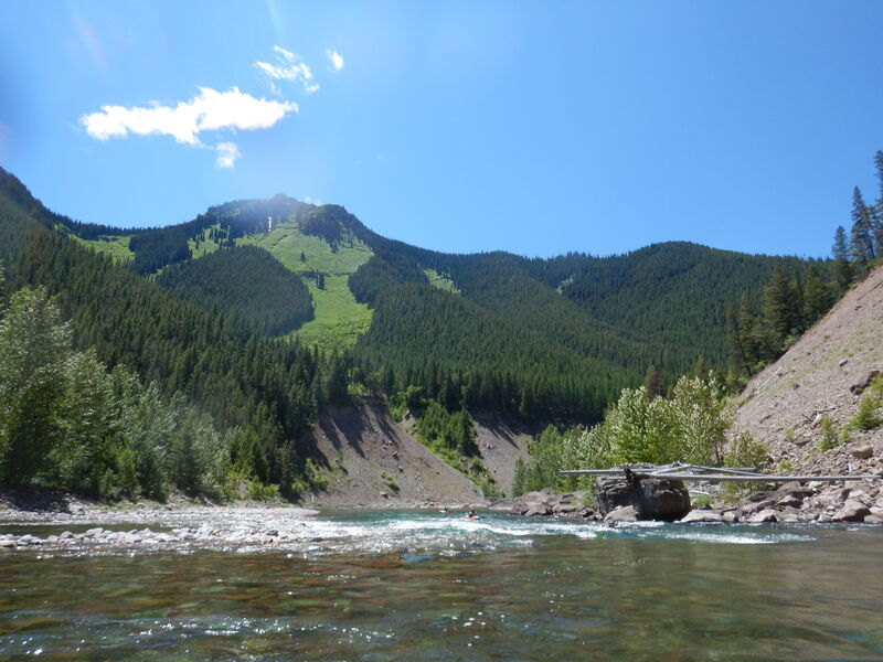
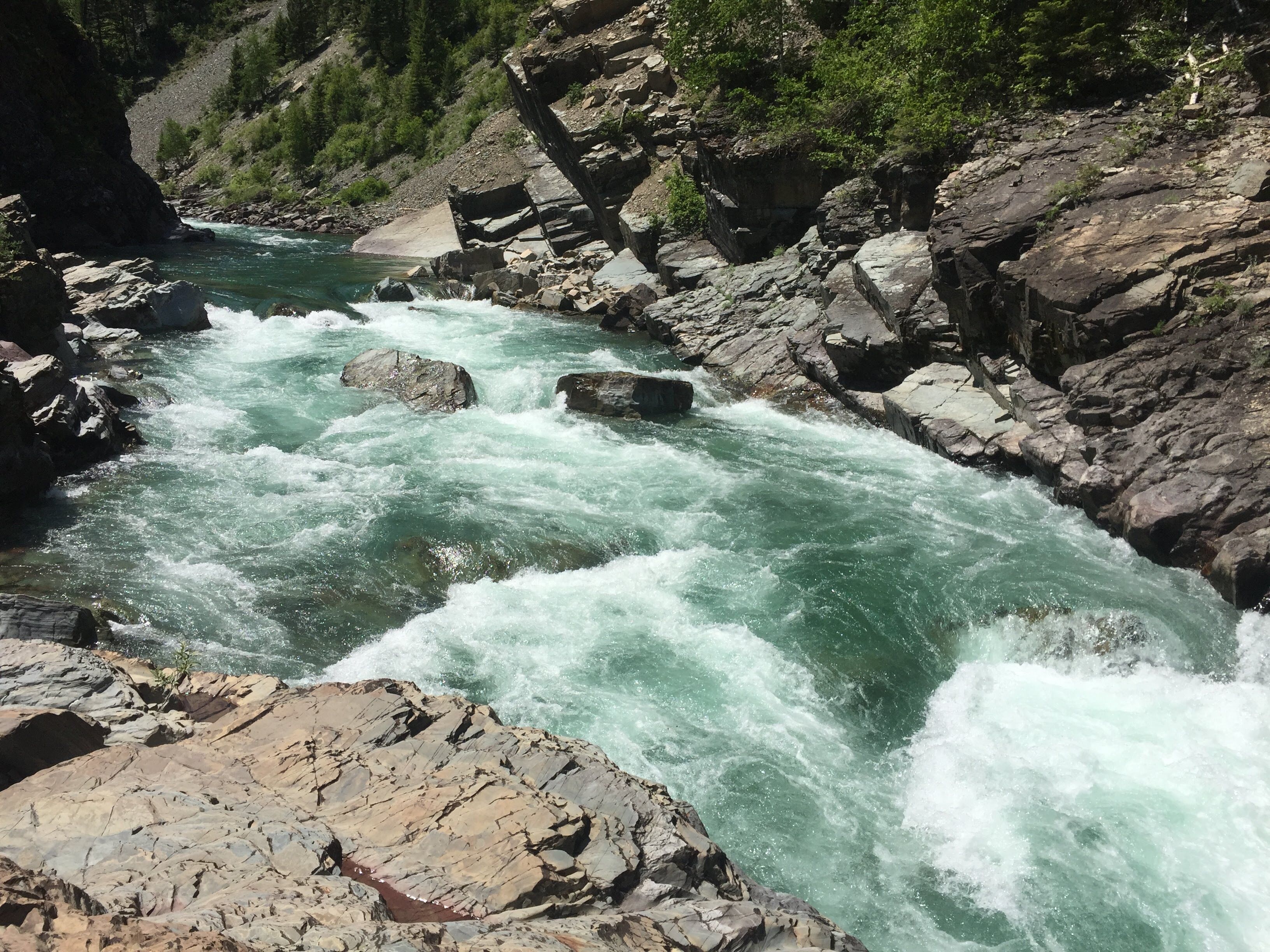
Like the Three Forks Rapid series, the Spruce Park Rapid series is about a two-mile section of rocky rapids that ends with a large rapid at the site of the proposed Spruce Park Dam. Dam efforts were defeated, leaving this river in is free-flowing state. Prior to the beginning of the rapid series, there is a large flat campsite on river right in Spruce Park, a widening of the river corridor. With the exception of the last rapid, most are read-and-run, though rafts at lower flows may want to scout. At higher flows, watch for goose-neck-like bends in the river where currents may push against the walls. Eddy out above the last big rapid on river right to scout. At 3.6 ft the entrance drop can be run center or right. Running the center line makes it easy to shoot the gap between the two subsequent center boulders, followed by a move to the right to avoid a left-side pourover, which probably becomes a large hole at higher flows. If piloting a raft, consider the right line to avoid getting stuck between the rocks. The exit rapid has a large boulder dead center and can be run down the left channel. There are a couple good campsites at the end of this section and before you reach Bear Creek. While this series of rapids is often the end of overnight trips on the river, you can also hike up with boats or packrafts from Bear Creek to run this section as a fun day trip.
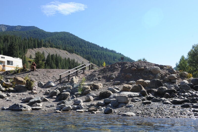
Large parking area easily accessible from Highway 2 with a small raft slide to help get in and out of the river on river right.
Jun 8, 2026
Paddled this stretch between June 7th and 8th. There's no longer any river wide wood in the Three Forks Series but there's still plenty of logs in play, particularly at river mile 77 (referencing the USFS river guide pamphlet). The main slot at the bottom of Lower Twenty-five Mile Rapid was blocked with wood. We caught the eddy on river right just above the slot and portaged over some large boulders. Fairly straight-forward portage with a paddle raft and kayaks.
May 24, 2026
Ran the upper with a mixed packraft and hardshell crew over May 23-24, 2026. Hiked Morrison Creek down to the river, then upstream to about 0.5 miles north of Schafer. Beautiful weather, great flows, awesome run. At the time (05/23-24/2026) there is a river wide strainer about halfway down the Three Forks series, mature tree blocking the entire channel. It's at a right bend in the river with a couple house sized boulders and an overflow channel on river right and a talus slope on river left. It's 1-2 drops above the final rapid. The log is visible from upstream with enough time to catch an eddy at our flows (around 6K on the West Glacier gauge and rising) but if it was high it would have been more tenuous. Easy portage, a crew with a 14' raft was portaging when we got there. Sorry no photo. Just a heads up if you're running this stretch.
Jul 11, 2014
I just posted a bunch of new pictures with captions for this river. I couldn't find the most reliable info for this section and wanted to update what was here. We started at Shafer running at 8200 and ended at Essex at around 6400 and I thought being a class IV boater that it was perfect! Check out the pics and enjoy.
Feel free to contact me at jgras@sailingscubaadventures.com for more,
Thanks to Glacier Whitewater and Mike from Helena for all the great info!