Rock
Indianford / Janesville Dams (PnP)

| Difficulty | III |
| Length | 0.093 mi |
| Avg Gradient | n/a |
| Gauge | Rock River at Newville, Wi |
| Flow Rate as of 39 minutes | 501 cfsbelow recommended |
| Reach Info Last Updated | February 2, 2025 |
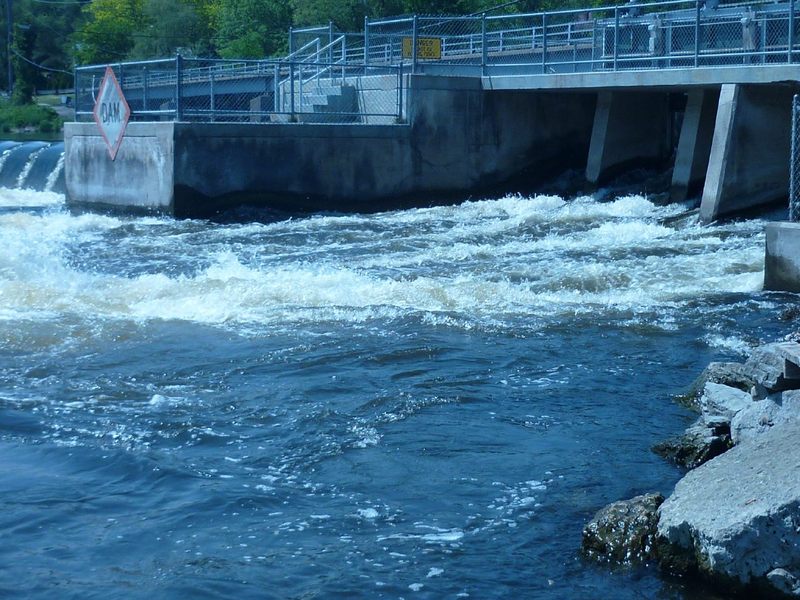
In general you don't want to mess with the main width of the dam at Indianford. Across that whole width, there is large rock rubble (in the landing zone and outflow) to reduce/eliminate hydraulic scouring (erosion) of the riverbed. The hydropower plant sits to river-right. On river-left, there are six releasable gates. Depending upon flow, and which gates on the dam are open, there can be a sweet wave where the outflow from those gates hits the pool below.
Gauging can be a bit funky, since the nature of this wave will depend upon how many and how far the gates are opened (and possibly which specific gates in the event that they don't open all six equally), and also upon the river level downstream. Which is to say, a certain reported flow (or flow range) on the cited gauge, one time may be producing a wonderful fast playable wave, and at some other time (at the same gauge reading) may not produce anything remotely worthwhile!
If you are 'skunked' here, you are not far from the Yahara River and the Badfish River, either of which can offer a nice float trip with some (admittedly quite minor) rapids and play possibilities.
If neither of those interest you, you may wish to check out the dam at Rockton, IL.
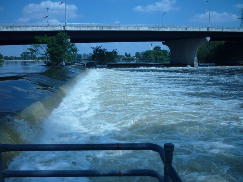
In general, you don't want to mess with the main width of the dam. Across that whole width, there is large rock rubble (in the landing zone and outflow) which is used to reduce/eliminate hydraulic scouring of the riverbed. However, the left-most part of the dam has releasable gates. Depending upon flow, and which gates on the dam are open, there can be a sweet wave where the outflow from those gates hits the pool below.
Gauging can be a bit funky, since the nature of this wave will depend upon how many (and possibly which specific) gates are open, and also upon the downstream river level.
(Reported flow was 3440 cfs when photo was taken, and it did not look at all friendly or surfable.)
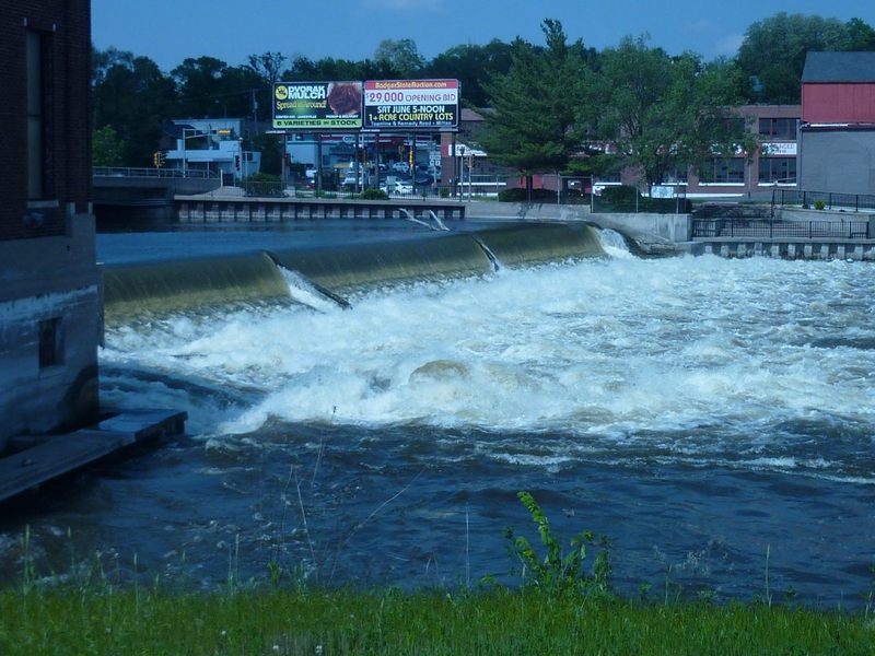
The first dam in Janesville has a hydro plant on river-right (to the left of the photo). The main dam slopes off steep and slams hard into a line of rocks at the base (to disperse the force of the water and reduce hydraulic scouring of the river bed). Between the main dam and the walls of the power-plant, there are releasable gates which allow 'excess' water to pour through. This tongue of water creates a huge surging hole in the river/pool bleow. At the flow in the photo (3440 cfs on gauge), play would be impossible. It is conceivable that there could be some flow at which a potentially playable wave could occur. There is a portage path for canoes to get around the dam and back into the river downstream, so there is convenient access. So . . . has anyone ever looked at this, or put-in and found it playable?
(Listed distance is road miles from Indianford, not river miles.)
The second ('lower') dam in Janesville was immediately under Hwy.51/Center Avenue. This is in a city park, just downstream of a huge rock outcropping with a historical plaque, marking it as the site of the spot where settlers crossed the river, and where the first settler's cabin was built. This rock (significant to the Native American Tribes and settlers alike) apparently is what the county is named after.
The dam was a split-wing affair, the river-left half (to the right in the photo frame) having been perpendicular to the flow (parallel to and under the highway bridge), white the river-right half (to the left in the photo frame) took a steep angle diagonally downstream. Flow over both 'wings' angles off then plunged into the river below, forming (at almost all flows) a nasty hydraulic.
In 2018, this dam was removed (accompanied with much controersy). As a result, there is likely little-to-nothing remaining of interest to whitewater paddlers here.
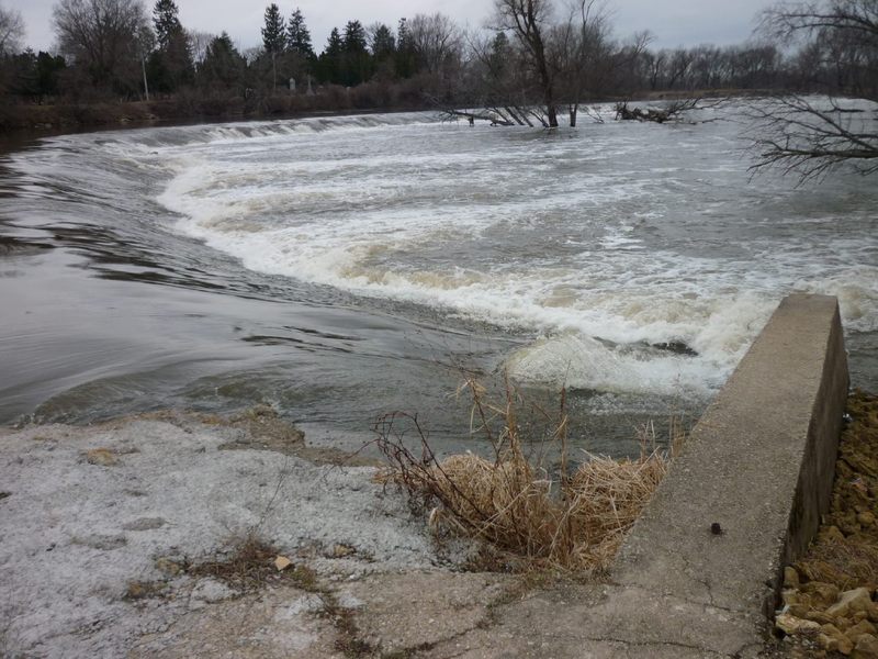
A WIDE dam in Rockton dam diverts most of the flow into a canal (to river left). It would take significant (higher than normal late-spring/summer flow) to have enough water passing over the dam to make it anything other than a scrape down the sloping face. It would take a significant amount of scouting, at a wide variety of flows, to find meaningful play here. At the right flows, it is entirely likely there may be a few spots which could offer some play, but there will also be numerous spots which would be just plain nasty (keepy). We would urge great caution for anyone opting to play at this dam on the Rock River at Rockton.
(Listed distance is road miles from Indianford, not river miles.)
See separate listing for this location (in Illinois).
No trip reports yet.