Kent Creek, S.Fk.
Levings Lake to Rock River (2.37 miles)

| Difficulty | II(III) |
| Length | 2.5 mi |
| Avg Gradient | 20 fpm |
| Gauge | Piscasaw Creek Near Walworth, Wi |
| Flow Rate as of 1 hour | 4 cfsbelow recommended |
| Reach Info Last Updated | April 2, 2019 |
Starting on a lake in a park (or below its dam), scenery starts off with a short stretch of tree-lined 'wilderness', but that quickly devolves to a channelized section running through industrial/factory area of the city, criss-crossed with street and railroad bridges.
Boaters may be interested in checking (before putting in, while setting shuttle) the flow and possible interest on the Rock River (just beyond our listed take-out). It may be worthwhile for some bigger-water play, ferrying in strong currents, etc. before calling it a day here. We are unsure the feasibility of carrying up and whether any convenient repeat-play might be available here.
Anyone having actually had a boat on the water (either on Kent or on the Rock) is encouraged to add a comment or report (photos or video would be great, too).
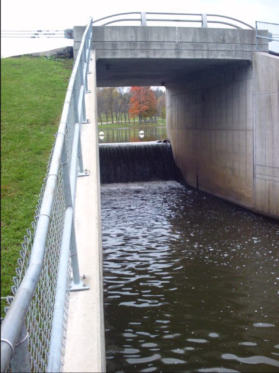
Coming out of Levings Lake, the stream passes over a dam. There are no obstructions (other than the marker buoys in the lake) impeding passage over the brink. At higher flows I expect there would be thundering chaos at the base of this, as it is under the parkway road where the sound will echo off the cement box culvert you are in. You would have to VERY carefully assess the situation (as to 'keepiness' of the hole at the base, and your likelihood to clear any backwash) before deciding if you should run this. If there is any doubt, you should carry down the embankment and put it below the dam.
Best I can tell, drainage area above this point appears to be on the order of 14 square miles, substantiating that this is a fairly small creek which will run only brief periods of peak runoff (snowmelt or heavy rains).
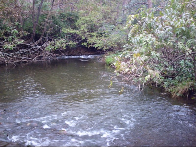
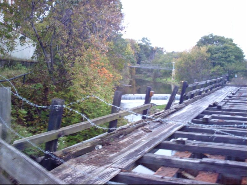
Immediately downstream of the put-in, the creek passes under a railroad trestle (a criss-cross wooden beam affair, with more than adequate clearance) and trips down a very short rocky pitch. At paddleable flows, virtually all rocks should be covered, and this will probably be little more than exciting splish-splash to start off the run. It is possible some minor play may be possible as the gradient encounters a fair size/depth pool (for this little creek) before winding its way downstream.
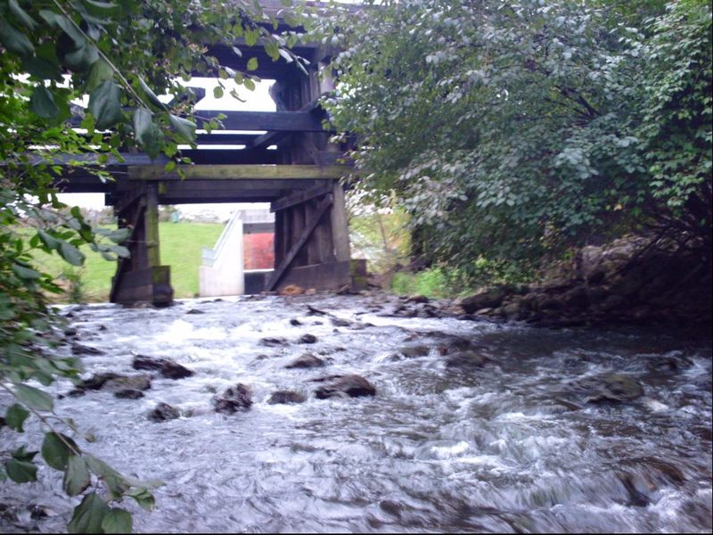
Immediately after passing under Cunningham Road the creek passes through the supports of a defunct rail line bridge. Beneath this bridge, the streambed has an unusual array of rock and timber armament. Tight to the left under the bridge, flow will fall off (probably rather chaotically) into a slightly deeper channel, before tripping down into a pool below.
WARNING: There are big timbers in the outflow (which will be well submerged at any boatable flow) that would be very problematic if you flip or swim here.
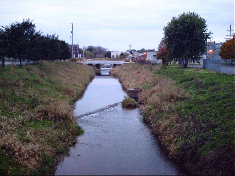
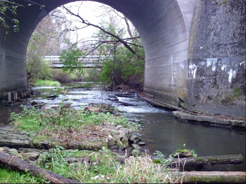
The channelized stretch of this stream has a series of gabions (think chain-link fence 'boxes', filled with rock rubble) probably for erosion control in the streambed and/or concrete strips (probably protecting utility pipes passing under the streambed). While they appear as 'falls' or 'pourover rapids' on the low-flow satellite views on Google, at what would be boatable flows I expect these would be completely covered and probably create little more than riffles (though this is just conjecture unsupported by direct observation).

The confluence with N.Fk.Kent Creek is likely have somewhat chaotic currents when these creeks would be at boatable flows. Since the N.Fk. is twice-as-large, flow for the remaining distance (and final drop) is likely to be nearly triple that which you have been on prior to this point.
This ledge (not certain if natural or man made, since close-up inspection is not convenient -- the whole area is fenced and posted no parking, no trespassing) is almost certainly sufficient to cause some whitewater action (or concern) at boatable flows. That is, unless the flows in the Rock River (not far downstream) are sufficiently high as to 'back-up' this far upstream and thus swallow up this ledge. Since this is such a uniform pour-over, it seems likely that it could (at times) have quite a 'roller' at its base which could either make for play or panic (danger).
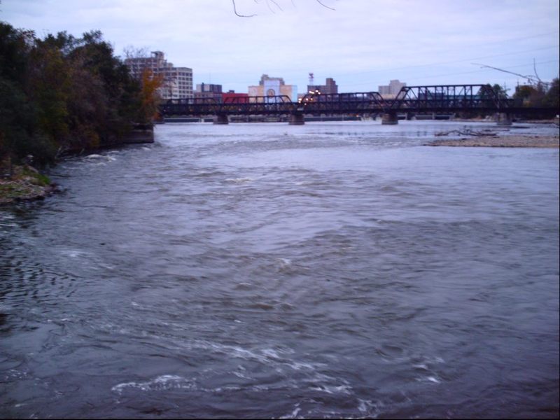
Just downstream of the Rockford Dam, the Rock River encounters an area of rubble shoals. At low flows, this makes some pleasant riffles. A slightly deeper channel tight to the right makes some decent waves and strong currents as the outflow from Kent Creek enters. At high flows I expect this whole shoals will be covered and would present no boating opportunities. It appears possible that, at some low-to-moderate flows, there could be some tame entertainment possible.
If I recall correctly, this (the Rockford Dam) is an area that some folks were 'investigating' as a possible site for a dam-bypass whitewater play park. In fact, there was some speculation that it could be created as the whitewater venue for Chicago's bid for the 2016 Summer Olymics. That bid ultimately failed, and the possibility of an Olympic caliber course here was probably a pipe-dream (it's doubtful there is really sufficient overall drop, from above to below the dam, to fashion a true Olympic style course). I haven't heard anything lately about any continuing plans for possible fish-passage/canoe passage/whitewater course at this site. As things stand presently, the dam has a nasty killer hydraulic across most of it's width, and boaters are advised to stay well away from the Rockford Dam (both upstream and downstream).