Turtle Creek
A) Delavan to Hwy.140 (PnP or up to 19 miles)
| Difficulty | I(II) |
| Length | 19.1 mi |
| Avg Gradient | n/a |
| Gauge | Turtle Creek at Carvers Rock Road Near Clinton, Wi |
| Flow Rate as of 38 minutes | 58 cfsbelow recommended |
| Reach Info Last Updated | March 22, 2025 |
This run will be interesting mostly as a scenic, rural float trip with a few shoals, riffles, and rips. Some locations may offer minor whitewater (possible 'park-and-play' opportunities -- scroll down for the 'Rapids' list below; also check the 'Map' tab for locations), but serious whitewater boaters should probably look to other listed rivers.
A dam (creating Comus Lake) spills flow under N.Terrace Street. The dam is being rebuilt (2024/2025) and presently has boards in vertical slots. Unsure if it will have bottom spill lift-gates or if it will be top spill. Either way, water will sheet shallow across cement splash pan under the road. Midway under the bridge it meets the downstream pool height and creates a wave/hole. At many flows, this is likely playable.
Park and play is possible, and likely a 'best bet' for true whitewater boaters, ignoring the rest of the run, other than perhaps driving to Klug Road if you're interested in stalls and squirts in currents there.
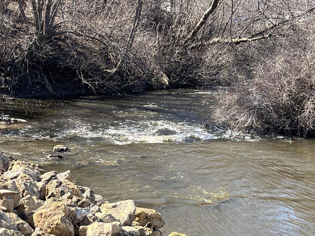
The pool is decent sized, and flow exits to the left, spilling over rock rubble. At high flows, this will be 'washed out'. At lower flows, it will just be rocky. (The 'featured photo' atop this listing shows this rocky rubble at ~260 cfs.)
By our listed take-out, drainage area increases to ~202 square miles (more than 6x the put-in location).
Jackson Creek enters from river-left. About 0.3 mile upstream, it has a small dam off Zoellner Lane (also marked Waterworks Drive on some maps), adjacent to Andy's Park (a skate/bike park with ramps, etc.). I heard rumors this site might provide some play opportunities.
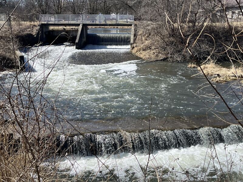
Jackson Creek has two gauges. The first is labeled 'Jackson Creek at Mound Road Near Elkhorn, WI', and has drainage area 16.5 square miles. The second gauge is about 260 yards downstream of a dam which regulates pond height for Delavan Lake. It lists drainage of 42.1 square miles. Oddly, while that gauge is on Jackson Creek, it is labeled 'Delavan Lake Outlet at Borg Road Near Delavan, WI'. At the Veterans Park dam, drainage is 51.3 Sq.Mi., so flow here could be 1.2 times that gauge reading. (Photo accompanying is at 72 cfs on that gauge, so possibly ~86 cfs coming through this dam.)
Outflow from the dam may look like it would provide some play (at some flows). However, when there is adequate flow to create a (potentially surfable) wave at the base of the spillway of the dam, the current rips through the short pool and drops over a small cement ledge, leaving precious little time or space for a paddler to stay in the short pool for any repeat play.
For years (and as of spring, 2025) there has been a large deadfall just downstream of this cement ledge. Beyond that, more strainers and sweepers, then a street-bridge for CTH.P lies which sits so low over the water that it will not allow boater passage at virtually any flow.
USGS lists a sampling site with drainage area 83.3 square miles. That is, flow here might be about 4/10ths the gauge reading.
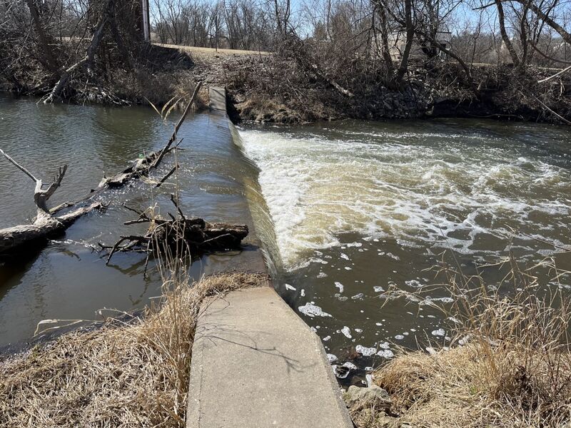
Immediately downstream of the confluence with Jackson Creek, a short dam ('hydraulic jump') spans the creek. Canoes (15-17') are likely to span the drop and be fine. Shorter recreational kayaks (and proper whitewater boats) may be likely to be caught by the reversal. There should be slackwater enough to get ashore to scout and (likely) portage.
FWIW, the road which nears the river on the south/river-left is marked 'Private Drive Keep Out'. The north/river-right shore contains the Delavan Street Department. Signs indicate the property is under video surveillance, so it might not be a good idea to linger on either shore!
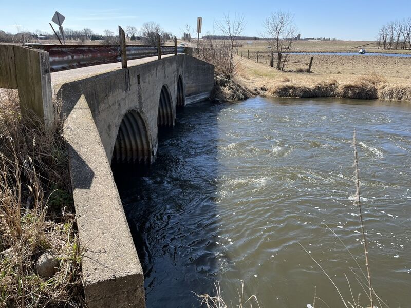
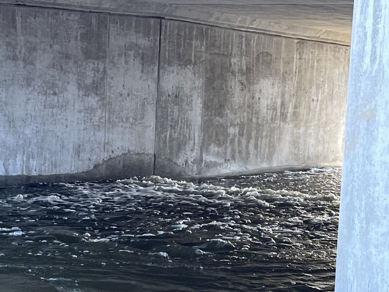
At this road crossing, the creek passes through three culverts. Snags may block some combination of (one, two, or all three) culverts. Approach with caution to carefully assess whether any are passable! The outflow (downstream side of the road/culverts) will contain somewhat strong currents as the stream hits a fairly deep pool. Minor play may be possible for proper whitewater boats at most flows. Primarily this would consist of bow-stalls or stern-squirts into the currents. If anyone still has a squirt boat, there could be some decent 'down time' here. Since there are dams and ponds upstream (on both the Turtle and Jackson creek), water is generally pretty clear for an upper Midwest stream.
Roadside parking is available, so this could be done as a PnP (park-and-play), or end of a short trip from the listed put-in.
FWIW, USGS lists another sampling site at this location, citing drainage area here as 84.7 square miles.

Starting about this area there is a series of switch-backs, overflow cut-through channels, and dead-end backwaters which form an interesting 'maze' of sorts. You can follow the main flow, or try a few cutoffs.
Listed mostly as a 'progress marker', this tributary (with it's 69.6 square miles of drainage) will usually add fairly subtantial flow for the rest of the run.
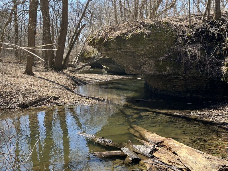
Just after Carver Rock Road, a small creek enters from the right. Before or after your run (while running shuttle), you may find it interesting to take a little side trek to enjoy Carver-Roehl County Park. Through this area, Spring Brook rushes (or trickles) past pretty rock outcroppings (short 'bluffs'), making quite picturesque scenery. There is a small 'turnoff' just north of the intersection of E.Creek Road and S.Carvers Rock Road, as well as the larger Carver-Roehl County Park area further to the north on S.Carvers Rock Road. Very pleasant trails (and a few bridges across the brook) meander through the woods.
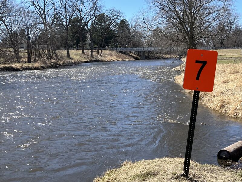
Testament to the popularity of this river (mostly for casual canoeists and recreational kayakers), Turtle Creek Access at State Highway 140 is at river right.