Net
Holyoke (PnH)
| Difficulty | II-III |
| Length | 0.2 mi |
| Avg Gradient | 80 fpm |
| Reach Info Last Updated | April 2, 2019 |
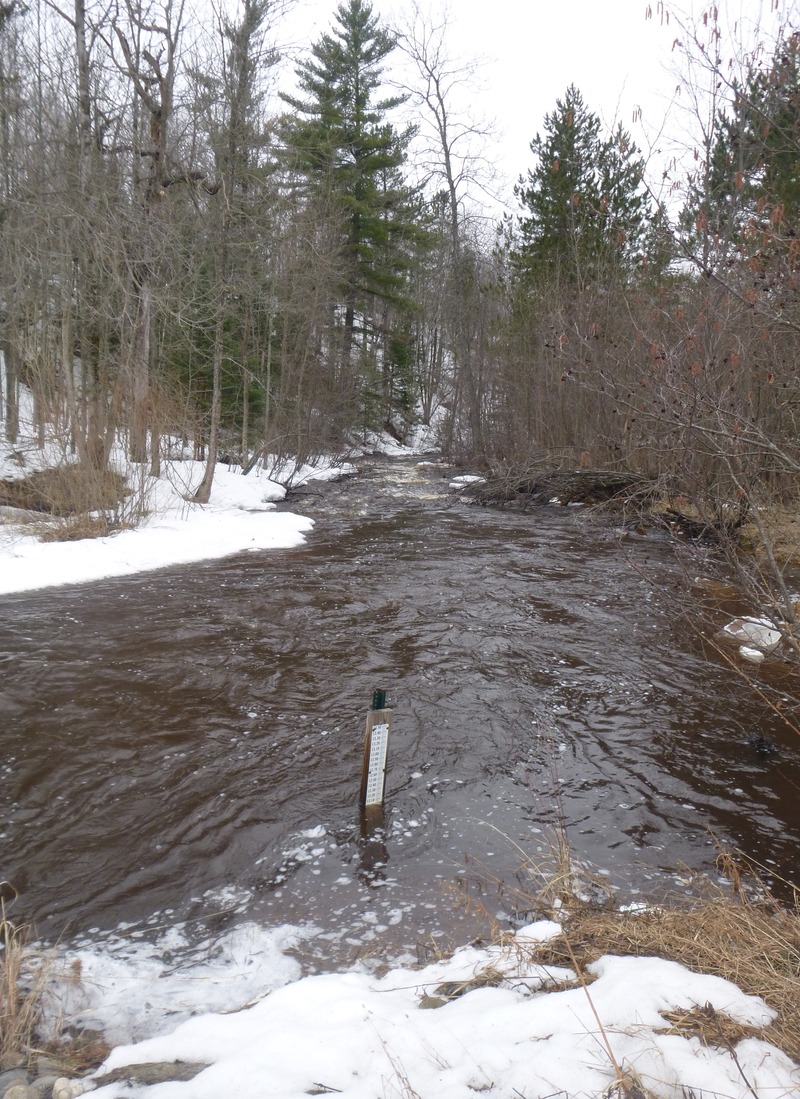
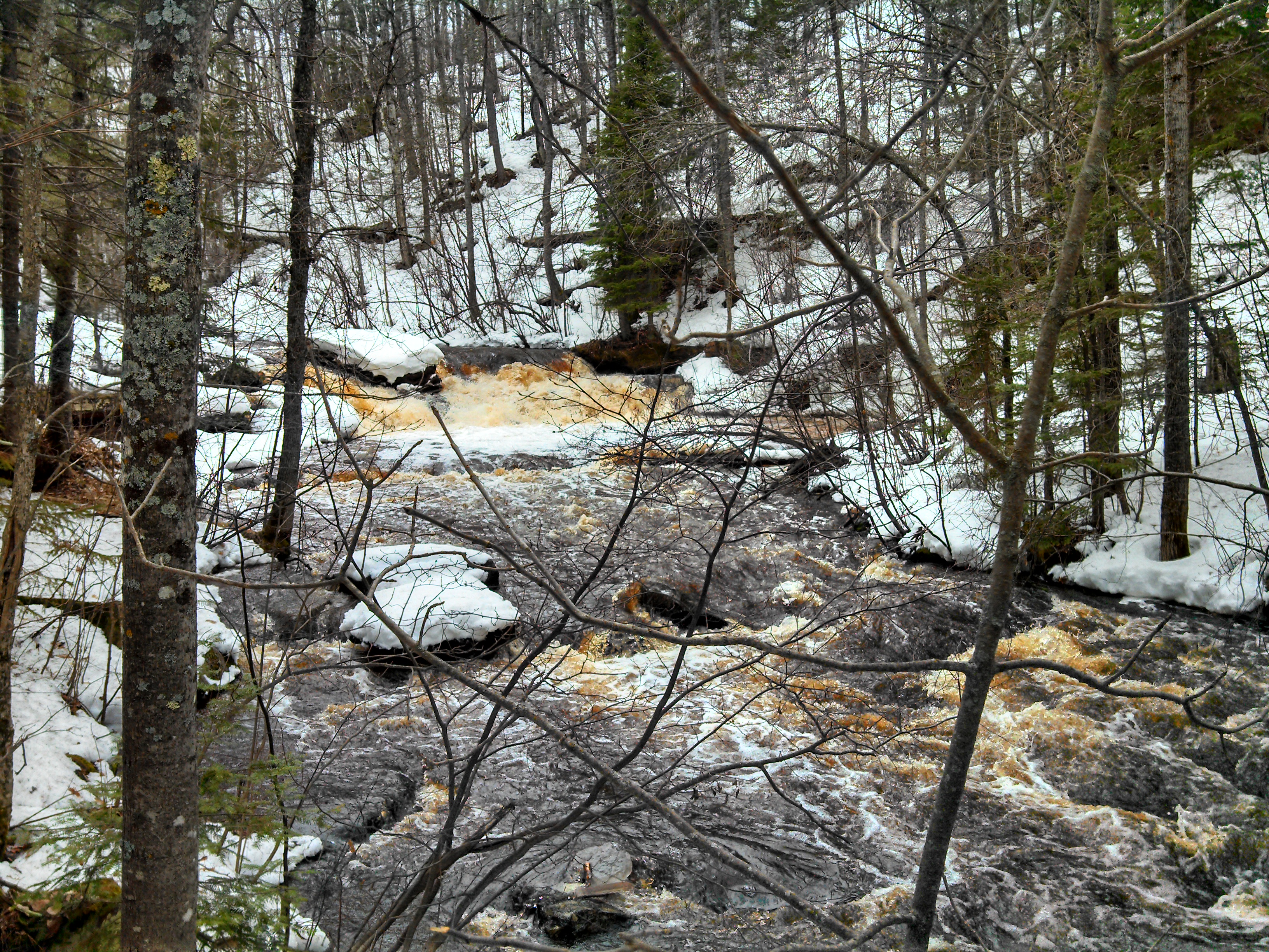
Topo maps show a 'rapids' near Holyoke. Further analysis shows a stretch with 80' of drop in a mile, which should generate some significant rapids and/or falls. There is sufficient drainage area above Holyoke to have adequate flow here upon spring melt and at times of heavy rain. However, it is also undoubtedly a small enough stream that deadfall will be a significant concern. It may possible to do a 'park and huck' on (part or all of) the steepest gradient which is concentrated in a park in Holyoke. Gradient upstream and down would suggest a longer run could have some additional merit, however (again) deadfall and sweepers (overhanging live shrubbery and trees on shore) are extremely likely to be a problem, negating the advisability of attempting any longer run.
On 2014-04-08, 'cupcake' provided:
Doing a bit of recon on this river, I wrote a letter to the township of Holyoke and a couple of property owners. The following information is from a property owner who lives right alongside the river:
The Net River is a wild river, and narrow, and overhung with alder brush. We have a community park, Holyoke Park, which gives public access to the river. Trout fishermen have been known to fish in the river, but not that much. I would say that the river is inaccessible beyond the park, and especially to any water craft. When the water is high in the Spring, the overhanging branches dip into it. As the water recedes, it is quite shallow. The river flows through areas of red clay . . . steep banks and red clay 'volcanoes' where the ground water and the clay make a sticky mess . . . not quite quicksand but . . .
Also, once you'd get on the river, there is no easy way to get off as the river flows through dense forest and uninhabited territory (again with the steep banks or alder brush . . . you wouldn't get your kayak out with you!)
I hope this message hasn't made you feel c
...
OK, this is not a rapids or feature on the listed run, but rather a nearby stream with another shot of gradient to check out (to look at and see if it might be a run).
The Little Net River has about 11.5 square miles of drainage above the road at the location marked here. While there is gradient upstream of the road, it drops about 80' in about a half-mile below the road before easing back. Lack of any good access roads downstream mean this will be a 'park and huck' (or just a park and look).
(The negative value distance listed is the straight-line distance (from our listed put-in on the Net) to the Little Net at CR.8.)
At our listed put-in, drainage is 26.9 square miles (as calculated by USGS StreamStats 4.0 Beta software).