Pike, N.Br.
A) Carney Rapids/Old County A to Four Foot Falls (0.4 miles)
| Difficulty | III |
| Length | 0.28 mi |
| Avg Gradient | n/a |
| Gauge | Pike River, Upper Branch Runs |
| Flow Rate as of 1 hour | 30 cfsbelow recommended |
| Reach Info Last Updated | February 2, 2021 |
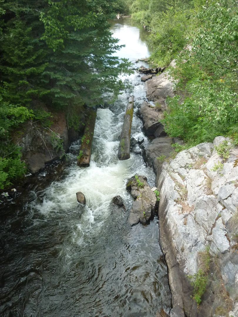
At Old County A, Carney Rapids drops into a mini-gorge (right under the road bridge) which would be a sweet, straight-forward drop, except ...
There are huge timbers (embedded in the rock flanking the drop) which have huge spikes sticking out of them. Additionally, there is a large log in the pool at the base of the drop, angled diagonally up toward the drop, ready to hammer anyone / anything coming down the drop. Unless you have done a recent low-water scout, or otherwise have confirmation that these things have changed, this makes this a highly recommended portage (I.E., have a look, but plan to put in below it).
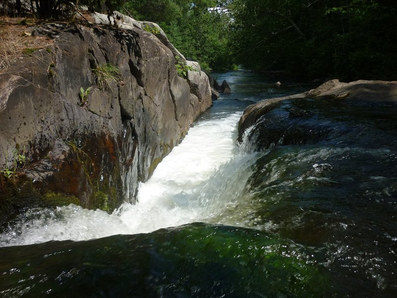
About one-third of a mile (of flat/flowing water with intermixed easy rapids) leads a to another interesting drop, Four-Foot Falls. A 1.5-2.0' ledge is a straight-forward run right or center, or a twisting run river left toward center. Almost immediately beyond this ledge is a weird slot against the left wall. At low water, all the flow drops about 2.5' into this slightly more than boat-width slot. At higher flows, another path down a somewhat more inviting ledge/falls would be available on river right.
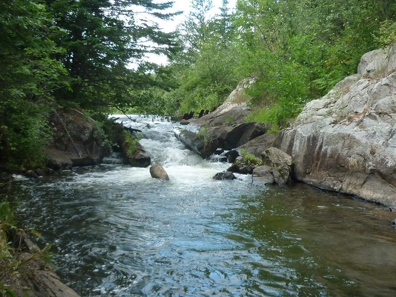
For what it's worth . . . upstream of here, I have paddled (approximately 2 miles) from CCC Camp Road down to Old County A. It is a fine northwoods float, but holds no real whitewater. I have also paddled (the ~4.3 miles) from 4' Falls down to the 'Four Falls' put-in, and the river consists of easy shoals, flat water, and snags, with little gradient and extraordinarily little interest for whitewater paddlers (Incidently, same is true for all unlisted 'intervening' stretches of the Pike and both it's branches. I have not paddled upstream of the uppermost listed reaches, but have paddled all 'intervening' stretches, and cannot recommend as a whitewater trip anything other than what has been listed.)
This short sliding flume drop would be easy fun to run if it were 'clean'. Unfortunately, huge timbers with huge spikes line the drop, and large rocks and another timber lay wait in the pool at the base. While I will concede that at some high flow it is possible (likely) that these hazards may be adequately covered to make a run possible, it is certainly NOT something I would encourage anyone to take lightly. If you have not seen this in person at a decent handful of flows, if you do not know how far underwater the spikes and the timbers may be, you really should not consider running this drop.
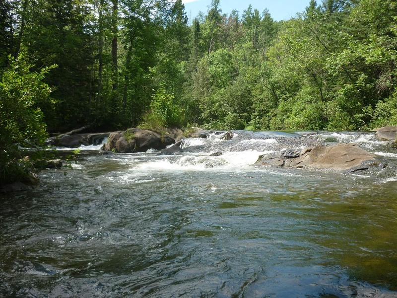
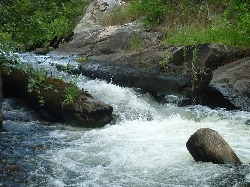
A short drive (or float) downstream of the Old-CCC Road bridge lies Four-foot Falls. The river twists to the right and spills across a broken upper sloping ledge, then twists sharply left to drop down a slot.
The lower part of this drop has a slot on river-left into which ALL the water falls at low summer flows. With better boatable flows, water will spread across sloping rock at what will be right or center-right of the flow. This is likely to be the more preferred route down this part of the drop.
Downstream, there is flatwater (occasionally punctuated by very very minor boulderbed rips) until the put-in for the 'Four Falls' section.
Jul 31, 2011
This is the entrance to (upper part of) Four Foot Falls.
Jul 31, 2011
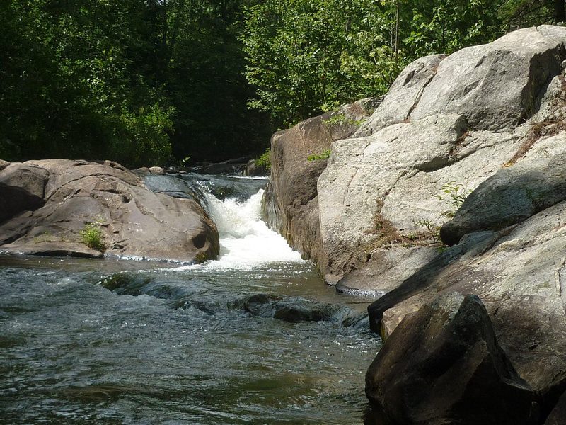
The lower part of Four-Foot Falls has a barely boat-width slot tight river-left (up against a steep rock-face which forms the shore). At the low summer flow in the photo, all water pours into that slot. At higher (runnable) flows, water may sheet across the rocks in center and river-right.
Jul 31, 2011
Not all that tall, but definitely potentially ugly! This shot shows the whole drop. Since it is taken from overhead (from the 'Old CCC Road' bridge), the perspective totally flattens-out the drop.