Clear Creek
Clear Creek Springs to Wasioto (1 mile)

| Difficulty | II-IV |
| Length | 2.9 mi |
| Avg Gradient | 120 fpm |
| Gauge | Cumberland River at Pineville |
| Flow Rate as of 1 hour | 977.32 ftbelow recommended |
| Reach Info Last Updated | December 1, 2024 |
I left the original entry below unedited to preserve the beta for the section mentioned. In 2024 I scouted this area to look for a decent paddling experience and I believe there is more to this run than just the 1 mile listed starting at the college. Upstream from the college is KY190 with a bridge crossing Clear Creek with a quiet area for parking without encroaching in the college grounds. There is a walking/biking trail all the way to the golf course, which adds about 1.7 miles to the run for a total of 2.8 miles. Some bedrock features and large rocks, although smaller feautures than downstream. Very scenic and easy section! Additionally, there is a completely unmentioned stream Little Clear Creek which creates a confluence with clear creek just before you enter the gorge section. Little Clear has a significant drainage area and many very awesome boulder gardens. The put in for this section is south of the college on Little Clear Creek road at the first bridge on your left as you head into the WMA. Some private property adjacent this creek but still affords beautiful scenery and features. Little clear again adds about 2 miles to the run for 3 miles total. Caution as there is a rather large undercut tree where little clear meets KY190 just before the college.
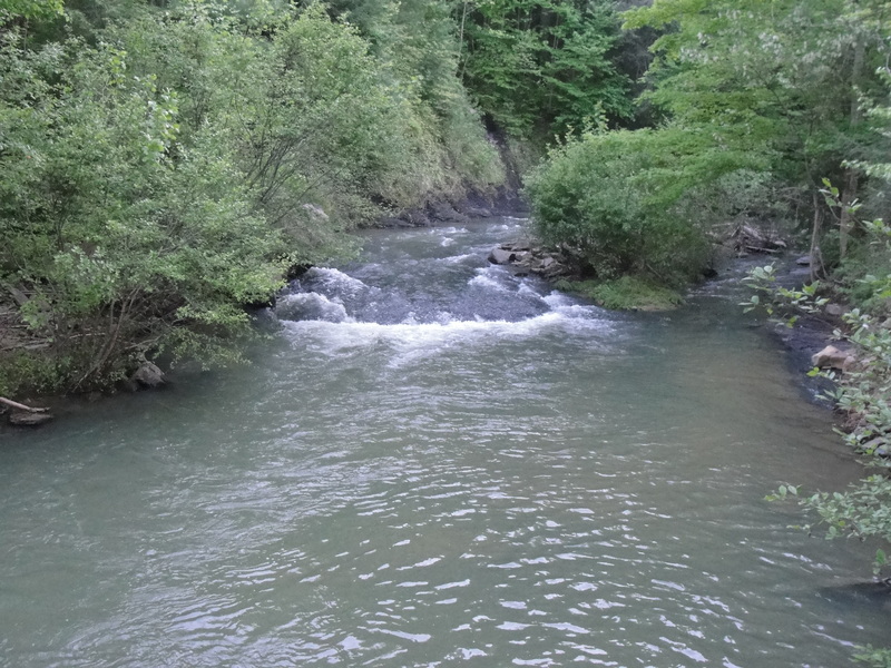
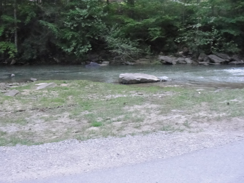
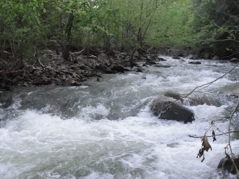
The run starts on the campus of Clear Creek Baptist Bible College. The put-in is right below a small bridge on Holly Hill Road. The first stretch runs behind a large dorm building, until the Clear Creek confluences with the Little Clear Creek. This is the first rapid on the stretch, Genesis (II). This one is a 100 yard section of small drops and ledges, nothing over 2 or 3 ft. After Genesis the Creek enters the gorge section, and is surrounded by rhododendron and Hemlock trees. The class II boogie continues until about 100 yards after the first rustic bridge.
A horizon line will appear, this is where you would want to get out and scout the rapid and the bridge after the rapid f
...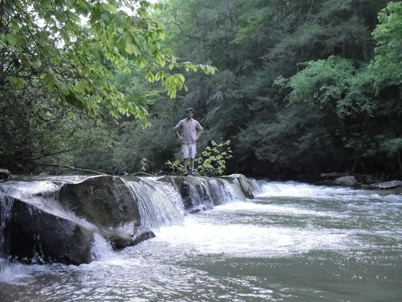
Three foot diagonal ledge leading into a river right chute, then a river left chute. You should scout this one.
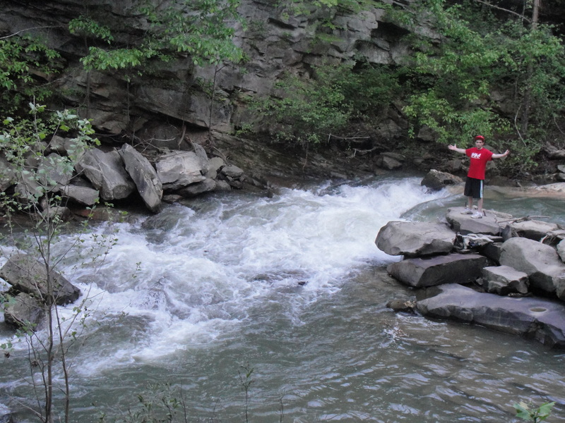
After the big pool, a river right break in an old dam with a medium sized rock right in the middle of the chute. There is a possibility for some metal in this one.
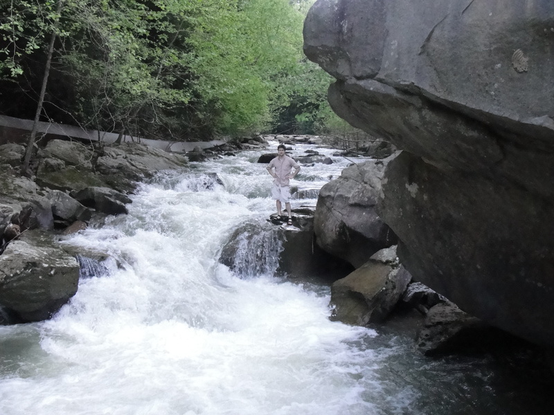
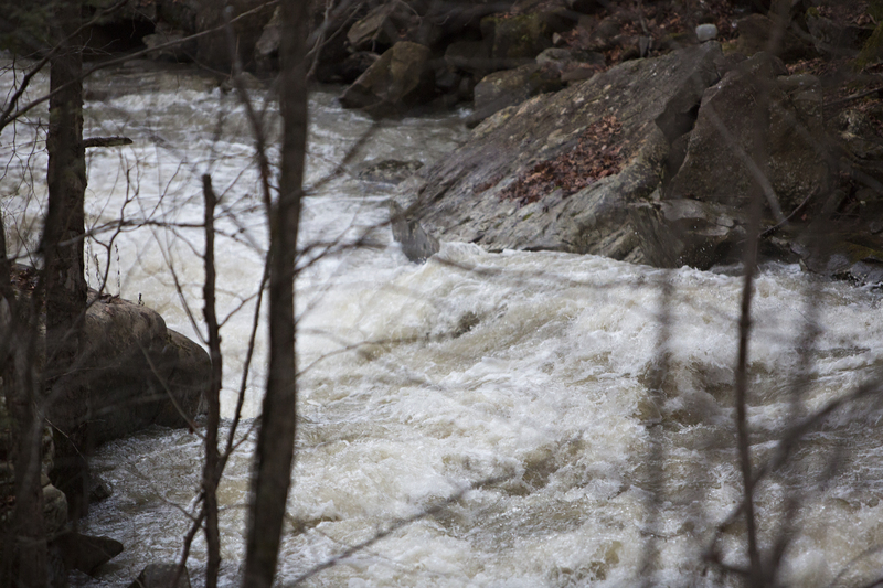
Long slide type rapid with a diagonal hole at the bottom. The hole will punch you toward a large boulder on river left, that has potential for a pin and is undercut.
Class II boogie water leading to the take out.
Jan 5, 2015
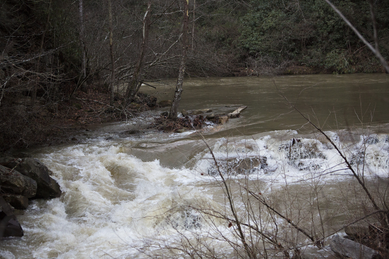
Right Hook after big rain
Dec 18, 2010
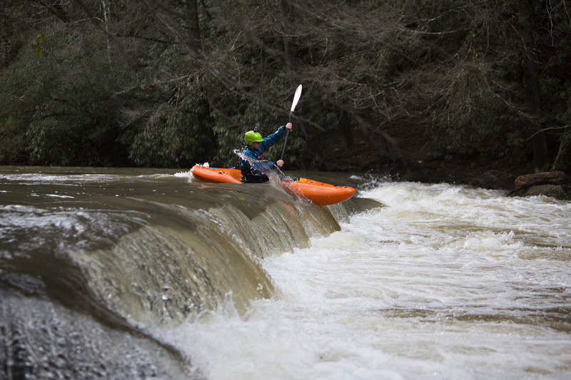
Had a good run on Clear Creek 12/17/2010. After about 1.3 inches of rainfall the day before. All the rapids were full of water and ready to go. The entrance to Gilligans Island has a torso sized log in it, stay right on the way down. Here are a couple links to some footage from the day.
http://www.youtube.com/watch?v=B9mxcbNiOVg
http://www.youtube.com/watch?v=u4Iexzb\_8iw