Doublekill
Iron Mountain Road (NJ) to Rt 94(NY)

| Difficulty | V+ |
| Length | 2 mi |
| Avg Gradient | 223 fpm |
| Reach Info Last Updated | April 15, 2010 |
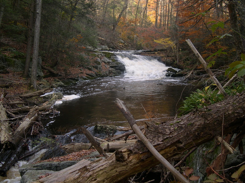
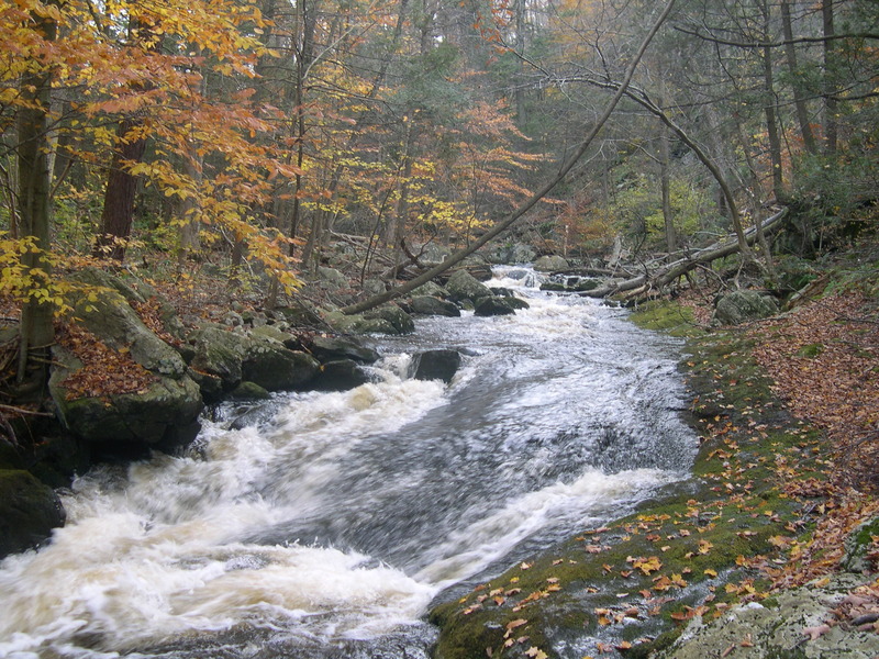
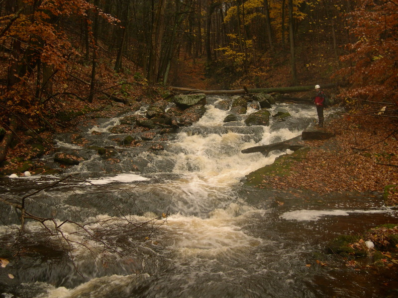
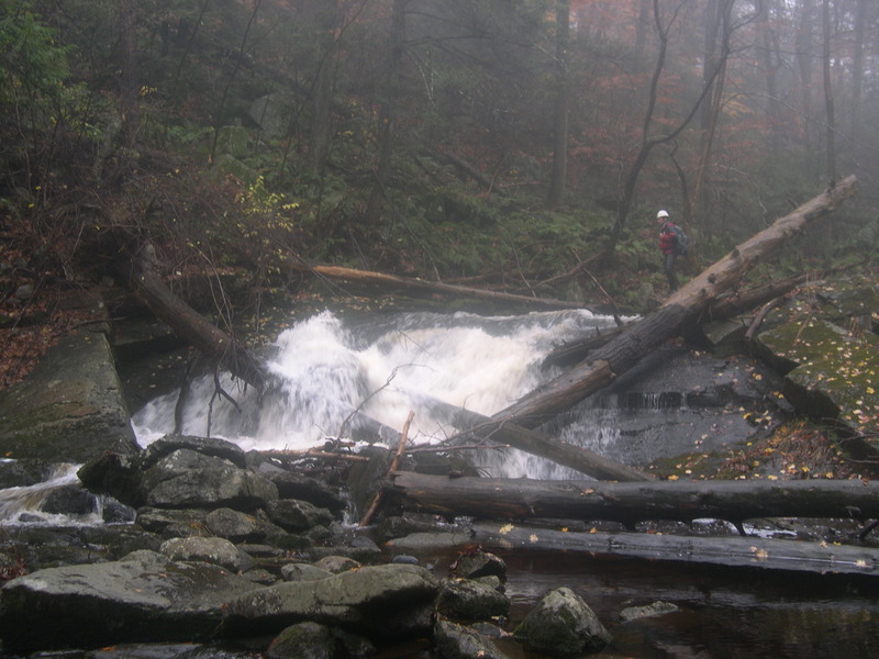
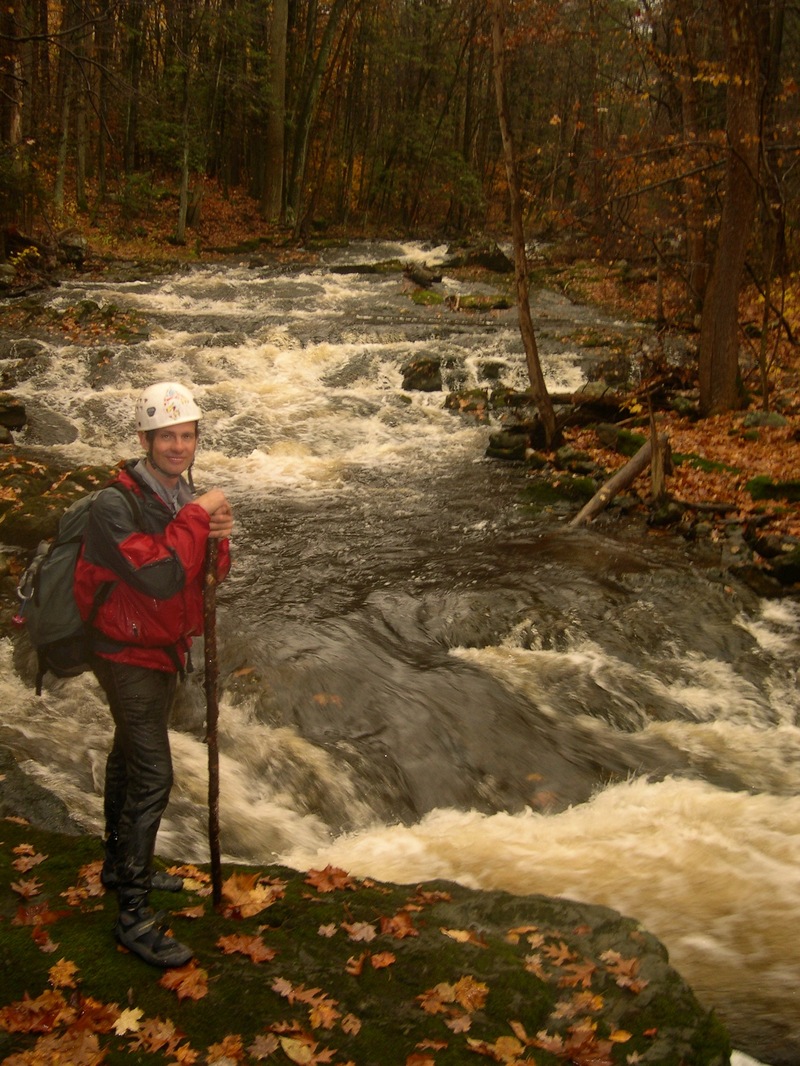
This is an amazing beautiful remote run. The dense old growth set in a deep and steep rocky gorge give a unique feeling especially for NJ. Come get NJ at it's best! These are the among best if not the very best remote NJ bedrock drops. Only Devil's Tea table comes close in my mind but it lacks the Doublekill's length, remoteness and stomp factor.
Gradient by mile:
Mile 1: 263 ft
Mile 2: 260 ft
Mile 3: 144 ft
MAX GRADIENT: 360 ft/mile, which occurs from about mile .75 to mile 1.25.\
1.9 miles of the run is within New Jersey and the last .6 miles is in New York state. Watershed is aprox 6-7 square miles.
When the big rains come you can swing by this gem to see if it's up. The large marshy headwaters with several ponds may keep the levels up more than we might expect for multiple days. Please post runs and the amount of rain that allowed you to boat the doublekill. The doublekill always seems to have some water so I think it may go more often than one might assume.
Take care not to enter the gorge too early in the Early Spring as this north facing deeply shaded gorge acts like an icebox and holds ice in the drops much longer than the surrounding areas.
First Descent:
Especially while the creek is strainer intensive runs should be started early in the day. The first decent on 3/30/2010 by Wayne Gman and Steve Strange started at 1pm (start of hike) and ended at 8pm just 15 minutes after dark. That day the two hiked and boated in a hard rain adding 1 inch to the 1 inch that already fell over the previous 12 hrs. The watershed was very wet before this rain event started.
the West Brook guage had spiked to 275 cfs the previous day and spiked to 400 cfs while the 1st D was run. The guage continued to rise to 475 overnight.
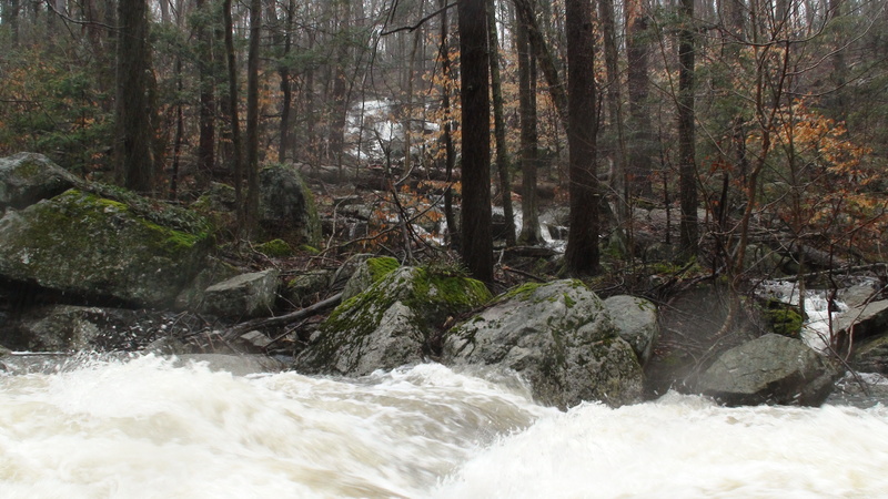
All drops were run on the 1st D day except for Boof & Rally. There are many life threatening strainers on the run right now. Only boaters comfortable with r
...
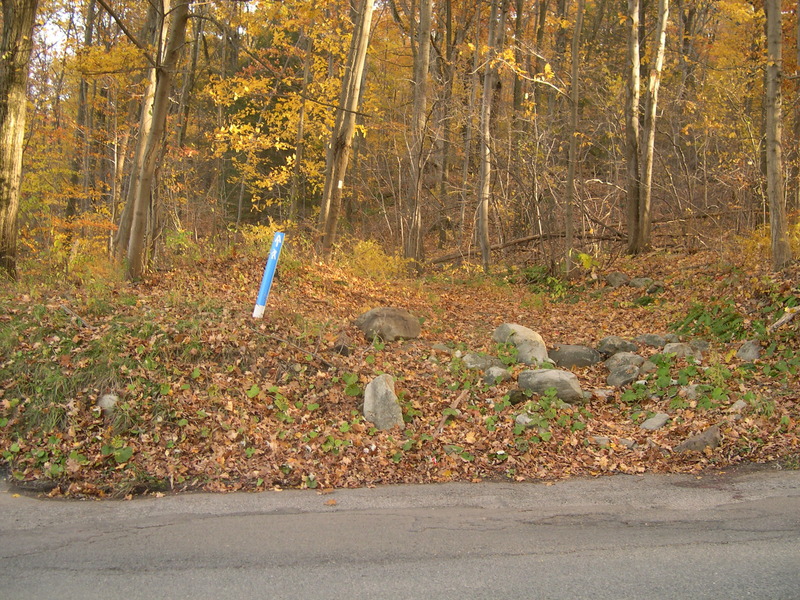
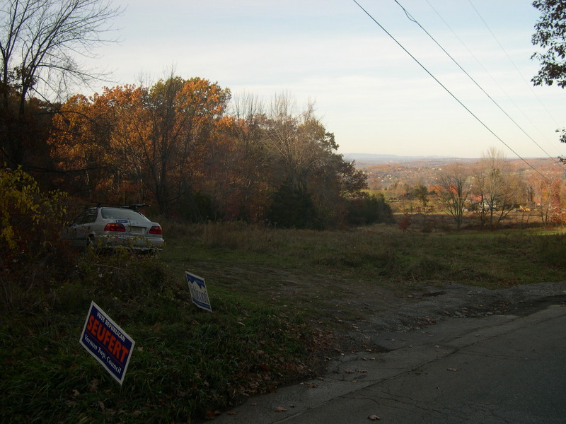
Iron Mountain Bridge is the putin for the Doublekill. How do you get there:
1. Park on Barret road on river left side of the creek.(far from the cr.) Walk in 30-40 minutes on the AT access trail. Stay on the trail.
2. Access Wawayanda Rd within Wawaynda NJ State Park. You can walk in 100 feet to access a pond. follow the outflow to the Doublekill. Depending on where you access you could cross 1 or 2 small ponds. The last pond looks to have some significant vertical to drop so if the water is really up you might get some boatable rapids. Let us know! If you access the doublekill via wawayanda road drive up on the river right or east side of the doublekill.
This is the first blind bend to the LEFT where you would have to commit to flow without seeing the next eddy. Grab the big eddy on Left at the top. Scout this easy corner for class 5 wood hazards. Up to this point parties will likely have boat scouted everything and hopped around a couple riverwide logs. Beware: the wood will intensify from here on out. Also make a mental note that there will be a hidden sieve about 2 features downstream in the left line of a big cascade. Favor the right lines which were also the wood free lines on the first decent day.
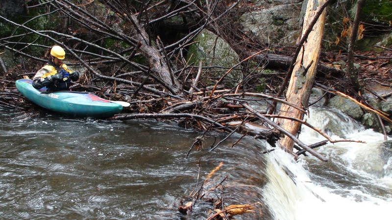
Deep slot is a minor rapid with a single boat deep fluming slot against the river Left wall. It would be a real sucky spot to encounter a strainer as the current is strong and green. As of 3/30/10 it was blocked with huge amounts of wood on the left leaving only a shallow manky boatable line on right. Absent wood this is a class 3 drop w/ slot move.
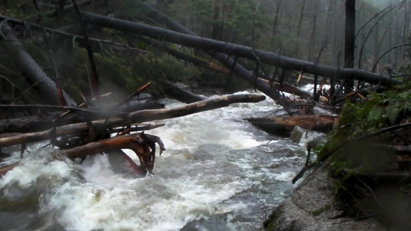
This is the slalom of logs currently above Blind Dog
A pretty steep beefy cascade with the most significant sieve on the Doublekill. Several quick technical moves and slipping by a hole at the bottom cleans this drop. Good lines enter on the top River Right and work through the center. The Blind dog sieve was undetectable at high flows on the 1st D (bridge gauge underwater). When dry scouted Fall/2008 it was thought that it could easily be a head underwater situation at high water. Boaters stuffed the sieve with branches in 2008 but highwater could have cleaned it.
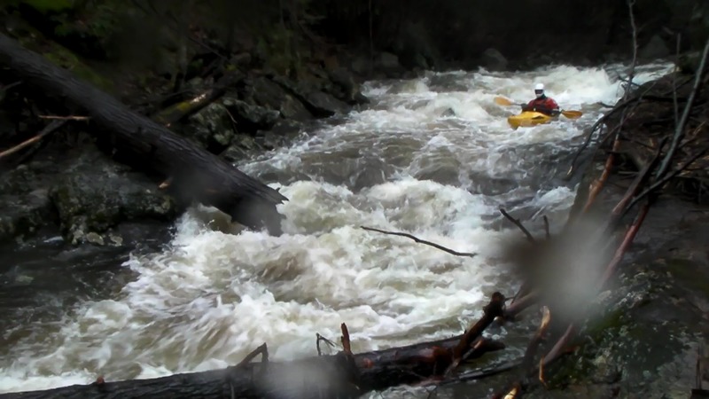
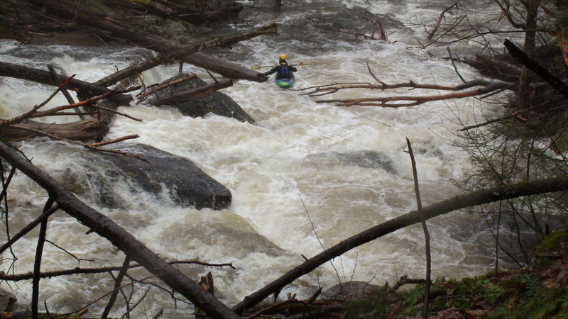
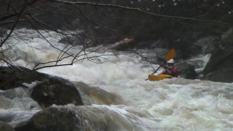
Gnargaritas for Breakfest, Lunch or Dinner it's all good. Gnargarita is one of the big 3 on the creek and the easiest too. Stay far river right in the entry or the rockbed will funnel you Left to the fanning piton rock at the bottom. Wayne cleaned it the 1st time. Steve struck a river right ledge on the landing just a little further right. The 3rd decent the hole reached out an grabbed its first boat requiring an offside roll. Exiting really wasn't that bad.
Of special note is that MEATBALL is just below (out of sight) on a !!VERY!! fast water train from Gnargarita straight to it without an eddy. Meatball till it gets cleaned out is very likely terminal.
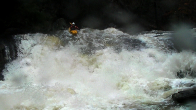
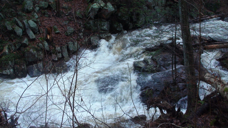
Meatball is a huge high speed steep bedrock flume that currently leads around a blind S bend into 2 gigantic hemlocks crossing the current with a Boulder pinned on those 200 year old logs. Water flows under, between and through the mess. There is even a little cave action on the far river Right and its hard to determine what the action is there.
On the First Descent of MEATBALL the water was high and rising. Water overflowed the upper flume on the Left creating a big liquid slide. Wayne Gman seal launched in just above in the chute, paddled over the upper lip of the flume's S bend. That first line was 8 feet off the river left wall.
Absent wood and meatball boulder this drop would likely be class 5.1. However it's currently rated class 6 as it is going to be infrequently run on the Left and only at favorable high flow. Blowing the line will carry typical Class 6 possibilites. If the wood and meatball blow out the rating will drop.
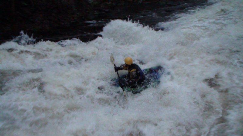
After the short pool below Meatball you can catch a good eddy if you get on it quick through the hole at the bottom. The boogie water takes off fast. Wayne ran this on the fly not being able to stay in the eddy below Meatball (small wood issues). Missing 3 single boat eddies because of guard rocks, a strainer had to be dealt with. A quick pin and ducking under led to another 100 yard run on the fly. Wayne finally finished by beaching the boat in a shallow forking of the creek where it overflowed the left bank. Eddies are available up till Boof and Rally rapid.
This steep rapid picks up wood. The wood pictured here is after the rapid. (boof and rally is at the top of the pic) Always scout it. Very attentive boaters can tell this rapid is coming. As you look down a straight creek 50 yards you can make out the only dark wall of stone on river Right in this area below Meatball. Get out immediately and scout( or portage) on Left.
This the last of the Big 3 rapids has a chute into a captive little spot against a wall. Looked bad. We thought there looked like a left move at the high flow to avoid the hole. It needs a careful closer scout than we gave it with failing light. The left move might be completely impossible. There is a small jog to the left in the rapid with a boulder down on the left. At dry levels we were concerned about the pinch down and flow of water under and around this boulder but I think it will mostly be out of play to a boater.....swimming might be a different matter though. This rapid was clogged on the first D so first dibs are still out there for the lucky boater. The drop looked clear but the outflow was choked with 3 logs. Go get it, let us know how it was.
The Slide picks up wood on the left where there is a long 90 degree corner that defines the river left bank. The water flumes towards this and down along it. The dry scout showed a huge worn and stripped tree in this spot. Hedging the strainer bets, with light fading fast, we were happy to run the techincal river right side with the large piton rock in play. It was boat abusive. The left side is probably the more fun side for future runs. It was challenging on the right to miss the piton rock and we had mixed results of hit or miss, but the irregular creek bottom and the merge into the quick river left water caused both boaters to finish the drop backwards. There was a Large eddy to catch on the bottom right.
The last of the run was fast especially in big flow. Eddies could be harder to hit despite the flattening out of the run with an ill placed strainer. We wished we had quick scouted the town section as it was now dark. The last of the creek felt like class 3 boating.
Take Out: This run is not going to get run that frequently and I think it is likely fine to takeout on creek Left when you get to the Tool Rental hardware store behind Mom's Deli strip mall. The hardware store has a huge parking lot and I doubt they will notice you cutting through the side of their lot the few days a year that this creek gets run. You want to spot or mark the takeout bank before you start your run. You'll walk 100 yards pulling out here.
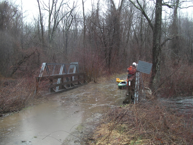
Bridge Warning: The Bridge just downstream of RT 94 was distroyed by the creek a few weeks earlier. Who knows what the construction project down there means to a boater so take care paddling below the RT 94 Bridge for a takeout.
Wire Warning: (150-ish yards before Rt 94 Bridge) In the fading light Steve ran into some wire on river right (not barbed) strung 'across' the creek for a weak fence. I think in high water the creek created a channel that does not normally exist though a fenced in area. It was a spot we could stop and that is why were were there...otherwise we likely would have been in the middle of the flow far from the banks just finishing the run. I don't think it will be much of an issue to future boaters with daylight but for us it was the right time to get off the creek.
Apr 7, 2010
Low Water