Boquet
1. Route 73 to Split Rock Falls
| Difficulty | IV-V |
| Length | 3.9 mi |
| Avg Gradient | n/a |
| Gauge | East Branch Ausable River at Au Sable Forks Ny |
| Flow Rate as of 41 minutes | 1.15 ftbelow recommended |
| Reach Info Last Updated | February 15, 2026 |
This run is widely considered one of the top creek runs in New York with convenient roadside access.
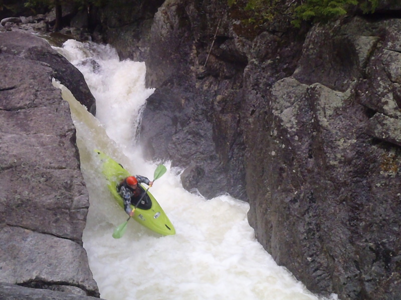
The run begins at the Route 73 bridge on the North Fork of the Boquet. Just downstream, a bedrock drop known as the Shoebox provides a rapid that is significantly more difficult than the overall character of the section and should be approached with caution.
For the next three miles, the river features a steady sequence of boulder gardens with occasional bedrock ledges. The whitewater is generally mellower above the confluence with the South Branch, located about one mile below the put-in.
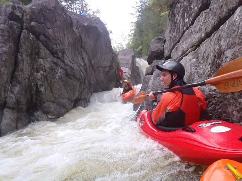
Downstream of the confluence, the river enters a final gorge leading to Split Rock Falls. This stretch offers excellent channelized boating, but paddlers should be alert for Andy’s Hole, a hazardous feature that has delivered severe, potentially life-threatening consequences at higher flows.
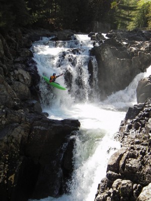
At the bridge, Split Rock Falls lies just downstream. Most trips end here, as flows that provide good conditions for this run often indicate a very high and committing level at Split Rock.
Below Split Rock is an extremely impressive and rarely run gorge. The first drop is exceptionally burly and ranks among the most serious runnable drops in New York. With significant effort, it may be possible to put in below this initial drop for roughly a quarter mile of steep, locked-in gorge boating.
At lower water levels, the final gorge above Split Rock can still provide enjoyable, channelized paddling even when the upper section feels too bony. Split Rock itself is runnable down to relatively low flows and sees many of its descents at these levels.
For those interested in exploration, both the North Fork and South Fork above Route 73 have been scouted, and the North Fork contains a spectacular gorge several miles upstream of the bridge.
Confluence of the North and South Fork Boquet Rivers.
The bridge marks the approach to Split Rock Falls.
Split Rock Falls is a signature drop on the Boquet River, located just downstream of the Highway 9 Bridge. At most flows suitable for the upstream sections, the falls are steep and powerful, requiring a high and committing flow to run safely, and most paddlers take out above the falls. Split Rock itself is runnable down to relatively low flows and sees many of its descents at these levels. In addition to its whitewater appeal, the falls are a popular swimming and recreation spot during the summer months, with large pools at the base attracting swimmers when flows are low.
Apr 1, 2004
Once again Birdman shows us how to do it with style (minivan style that is)...