Yét Atwam Creek
Cabin Creek Trailhead to McCloud River
| Difficulty | IV(V) |
| Length | 11 mi |
| Avg Gradient | n/a |
| Gauge | Yét Atwam Creek Above Mccloud Confluence |
| Flow Rate as of 21 days | 544 cfsstale data |
| Reach Info Last Updated | March 6, 2023 |
Overview:
Yét Atwam Creek is an excellent 11-mile-long rainy season creek with the added bonus of getting an additional ten miles of the Lower McCloud River for a total run length of 21 miles. This run can make for a very long day. For the most part the creek pretty continuous class II and III rapids. However, there are two significant waterfalls in the first few miles. At mile six, is a scenic gorge with about six class IV rapids. Other solid class III and IV rapids are scattered throughout the run. On a small creek like this, logs, log jams or brush could always cause problems. Once boaters reach the McCloud, they will face three big class IV rapids along with numerous smaller rapids and a big increase in the flow. What more could you want?
Private Property:
The first five miles of the creek below the trailhead are within the Shasta-Trinity National Forest. A trail follows the creek for this distance. At Bear Trap Creek confluence, Yét Atwam Creek enters private property (McCloud River Club?). There is no further public property along this creek or the McCloud River until the take-out at Gillman Road on Lake Shasta. A private road follows Yét Atwam Creek from Bear Trap Creek to the confluence with the McCloud. If you need to stop in the private property zone, stay within the high water line to avoid trespassing, unless forced to scout or portage.
Put-in: Cabin Creek trailhead at the end of Yét Atwam Creek Road. From I-5 take highway 89 to the town of McCloud. In McCloud turn south on Yét Atwam Creek Road towards Lake McCloud for six miles. As the road starts to leave Yét Atwam, turn right onto the dirt road leading to the Cabin Creek Trail. The last 3 miles to the trailhead are dirt road. Depending on road and snow conditions, you may have to park further upstream and carry to this point or poss
...
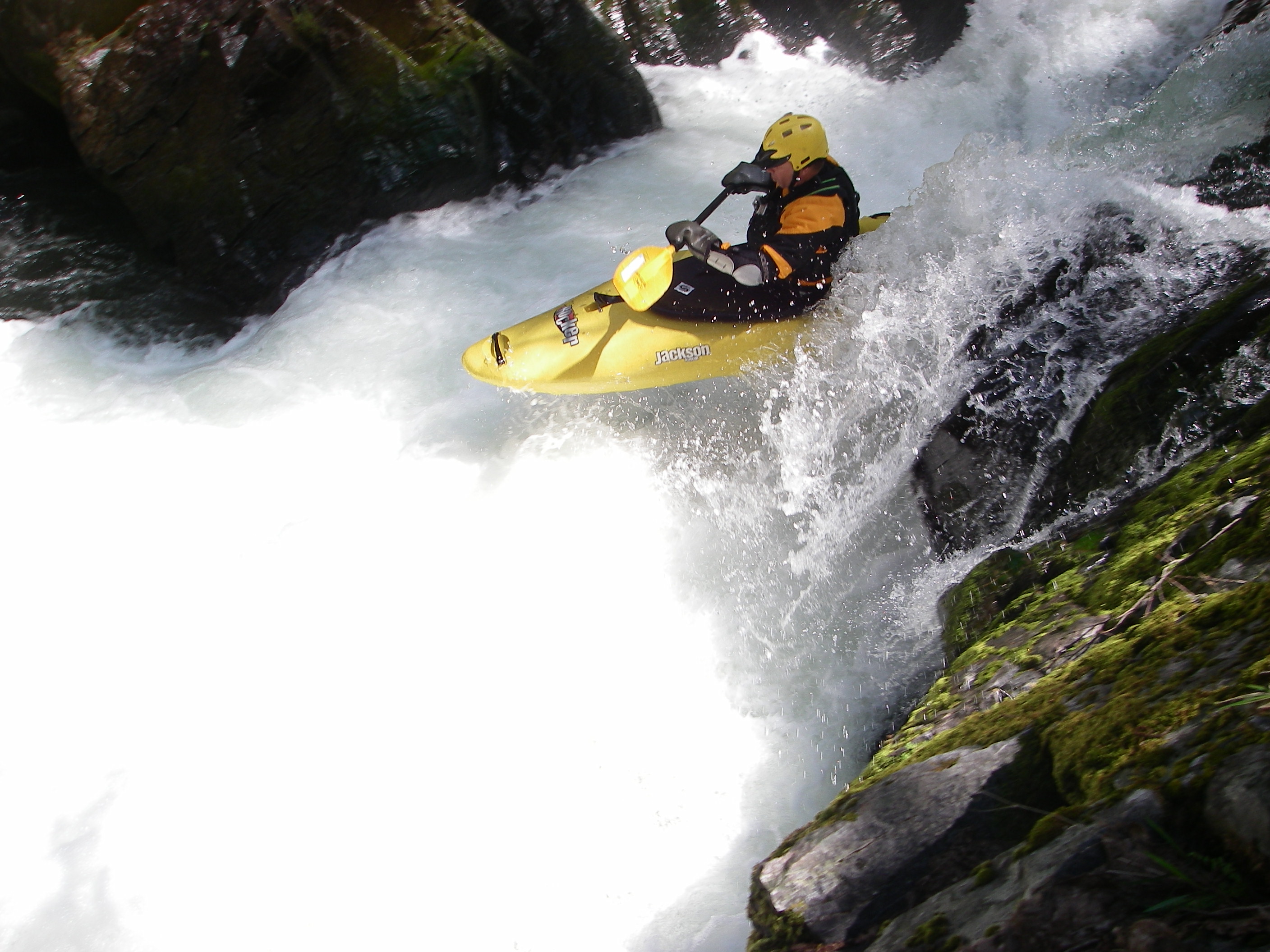
There is a good scouting view of this waterfall on river left. You can also portage left over the rocks and down a crack to the pool. The waterfall has been run on river right.
You can scout this waterfall on the left and also run it down the left. A portage route is on river right.

Beartrap creek marks the end of public property and the end of the public trail. Yét Atwam Creek runs through private property from here down and a private road follows the creek to the McCloud confluence. Stay within the high water mark unless forced to scout or portage.
Tom Neal Creek comes in from the right just after a road bridge. This is a major tributary. It has been reported to contribute from 1/3 the flow up to equal the flow of the main creek. It probably contributes a lower percentage late in the season and more during the winter.
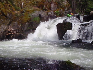
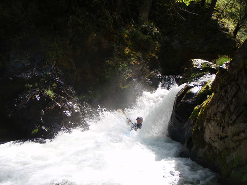
Within a couple hundred yards after Tom Neal Creek, get ready for the gorge. After you run the first class 4, eddy out right just above the next drop. You can scout all 5 remaining drops in the gorge by climbing up the hillside 20' and following the faint trail. You could portage all the drops in the gorge on this same trail as well.
For descriptions of the rapids on the McCloud below this point, see the Lower McCloud page. The major rapids on the McCloud below the Yét Atwam Creek confluence are Double Drop Falls, Tuna Creek Falls, Valhalla Falls. The land in this area is all private property, so stay below the high water mark unless forced to scout or portage.
Jun 6, 2011
This is a fun class 4 run. It does makes for a very long day if done as a one day trip with low flows on Yét Atwam Creek. If you're thinking about making a two day trip out of this run get yourself a Shasta-Trinity National Forest map which will help you locate public property for camping purposes. Flows for Yét Atwam Creek are not available online so a little educated guessing is in order for figuring out if it's runnable. This is what I did; go to dreamflows, look for the McCloud river, look for the flow at ah-di-na camp and at Shasta Res, Subtract the ah-di-na camp # from the Shasta Res.# and if it's greater than 500cfs you should be good to go. I had a 550cfs remainder and it was doable but we had some rock bashing for the first 5 miles of the creek before tributaries added more volume. The rapids on my lowish run were mostly class 2 & 3 with the obvious exceptions being the waterfalls at the beginning and the gorge just past Tom Neil Ck. This gorge is a spectacular piece of class 4 whitewater and well worth the price of admission. We had 1,200cfs on the McCloud at Shasta gauge and that's a great flow for the McCloud, especially if it's a first time run, the McCloud will seem huge in comparison toYét Atwam Creek. For us the write-ups on 'A Wet State' and Darin McQuaid's site were valuable assets in preparing for making a run
Apr 25, 2010
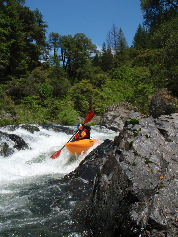
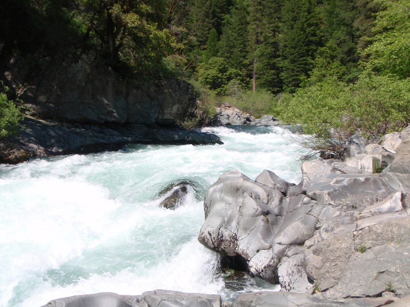
Photo from a trip on Yét Atwam Creek.
