Yét Atwam Creek
Cabin Creek Trailhead to McCloud River
June 6, 2011
| Reporter | Nick Sinderson |
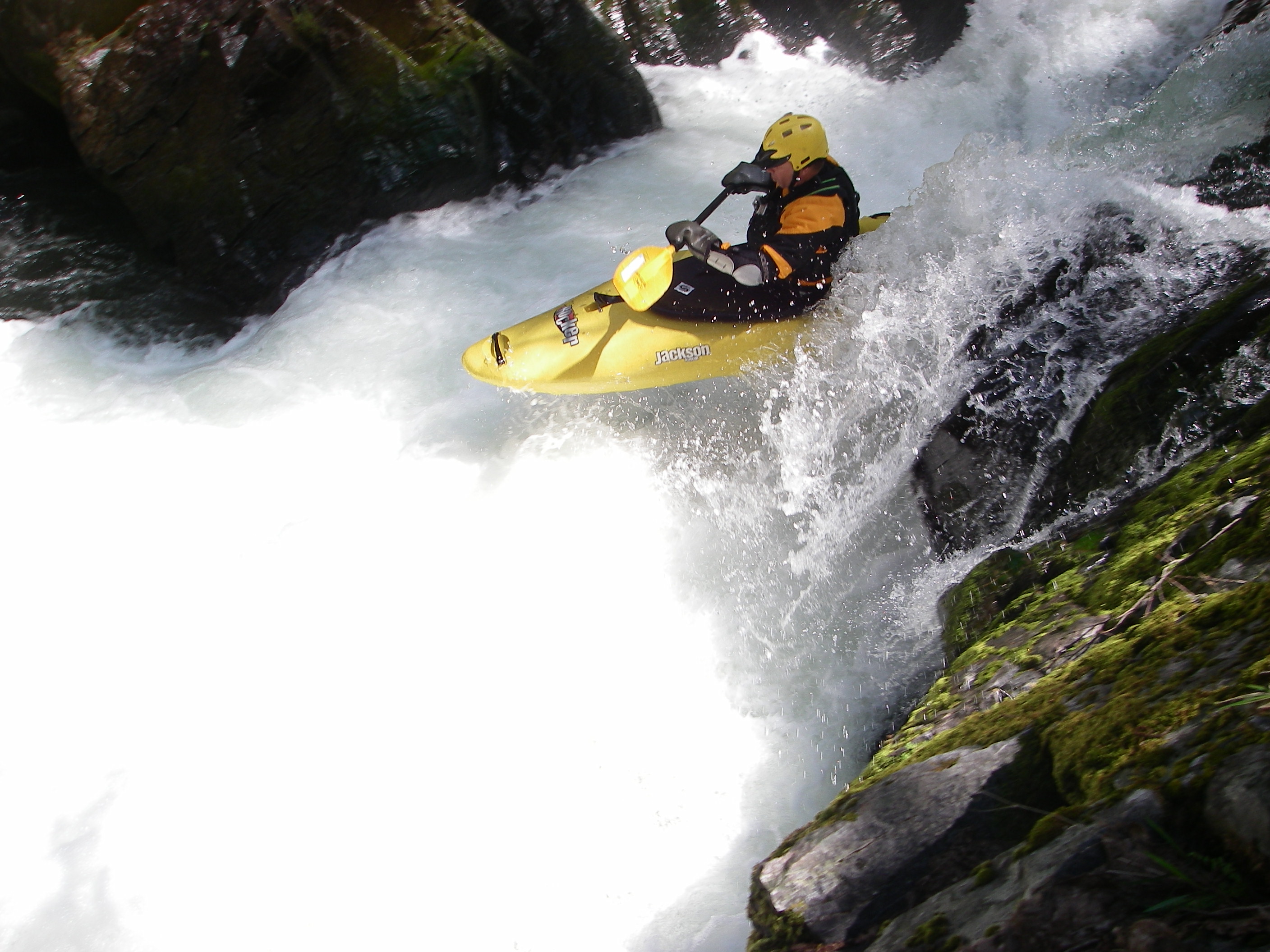
This is a fun class 4 run. It does makes for a very long day if done as a one day trip with low flows on Yét Atwam Creek. If you're thinking about making a two day trip out of this run get yourself a Shasta-Trinity National Forest map which will help you locate public property for camping purposes. Flows for Yét Atwam Creek are not available online so a little educated guessing is in order for figuring out if it's runnable. This is what I did; go to dreamflows, look for the McCloud river, look for the flow at ah-di-na camp and at Shasta Res, Subtract the ah-di-na camp # from the Shasta Res.# and if it's greater than 500cfs you should be good to go. I had a 550cfs remainder and it was doable but we had some rock bashing for the first 5 miles of the creek before tributaries added more volume. The rapids on my lowish run were mostly class 2 & 3 with the obvious exceptions being the waterfalls at the beginning and the gorge just past Tom Neil Ck. This gorge is a spectacular piece of class 4 whitewater and well worth the price of admission. We had 1,200cfs on the McCloud at Shasta gauge and that's a great flow for the McCloud, especially if it's a first time run, the McCloud will seem huge in comparison toYét Atwam Creek. For us the write-ups on 'A Wet State' and Darin McQuaid's site were valuable assets in preparing for making a run