Green River (Lamoille Trib)
Green River Reservoir to Lamoille River

| Difficulty | IV-V |
| Length | 3 mi |
| Avg Gradient | n/a |
| Reach Info Last Updated | April 21, 2015 |
The Green River in Vermont provides a remote ,scenic, and exciting whitewater boating opportunity below the Green RIver Dam. American Whitewater and the Vermont Paddlers Club have been working on the relicensing of the Green River Dam since 2010 to require scheduled whitewater releases. We helped the owner, Morrisville [...]Read More
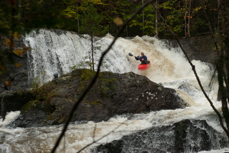
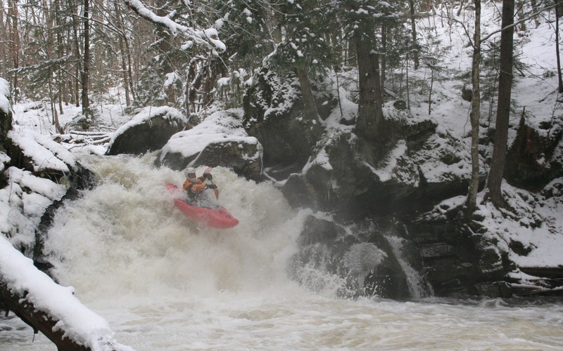
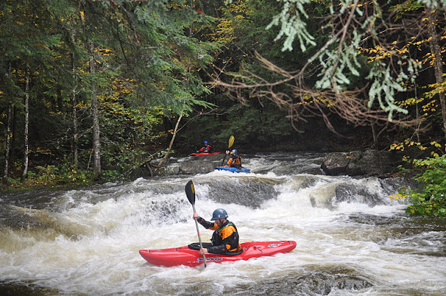
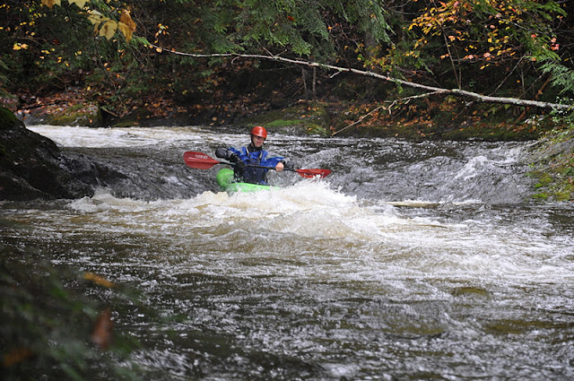
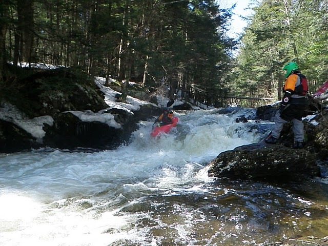
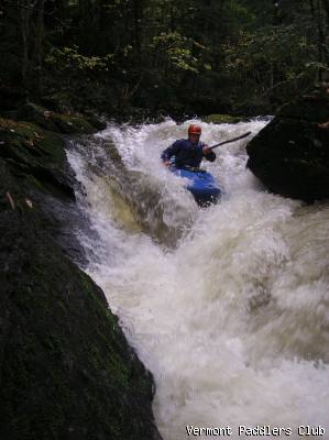
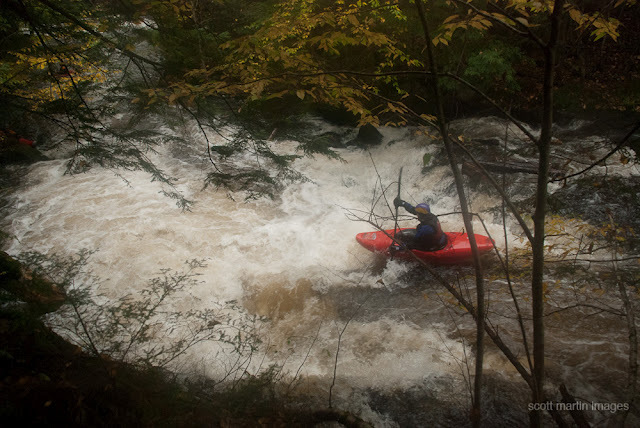
The Green River is a dam release Class IV and V creek run currently being analyzed through the FERC dam relicensing process. There are two distinct sections. The first is the Upper Class I/II Section from the dam down to just above the putin culvert for the Lower Class IV/V Section.
The Upper Green River (Class I/II):
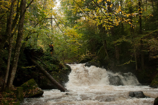
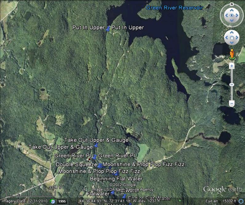
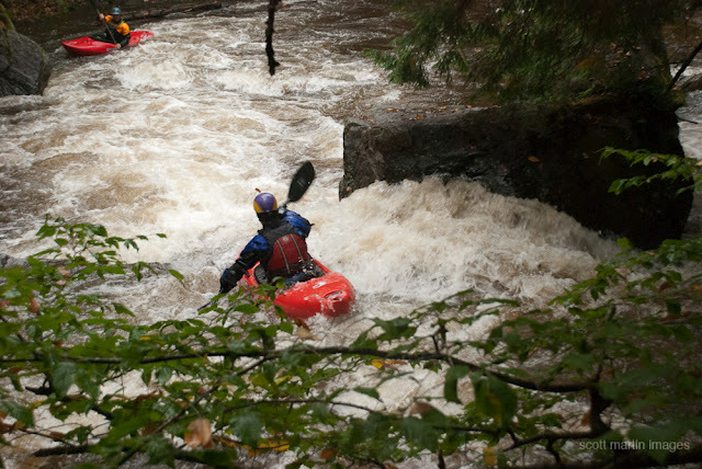
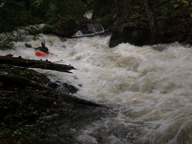
The river itself, tiny and no more than 30 feet wide, starts directly below the dam in a gorge of sorts where the toes of the valley walls end directly at the water’s edge. They aren’t vertical bedrock but steep enough that you notice how “V” shaped the valley is once you put on the water. Approximately 200 yards down from the foot of the dam is a very nice river wide play wave with decent eddy service on river right. This is far and away the largest whitewater feature on this stretch of the river. Below this play wave the river flattens and becomes moving water down what feels like a hallway, beautiful. After some meanderings and a few riffles, you pop out into the first of three wetland complexes, complete with sedge meadows, beaver lodges, and tannin laden water probably loaded with some big old brown trout. The river meanders through the meadows backing on its self several times before you run into the next pinch in the hillsides, where there is a set of class I/II- riffles leading to the next open sedge-wetland complex. There are three of these open areas and pinches in total before the river necks down and you are channeled in moving water for the final stretch. You will see a VERY low green bridge that is hard to limbo, even in a kayak, so if you are uncomfortable in tight places eddy out on river right and portage or use this as your take out. The actual take out is a short stretch downstream on the road side (river left) of the river across from the stick flow gauge. CAUTION – make sure to take out at this location because just below is a class V rapid into a culvert and 40 foot unrun
...
Nice very short gorge sneak of Moonshine river right
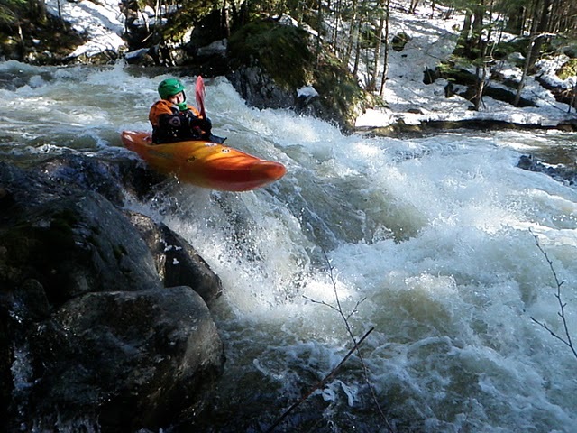
Class IV rapid with must make move right to left to avoid undercut boulder.
Class III drop with slide/flake boof on left and boof over hole on right.
Class III drop with sticky hole on first ledge and green tongue on second
Class III drop after downed tree. Great boof or plug into begining of flat water section
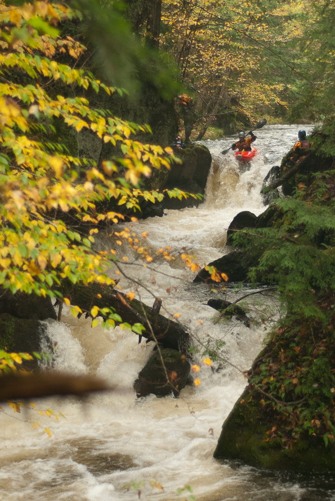
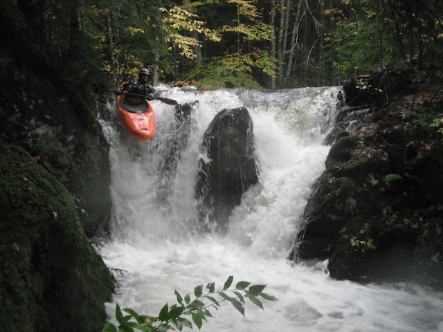
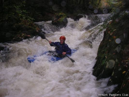
Class V multiple stage drop in very tight walled potholed gorge.
Nice Class III+ drop with left curler into giant pillow and boof.
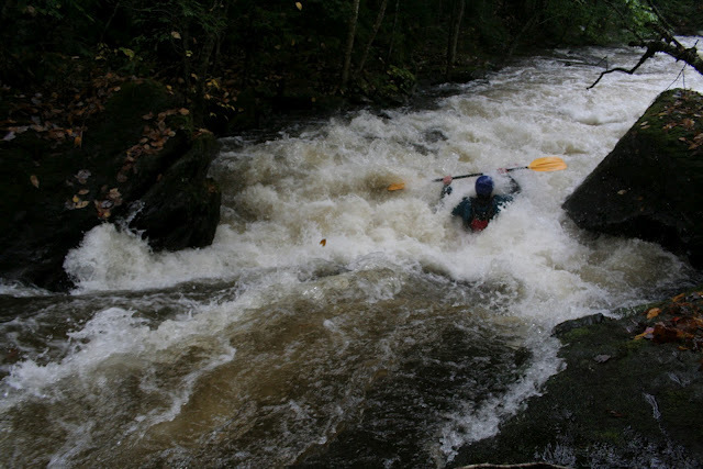
Class III+ continuous ledge features for a good 1/4 mile.
Class III+ set of ledges with micro eddies on right to catch on the way down.
Class IV+ boof on left into runout series of ledges. Beware of wood here!
Class III Tight little drop with boof on left and hole tucked into right
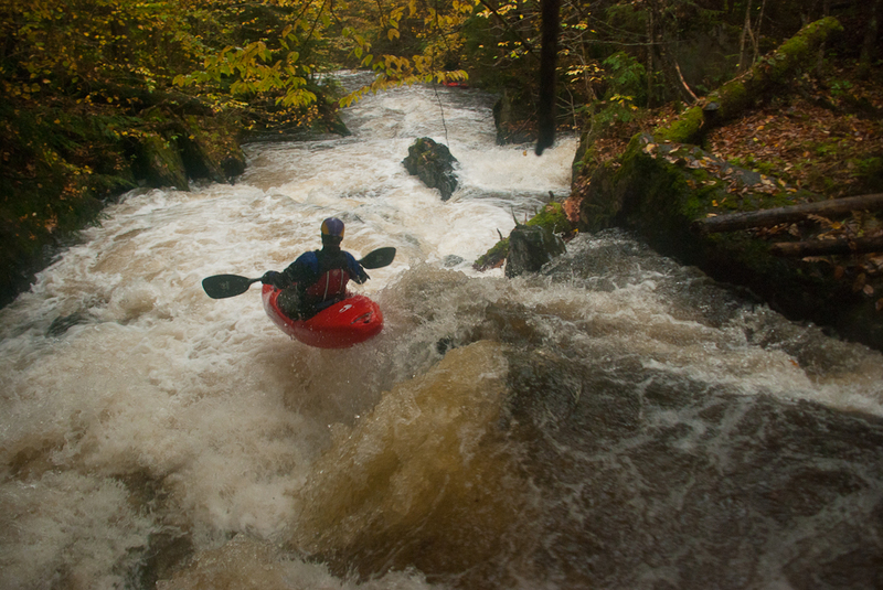
Class IV. Long rapid with lead in on left and slide/boof over hole. Gets busier at higher levels opening up cleaner left line to the boof.
Class IV rapid with a couple of options. Last drop, right hand bend around boulder and over ledge.
Mar 25, 2012
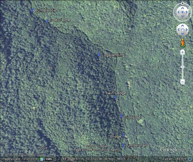
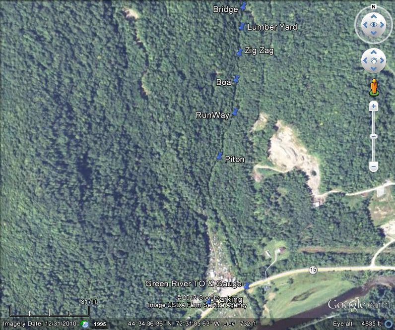
rapid locations ID