Big Laurel Creek
Hurricane to Hot Springs
| Difficulty | III-IV |
| Length | 3.7 mi |
| Avg Gradient | 50 fpm |
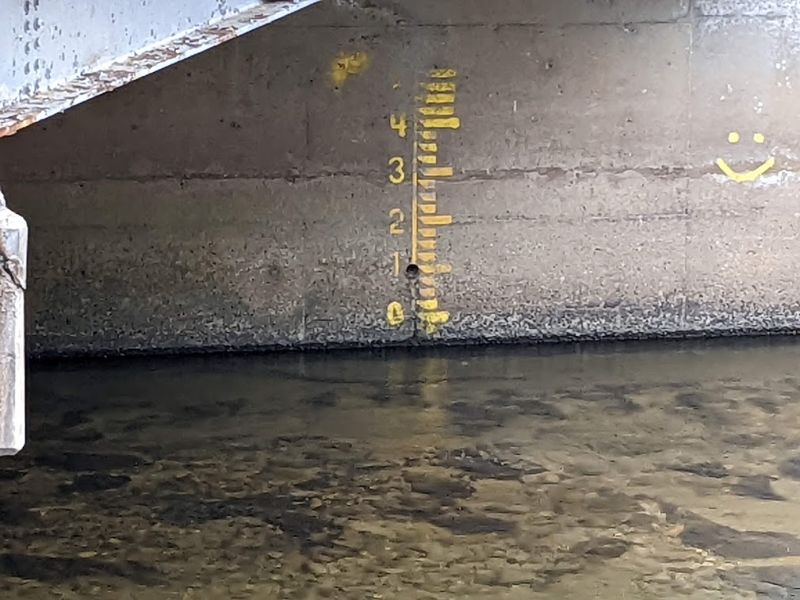
| Gauge | Ivy River Near Marshall, Nc |
| Flow Rate as of 1 hour | 113 cfsbelow recommended |
| Reach Info Last Updated | May 27, 2026 |
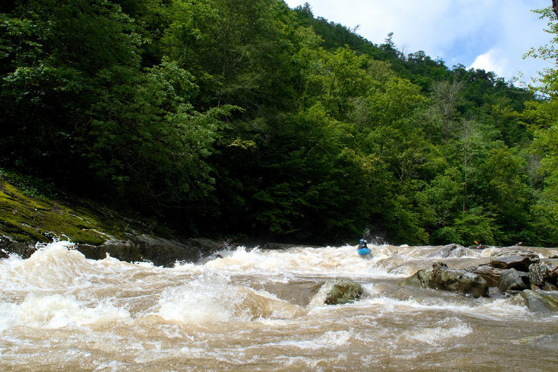
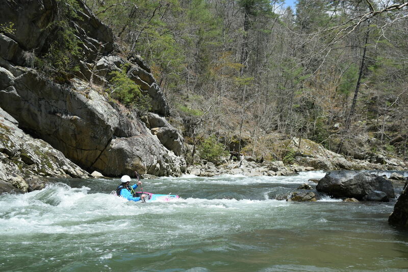
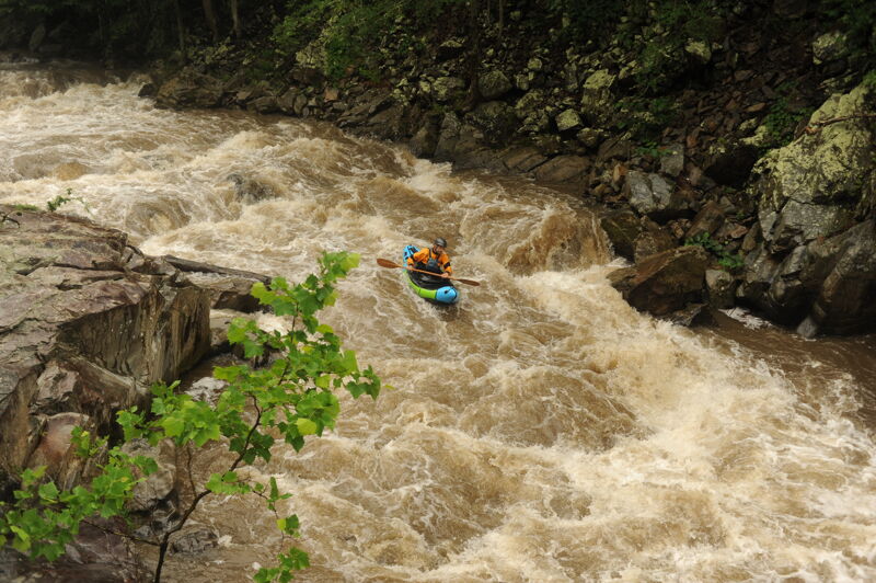
Big Laurel Creek is one of Western North Carolina’s classic whitewater runs, prized for its quality Class III/IV rapids, beautiful mountain scenery, and reliable runnable flows. The creek can be enjoyed over a wide range of water levels by paddlers with the skills to do so. At low to medium flows, it offers an excellent training ground for paddlers making the transition from river running to creek boating, with continuous technical rapids that reward precise boat control and good line selection. At higher flows, Big Laurel transforms into a powerful, fast-moving creek with bigger features and a more serious character.
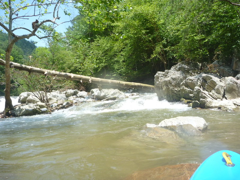
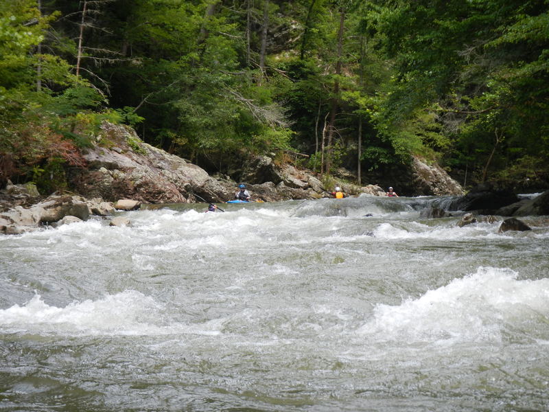
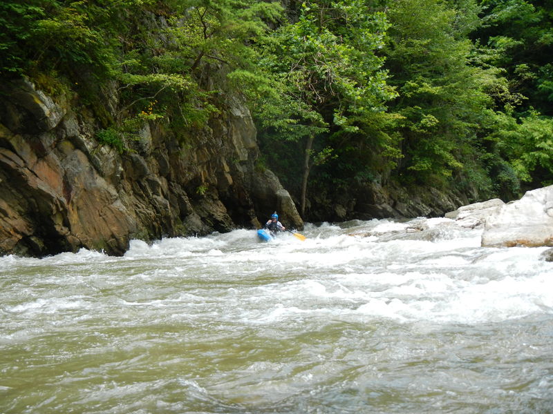
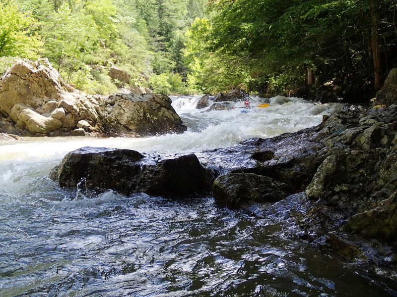
The signature rapids on this run are Pinball, Stairstep, Suddy Hole, and the Narrows. Between them are several smaller rapids offering technical lines, a couple classic boofs, and a handful of play spots. Paddlers should be aware of an easily avoided sieve on river left partway through Stairstep Rapid, as well as the stout but straightforwardly avoidable hole on river right at Suddy Hole.
A well-maintained trail parallels the entire run on river left, making scouting and portaging easy and providing added comfort for paddlers stepping up to the run for the first time.
Big Laurel Creek has grown increasingly popular with hikers and swimmers in recent years, especially during summer months, so expect company on warm-weather weekends and be prepared for foot traffic at access points and occasional spectators along the river.
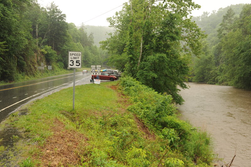
Access Logistics: The put-in is at the Highway 25 bridge in Hurricane, NC. Big Laurel Creek drops roughly 200 feet over 3.7 miles before joining the French Broad River. The standard take-out continues another 3.3 miles down the French Broad River to the Hot Springs access on river right, just upstream of the Highway 25 bridge in Hot Springs.
There are two alternatives to the standard Hot Springs take-out. The first is to hike the well-maintained trail on river left back to the put-in, ma
...
Put on at the upstream end of the large river-left parking lot. In this spot the river is very close to the lot and short trails provide access down to the shoreline.
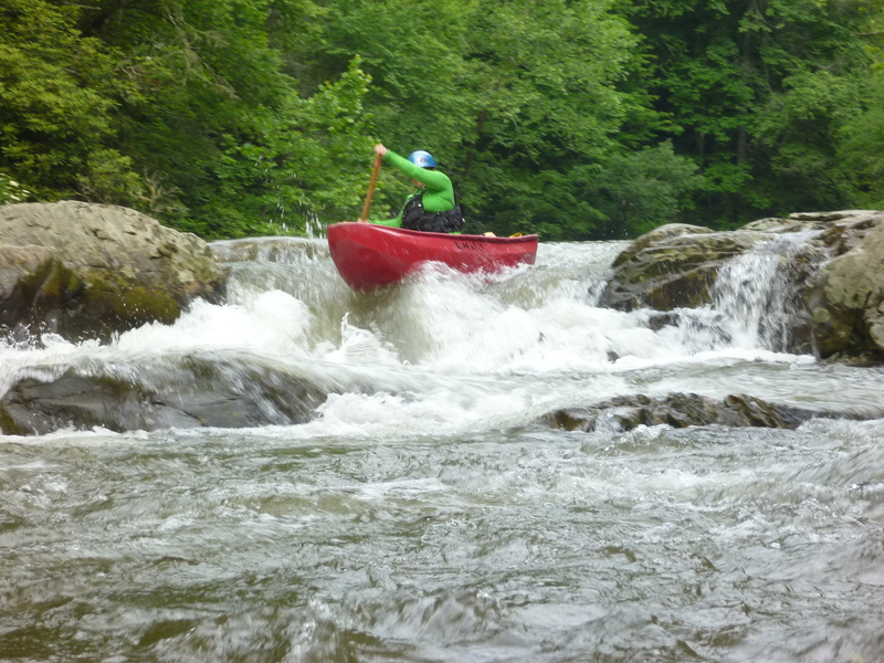
Pinball / 1st Rapid is the first horizon line you come to. Almost all paddlers run the opening left of center. At the bottom is a rock squarely in the most direct path. One option is to boof left into the eddy above and left of the rock; this is fairly easy. The other option (shown in the photo) is to angle right of the bottom rock. The challenge is a hidden underwater rock that you will hit if you cheat right too soon. It can pinball you into the bottom rock you are trying to avoid, which is much more of a problem at lower water levels. At higher levels, the pinball rock is farther underwater and you can move right earlier. Run the left-hand chute. The right-hand chute, which appears to be the obvious route, leads directly into a pinning rock.
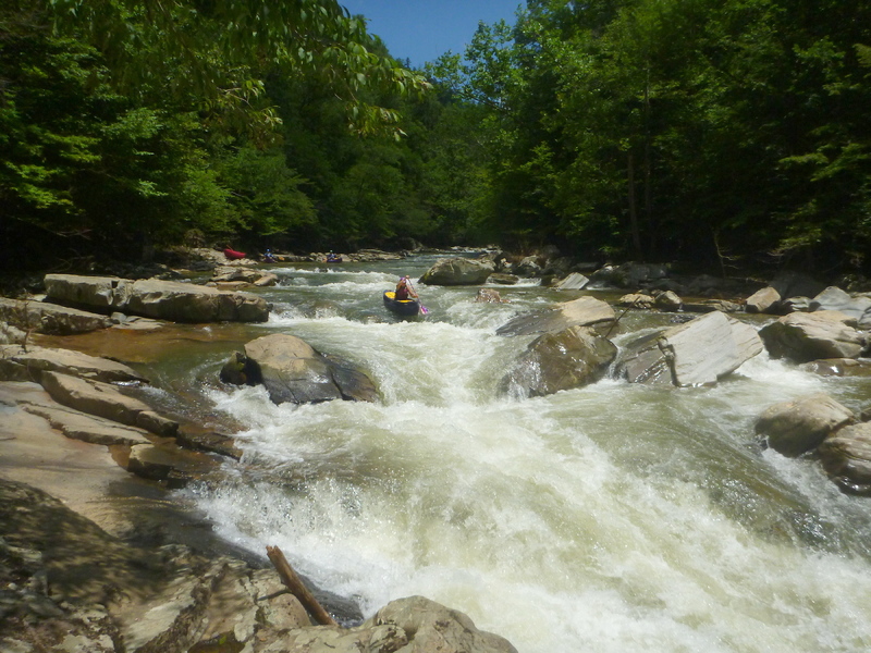
Stairstep is the 1st horizon line after Pinball. The first 3 steps are not large, but by the 4th one you need to be lined up properly to run the big drop into the hole (not a keeper). This is followed by a succession of fairly large breaking waves. Stairstep gets harder with higher water levels; above a foot it is fairly beefy. Next to the 1st step there is a large boulder in the center of the river (boaters will pass to the right of it) with a fairly large eddy behind it. A lot of boaters catch this eddy. You can do so but be aware that there is a sieve at the lower end of that eddy that a few people have been sucked into. Fortunately all flushed out until December 2019. On Dec 15 April Morton was swept into the sieve, which also had a log in it. The members of her group responded quickly but were not able to extract her in time.
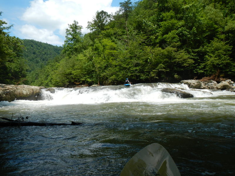
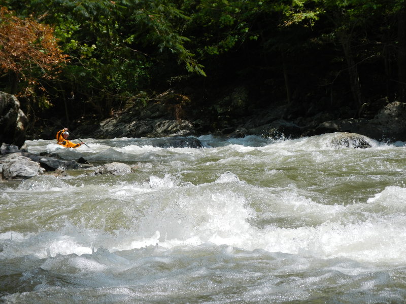
Suddy Hole consists of two drops. Most boaters eddy out after the first drop. As you look over the horizon line of the second, you will see a “dead” tree across the creek at the bottom of the rapid. The tree is still partly alive and has a prominent “Y” about 15 feet up from the base. If you aim for this tree, you will be on the most commonly run line. The nasty recirculating Suddy Hole is on river right. There is also an exciting line on river left at higher levels (above 6 inches).

Prelude (sometimes called False Narrows, Upper Narrows, and sometimes considered part of the Narrows) is a longish rapid and fairly intense, especially at higher water levels.
Start on river right and move toward river center over the first drop. Run the slide that immediately follows down the center.
The path with enough water takes you to river right and to the base of a cliff. One good stroke at the right time keeps you from being pushed into it.

Small entry drop, then the main flume, run on river right. Smooth tongue leads into a breaking wave (low levels) or hole (medium and up). Hole is usually punched fairly easily.
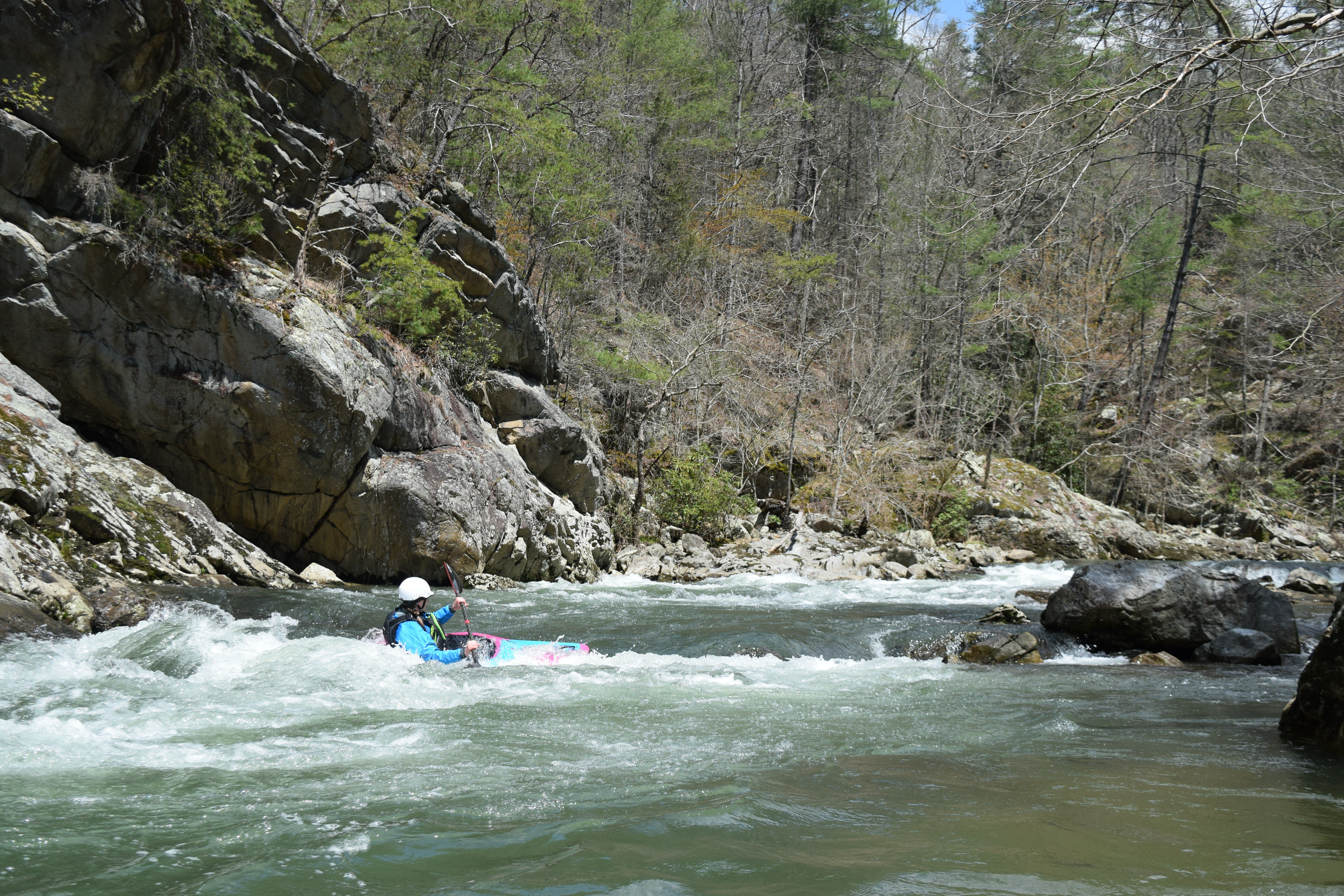
Humble Pie (aka Commitment Eddy) is the last rapid before the French Broad. Below about 8 inches, you are forced to take a route on the far left. The gap between the left bank and the 1st boulder is about 15 ft. Avoid the extreme left - i.e. the 5 ft closest to the left bank. The first hole tends to surf you to the left, the second more to the right. The boater in the picture is in the 1st hole. Above 8 inches a couple lines open up near the center. Below 0, it starts getting boney and one line is to make the 'commitment' to catch the eddy behind that 1st large boulder. If you don't commit or blow the line you will be on a pinning rock. At those low levels, most people choose to make a couple quick turns around the partially exposed rocks.
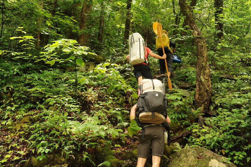
To skip the 3 mile section on the French Broad River, some paddlers take out at the railroad trestle on river left and carry 0.7 miles up the railroad tracks to the Stackhouse access on the French Broad River. Another option is to hike the river-left creekside trail back up to your car. This is a great option for those with packrafts and avoids the need for a shuttle.
The most common way to paddle Big Laurel Creek is to continue onto Section 9 of the French Broad River and take out in Hot Springs at the access point on the upstream river right side of the Highway 25 Bridge.
May 27, 2026
We had a great day out on Big Laurel with a group of 3 packrafters and a kayaker who joined for the run. The reading on the bridge was approximately -1'. We put on shortly after noon. It was about an 80 minute paddle (we took our time) and an 80 minute hike back to the put-in. Since we had packrafts it was easy to take out shortly upstream of the French Broad confluence and hike the river left trail back to the put-in.
Jan 6, 2026
Hiked down the Laurel from the Store on Jan 2nd for after dinner exercise and general river scouting. The river was very low. Saw a 4-ft x 6' pine log in the river-left sieve at Stairstep Rapid. Judging from the condition, it had been there a long while, but was still strong and was jammed under a rock. It took me 15 minutes to free it by pulling upstream. This was with very little water pressure. Really nasty with branches coming off of it. It would be a near certain hang-up for any object passing thru.